Frost, Texas

Last updated

Frost, Texas
Downtown Frost Wiki 2.jpg
Downtown Frost (2017)
TXMap-doton-Frost.PNG
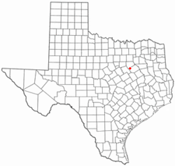
Location of Frost, Texas
Navarro County Frost.svg
Coordinates: 32°4′45″N96°48′31″W / 32.07917°N 96.80861°W / 32.07917; -96.80861
Country United States
State Texas
County Navarro
Area
[1]
  Total1.13 sq mi (2.94 km2)
  Land1.13 sq mi (2.93 km2)
  Water0.00 sq mi (0.01 km2)
Elevation
525 ft (160 m)
Population
 (2010)
  Total643
  Estimate 
(2019) [2]
641
  Density566.76/sq mi (218.78/km2)
Time zone UTC-6 (Central (CST))
  Summer (DST) UTC-5 (CDT)
ZIP code
76641
Area code 903
FIPS code 48-27768 [3]
GNIS feature ID1336276 [4]
Historical population
CensusPop.Note
1900 621
1910 70213.0%
1920 91330.1%
1930 748−18.1%
1940 671−10.3%
1950 585−12.8%
1960 508−13.2%
1970 5487.9%
1980 5642.9%
1990 5792.7%
2000 64811.9%
2010 643−0.8%
2019 (est.)641 [2] −0.3%
U.S. Decennial Census [5]

Frost is a city in Navarro County, Texas, United States. The population was 643 at the 2010 census.

Contents

Geography

Frost is located at 32°4′45″N96°48′31″W / 32.07917°N 96.80861°W / 32.07917; -96.80861 (32.079218, –96.808544). [6]

According to the United States Census Bureau, the city has a total area of 1.1 square miles (2.8 km2), of which 1.1 square miles (2.8 km2) is land and 0.88% is water.

Frost was founded by fifth generation Texan, Miles Frost in 1899 as a trading post for north central Texas farmers.

The town was established in 1881 when the St. Louis Southwestern Railway was constructed through Frost on its way from Corsicana to Hillsboro. It was named after Samuel R. Frost, attorney for the railroad and a prominent local politician. [7]

Demographics

As of the census [3] of 2000, there were 648 people, 225 households, and 175 families residing in the city. The population density was 572.8 inhabitants per square mile (221.2/km2). There were 250 housing units at an average density of 221.0 per square mile (85.3/km2). The racial makeup of the city was 78.40% White, 7.25% African American, 0.15% Native American, 1.23% Asian, 12.35% from other races, and 0.62% from two or more races. Hispanic or Latino of any race were 17.13% of the population.

There were 225 households, out of which 42.2% had children under the age of 18 living with them, 60.9% were married couples living together, 11.6% had a female householder with no husband present, and 22.2% were non-families. 20.4% of all households were made up of individuals, and 13.3% had someone living alone who was 65 years of age or older. The average household size was 2.84 and the average family size was 3.29.

In the city, the population was spread out, with 31.3% under the age of 18, 9.1% from 18 to 24, 28.4% from 25 to 44, 17.9% from 45 to 64, and 13.3% who were 65 years of age or older. The median age was 33 years. For every 100 females, there were 100.0 males. For every 100 females age 18 and over, there were 89.4 males.

The median income for a household in the city was $33,750, and the median income for a family was $38,382. Males had a median income of $30,469 versus $19,688 for females. The per capita income for the city was $17,350. About 13.7% of families and 15.5% of the population were below the poverty line, including 15.0% of those under age 18 and 8.8% of those age 65 or over.

Education

The City of Frost is served by the Frost Independent School District.

Climate

The climate in this area is characterized by hot, humid summers and generally mild to cool winters. According to the Köppen Climate Classification system, Frost has a humid subtropical climate, abbreviated "Cfa" on climate maps. [8]

Cultural references

On May 6, 1930, a tornado struck the city, destroying many buildings and leaving 41 dead. The event was commemorated in the song "Frost Texas Tornado Blues" by Texas Alexander and the Mississippi Sheiks, recorded April 9, 1934 in San Antonio, Texas on the Okeh label. [9]

Related Research Articles

<span class="mw-page-title-main">Powhatan, Louisiana</span> Village in Louisiana, United States

Powhatan is a village in Natchitoches Parish, Louisiana, United States. The population was 141 at the 2000 census. It is part of the Natchitoches Micropolitan Statistical Area.

<span class="mw-page-title-main">Gladwin, Michigan</span> City in Michigan, United States

Gladwin is a city in Gladwin County in the U.S. state of Michigan. The population was 3,069 at the 2020 census. Gladwin is the county seat of Gladwin County. The city is at the southwest corner of Gladwin Township, but the two are administered autonomously.

<span class="mw-page-title-main">Evart, Michigan</span> City in Michigan, United States

Evart is a city in Osceola County in the U.S. state of Michigan. The population was 1,742 at the 2020 census. The city lies on the northern edge of Evart Township and is partially within neighboring Osceola Township, although the city is administered autonomously.

<span class="mw-page-title-main">Linn, Missouri</span> City in Missouri, United States

Linn is a city in Osage County, Missouri, United States. The population was 1,350 at the 2020 census. It is the county seat of Osage County. Linn is part of the Jefferson City, Missouri Metropolitan Statistical Area.

<span class="mw-page-title-main">Bowman, North Dakota</span> City in North Dakota, United States

Bowman is a city and county seat of Bowman County, North Dakota, United States. The population was 1,470 at the 2020 census.

<span class="mw-page-title-main">Elco, Pennsylvania</span> Borough in Pennsylvania, United States

Elco is a borough in Washington County, Pennsylvania, United States. The population was 263 at the 2020 census.

<span class="mw-page-title-main">Silverton, Texas</span> City in Texas, United States

Silverton is a city in Briscoe County, Texas, United States. The population was 731 at the 2010 census. It is the county seat of Briscoe County.

<span class="mw-page-title-main">Caldwell, Texas</span> City in Texas, United States

Caldwell is a city in and the county seat of Burleson County, Texas, United States. The population was 3,993 at the 2020 census. It is part of the Bryan-College Station metropolitan area.

<span class="mw-page-title-main">Paducah, Texas</span> Town in Texas, United States

Paducah is a town in Cottle County, Texas, United States. The population was 1,186 at the 2010 census, down from 1,498 in 2000. It is the county seat of Cottle County. It is just south of the Texas Panhandle and east of the Llano Estacado.

<span class="mw-page-title-main">Jewett, Texas</span> City in Texas, United States

Jewett is a city in Leon County, Texas, United States. The population was 1,167 at the 2010 census. It was laid out in 1871 by the International Railroad Company.

<span class="mw-page-title-main">Powell, Texas</span> Town in Texas, United States

Powell is a town in Navarro County, Texas, United States. The population was 136 at the 2010 census.

<span class="mw-page-title-main">Tye, Texas</span> City in Texas, United States

Tye is a city in Taylor County, Texas, United States. The population was 1,242 at the 2010 census. It is part of the Abilene, Texas Metropolitan Statistical Area.

<span class="mw-page-title-main">Garfield, Texas</span> CDP in Texas, United States

Garfield is a census-designated place (CDP) in Travis County, Texas, in the United States. As of the 2020 census, the CDP population was 1,825.

<span class="mw-page-title-main">Woodville, Texas</span> Town in Texas, United States

Woodville is a town in Tyler County, Texas, United States. The town is intersected by three U.S. highways: U.S. Highway 69, U.S. Highway 190, and U.S. Highway 287. The population was 2,403 at the 2020 census. It is the county seat of Tyler County. The town was named after George Tyler Wood, governor of Texas from 1847 to 1849.

<span class="mw-page-title-main">Burnsville, West Virginia</span> Town in West Virginia, United States

Burnsville is a town in Braxton County, West Virginia, United States, at the confluence of the Little Kanawha River and Saltlick Creek. The population was 401 at the 2020 census. Burnsville was incorporated in 1902 by the Circuit Court and named for Captain John Burns who operated the first sawmill in that section of the state and who established the town shortly after the close of the American Civil War. It was named "All West Virginia City" in 1976.

<span class="mw-page-title-main">Oakhurst, Oklahoma</span> Census-designated place in Oklahoma, United States

Oakhurst is an unincorporated community and census-designated place (CDP) in Creek and Tulsa counties in the U.S. state of Oklahoma. The population was 2,262 at the 2020 census, a slight increase from the 2010 population of 2,185.

<span class="mw-page-title-main">Bartlett, Texas</span> City in Texas, United States

Bartlett is a city in Bell and Williamson counties in the U.S. state of Texas. The population was 1,633 at the 2020 census.

<span class="mw-page-title-main">Horseshoe Bay, Texas</span> City in Texas, United States

Horseshoe Bay is a city in Llano and Burnet counties in the U.S. state of Texas.

<span class="mw-page-title-main">Ackerly, Texas</span> City in Texas, United States

Ackerly is a city in Dawson and Martin Counties in the U.S. state of Texas. As of the 2020 Census, the population was 264. The Martin county portion of Ackerly is part of the Midland-Odessa metropolitan area.

<span class="mw-page-title-main">Mineral Wells, Texas</span> City in Texas, United States

Mineral Wells is a city in Palo Pinto and Parker Counties in the U.S. state of Texas. The population was 14,820 at the 2020 census. The city is named for mineral wells in the area, which were highly popular in the early 1900s.

References

  1. "2019 U.S. Gazetteer Files". United States Census Bureau. Retrieved August 7, 2020.
  2. 1 2 "Population and Housing Unit Estimates". United States Census Bureau. May 24, 2020. Retrieved May 27, 2020.
  3. 1 2 "American FactFinder". United States Census Bureau. Archived from the original on February 12, 2020. Retrieved January 31, 2008.
  4. "US Board on Geographic Names". United States Geological Survey. October 25, 2007. Retrieved January 31, 2008.
  5. "Census of Population and Housing". Census.gov. Archived from the original on April 26, 2015. Retrieved June 4, 2015.
  6. "US Gazetteer files: 2010, 2000, and 1990". United States Census Bureau. February 12, 2011. Retrieved April 23, 2011.
  7. Love, Annie Carpenter (1933). History of Navarro County.
  8. "Frost, Texas Koppen Climate Classification (Weatherbase)". Weatherbase.com. Retrieved November 4, 2023.
  9. "Big Road Blues Show 8/1/10: Sitting On Top Of The World – Mississippi Sheiks & Associates". August 1, 2010. Retrieved June 27, 2015.