The airport is in the southwestern corner of Fullerton on Commonwealth Avenue, northeast of the junction of the Santa Ana (I-5) and Riverside (SR 91) Freeways. The airport and its industrial park are surrounded by residential areas. It is popular among private pilots traveling within the state of California, but there are occasional flights to and from Nevada, Arizona and Utah.[2]
History
Fullerton Municipal Airport can trace its origins to 1913 when barnstormers and crop dusters used the former pig farm as a makeshift landing strip. The site later became home to a sewer farm.
The airport's "official" birthday is 1927. William and Robert Dowling, with the aid of H. A. Krause and the Fullerton Chamber of Commerce, had petitioned the council for permission to turn the by then-abandoned sewer farm into a landing field. The Fullerton City Council approved Ordinance 514 in January 1927, formally establishing the airport. The council leased the land to the chamber for five years, at a fee of $1 per year, and the chamber, in turn, subleased operations to William Dowling and friend Willard Morris of Yorba Linda. The city would assume direct control of the facility in January 1941.
A portion of the Howard Hughes feature Hell's Angels was filmed at Fullerton in 1929. Hughes would feature later in Fullerton's history by buying a tract of land for Hughes Aircraft. The campus eventually became home to Hughes Aircraft Ground Systems Group, closing in 2000.
In 1949 Dick Riedel and Midway City's Bill Barris of Fullerton Air Service, sponsored by the Fullerton Chamber of Commerce, set a world flight endurance record from the airport, keeping their modified Aeronca Sedan, the Sunkist Lady aloft for 1,008 hours and 2 minutes.[3]
After two crashes in eight days in 1992, Fullerton Airport faced calls for it to be closed, by the then-mayor of Buena Park, Rhonda McCune. Due to the airport's location near the border of Fullerton and Buena Park, Mayor McCune alleged that "Fullerton gets all of the economic benefits from the airport while we get the accidents."[4]
The now-closed flight school, Aviation Facilities Inc. (AFI Flight Training), was located West of the control tower on the south side of the field. (closed 2022)
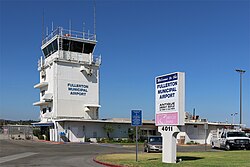
Facilities
Fullerton Municipal Airport tower
Fullerton Municipal Airport covers 86 acres (350,000m2) and has one runway and one heliport:
6/24: 3,121 × 75ft (951 × 23 m), asphalt
Heliport H1: 37 × 37ft (11 × 11 m), concrete
Its control tower handles an average of 262 operations per day.
(*) former LAWA airports (X) As of 2019[update] previously had commercial service but now does not.
This page is based on this Wikipedia article Text is available under the CC BY-SA 4.0 license; additional terms may apply. Images, videos and audio are available under their respective licenses.