Gargando

Last updated
Gargando
Town and Commune
Mali adm location map.svg
Red pog.svg
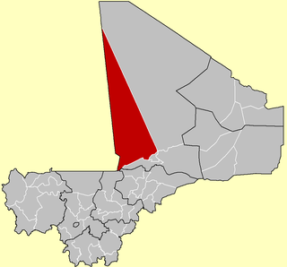
Gargando
Location in Mali
Coordinates: 16°28′N4°11′W / 16.467°N 4.183°W / 16.467; -4.183 Coordinates: 16°28′N4°11′W / 16.467°N 4.183°W / 16.467; -4.183
CountryFlag of Mali.svg  Mali
Region Tombouctou Region
Cercle Goundam Cercle
Government
  MayorAbdoulahi Ag Hamouna [1]
Population
 (2009)
  Total7,950
Time zone UTC+0 (GMT)

Gargando is a small town located in the Tombouctou Region of Mali. The people are mainly from subdivisions of the Kel Ansar tribe (which traces its origin to the Ansar of Medina). The village has many educated Touareg people.

Tombouctou Region Region in Mali

Tombouctou Region is one of the administrative regions of Mali. It is the largest of Mali's eight regions and includes a large section of the Sahara Desert. For administrative purposes, the region is subdivided into five cercles.

Mali Republic in West Africa

Mali, officially the Republic of Mali, is a landlocked country in West Africa. Mali is the eighth-largest country in Africa, with an area of just over 1,240,000 square kilometres (480,000 sq mi). The population of Mali is 18 million. 67% of its population was estimated to be under the age of 25 in 2017. Its capital is Bamako. The sovereign state of Mali consists of eight regions and its borders on the north reach deep into the middle of the Sahara Desert, while the country's southern part, where the majority of inhabitants live, features the Niger and Senegal rivers. The country's economy centers on agriculture and mining. Some of Mali's prominent natural resources include gold, being the third largest producer of gold in the African continent, and salt.

Medina City in Al Madinah, Saudi Arabia

Medina, also transliterated as Madīnah, is the capital of the Al-Madinah Region in Saudi Arabia. At the city's heart is al-Masjid an-Nabawi, which is the burial place of the Islamic prophet, Muhammad. Medina is one of the three holiest cities in Islam, the other two being Mecca and Jerusalem.

The diaspora of Gargando people is spread throughout Mali and includes the Cherifène, the Kel Razaf, the Idanane, the Kel Tinakawate, the Kel Indierene, the Kel Emmimalane etc. The current chief of the Kel Antessar tribe, Mohamed Elmehdi Ag Attaher, comes from Gargando, although the geographical borders of the town do not correspond to the sociological classification of the inhabitants.

The Commune Rurale of Gargando was created by Law 96-059 of 4 November 1996. It is bordered on the north by the Commune Rurale of Adarmalane, on the northwest by the Commune Rurale of Râz-El-Mâ, on the northeast by the Commune of M'Bouna, on the east by the communes of Télé and Goundam, on the west by the Commune Rurale of Télemsi and that of Aljounoub, on the southwest by the communes of Djanké and Soumpi, on the south by the Commune of Soboundou, and on the southeast by the Commune Rurale of Tonka.

Adarmalane Commune in Tombouctou Region, Mali

Adarmalane also D'adarmalane is a rural commune of the Cercle of Goudam in the Tombouctou Region of Mali. It lies to the south of Lake Faguibine.

Raz El Ma Commune and village in Tombouctou Region, Mali

Raz El Ma is a village and commune of the Cercle of Goundam in the Tombouctou Region of Mali. In the 2009 census the commune had a population of 4,121.

M'Bouna is a village and commune of the Cercle of Goudam in the Tombouctou Region of Mali. As of 1998, the commune had a population of 6,070.

The population of the 2009 Census was 7,950. [2] The population is Tamacheq. [3]

National government is represented by the Sub-Prefect, the national health service by the Chief of the Medical Post, and the national education service by the directors of schools.

Related Research Articles

Aguelhok Commune and town in Kidal Region

Aguelhok or Adjelhoc is a rural commune and village in the Kidal Region of eastern Mali in the Tessalit Cercle. In the census of 2009 the commune had a population of 8,080.

Niéna Commune and town in Sikasso Region, Mali

Niéna is a small town and rural commune in the Cercle of Sikasso in the Sikasso Region of southern Mali. The commune covers an area of 1,040 square kilometers and includes the town and 42 villages. In the 2009 census it had a population of 32,265. The town is the administrative center (chef-lieu) of the commune. It is 76 km west of Sikasso on the RN7, the main road linking Sikasso and Bougouni.

Nara, Mali Commune and town in Koulikoro Region, Mali

Nara is a town and rural commune in the Koulikoro Region of southwestern Mali. The town is the administrative center of the Nara Cercle. It is 37 km south of the Mauritanian border and 292 km north-northeast of the Malian capital, Bamako. The rural commune covers an area of 1300 square kilometers and includes the town and 16 surrounding villages. In the 2009 census the commune had a population of 19,793.

Yorosso Commune and town in Sikasso Region, Mali

Yorosso is a town and rural commune in the Yorosso Cercle, in the Sikasso Region of southern Mali. The town serves as the seat of the Yorosso Cercle. It lies 151 km northeast of Sikasso and 202 km southeast of Ségou. The commune covers an area of 487 square kilometers, and includes the Yorosso town and nine other surrounding villages. According to the 2009 census, it had a population of 22,063.

Goundam Cercle Cercle in Tombouctou Region, Mali

Goundam Circle is a second-level administrative subdivision of the Tombouctou Region in northern Mali. Its administrative center is the town of Goundam, although the most populous commune is that of Tonka. In the 2009 census, the circle had a population of 150,150.

Guénégoré Commune and village in Kayes Region, Mali

Guénégoré is a village and rural commune in the Cercle of Kéniéba in the Kayes Region of south-western Mali. It is located near the border with Guinea. The commune includes 7 villages and in the 2009 census had a population of 7,229.

Kalifabougou Commune and town in Koulikoro Region, Mali

Kalifabougou is a small town and rural commune in the Cercle of Kati in the Koulikoro Region of south-western Mali. The commune includes 12 villages and covers an area of 241 km2. In the 2009 census the population of the commune was 4,796. The village of Kalifabougou is 30 km northwest of Kati, the chef-lieu of the cercle.

Guiré Commune and town in Koulikoro Region, Mali

Guiré is a small town and rural commune in the Cercle of Nara in the Koulikoro Region of south-western Mali. The commune covers an area of 6,892 square kilometers and extends to the Mauritanian border. It contains 25 villages and had a population of 19,879 in the 2009 census. The town of Guiré is 90 km southeast of Nara, the administrative centre (chef-lieu) of the cercle.

Nimbougou Commune and village in Sikasso Region, Mali

Nimbougou is a village and rural commune in the Cercle of Kadiolo in the Sikasso Region of southern Mali. The commune covers an area of 238 square kilometers and includes 5 villages. In the 2009 census it had a population of 9,992. The village of Nimbougou, the administrative center (chef-lieu) of the commune, is 43 km northeast of Kadiolo and 8 km from the border with Burkina Faso The primary language is Senufo, specifically Suppire.

Lobougoula Commune and town in Sikasso Region, Mali

Lobougoula is a small town and rural commune in the Cercle of Sikasso in the Sikasso Region of southern Mali. The commune covers an area of 1418 square kilometers and includes the town and 31 villages. In the 2009 census it had a population of 32,505. The town of Lobougoula, the chef-lieu of the commune, is 49 km southwest of Sikasso.

Kignan Commune and town in Sikasso Region, Mali

Kignan is a small town and rural commune in the Cercle of Sikasso in the Sikasso Region of southern Mali. The commune covers an area of 646 square kilometers and includes the town and 14 villages. As of the 2009 census it had a population of 33,962. The town of Kignan is 77 km northwest of Sikasso on the R20 road that links Sikasso to Fana.

Dogoni Commune and town in Sikasso Region, Mali

Dogoni is a small town and rural commune in the Cercle of Sikasso in the Sikasso Region of southern Mali. The commune covers an area of 361 square kilometers and includes the town and 12 villages. In the 2009 census it had a population of 15,186. The town of Dogoni, the chef-lieu of the commune, is 100 km north-northwest of Sikasso.

Blendio Commune and town in Sikasso Region, Mali

Blendio is a small town and rural commune in the Cercle of Sikasso in the Sikasso Region of southern Mali. The commune covers an area of 369 square kilometers and includes the town and 13 villages. In the 2009 census it had a population of 18,207. The town of Blendio, the chef-lieu of the commune, is 81 km west-northwest of Sikasso.

Mahou, Mali Commune and village in Sikasso Region, Mali

Mahou is a village and rural commune in the Yorosso Cercle in the Sikasso Region of southern Mali. The commune covers an area of 263 square kilometers and includes 4 villages. In the 2009 census it had a population of 16,212. The village of Mahou, the administrative center (chef-lieu), is 30 km southeast of Yorosso on the border with Burkina Faso.

Wassoulou-Ballé Commune in Sikasso Region, Mali

Wassoulou-Ballé is a rural commune in the Cercle of Yanfolila in the Sikasso Region of southern Mali. The administrative center (chef-lieu) of the commune is the town of Yanfolila. The town is also the administrative center of the cercle. It lies 272 km west of Sikasso, 164 km south of Bamako and 23 km from the border with Guinea. The commune covers an area of 1,594 square kilometers and includes the town of Yanfolila and 29 villages. In the 2009 census it had a population of 51,727.

Djallon-Foula Commune in Sikasso Region, Mali

Djallon-Foula is a rural commune in the Cercle of Yanfolila in the Sikasso Region of southern Mali. The commune covers an area of 471 square kilometers and includes eight villages. In the 2009 census it had a population of 10,678. The village of Guélélinkoro, the administrative center (chef-lieu) of the commune, is 40 km west of Yanfolila and 4 km east of the Sankarani River that marks the border of Mali with Guinea.

Baya, Mali Commune in Sikasso Region, Mali

Baya is a rural commune in the Cercle of Yanfolila in the Sikasso Region of southern Mali. The commune covers an area of 128 square kilometers and includes the small towns of Kangaré and Dalabala, three villages and part of Lake Sélingué. In the 2009 census the commune had a population of 33,519. The town of Kangaré, the administrative center (chef-lieu) of the commune, lies to the east of the Sélingué Dam, 52 km north of Yanfolila.

Dialloubé Commune and town in Mopti Region, Mali

Dialloubé is a small town and rural commune in the Cercle of Mopti in the Mopti Region of Mali. The commune covers an area of approximately 1,425 square kilometers and includes the town and 8 villages. In the 2009 census the commune had a population of 13,727.

Léré, Mali Commune and town in Tombouctou Region, Mali

Léré is a small town and rural commune of the Cercle of Niafunké in the Tombouctou Region of Mali. The commune covers an area of approximately 1,342 square kilometers and contains the town and 18 villages. In the 2009 census the commune had a population of 16,072.

Fakala Commune in Mopti Region, Mali

Fakala is a Rural Commune of the Cercle of Djenné in the Mopti Region of Mali. The commune contains 30 villages and had a population of 32,689 in the census of 2009. The local government is based in the small town of Sofara.

References

  1. "Informations sur les élus. Année d'élection 2009" (in French). Ministère de l’Administration territoriale et des Collectivités locales. 12 August 2009. p. 525. Retrieved 2010-12-29. Archived at wikiwix.com.[ dead link ]
  2. "Répartition par commune de la population résidente et des ménages" (PDF) (in French). Institut national de la statistique (Mali). Archived from the original (PDF) on 2011-07-22. Retrieved 2010-12-29.
  3. Plan de Securite Alimentaire Commune Rurale de Gargando 2006-2010 (PDF) (in French), Commissariat à la Sécurité Alimentaire, République du Mali, USAID-Mali, 2006, archived from the original (PDF) on 2012-03-18.