The Araucanía, Araucanía Region is one of Chile's 16 first order administrative divisions and comprises two provinces: Malleco in the north and Cautín in the south. Its capital and largest city is Temuco; other important cities include Angol and Villarrica.

The Los Ríos Region is one of Chile's 16 regions, the country's first-order administrative divisions. Its capital is Valdivia. It began to operate as a region on October 2, 2007, having been created by subdividing the Los Lagos Region in southern Chile. It consists of two provinces: Valdivia and the newly created Ranco Province, which was formerly part of Valdivia Province.

The Chilean Coastal Range is a mountain range that runs from north to south along the Pacific coast of South America parallel to the Andean Mountains, extending from Morro de Arica in the north to Taitao Peninsula, where it ends at the Chile Triple Junction, in the south. The range has a strong influence on the climate of Chile since it produces a rain shadow to the east. Because of this the vegetation growing on the seaward slopes is much more exuberant than in the interior. Compared to the coastal lowlands and the Intermediate Depression it is sparsely populated with land use varying from protected areas to grazing and silviculture. The range is present in all Chilean regions except for Coquimbo Region and Magallanes Region.

The Liquiñe-Ofqui Fault is major geological fault that runs a length of roughly 1200 km in a NNE-SSW orientation and exhibits current seismicity. It is located in the Chilean Northern Patagonian Andes. It is a dextral intra-arc transform fault. Most large stratovolcanoes of the Southern Volcanic Zone of the Andes are aligned by the fault which allows for the movement of magma and hydrothermal fluids.

The Andean Volcanic Belt is a major volcanic belt along the Andean cordillera in Argentina, Bolivia, Chile, Colombia, Ecuador and Peru. It formed as a result of subduction of the Nazca Plate and Antarctic Plate underneath the South American Plate. The belt is subdivided into four main volcanic zones that are separated from each other by volcanic gaps. The volcanoes of the belt are diverse in terms of activity style, products and morphology. While some differences can be explained by which volcanic zone a volcano belongs to, there are significant differences within volcanic zones and even between neighboring volcanoes. Despite being a type location for calc-alkalic and subduction volcanism, the Andean Volcanic Belt has a large range of volcano-tectonic settings, such as rift systems and extensional zones, transpressional faults, subduction of mid-ocean ridges and seamount chains apart from a large range on crustal thicknesses and magma ascent paths, and different amount of crustal assimilations.
Lanalhue Fault is a northwest-striking fault that marks the contact between two distinct units of continental basement, the Eastern and Western Series in south-central Chile, separating the Nahuelbuta Range Cordillera de Nahuelbuta at the east and the Arauco Peninsula and Basin to the west. The fault takes name from Lanalhue Lake, which is located in part of the fault trace, of elongated shape shows the NW-SE trend. The lanalhue fault makes up a major lithological boundary in the Chilean Coast Range to which Cordillera de Nahuelbuta belongs. The Nahuelbuta Range is composed by Carboniferous granitic core bounded by High-T metasedimentary rocks referred as the Eastern Series. The Arauco Basin contains over 3 km of late Cretaceous to Holocene continental and marine sediments, being a major center of coal mining and hydrocarbon exploration for over a century. From Valparaíso Region to Lanalhue Fault Carboniferous-Permian granitoids makes up a large part of the bedrock of the Chilean Coast Range. These igneous rocks was once part of a proto-Andean magmatic belt. South of Lanalhue Fault most of the Chilean Coast Range is an accretionary wedge formed by at least since the Paleozoic along the subduction zone at South Americas western margin.

The Atacama Fault Zone (AFZ) is an extensive system of faults cutting across the Chilean Coastal Cordillera in Northern Chile between the Andean Mountain range and the Pacific Ocean. The fault system is North-South striking and runs for more than 1100 km North and up to 50 km in width through the Andean forearc region. The zone is a direct result of the ongoing subduction of the Eastward moving Nazca Plate beneath the South American Plate and is believed to have formed in the Early Jurassic during the beginnings of the Andean orogeny. The zone can be split into 3 regions: the North, Central and South.

Calabozos is a Holocene caldera in central Chile's Maule Region. Part of the Chilean Andes' volcanic segment, it is considered a member of the Southern Volcanic Zone (SVZ), one of the three distinct volcanic belts of South America. This most active section of the Andes runs along central Chile's western edge, and includes more than 70 of Chile's stratovolcanoes and volcanic fields. Calabozos lies in an extremely remote area of poorly glaciated mountains.

The history of yerba mate, that stretches back to pre-Columbian Paraguay, is marked by a rapid expansion in harvest and consumption in the Spanish South American colonies but also by its difficult domestication process, which even if discovered in the mid 17th century had to be rediscovered later when production was industrialized around 1900.
The Asunción Rift is a composite graben and rift in eastern Paraguay. The rift is at some localities filled with up to 2500 m of sediments. The rift has a width of 40 to 25 km and can be divided in three segments. The western segment has a NW-SE strike and runs a length of over 90 km between the localities of Benjamin Aceval and Paraguarí. The central section runs from Paraguarí to Villarrica in a E-W direction and has a length of 70 km. The eastern section has a NW-SE orientation and a length of 40 km and runs from Villarrica to the Ybytyruzú Mountains.

The El Tigre Fault is a 120 km long, roughly north-south trending, major strike-slip fault located in the Western Precordillera in Argentina. The Precordillera lies just to the east of the Andes mountain range in South America. The northern boundary of the fault is the Jáchal River and its southern boundary is the San Juan River. The fault is divided into three sections based on fault trace geometry, Northern extending between 41–46 km in length, Central extending between 48–53 km in length, and Southern extending 26 km in length. The fault displays a right-lateral (horizontal) motion and has formed in response to stresses from the Nazca Plate subducting under the South American Plate. It is a major fault with crustal significance. The Andes Mountain belt trends with respect to the Nazca Plate/South American Plate convergence zone, and deformation is divided between the Precordilleran thrust faults and the El Tigre strike-slip motion. The El Tigre Fault is currently seismically active.
Fueguino is a volcanic field in Chile. The southernmost volcano in the Andes, it lies on Tierra del Fuego's Cook Island and also extends over nearby Londonderry Island. The field is formed by lava domes, pyroclastic cones, and a crater lake.
Negro de Chorrillos is a volcano in the Andes.

The Huincul Fault or Huincul Fault Zone is an east-west oriented continental-scale fault that extends from the Neuquén Basin eastwards into the Argentine Shelf. To the west it has been proposed that it extends across the Andes to the Chilean Coast Range.

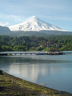
The Mocha-Villarrica Fault Zone is a northwest-trending geological fault zone in southern Chile and Argentina. The fault zone runs from Mocha Island in the Pacific to the Andes where it aligns Villarrica, Quetrupillán and Lanín volcanoes. It is one of several fault zones that traverses the north-south Liquiñe-Ofqui Fault.
The Biobío-Aluminé Fault Zone is a northwest-trending geological fault zone in south-central Chile and Argentina. The fault aligns with the middle-upper course of Bío Bío River where fault traces are largely covered with fluvial gravels. The northernmost reaches of the north-south Liquiñe-Ofqui Fault intersect and displace the Biobío-Aluminé Fault Zone.