Gibson, North Carolina

Last updated

Gibson, North Carolina
Gibson, North Carolina.jpg
Scotland County North Carolina incorporated and unincorporated areas Gibson highlighted.svg
Location in Scotland County and the state of North Carolina.
Coordinates: 34°45′34″N79°36′25″W / 34.75944°N 79.60694°W / 34.75944; -79.60694
Country United States
State North Carolina
County Scotland
Government
  TypeTown Commission
  MayorEric Stubbs
Area
[1]
  Total0.98 sq mi (2.53 km2)
  Land0.98 sq mi (2.53 km2)
  Water0.00 sq mi (0.00 km2)
Elevation
[2]
249 ft (76 m)
Population
 (2020)
  Total449
  Density460.04/sq mi (177.67/km2)
Time zone UTC-5 (Eastern (EST))
  Summer (DST) UTC-4 (EDT)
ZIP code
28343
Area codes 910, 472
FIPS code 37-25940 [3]
GNIS feature ID2406564 [2]

Gibson is a town in Scotland County, North Carolina, United States. The population was 540 at the 2010 census.

Contents

History

Gibson was originally located in Richmond County, North Carolina. [4] A post office was built in the area in 1846, and the town was named for its first postmaster, Noah Gibson. [5] In 1883 the Raleigh and Augusta Air Line Railroad made plans to build a spur line to Gibson to bring goods to the locale and ship cotton out from local residents to markets. In anticipation of the railroad connection, Gibson residents erected a depot, hotel, academy, and several additional stores. The spur was built in 1884 and opened on July 1 with daily rail service to Hamlet. In 1891 the Charleston, Sumter and Northern Railroad line from Bennettsville, South Carolina was linked to the Air Line at the Gibson depot. Scotland County was created in 1899 and Gibson became a part of the new jurisdiction. [4] The town was incorporated that year. [5] In 1904 a bank was established. [6] A civic ruritan club was founded in 1946. [7] The rail depot was later restored and turned into a community center. [8]

Geography

According to the United States Census Bureau, the town has a total area of 1.0 square mile (2.6 km2), all of it land.

Demographics

Historical population
CensusPop.Note
1920 264
1930 41758.0%
1940 4354.3%
1950 60940.0%
1960 501−17.7%
1970 5020.2%
1980 5336.2%
1990 532−0.2%
2000 5849.8%
2010 540−7.5%
2020 449−16.9%
U.S. Decennial Census [9]

As of the census [3] of 2000, there were 584 people, 213 households, and 146 families residing in the town. The population density was 595.1 people per square mile (229.8 people/km2). There were 247 housing units at an average density of 251.7 per square mile (97.2/km2). The racial makeup of the town was 49.66% White, 42.12% African American, 6.85% Native American, 0.68% from other races, and 0.68% from two or more races. Hispanic or Latino of any race were 0.86% of the population.

There were 213 households, out of which 34.7% had children under the age of 18 living with them, 40.4% were married couples living together, 23.5% had a female householder with no husband present, and 31.0% were non-families. 29.1% of all households were made up of individuals, and 18.8% had someone living alone who was 65 years of age or older. The average household size was 2.72 and the average family size was 3.37.

In the town, the population was spread out, with 32.4% under the age of 18, 9.2% from 18 to 24, 24.3% from 25 to 44, 17.1% from 45 to 64, and 17.0% who were 65 years of age or older. The median age was 33 years. For every 100 females, there were 85.4 males. For every 100 females age 18 and over, there were 75.6 males.

The median income for a household in the town was $21,696, and the median income for a family was $27,125. Males had a median income of $27,143 versus $19,167 for females. The per capita income for the town was $15,542. About 24.1% of families and 23.6% of the population were below the poverty line, including 36.6% of those under age 18 and 15.3% of those age 65 or over.

Related Research Articles

<span class="mw-page-title-main">Dillon County, South Carolina</span> County in South Carolina, United States

Dillon County is a county located in the U.S. state of South Carolina. As of the 2020 census, the county's population was 28,292. The county seat is Dillon.

<span class="mw-page-title-main">Elon, North Carolina</span> Town in North Carolina, United States

Elon is a town in Alamance County, North Carolina, United States. It is part of the Burlington metropolitan statistical area. The population as of the 2020 census was 11,324. The town of Elon is home to Elon University.

<span class="mw-page-title-main">Elk Park, North Carolina</span> Town in North Carolina, United States

Elk Park is a town in Avery County, North Carolina, United States. The town was so named because of the number of elk killed there. The population was 452 at the 2010 census.

<span class="mw-page-title-main">Clarkton, North Carolina</span> Town in North Carolina, United States

Clarkton is a town in Bladen County, North Carolina, United States. The population was 837 at the 2010 census.

<span class="mw-page-title-main">Patterson Springs, North Carolina</span> Town in North Carolina, United States

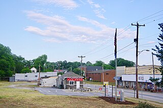
Patterson Springs is a town in Cleveland County, North Carolina, United States. The population was 622 at the 2010 census.

<span class="mw-page-title-main">Rural Hall, North Carolina</span> Town in North Carolina, United States

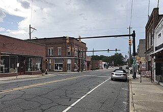
Rural Hall is a town in Forsyth County, North Carolina, United States. It is a part of the Piedmont Triad. The population was 3,360 at the 2020 census. The town has one public park: Covington Memorial Park.

<span class="mw-page-title-main">Ellerbe, North Carolina</span> Town in North Carolina, United States

Ellerbe is a town in Richmond County, North Carolina, United States. The population was 1,054 at the 2010 census.

<span class="mw-page-title-main">Hamlet, North Carolina</span> City in North Carolina, United States

Hamlet is a city in Richmond County, North Carolina, United States. The population was 6,042 at the 2020 census.

<span class="mw-page-title-main">Laurinburg, North Carolina</span> City in North Carolina, United States

Laurinburg is a city in and the county seat of Scotland County, North Carolina, United States. Located in southern North Carolina near the South Carolina border, Laurinburg is southwest of Fayetteville and is home to St. Andrews University. The population at the 2010 census was 15,962 people.

<span class="mw-page-title-main">Walnut Cove, North Carolina</span> Town in North Carolina, United States

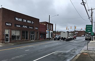
Walnut Cove is a town in Stokes County, North Carolina, United States. The population was 1,536 at the 2020 census.

<span class="mw-page-title-main">Indian Trail, North Carolina</span> Town in North Carolina, United States

Indian Trail is a suburban town in Union County, North Carolina, United States. A part of the Charlotte metropolitan area, Indian Trail has grown rapidly in the 21st century, going from 1,942 residents in 1990 to 39,997 in 2020.

<span class="mw-page-title-main">Kittrell, North Carolina</span> Town in North Carolina, United States

Kittrell is a town in Vance County, North Carolina, United States.

<span class="mw-page-title-main">Belton, South Carolina</span> City in South Carolina, United States

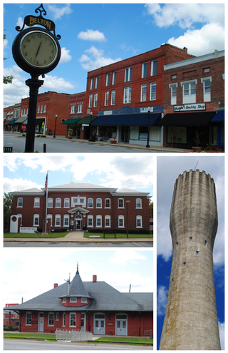
Belton is a city in eastern Anderson County, South Carolina. The population was 4,134 at the 2010 census.

<span class="mw-page-title-main">Joanna, South Carolina</span> Census-designated place in South Carolina, United States

Joanna is an unincorporated community and census-designated place (CDP) in Laurens County, South Carolina, United States. The population was 1,539 at the 2010 census, down from 1,609 at the 2000 census. It is part of the Greenville–Mauldin–Easley Metropolitan Statistical Area.

<span class="mw-page-title-main">Branchville, South Carolina</span> Town in South Carolina, United States

Branchville is a town in Orangeburg County, South Carolina, United States. The population was 1,024 at the 2010 census.

<span class="mw-page-title-main">Duncan, South Carolina</span> Town in South Carolina, United States

Duncan is a town in Spartanburg County, South Carolina, United States. Its population was 3,181 at the 2010 census.

<span class="mw-page-title-main">Alberta, Virginia</span> Town in Virginia, United States

Alberta is a town in Brunswick County, Virginia, United States. The population was 302 at the 2020 census. It is home to the Christanna Campus of Southside Virginia Community College.

<span class="mw-page-title-main">McKenney, Virginia</span> Town in Virginia, United States

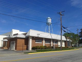
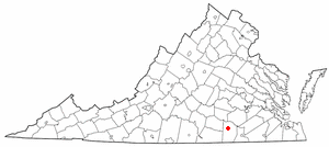
McKenney is an incorporated town in Dinwiddie County, Virginia, United States. The population was 483 at the 2010 census.

<span class="mw-page-title-main">Gibsonville, North Carolina</span> Town in North Carolina, United States

Gibsonville is a town in both Alamance and Guilford counties in the U.S. state of North Carolina. Most of Gibsonville is situated in the Greensboro-Winston-Salem-High Point Combined Statistical Area and the eastern portion is in the Burlington, North Carolina Metropolitan Statistical Area, encompassing all of Alamance County. According to the 2020 census, the population of Gibsonville was 8,971.

<span class="mw-page-title-main">Suffield Depot, Connecticut</span> Census-designated place in Connecticut, United States

Suffield Depot is the name of a census-designated place (CDP) corresponding to the village of Suffield, the primary settlement of the town of Suffield, Connecticut, in Hartford County. The population of the CDP was 1,325 as of the 2010 census.

References

  1. "ArcGIS REST Services Directory". United States Census Bureau. Retrieved September 20, 2022.
  2. 1 2 U.S. Geological Survey Geographic Names Information System: Gibson, North Carolina
  3. 1 2 "U.S. Census website". United States Census Bureau . Retrieved January 31, 2008.
  4. 1 2 Carriker & Linder 1982, p. 7.
  5. 1 2 Powell 1976, p. 190.
  6. Carmichael 1950, p. 7.
  7. Carmichael 1950, p. 16.
  8. Carriker & Linder 1982, p. 8.
  9. "Census of Population and Housing". Census.gov. Retrieved June 4, 2015.

Works cited