| Gilmore Mills, Virginia | |
|---|---|
| Unincorporated community | |
 Gilmore Mills, Virginia  Gilmore Mills, Virginia | |
| Coordinates: 37°36′31″N79°32′29″W / 37.60861°N 79.54139°W Coordinates: 37°36′31″N79°32′29″W / 37.60861°N 79.54139°W | |
| Country | United States |
| State | Virginia |
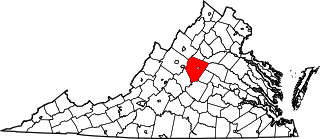
| County | Rockbridge |
| Elevation | 781 ft (238 m) |
| Time zone | Eastern (EST) (UTC-5) |
| • Summer (DST) | EDT (UTC-4) |
| Area code(s) | 276 |
| GNIS feature ID | 1492998 [1] |
Gilmore Mills is an unincorporated community in Rockbridge County, Virginia, United States. Gilmore Mills is located on the James River 5.3 miles (8.5 km) west-southwest of Glasgow.
Rockbridge County is a county located in the Commonwealth of Virginia. As of the 2010 census, the population was 22,307. Its county seat is Lexington. The independent cities of Buena Vista (6,680) and Lexington (7,170) are both enclaved within the county's geographical borders.

Virginia, officially the Commonwealth of Virginia, is a state in the Southeastern and Mid-Atlantic regions of the United States located between the Atlantic Coast and the Appalachian Mountains. Virginia is nicknamed the "Old Dominion" due to its status as the first English colonial possession established in mainland North America and "Mother of Presidents" because eight U.S. presidents were born there, more than any other state. The geography and climate of the Commonwealth are shaped by the Blue Ridge Mountains and the Chesapeake Bay, which provide habitat for much of its flora and fauna. The capital of the Commonwealth is Richmond; Virginia Beach is the most populous city, and Fairfax County is the most populous political subdivision. The Commonwealth's estimated population as of 2018 is over 8.5 million.

The James River is a river in the U.S. state of Virginia that begins in the Appalachian Mountains and flows 348 miles (560 km) to Chesapeake Bay. The river length extends to 444 miles (715 km) if one includes the Jackson River, the longer of its two source tributaries. It is the longest river in Virginia and the 12th longest river in the United States that remains entirely within a single state. Jamestown and Williamsburg, Virginia’s first colonial capitals, and Richmond, Virginia's current capital, lie on the James River.
Annandale and the Varney's Falls Dam were listed on the National Register of Historic Places in 1993. [2]

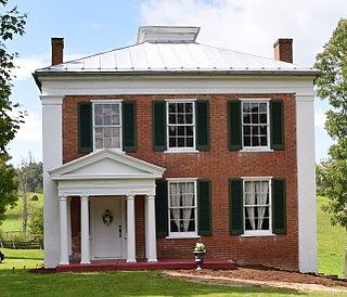
Annandale, also known as Alpine Farms, is a historic home located at Gilmore Mills, Botetourt County, Virginia. It was built in 1835, and is a two-story, Greek Revival-style brick dwelling with a deck-on-hip roof. It has a one-story, three bay, wooden front porch with tapering square columns. A two-story brick west wing and a single story frame ell, were added in 1969. Also on the property is a contributing brick dairy or meathouse.
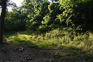
Varney's Falls Dam is a historic lock and dam structure located on the James River near Gilmore Mills, Botetourt County, Virginia. It was built in 1851, and is a massive limestone structure. The lock chamber measures 100 feet long between gate recesses, 15 feet wide, and approximately 21 feet from the top on the upriver end to ground level. Associated with the lock are the lock and dam abutment structures, the remaining towpaths, canal bed, berm bank, towpath culvert and remnants of a towpath bridge. The dam was destroyed in 1881, and the lock gates removed in 1885.

The National Register of Historic Places (NRHP) is the United States federal government's official list of districts, sites, buildings, structures, and objects deemed worthy of preservation for their historical significance. A property listed in the National Register, or located within a National Register Historic District, may qualify for tax incentives derived from the total value of expenses incurred preserving the property.