
The River Avon is a river in the Strathspey area of the Scottish Highlands, and a tributary of the River Spey. It drains the north-eastern area of the Cairngorm Mountains and is largely contained within the Cairngorms National Park

Lochaber is a name applied to a part of the Scottish Highlands. Historically, it was a provincial lordship consisting of the parishes of Kilmallie and Kilmonivaig, as they were before being reduced in extent by the creation of Quoad Sacra parishes in the 19th century. Lochaber once extended from the Northern shore of Loch Leven, a district called Nether Lochaber, to beyond Spean Bridge and Roybridge, which area is known as Brae Lochaber or Braigh Loch Abar in Gaelic. Lochaber is now also used to refer to a much wider area, one of the 16 ward management areas of the Highland Council of Scotland and one of eight former local government districts of the two-tier Highland region. The main town of Lochaber is Fort William.

Glen Affric is a glen south-west of the village of Cannich in the Highland region of Scotland, some 15 miles west of Loch Ness. The River Affric runs along its length, passing through Loch Affric and Loch Beinn a' Mheadhoin. A minor public road reaches as far as the end of Loch Beinn a' Mheadhoin, but beyond that point only rough tracks and footpaths continue along the glen.

Cannich is a village at the southern end of Strathglass, in the Highlands of Scotland, about 26 miles (42 km) west of the city of Inverness. It is at the furthest point of the A831 that loops around the Aird from Beauly to Drumnadrochit.

Sgurr na Lapaich is a mountain in the Northwest Highlands of Scotland, situated north of Loch Mullardoch in the high ground that separates Glen Cannich and Glen Strathfarrar. The mountain reaches a height of 1,150 metres, and is the fourth-highest mountain north of the Great Glen. There is no higher ground to the north of it in Great Britain.

Sgùrr a' Bhealaich Dheirg is a mountain in Kintail on the northern side of Glen Shiel in the Scottish Highlands. With a height of 1,036 metres (3,399 ft), it is classed as a Munro. It is the highest of three Munros known as the "Brothers of Kintail" in contrast to the Five Sisters of Kintail which lie just to the west.
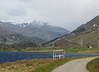
Glen Strathfarrar is a glen in the Highland region of Scotland, near Loch Ness.

Sròn a’ Choire Ghairbh is a Scottish mountain situated on the northern side of Loch Lochy, 13 kilometres north of Spean Bridge in the Highland Council area.

Stob Ghabhar is a mountain in the Scottish Highlands, part of the Black Mount group. It is a Munro with a height of 1,089.2 metres (3,573 ft). Stob Ghabhar lies nine kilometres (5.6 mi) northwest of Bridge of Orchy and stands on the border of the Argyll and Highland council areas.

Meall na Teanga is a Scottish mountain located in the Highland council area, 11 km (7 mi) north of Spean Bridge.
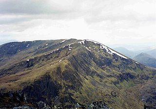
An Riabhachan is a Scottish mountain in the Skye and Lochalsh district of the Highland council area. It is situated 35 kilometres east of Kyle of Lochalsh standing in an isolated position at the western end of Loch Mullardoch, ten kilometres from any public road.
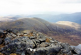
Càrn nan Gobhar is a mountain rising to 993 metres (3,258 ft) in the Northwest Highlands of Scotland. It stands on the northern side of Loch Mullardoch in the upper part of Glen Cannich, in a remote group of four Munros informally known as "The Mullardochs" which form the high ground between Loch Mullardoch and Loch Monar.

River Shira is the river that runs for about 7 miles through Glen Shira, originating to the north-east at 350 metres (1,150 ft) altitude, near the start of the River Fyne.

Meall na h-Eilde is a Scottish hill situated in the high ground between the Great Glen and Glen Garry, 23 km north of Fort William in the Highland Council Area.
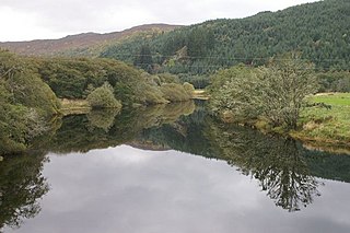
The River Glass is a river in the Scottish Highlands which flows northeastwards down Strathglass. It begins at the confluence of the River Affric and the Abhainn Deabhag, near the village of Tomich. It is joined by the River Cannich near the village of Cannich, then flows as far as a confluence with the River Farrar near Struy, from which point the merged waters are known as the River Beauly.

Loch Mullardoch is a major reservoir in Glen Cannich in the Northwest Highlands of Scotland. It was created by the damming in 1951 of the River Cannich just upstream of Mullardoch House, as part of the Affric-Beauly hydro-electric power scheme. A car park at the southern end of the dam is the terminus of the public road up Glen Cannich. The reservoir extends for about 14 km westwards up the glen to the point where the Abhainn a Choilich and Abhainn Sithidh burns drop down from the West Benula deer forest.
John Farquharson (1699–1782), was a Scottish Jesuit priest and folk hero in the Scottish folklore of Lochaber and Strathglass.
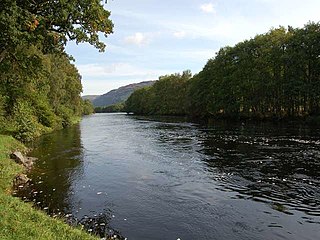
Strathglass is a strath or wide and shallow valley in the Northwest Highlands of Scotland down which runs the meandering River Glass from the point at which it starts at the confluence of the River Affric and Abhainn Deabhag to the point where, on joining with the River Farrar at Struy, the combined waters become the River Beauly.

Alexander Cameron of Lochiel, S.J. was a Scottish nobleman and outlawed Roman Catholic priest in the Society of Jesus. He is currently being promoted by the Knights of St Columba for Canonization as a Saint and a martyr by the Roman Catholic Church.


