Glencoe, Oklahoma

Last updated

Glencoe, Oklahoma
Entrance to Glencoe, Oklahoma from Lela, Oklahoma.jpg
Glencoe, as seen coming from Lela
Nickname: 
Gem of Payne County
Motto: 
"How do you build history?"
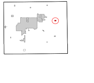
Payne County Oklahoma incorporated and unincorporated areas Glencoe highlighted.svg
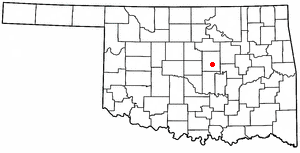
Location within Payne County and Oklahoma
Coordinates: 36°13′54″N96°55′53″W / 36.23167°N 96.93139°W / 36.23167; -96.93139
Country United States
State Oklahoma
County Payne
Government
  TypeMayor-City Council
  MayorJon D. Kuhn
Area
[1]
  Total1.71 sq mi (4.43 km2)
  Land1.67 sq mi (4.34 km2)
  Water0.04 sq mi (0.10 km2)
Elevation
[2]
1,043 ft (318 m)
Population
 (2020)
  Total499
  Density298.09/sq mi (115.09/km2)
Time zone UTC-6 (Central (CST))
  Summer (DST) UTC-5 (CDT)
ZIP code
74032
Area code 580
FIPS code 40-29400 [3]
GNIS feature ID2412684 [2]

Glencoe is a town in northern Payne County, Oklahoma, United States. The population was 601 at the 2010 census, an increase of 3.1 percent from the figure of 583 in 2000. [4] Glencoe is a midway point between Pawnee County and Stillwater, which is the county seat.

Contents

History

Glencoe was founded in 1899 with the establishment of the Glenco Post Office on the Eastern Oklahoma Railway. The first lots were sold on April 15, 1900. After J. Hunter Williams, editor of the Glencoe Mirror, was named postmaster on January 4, 1901, he persuaded the U.S. Post Office Department to change the spelling of the town's name to Glencoe. [lower-alpha 1] Also that year, Glencoe was reported to be a sundown town, prohibiting African Americans from living or stopping in the town. [6] In its early history Glencoe served as a trading center for the area and agriculture was the mainstay of the local economy. On January 22, 1914, a fire swept through downtown and destroyed most of the business district. While some businesses were rebuilt, the town's future growth was negatively affected by the fire. [5]

Geography

According to the United States Census Bureau, the town has a total area of 0.8 square miles (2.1 km2), all land. The town is 7 miles (11 km) east of Stillwater, the county seat, on State Highway 51 and 8 miles (13 km) north on State Highway 108. [5]

Glencoe is a hub for northern Payne County and southern Noble County and serves as the principal community for the area. With deep historical ties to agriculture, the culture of the town is based around the traditions that accompany farming.

Glencoe is located approximately 5.8 miles from Lake Lone Chimney, on the border between Payne and Pawnee counties. The lake historically served as a recreational outlet for the town, drawing in sportsmen for tournaments and other outdoors event. Following the drought which ravished the region in the early 2010s, the lake experienced dramatic water losses and as a result, the economy and culture of the town was negatively impacted.

Demographics

Historical population
CensusPop.Note
1910 373
1920 354−5.1%
1930 297−16.1%
1940 33713.5%
1950 309−8.3%
1960 284−8.1%
1970 42148.2%
1980 49016.4%
1990 473−3.5%
2000 58323.3%
2010 6013.1%
2020 499−17.0%
U.S. Decennial Census [7]

As of the census [3] of 2000, there were 583 people, 233 households, and 164 families residing in the town. The population density was 740.9 inhabitants per square mile (286.1/km2). There were 261 housing units at an average density of 331.7 per square mile (128.1/km2). The racial makeup of the town was 90.74% White, 0.17% African American, 4.46% Native American, 0.51% from other races, and 4.12% from two or more races. Hispanic or Latino of any race were 0.69% of the population.

There were 233 households, out of which 34.8% had children under the age of 18 living with them, 57.5% were married couples living together, 11.6% had a female householder with no husband present, and 29.2% were non-families. 27.0% of all households were made up of individuals, and 12.4% had someone living alone who was 65 years of age or older. The average household size was 2.50 and the average family size was 3.02.

In the town, the population was spread out, with 27.6% under the age of 18, 8.7% from 18 to 24, 27.1% from 25 to 44, 23.2% from 45 to 64, and 13.4% who were 65 years of age or older. The median age was 37 years. For every 100 females, there were 84.5 males. For every 100 females age 18 and over, there were 80.3 males.

The median income for a household in the town was $30,658, and the median income for a family was $35,769. Males had a median income of $24,219 versus $20,938 for females. The per capita income for the town was $12,643. About 6.4% of families and 8.1% of the population were below the poverty line, including 6.8% of those under age 18 and 15.5% of those age 65 or over.

Culture

The culture of the town is widely influenced by traditions of the Southern United States. Festivals and carnivals are an annual event in which people from all over the region come to take part in the events.

Glencoe, located within the Bible Belt, is predominantly Evangelical Protestant with a majority of the townspeople either following teachings that correlate to the United Methodist, Southern Baptist, or Nondenominational churches. Despite the differences, all congregations within the town part-take in the Ministerial Alliance, to which churches come together often to focus on the theological similarities.

Glencoe was the setting for an independent film, "Left of Center," based on the book by Brandi Hodges.

Education

Glencoe is located approximately 16.7 miles from Oklahoma State University to which many residents hold as an alma mater or employer.

Glencoe is home to a Class A school system. Glencoe High School has been given an 'A' value on the annual state report cards which are assigned by the Oklahoma Department of Education.

Sports

Glencoe has strong ties to basketball, baseball and softball. Glencoe is known statewide for its local basketball program, which won the state champion title in years pasts, as well as three consecutive times in the years 2013, 2014, and 2015. Glencoe was also state champions in basketball in 2006 and in 2022.[ citation needed ]

Notes

  1. Glen Coe is a glen in Scotland where soldiers commanded by a Captain Campbell once massacred members of the Clan MacDonald. [5]

Related Research Articles

<span class="mw-page-title-main">Payne County, Oklahoma</span> County in Oklahoma, United States

Payne County is located in the U.S. state of Oklahoma. As of the 2020 census, its population was 81,646. Its county seat is Stillwater. The county was created in 1890 as part of Oklahoma Territory and is named for Capt. David L. Payne, a leader of the "Boomers".

<span class="mw-page-title-main">Pawnee County, Oklahoma</span> County in Oklahoma, United States

Pawnee County is a county located in the U.S. state of Oklahoma. As of the 2020 census, the population was 15,553. Its county seat is Pawnee. The county is named after the Pawnee Nation, whose reservation used to encompass the county prior to allotment in 1893.

<span class="mw-page-title-main">Noble County, Oklahoma</span> County in Oklahoma, United States

Noble County is located in the north central part of Oklahoma. As of the 2020 census, the population was 10,924. Its county seat is Perry. It was part of the Cherokee Outlet in Indian Territory until Oklahoma Territory was created in 1890, and the present county land was designated as County P. After the U. S. government opened the area to non-Indian settlement in 1893, it was renamed Noble County for John Willock Noble, then the United States Secretary of the Interior.
<span class="mw-page-title-main">Creek County, Oklahoma</span> County in Oklahoma, United States

Creek County is a county located in the U.S. state of Oklahoma. As of the 2020 census, the population was 71,754. Its county seat is Sapulpa.

<span class="mw-page-title-main">Calumet, Oklahoma</span> Town in Oklahoma, United States

Calumet is a town in Canadian County, Oklahoma, United States. It is part of the Oklahoma City Metropolitan Area. The population was 507 at the 2010 census, a 5.23 percent decrease since 2000.
<span class="mw-page-title-main">Garber, Oklahoma</span> City in Oklahoma, United States

Garber is a city in Garfield County, Oklahoma, United States. The population was 822 at the 2010 census. The city is named after Martin Garber, father of Milton C. Garber, former U.S. congressman, Enid mayor, newspaper editor, and judge. The land was previously part of the Cherokee Outlet, until the U.S. government declared it open to non-Indian settlement in 1893.
<span class="mw-page-title-main">Sparks, Oklahoma</span> Town in Oklahoma, United States

Sparks is a town in Lincoln County, Oklahoma, United States. The population was 169 at the 2010 census, a 23.4 percent gain from the figure of 137 in 2000. The center of population of Oklahoma is located in Sparks.

<span class="mw-page-title-main">Warwick, Oklahoma</span> Town in Oklahoma, United States

Warwick is a town in Lincoln County, Oklahoma, United States. The population was 184 at the 2020 census, up from 148 in 2010.

Shady Grove is a census-designated place (CDP) in McIntosh County, Oklahoma, United States. The population was 199 at the 2010 census, a decrease of 14.4 percent from 229 in 2000. This is not to be confused with the similarly-named Shady Grove in Cherokee County, or the Shady Grove in Pawnee County.
<span class="mw-page-title-main">Morrison, Oklahoma</span> Town in Oklahoma, United States

Morrison is a town in southeastern Noble County, Oklahoma, United States. The population was 733 at the 2010 census, an increase from the figure of 636 in 2000.

<span class="mw-page-title-main">Blackburn, Oklahoma</span> Town in Oklahoma, United States

Blackburn is a town in Pawnee County, Oklahoma, United States. The population was 108 at the 2010 census, up 5.9 percent from the figure of 102 recorded in 2000. It is 12 miles (19 km) east of the city of Pawnee.

<span class="mw-page-title-main">Hallett, Oklahoma</span> Town in Oklahoma, United States

Hallett is a town in Pawnee County, Oklahoma, United States. It is located 19 miles southeast of Pawnee, the county seat of Pawnee County, on State Highway 99, slightly north of U.S. Highway 412. The population was 125 at the 2010 census, a 25.6 percent decline from the figure of 168 recorded in 2000.

<span class="mw-page-title-main">Jennings, Oklahoma</span> Town in Oklahoma, United States

Jennings is a town in Pawnee County, Oklahoma, United States. The population was 363 at the 2010 census, a 2.7 percent decline from the figure of 373 recorded in 2000.

<span class="mw-page-title-main">Pawnee, Oklahoma</span> City in Oklahoma, United States

Pawnee is a city and county seat of Pawnee County, Oklahoma, United States. The town is northeast of Stillwater at the junction of U.S. Route 64 and State Highway 18.

<span class="mw-page-title-main">Ralston, Oklahoma</span> Town in Oklahoma, United States

Ralston is a town in Pawnee County, Oklahoma, United States. The town is southeast of Ponca City on State Highway 18 near the west bank of the Arkansas River. The population was 330 at the 2010 census, a decline of 7 percent from the figure of 355 recorded in 2000.
<span class="mw-page-title-main">Skedee, Oklahoma</span> Town in Oklahoma, United States

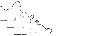
Skedee is a town in Pawnee County, Oklahoma, United States. Skedee is northwest of Tulsa, northeast of Stillwater, and southeast of Ponca City. The population was 62 at the time of the 2020 Census, a 21.6% increase from the figure of 51 recorded in the 2010 Census.

<span class="mw-page-title-main">Westport, Oklahoma</span> Town in Oklahoma, United States

Westport is a town in Pawnee County, Oklahoma, United States. The population was 298 at the 2010 census, a gain of 12.9 percent over the figure of 264 in 2000.
<span class="mw-page-title-main">Ripley, Oklahoma</span> Town in Oklahoma, United States

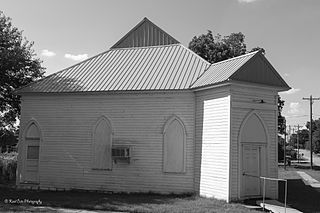
Ripley is a town in southeastern Payne County, Oklahoma, United States. The population was 423 at the 2010 census, a decline of 9.2 percent from the figure of 444 in 2000. The town was named after Edward Ripley, the 14th president of the Atchison, Topeka and Santa Fe Railway.

<span class="mw-page-title-main">Yale, Oklahoma</span> City in Oklahoma, United States

Yale is a city in Payne County, Oklahoma, United States. The population was 1,059 at the 2020 census, a decline of 13.6 percent from the figure of 1,227 in 2010.

<span class="mw-page-title-main">Quay, Oklahoma</span> Census-designated place in Oklahoma, United States

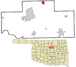
Quay is an unincorporated community and census-designated place (CDP) located on the boundary line between Pawnee and Payne counties in the U.S. state of Oklahoma. The population was 47 at the 2000 census, when it was still a town; the community disincorporated on August 23, 2000. No population was recorded in the census of 2010. But the 2020 Census recorded 39 persons.

References

  1. "ArcGIS REST Services Directory". United States Census Bureau. Retrieved September 20, 2022.
  2. 1 2 U.S. Geological Survey Geographic Names Information System: Glencoe, Oklahoma
  3. 1 2 "U.S. Census website". United States Census Bureau . Retrieved January 31, 2008.
  4. CensusViewer:Population of the City of Glencoe, Oklahoma
  5. 1 2 3 Carla S. Chlouber, "Glencoe," Encyclopedia of Oklahoma History and Culture- Accessed July 3, 2008.
  6. "Race War Feared". Stark County Democrat. Canton, Ohio. News-Democrat Wire Service. June 25, 1901. p. 6 via Chronicling America. United States marshals have been ordered to Glencoe, Oklahoma, to try to prevent a race war. People have never allowed negroes to live or stop there. When the Santa Fe Railway company brought forty negro laborers there to work they were visited by a committee of citizens who warned them to leave under penalty of a visit from vigilants with ropes, if they failed to go further. Trouble is feared.
  7. "Census of Population and Housing". Census.gov. Retrieved June 4, 2015.