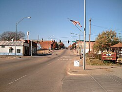
Drumright is a city in Creek and Payne counties in the U.S. state of Oklahoma. It began as an oil boom town. However, the population has declined as oil production has waned in the area. The population was 2,907 at the 2010 census, a figure almost unchanged from 2,905 in 2000.[4] Drumright and nearby Cushing were at the center of the large, productive Cushing-Drumright Oil Field in the 1910s and 1920s. Now Drumright is home to a festival called The Drumright Monthly Market, where hundreds of visitors come on the first Saturday of every month, seeking crafts and delicacies from all over the region.
The town sprang up nearly overnight in 1912, after wildcatter Tom Slick struck oil on the farm of Frank Wheeler, causing a rush of speculators, oilfield workers, and merchants into the area. A post office was established in the community on December 28, 1912. Local landowners James W. Fulkerson and Aaron Drumright platted a townsite, which was initially called Fulkerson, The town was renamed for Aaron Drumright, a farmer and later local businessman whose farm was part of the townsite.[5]
Oil workers flooded into town so quickly that they lived in tents or shacks made from box cars, causing the community to be known locally as "Ragtown." Hotels and boarding houses were constructed next, as well as amenities like gambling dens, dance halls, and roadhouses, where the workers could spend their money. Drumright incorporated as a town on May 27, 1913. In 1914, the city built a two-story building of stone to serve as an elementary and high school. It was called Washington School, and is listed on the National Register of Historic Places (NRIS 81000462). Two banks opened in the town during 1914. Drumright was designated a first-class city after an election on April 18, 1916. The 1920 census reported a population of 6,460.[5]
The Oil Fields and Santa Fe Railway, an Atchison, Topeka & Santa Fe Railroad (AT&SF) subsidiary, built a track from Frey Junction (south of Oilton) to Drumright in 1915.[6] The following year, the AT&SF built a line north from Shamrock to Drumright. The Oil Fields and Santa Fe Railway was merged into the AT&SF in 1941.[7]
In 1919 a riot broke out in Drumright during a strike by telephone workers. The town's mayor and chief of police were locked in the town jail by rioters. The Governor of Oklahoma sent six militia units to town to restore order.
Beginning with the Depression of the 1930s, the town declined as oil production waned, and a large refinery at the edge of town closed in the 1950s.
Tornadoes have caused loss of life and property damage in Drumright on at least two occasions: on April 2, 1956, when five people were killed and several homes, a school, and the public library were damaged; and on June 8, 1974, when 12 people were killed, a nursing home was destroyed, and about 100 homes were damaged or destroyed.[5]
Geography
Drumright is located in western Creek County. A small portion of the city extends west into Payne County. Drumright is 26 miles (42km) west of Sapulpa, 42 miles southwest of Tulsa and 76 miles northeast of Oklahoma City at the junction of State Highways 16, 33 and 99.[5] According to the United States Census Bureau, the city has a total area of 7.5 square miles (19.5km2), of which 0.02 square miles (0.04km2), or 0.19%, is water.[11]
As of the census[3] of 2000, there were 2,905 people, 1,209 households, and 790 families residing in the city. The population density was 411.8 inhabitants per square mile (159.0/km2). There were 1,378 housing units at an average density of 195.4 per square mile (75.4/km2). The racial makeup of the city was 84.44% White, 0.93% African American, 8.47% Native American, 0.03% Asian, 0.17% from other races, and 5.96% from two or more races. Hispanic or Latino of any race were 0.90% of the population.
There were 1,209 households, out of which 29.9% had children under the age of 18 living with them, 47.5% were married couples living together, 14.2% had a female householder with no husband present, and 34.6% were non-families. 31.0% of all households were made up of individuals, and 16.5% had someone living alone who was 65 years of age or older. The average household size was 2.34 and the average family size was 2.92.
In the city, the population was spread out, with 25.5% under the age of 18, 8.0% from 18 to 24, 25.2% from 25 to 44, 20.3% from 45 to 64, and 20.9% who were 65 years of age or older. The median age was 38 years. For every 100 females, there were 87.5 males. For every 100 females age 18 and over, there were 81.2 males.
The median income for a household in the city was $27,292, and the median income for a family was $34,761. Males had a median income of $30,069 versus $20,123 for females. The per capita income for the city was $14,511. About 13.7% of families and 17.3% of the population were below the poverty line, including 19.7% of those under age 18 and 11.0% of those age 65 or over.
Government
Drumright has a council-manager form of government.[5] The current Mayor is Deborah Guillot Bright. The Vice Mayor is Jeremy Snow. The other city commissioners are Derrek Beaumont, Tabitha Snell and Misty Cook. The City Manager is Mark Whinnery, the City Clerk is Shawna Jackson and the City Attorney is Andrew Nestor, III.
City Hall is located at 424 E Broadway.
The Library is located at 104 E Broadway.
The Fire Department is located at 116 W Broadway.
The Police Department is located at 122 W Broadway.
Economy
Today, oil, gas, education, medicine and agriculture are the largest local industries. Drumright is home to an area vocational and technical school, Central Technology Center, which opened August 22, 1970, and employs about 125 people.[5] Drumright is also home to the Drumright Regional Hospital. A tourist attraction is the Tidewater Winery that opened in a historic building that once served as a school for the children of refinery workers.[5]
Transportation
Drumright is at the eastern intersection of State Highway 33 (east-west) and State Highway 99 (north-south). It is also the western terminus of State Highway 16 (also east–west, but further to the south of SH-33).[12]
Drumright School District includes approximately 500 students in two school buildings. Bradley Elementary serves Pre-K, Kindergarten, and 1st through 5th. Cooper Middle School serves 6th through 8th, while in another part of the same building, Drumright High School serves 9th through 12th.[16]
Central Tech, the marketing name for the Central Technology Center, previously Central Vo-Tech,[17] is an affiliate of Oklahoma CareerTech, the state’s system of career and technology education.[18] Central Tech offers full-time and short-term classes in a large variety of fields.[19]
Parks and attractions
The Drumright Monthly Market, where hundreds of visitors come, seeking crafts and delicacies from all over the region. First Saturday of every month April through December.
Drumright buildings sport multiple murals, including the Oil Patch Collage Mural on the Sugar Plum Antiques Building, the American Flag Mural on the Drumright Fire Department Building, the Way Park Mural on the Boomtown Theatre Building, and the Drumright Street Scene of 1920 Mural on the Citizen's Insurance Agency Building.[20] Additional murals are inside the Drumright Historical Museum.[21]
The Drumright Historical Museum is housed in a 1915 Santa Fe Depot which is on the National Register of Historic Places, and has old railroad cars, but focuses on the unique history of the first great oil discovery in Oklahoma in 1912, leading to the Drumright Field producing more oil than any other in the world by 1917.[21]
Whitlock Park features a splashpad, skateboard park, a stage for special events, pavilions, a playground for young kids, and walking paths.[22]
Way Park features a gazebo for musical performances.[23]
Dunbar Park has a gazebo for picnics.
Judy Shelton Burris Park has a Dog Park and a basketball court.
Centennial Park has a huge flagpole with an American flag and plaques commemorating former city leaders. The Hollow, located below Centennial Park, has open areas and native flora to enjoy.
Garrett Park in Country Club Heights has a basketball court.
Payne County is located in the U.S. state of Oklahoma. As of the 2020 census, its population was 81,646. Its county seat is Stillwater. The county was created in 1890 as part of Oklahoma Territory and is named for Capt. David L. Payne, a leader of the "Boomers".
Creek County is a county located in the U.S. state of Oklahoma. As of the 2020 census, the population was 71,754. Its county seat is Sapulpa.
Ardmore is the county seat of Carter County, Oklahoma, United States. The population was 24,725 at the time of the 2020 census, a 1.8% increase over the 2010 census figure of 24,283. The Ardmore micropolitan statistical area had an estimated population of 48,491 in 2013. Ardmore is 90 miles (140 km) from both Oklahoma City and Dallas/Fort Worth, Texas, at the junction of Interstate 35 and U.S. Highway 70, and is generally considered the hub of the 13-county region of South Central Oklahoma, also known by state tourism pamphlets as "Chickasaw Country" and previously "Lake and Trail Country". It is also a part of the Texoma region. Ardmore is situated about 9 miles (14 km) south of the Arbuckle Mountains and is located at the eastern margin of the Healdton Basin, one of the most oil-rich regions of the United States.
Boise City is a city in and the county seat of Cimarron County, in the Panhandle of Oklahoma, United States. The population was 1,166 at the 2020 census, a decline of 7.9 percent from 1,266 in 2010.
Oilton is a city in Creek County, Oklahoma, United States. The population was 885 at the 2020 census, a 12.6% decline from the 1,013 recorded in 2010.
Shamrock is an unincorporated community in Creek County, Oklahoma, United States, located on Oklahoma State Highway 16 south of Drumright and west-northwest of Bristow. The population was 65 at the time of the 2020 census. It was named for Shamrock, Illinois, the hometown of local store owner, James M. Thomas.
Gage is a town in Ellis County, Oklahoma, United States. The population was 433 at the time of the 2020 census.
Shattuck is a town in Ellis County, Oklahoma, United States. The population was 1,249 at the time of the 2020 census, a change from the 1,356 reported in the 2010 census.
Pauls Valley is a city in and the county seat of Garvin County, Oklahoma, United States. The population was 5,992 at the 2020 census, a decline of 3.2 percent from the figure of 6,187 in 2010. It was settled by and named for Smith Paul, a North Carolina native who married a Chickasaw woman and became a citizen of the Chickasaw Nation before the Civil War. The town economy is largely based on agriculture and oil production.
Marietta is a city and county seat in Love County, Oklahoma, United States. The population was 2,626 at the 2010 census, a 7.4 percent increase from the figure of 2,445 in 2000. Marietta is part of the Ardmore, Oklahoma, Micropolitan Statistical Area. For tourism purposes, the Oklahoma Department of Tourism includes it in 'Chickasaw Country'. It is also a part of the Texoma region.
Nowata is a city and county seat of Nowata County, Oklahoma, United States. The population was 3,731 at the United States Census, 2010, a 6.0 percent decline from the figure of 3,971 recorded in 2000. The area where it was established was then part of the Cherokee Nation in Indian Territory.
Cushing is a city in Payne County, Oklahoma, United States. The population was 7,826 at the time of the 2010 census, a decline of 6.5% since 8,371 in 2000. Cushing was established after the Land Run of 1891 by William "Billy Rae" Little. It was named for Marshall Cushing, private secretary to U.S. Postmaster General John Wanamaker.
Ripley is a town in southeastern Payne County, Oklahoma, United States. The population was 423 at the 2010 census, a decline of 9.2 percent from the figure of 444 in 2000. The town was named after Edward Ripley, the 14th president of the Atchison, Topeka and Santa Fe Railway.
Cheyenne is a town in Roger Mills County, Oklahoma, United States. As of the 2020 census, the town’s population was 771. It is the county seat of Roger Mills County.
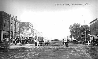
Woodward is a city in and the county seat of Woodward County, Oklahoma, United States. It is the largest city in a nine-county area. The population was 12,133 at the time of the 2020 census.
Gainesville is a city in and the county seat of Cooke County, Texas, United States. Its population was 17,394 at the 2020 census. It is part of the Texoma region and is an important Agri-business center.
Bartlesville is a city mostly in Washington County and Osage County, Oklahoma. The population was 37,290 at the 2020 census. Bartlesville is 47 miles (76 km) north of Tulsa and 18 miles (29 km) south of the Kansas border. It is the county seat of Washington County. The Caney River runs through Bartlesville.
The Cushing Oil Field, also known as the Cushing-Drumright Oil Field, is an oil field in northeastern Oklahoma, part of the Mid-Continent oil province. The 10-mile (16 km) by 3-mile (4.8 km) field includes southeastern Payne County, northwestern Creek County, and northeastern Lincoln County. Named for its primary supply center at Cushing, Oklahoma, the field was developed from 1912.
The Oil Fields and Santa Fe Railway was an Atchison, Topeka and Santa Fe Railway ("AT&SF") subsidiary. It owned trackage in and about the Cushing-Drumright Oil Field in Oklahoma, and was leased to and operated by the AT&SF from its inception in the 1915-1916 timeframe until its merger into the AT&SF in 1941. All of its tracks were abandoned by 1963.
The Drumright Oilers were a minor league baseball team based in Drumright, Oklahoma.
This page is based on this Wikipedia article Text is available under the CC BY-SA 4.0 license; additional terms may apply. Images, videos and audio are available under their respective licenses.