Kiefer, Oklahoma

Last updated

Kiefer, Oklahoma
Creek County Oklahoma incorporated and unincorporated areas Kiefer highlighted.svg
Location within Creek County, and the state of Oklahoma
Coordinates: 35°56′39″N96°03′10″W / 35.94417°N 96.05278°W / 35.94417; -96.05278
Country United States
State Oklahoma
County Creek
Area
[1]
  Total2.40 sq mi (6.23 km2)
  Land2.38 sq mi (6.16 km2)
  Water0.03 sq mi (0.07 km2)
Elevation
[2]
696 ft (212 m)
Population
 (2020)
  Total2,187
  Density919.29/sq mi (354.96/km2)
Time zone UTC-6 (Central (CST))
  Summer (DST) UTC-5 (CDT)
ZIP code
74041
Area code(s) 539/918
FIPS code 40-39750 [3]
GNIS feature ID2412832 [2]

Kiefer is a town in Creek County, Oklahoma, United States. The population was 2,187 at the 2020 census, [4] a 30% increase over the 1,685 population recorded at the 2010 census, which itself was a 64 percent increase over the 1,026 figure recorded in 2000. [5]

Contents

History

Kiefer was originally known as "Praper" when a post office was first established in 1901. The St. Louis, Oklahoma and Southern Railway (later the St. Louis and San Francisco Railway) constructed a line south from Sapulpa through Praper between 1900 and 1901. The route is today operated by BNSF. Praper became an oil boom town by 1906, when it grew into a major shipping point for crude from the Glenn Pool field. The post office was renamed "Kiefer" on December 12, 1906. [6] [7] According to the Encyclopedia of Oklahoma History and Culture, the name honored at least one of three different people named Kiefer who lived in the area. [6]

Kiefer voted to incorporate on November 20, 1908. The 1910 census reported a population of 1,197 inhabitants. This increased to 1,663 in 1920. [6]

In the early days, Kiefer was on the route of the Sapulpa & Interurban Railway (“S&I”) streetcar/interurban line connecting to Tulsa through Sapulpa; S&I subsequently went through a series of mergers and name changes, with only the Tulsa-to-Sapulpa portion continuing as the Tulsa-Sapulpa Union Railway. [8] [9]

The Kiefer Searchlight was a weekly newspaper published in Kiefer that included local, state, and national news along with advertising. 123 issues from 1908 to 1911 are available online. [10]

In the 21st century, Kiefer is mostly a commuter town, with 94.6 percent of workers living in town commuting to jobs elsewhere, primarily in Tulsa. [6] However, it is also headquarters for Bridge Crane Specialists, a company involved in the design, manufacturing, installation, and servicing of overhead and work station crane systems. [11]

Kiefer is the site of an extensive residence known to locals as the Kiefer Castle, having been built to resemble a fairy-tale castle. [12]

Geography

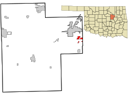
Kiefer is located in eastern Creek County. U.S. Highway 75A passes through the center of the town, leading north 5 miles (8 km) to the center of Sapulpa, the county seat, and south 5 miles (8 km) to Mounds. Oklahoma State Highway 67 leads east from Kiefer 3 miles (5 km) to the U.S. Route 75 freeway in Glenpool. Via Highways 67 and 75 it is 18 miles (29 km) north to downtown Tulsa.

According to the United States Census Bureau, Kiefer has a total area of 2.4 square miles (6.1 km2), of which 0.02 square miles (0.06 km2), or 1.04%, is water. [13]

Education

Kiefer has an elementary, middle and high school. The school teams are known as the Trojans. [6]

Demographics

Historical population
CensusPop.Note
1910 1,197
1920 1,66338.9%
1930 606−63.6%
1940 330−45.5%
1950 275−16.7%
1960 48977.8%
1970 80364.2%
1980 91213.6%
1990 9625.5%
2000 1,0266.7%
2010 1,68564.2%
2020 2,18729.8%
U.S. Decennial Census [14]

As of the census [3] of 2000, there were 1,026 people, 373 households, and 281 families residing in the town. The population density was 561.3 inhabitants per square mile (216.7/km2). There were 410 housing units at an average density of 224.3 per square mile (86.6/km2). The racial makeup of the town was 85.09% White, 0.19% African American, 9.45% Native American, 0.19% Asian, 0.58% from other races, and 4.48% from two or more races. Hispanic or Latino of any race were 3.12% of the population.

There were 373 households, out of which 38.9% had children under the age of 18 living with them, 57.6% were married couples living together, 12.9% had a female householder with no husband present, and 24.4% were non-families. 20.4% of all households were made up of individuals, and 5.1% had someone living alone who was 65 years of age or older. The average household size was 2.75 and the average family size was 3.19.

In the town, the population was spread out, with 29.7% under the age of 18, 9.0% from 18 to 24, 32.1% from 25 to 44, 21.2% from 45 to 64, and 8.1% who were 65 years of age or older. The median age was 33 years. For every 100 females, there were 95.8 males. For every 100 females age 18 and over, there were 92.8 males.

The median income for a household in the town was $34,844, and the median income for a family was $42,500. Males had a median income of $30,739 versus $22,386 for females. The per capita income for the town was $14,479. About 7.8% of families and 11.6% of the population were below the poverty line, including 13.4% of those under age 18 and 13.8% of those age 65 or over.

Related Research Articles

<span class="mw-page-title-main">Okmulgee County, Oklahoma</span> County in Oklahoma, United States

Okmulgee County is a county in the U.S. state of Oklahoma. As of the 2020 census, the population was 36,706. The county seat is Okmulgee. Located within the Muscogee Nation Reservation, the county was created at statehood in 1907. The name Okmulgee is derived from the Hitchita word okimulgi, meaning "boiling waters".

<span class="mw-page-title-main">Johnston County, Oklahoma</span> County in Oklahoma, United States

Johnston County is a county located in the U.S. state of Oklahoma. As of the 2020 census, the population was 10,272. Its county seat is Tishomingo. It was established at statehood on November 16, 1907, and named for Douglas H. Johnston, a governor of the Chickasaw Nation.

<span class="mw-page-title-main">Creek County, Oklahoma</span> County in Oklahoma, United States

Creek County is a county located in the U.S. state of Oklahoma. As of the 2020 census, the population was 71,754. Its county seat is Sapulpa.

<span class="mw-page-title-main">Bristow, Oklahoma</span> City in Oklahoma, United States

Bristow is a city in Creek County, Oklahoma, United States. The population was 4,222 at the 2010 census, down 2.4 percent from the figure of 4,325 recorded in 2000.

<span class="mw-page-title-main">Depew, Oklahoma</span> Town in Oklahoma, United States

Depew is a town in Creek County, Oklahoma, United States. It is 41 miles southwest of Tulsa. The population was 411 at the 2020 census. The town was named in honor of New York Senator Chauncey Depew.

<span class="mw-page-title-main">Kellyville, Oklahoma</span> Town in Oklahoma, United States

Kellyville is a town in Creek County, Oklahoma, United States. The population was 1,019 at the 2020 census.

<span class="mw-page-title-main">Lawrence Creek, Oklahoma</span> Town in Oklahoma, United States

Lawrence Creek is a town in Creek County, Oklahoma, United States. Incorporated March 15, 1983, it is primarily a bedroom community whose employed residents work in Sapulpa and Tulsa. The population was 149 at the 2010 census, a gain of 25.2 percent over the figure of 119 recorded in 2000.

<span class="mw-page-title-main">Mounds, Oklahoma</span> Town in Oklahoma, United States

Mounds is a town in Creek County, Oklahoma, United States. It is located just south of Tulsa; the town's population was 932 at the 2020 census.

<span class="mw-page-title-main">Oilton, Oklahoma</span> City in Oklahoma, United States

Oilton is a city in Creek County, Oklahoma, United States. The population was 885 at the 2020 census, a 12.6% decline from the 1,013 recorded in 2010.

<span class="mw-page-title-main">Sapulpa, Oklahoma</span> City in Oklahoma, United States

Sapulpa is a city in Creek and Tulsa counties in the U.S. state of Oklahoma. The population was 21,929 at the time of the 2020 census, compared with 20,544 at the 2010 census. It is the county seat of Creek County.

<span class="mw-page-title-main">Shamrock, Oklahoma</span> Town in Oklahoma, United States

Shamrock is an unincorporated community in Creek County, Oklahoma, United States, located on Oklahoma State Highway 16 south of Drumright and west-northwest of Bristow. The population was 65 at the time of the 2020 census. It was named for Shamrock, Illinois, the hometown of local store owner, James M. Thomas.

<span class="mw-page-title-main">Slick, Oklahoma</span> Town in Oklahoma, United States

Slick is a town in Creek County, Oklahoma, United States. The population was 151 at the 2020 census, a 15.3% increase over the population in 2010.

<span class="mw-page-title-main">Spaulding, Oklahoma</span> Town in Oklahoma, United States

Spaulding is a town in Hughes County, Oklahoma, United States. Although it was initially established at the turn of the 20th century, it did not incorporate as a town until 1978. The population was 178 at the 2010 census, up from 62 in 2000, when the town's area was approximately one-third of its 2010 area.

<span class="mw-page-title-main">Beggs, Oklahoma</span> City in Oklahoma, United States

Beggs is a city in Okmulgee County, Oklahoma, United States. The population was 1,179 as of the 2020 census. Beggs was named for C.H. Beggs, vice president of the St. Louis-San Francisco (Frisco) Railway.

<span class="mw-page-title-main">Terlton, Oklahoma</span> Town in Oklahoma, United States

Terlton is a town in Pawnee County, Oklahoma, United States. It is located one-half mile south of US 412/US 64 on Terlton Road and County Road E0570. The population was 77 at the time of the 2020 Census.

<span class="mw-page-title-main">Glenpool, Oklahoma</span> City in Oklahoma, United States

Glenpool is a city in Tulsa County, Oklahoma, United States. It is part of the Tulsa Metropolitan Statistical Area (TMSA). As of 2020, the population was 14,040, which represented an increase of 29.9% since the 2010 census, which reported the total population as 10,808.

<span class="mw-page-title-main">Friendly, West Virginia</span> Town in West Virginia, United States

Friendly is a town in Tyler County, West Virginia, United States. The population was 100 at the 2020 census.

<span class="mw-page-title-main">Oakhurst, Oklahoma</span> Census-designated place in Oklahoma, United States

Oakhurst is an unincorporated community and census-designated place (CDP) in Creek and Tulsa counties in the U.S. state of Oklahoma. The population was 2,262 at the 2020 census, a slight increase from the 2010 population of 2,185.

<span class="mw-page-title-main">Collinsville, Oklahoma</span> City in Oklahoma, United States

Collinsville is a city in Rogers and Tulsa counties in the U.S. state of Oklahoma, and a part of the Tulsa, Oklahoma Metropolitan Statistical Area. It was named for Dr. A. H. Collins, an engineer and surveyor who first surveyed the land that became this community. The population was 7,881 by the 2020 United States census, a 40.6% increase over the figure of 5,606 according to the 2010 census, which itself was an increase of 37.5 percent over the figure of 4,077 recorded in 2000.

<span class="mw-page-title-main">Fair Oaks, Oklahoma</span> Town in Oklahoma, United States

Fair Oaks is a town in Rogers and Wagoner counties in the U.S. state of Oklahoma. The population was 103 at the 2010 census, a 15.6 percent decline from the figure of 122 recorded in 2000. It is a suburb of Tulsa.

References

  1. "ArcGIS REST Services Directory". United States Census Bureau. Retrieved September 20, 2022.
  2. 1 2 U.S. Geological Survey Geographic Names Information System: Kiefer, Oklahoma
  3. 1 2 "U.S. Census website". United States Census Bureau . Retrieved January 31, 2008.
  4. "Kiefer (town), Oklahoma". United States Census Bureau. Retrieved August 13, 2023.
  5. CensusViewer: Population of the City of Kiefer, Oklahoma
  6. 1 2 3 4 5 "Kiefer". Linda D. Wilson, The Encyclopedia of Oklahoma History and Culture, Oklahoma Historical Society. Retrieved April 14, 2020.
  7. Shirk, George H. Oklahoma Place Names, Norman, Oklahoma: University of Oklahoma Press, 1965, p.117.
  8. "Tulsa streetcar and interurban lines in Google Maps". Michael Bates. Retrieved January 18, 2019.
  9. "Tulsa Sapulpa Union Railway". American-Rails.com. Retrieved January 18, 2019.
  10. "The Kiefer Searchlight". The Gateway to Oklahoma History. Retrieved April 14, 2020.
  11. "Home Page". Bridge Crane Specialists. Retrieved July 14, 2020.
  12. "SEEN: The Kiefer Castle". James Gibbard, Tulsa World, October 23, 2013. Retrieved April 14, 2020.
  13. "Geographic Identifiers: 2010 Demographic Profile Data (G001): Kiefer town, Oklahoma". U.S. Census Bureau, American Factfinder. Archived from the original on March 9, 2015. Retrieved March 6, 2015.
  14. "Census of Population and Housing". Census.gov. Retrieved June 4, 2015.