Inola, Oklahoma

Last updated

Inola is also a spider genus (Pisauridae).
Inola, Oklahoma
Nickname: 
Hay Capital of the World
OKMap-doton-Inola.PNG
Location of Inola, Oklahoma
Coordinates: 36°08′53″N95°31′29″W / 36.14806°N 95.52472°W / 36.14806; -95.52472
Country United States
State Oklahoma
County Rogers
Area
[1]
  Total6.75 sq mi (17.47 km2)
  Land6.68 sq mi (17.30 km2)
  Water0.07 sq mi (0.18 km2)
Elevation
[2]
574 ft (175 m)
Population
 (2020)
  Total1,890
  Density283.02/sq mi (109.27/km2)
Time zone UTC-6 (Central (CST))
  Summer (DST) UTC-5 (CDT)
ZIP code
74036
Area code(s) 539/918
FIPS code 40-37100 [3]
GNIS feature ID2412794 [2]
Website http://www.inolaok.com

Inola is a town in Rogers County, Oklahoma, United States. It is included in the Tulsa Metropolitan Statistical Area (TMSA). The population was 1,788 at the 2010 census with a 12.5 percent increase from 1,589 at the 2000 census. [4] Inola is a Cherokee word meaning "Black Fox." [5] The town styles itself as "The Hay Capital of the World." [6]

Contents

History

In 1889, the Kansas and Arkansas Valley Railway (later acquired by the Missouri Pacific Railway) built a line from Wagoner through the Foyil area onto the Kansas state line. The area was then just inside the northeastern corner of the Creek Nation in Indian Territory. A post office was established in March 1890 with the name Foyil. It was closed in September 1890 but reopened in April 1891. By 1901, the population was estimated at 100 people. The Dawes Commission had the town platted in 1902, before the Creek allotment. [5]

Strip mines began producing coal nearby before statehood in 1907, causing a small boom in population. Inola's population was 405 in 1920. As the coal industry began to decline, so did the town's population. The 1930 census reported only 399 residents. The decline continued through the post World War II era, reaching 294 in 1950. A turnaround began in the 1950s as residents began commuting to Tulsa. Inola's population grew to 584 in 1960 and 984 in 1970. The 1980 census showed 1,550 residents, increasing to 1,589 in 2000 and 1,788 in 2010. [5]

Geography

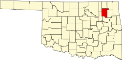
According to the United States Census Bureau, the town has a total area of 6.6 square miles (17 km2), of which 6.5 square miles (17 km2) is land and 0.1 square miles (0.26 km2) (0.91%) is water.

Demographics

Historical population
CensusPop.Note
1910 405
1920 49823.0%
1930 398−20.1%
1940 395−0.8%
1950 294−25.6%
1960 58498.6%
1970 94862.3%
1980 1,55063.5%
1990 1,444−6.8%
2000 1,58910.0%
2010 1,78812.5%
2020 1,8905.7%
U.S. Decennial Census [7]

Economy

The town has emerged as a bedroom community for Tulsa, about 28 miles to the west. [5]

In October 2020, tissue paper maker Sofidel opened a $360 million production factory in Inola. [8] The 1.8 million-square-foot plant includes a mill that transforms pulp into paper and a conversion facility that makes the finished product. [8] The factory employs more than 300 people, and this number is expected to double with a second operational phase. [8]

Black Fox Power Plant

The Black Fox Nuclear Power Plant was a nuclear power plant proposed by the Public Service Company of Oklahoma (PSO) in May 1973. The facility was to be built approximately 3 miles (4.8 km) outside of Inola and encompass the use of two General Electric (GE) Boiling Water Reactors. PSO argued that there would be great economic growth and better schools in the town. Many residents as well as outsiders were convinced that it would be dangerous to locate such a facility in their backyards. After nine years of court battles and minor earthquakes in the area, the decision was abandoned in 1982 and no complex was built. [5]

Related Research Articles

<span class="mw-page-title-main">Rogers County, Oklahoma</span> County in Oklahoma, United States

Rogers County is located in the northeastern part of the U.S. state of Oklahoma. As of the 2020 census, the population was 95,240, making it the sixth-most populous county in Oklahoma. The county seat is Claremore. Rogers County is included in the Tulsa, OK metropolitan statistical area.

<span class="mw-page-title-main">Circleville, Ohio</span> City in Ohio, United States

Circleville is a city in and the county seat of Pickaway County, Ohio, United States. The city is situated along the Scioto River, 25 miles (40 km) south of Columbus. The population was recorded to be 13,927 in the 2020 census.

<span class="mw-page-title-main">Watonga, Oklahoma</span> City in the United States

Watonga is a city in Blaine County, Oklahoma. It is 70 miles northwest of Oklahoma City. The population was 2,690 as of the 2020 United States census. It is the county seat of Blaine County.

<span class="mw-page-title-main">Heavener, Oklahoma</span> City in Oklahoma, United States

Heavener is a town in Le Flore County, Oklahoma, United States. The population was 3,414 at the 2010 census, an increase of 6.7 percent from 3,201 at the 2000 census. Heavener is notable for the Heavener Runestone just outside the city limits.

<span class="mw-page-title-main">Howe, Oklahoma</span> Town in Oklahoma, United States

Howe is a town in Le Flore County, Oklahoma, United States. It is part of the Fort Smith, Arkansas-Oklahoma Metropolitan Statistical Area. The population was 802 at the 2010 census, a gain of 15.1 percent over the figure of 697 recorded in 2000. The town was once noted for producing coal and coke, but today is chiefly supported by agriculture.

<span class="mw-page-title-main">Panama, Oklahoma</span> Town in Oklahoma, United States

Panama is a town in Le Flore County, Oklahoma, United States. It is part of the Fort Smith, Arkansas-Oklahoma Metropolitan Statistical Area. The population was 1,413 at the 2010 census.

<span class="mw-page-title-main">Crescent, Oklahoma</span> City in Oklahoma, United States

Crescent is a city in Logan County, Oklahoma, United States. The population was 1,299 as of the 2020 United States census. It is part of the Oklahoma City Metropolitan Statistical Area.

<span class="mw-page-title-main">Valliant, Oklahoma</span> Town in Oklahoma, United States

Valliant is a town in McCurtain County, Oklahoma, United States. The population was 754 at the 2010 census.

<span class="mw-page-title-main">Henryetta, Oklahoma</span> City in Oklahoma, United States

Henryetta is a city in Okmulgee County, Oklahoma, United States. The population was 5,640 at the 2020 census.

<span class="mw-page-title-main">Okmulgee, Oklahoma</span> City in Oklahoma, United States

Okmulgee is a city in and the county seat of Okmulgee County, Oklahoma, United States, and is part of the Tulsa Metropolitan Area. The name is from the Mvskoke word okimulgee, which means "boiling waters". The site was chosen because of the nearby rivers and springs. Okmulgee is 38 miles south of Tulsa and 13 miles north of Henryetta via US-75.

<span class="mw-page-title-main">Foyil, Oklahoma</span> Town in Oklahoma, United States

Foyil is a town in Rogers County, Oklahoma, United States. It was named for Alfred Foyil, a local landowner and the first postmaster of the town. The population was 344 at the 2010 census, a 47.0 percent increase over the figure of 234 recorded in 2000.

<span class="mw-page-title-main">Jenks, Oklahoma</span> City in Oklahoma, United States

Jenks is a city in Tulsa County, Oklahoma, United States, and a suburb of Tulsa, in the northeastern part of the state. It is situated between the Arkansas River and U.S. Route 75. Jenks is one of the fastest-growing cities in Oklahoma. The city's population was 16,924 in the 2010 census, but by 2020, this had grown to 25,949. The Census estimated Jenks' population as 27,141 in 2022.

<span class="mw-page-title-main">Wagoner, Oklahoma</span> City in Oklahoma, United States

Wagoner is a city in Wagoner County, Oklahoma, United States. The population was 8,323 at the 2010 census, compared to the figure of 7,669 recorded in 2000. It is the county seat of Wagoner County. Wagoner became the first city incorporated in Indian Territory on January 4, 1896.

<span class="mw-page-title-main">Saxton, Pennsylvania</span> Borough in Pennsylvania, United States

Saxton is a borough in Bedford County, Pennsylvania, United States. The population was 726 at the 2020 census.

<span class="mw-page-title-main">Mannford, Oklahoma</span> City in Oklahoma, United States

Mannford is a city in Creek County in the northeastern part of the U.S. state of Oklahoma. The population was 3,262 at the time of the 2020 census, up from 3,076 in 2010. The city sits next to Keystone Lake and claims to be the "Striped Bass Capital of the World".

<span class="mw-page-title-main">Collinsville, Oklahoma</span> City in Oklahoma, United States

Collinsville is a city in Rogers and Tulsa counties in the U.S. state of Oklahoma, and a part of the Tulsa, Oklahoma Metropolitan Statistical Area. It was named for Dr. A. H. Collins, an engineer and surveyor who first surveyed the land that became this community. The population was 7,881 by the 2020 United States census, a 40.6% increase over the figure of 5,606 according to the 2010 census, which itself was an increase of 37.5 percent over the figure of 4,077 recorded in 2000.

<span class="mw-page-title-main">Broken Arrow, Oklahoma</span> City in Oklahoma, United States

Broken Arrow is a city in Tulsa and Wagoner counties in the U.S. state of Oklahoma. It is the largest suburb of Tulsa. According to the 2020 census, Broken Arrow has a population of 113,540 residents and is the 4th most populous city in the state. The city is part of the Tulsa Metropolitan Area, which has a population of 1,023,988 residents.

<span class="mw-page-title-main">Tulsa Ports</span> Ports in the United States serving Oklahoma

Tulsa Ports consists of the ports of Catoosa and Inola near Tulsa, Oklahoma, United States, on the Verdigris River, a tributary of the Arkansas River and the Mississippi River.

The Black Fox Nuclear Power Plant was a nuclear power plant proposed by the Public Service Company of Oklahoma (PSO) in May 1973. It was cancelled in 1982.

Verdigris Southern Railroad, known as “VESO,” was initiated in 2021 to serve the Tulsa Port of Inola, one of the Tulsa Ports. VESO connects Port customers to the Union Pacific Railroad.

References

  1. "ArcGIS REST Services Directory". United States Census Bureau. Retrieved September 20, 2022.
  2. 1 2 U.S. Geological Survey Geographic Names Information System: Inola, Oklahoma
  3. "U.S. Census website". United States Census Bureau . Retrieved January 31, 2008.
  4. MuniNetGuide: Inola, Oklahoma. Archived October 7, 2012, at the Wayback Machine .
  5. 1 2 3 4 5 Larry O'Dell, "Inola" Encyclopedia of Oklahoma History and Culture Accessed March 19, 2012.
  6. "Inola: A Country Way of Life". Inola Chamber of Commerse. Archived from the original on June 18, 2008. Retrieved June 26, 2008.
  7. "Census of Population and Housing". Census.gov. Retrieved June 4, 2015.
  8. 1 2 3 "Tissue paper manufacturer Sofidel formally announces opening of plant in Inola". Tulsa World, October 6, 2020. Retrieved October 6, 2020.