Washington County is a county located in the northeastern part of the U.S. state of Oklahoma. As of the 2020 census, the population was 52,455. Its county seat is Bartlesville. Named for President George Washington, it is the smallest county in Oklahoma in total area, adjacent to the largest county in Oklahoma, Osage County.

Rogers County is located in the northeastern part of the U.S. state of Oklahoma. As of the 2020 census, the population was 95,240, making it the sixth-most populous county in Oklahoma. The county seat is Claremore. Rogers County is included in the Tulsa, OK metropolitan statistical area.
Cloud Creek is an unincorporated community and census-designated place (CDP) in Delaware County, Oklahoma, United States. The population was 121 at the 2010 census, a 40.7 percent increase over the figure of 86 recorded in 2000 census.

Kaw City is a city in eastern Kay County, Oklahoma, United States. The population was 325 as of the 2020 United States census. Kaw City was named for the Kanza Indians, called the Kaw by locals.
Shady Grove is a census-designated place (CDP) in McIntosh County, Oklahoma, United States. The population was 199 at the 2010 census, a decrease of 14.4 percent from 229 in 2000. This is not to be confused with the similarly-named Shady Grove in Cherokee County, or the Shady Grove in Pawnee County.
McCord is a census-designated place (CDP) in Osage County, Oklahoma, United States. The population was 1,440 at the 2010 census, a decrease of 15.8 percent from the figure of 1,711 reported in 2000.

Narcissa is a census-designated place (CDP) in Ottawa County, Oklahoma, United States. The population was 92 at the time of the 2020 United States census.

Longtown is a census-designated place (CDP) and unincorporated community in Pittsburg County, Oklahoma, United States. The population was 2,397 at the 2000 census.

Bushyhead is a census-designated place (CDP) in Rogers County, Oklahoma, United States. The population was 1,314 at the 2010 census, a 9.2 percent increase over the figure of 1,203 recorded in 2000. Established on the St. Louis-San Francisco Railway between Claremore and Vinita, the community was named for Dennis W. Bushyhead, Principal Chief of the Cherokee, 1879–1887. The post office existed from April 18, 1898, until November 15, 1955.

Claremore is a city and the county seat of Rogers County in Green Country, northeastern Oklahoma, United States. The population was 19,580 at the 2020 census, a 5.4 percent increase over the figure of 18,581 recorded in 2010. Located in the foothills of the Ozark Mountains. It is home of Rogers State University and is part of the Tulsa Metropolitan Area.

Foyil is a town in Rogers County, Oklahoma, United States. It was named for Alfred Foyil, a local landowner and the first postmaster of the town. The population was 344 at the 2010 census, a 47.0 percent increase over the figure of 234 recorded in 2000.
Gregory is a census-designated place (CDP) in Rogers County, Oklahoma, United States. The population was 150 at the 2000 census.
Justice is a census-designated place (CDP) in Rogers County, Oklahoma, United States. The population was 1,311 at the 2000 census.

Sequoyah is a census-designated place (CDP) in Rogers County, Oklahoma, United States. The population was 671 at the 2000 census.
Marble City Community is a census-designated place (CDP) in Sequoyah County, Oklahoma, United States. It is part of the Fort Smith, Arkansas-Oklahoma Metropolitan Statistical Area. The population was 420 at the 2000 census.
Pinhook Corners is a census-designated place (CDP) in Sequoyah County, Oklahoma, United States. It is part of the Fort Smith, Arkansas-Oklahoma Metropolitan Statistical Area. The population was 161 at the 2000 census.

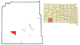
Oglala is a census-designated place (CDP) in West Oglala Lakota Unorganized Territory equivalent, Oglala Lakota County, South Dakota, United States. The population was 1,282 at the 2020 census. Its location is in the northwest of the Pine Ridge Indian Reservation.

Collinsville is a city in Rogers and Tulsa counties in the U.S. state of Oklahoma, and a part of the Tulsa, Oklahoma Metropolitan Statistical Area. It was named for Dr. A. H. Collins, an engineer and surveyor who first surveyed the land that became this community. The population was 7,881 by the 2020 United States census, a 40.6% increase over the figure of 5,606 according to the 2010 census, which itself was an increase of 37.5 percent over the figure of 4,077 recorded in 2000.
Tiawah is a census-designated place (CDP) in Rogers County, Oklahoma, United States. The population was 189 at the 2010 census, a 13.9 percent gain over the figure of 166 recorded in 2000. It was built on the St. Louis, Iron Mountain, & Southern Railway line running from Coffeyville, Kansas, to Fort Smith, Arkansas. The post office existed from August 24, 1903, until December 31, 1938. It is said to be named for Tiawah Mound in Georgia.

Limestone is a census-designated place (CDP) comprising the main village within the town of Limestone in Aroostook County, Maine, United States. The population was 1,075 at the 2010 census, out of a population of 2,314 for the entire town.


