Slick, Oklahoma

Last updated

Slick, Oklahoma
Slick OK Depot 10-2022.jpg
Railroad depot at Slick, now a church
Creek County Oklahoma incorporated and unincorporated areas Slick highlighted.svg
Location within Creek County, and the state of Oklahoma
Coordinates: 35°46′31″N96°16′00″W / 35.77528°N 96.26667°W / 35.77528; -96.26667
Country United States
State Oklahoma
County Creek
Area
[1]
  Total7.85 sq mi (20.34 km2)
  Land7.76 sq mi (20.09 km2)
  Water0.10 sq mi (0.25 km2)
Elevation
[2]
702 ft (214 m)
Population
 (2020)
  Total151
  Density19.47/sq mi (7.52/km2)
Time zone UTC-6 (Central (CST))
  Summer (DST) UTC-5 (CDT)
ZIP code
74071
Area code(s) 539/918
FIPS code 40-68000 [3]
GNIS feature ID2413297 [2]

Slick is a town in Creek County, Oklahoma, United States. The population was 151 at the 2020 census, a 15.3% increase over the population in 2010. [4]

Contents

History

Slick began as an oil boom town in 1920, and was named for oilman Thomas B. Slick, who drilled a discovery well nearby. A railroad, the Oklahoma-Southwestern Railway, was completed into town the same year. [5] By 1922, the town had an estimated population of 2500-3500. [5] However, production of oil began to decline in the latter part of 1923, and the railroad was abandoned by 1930. [5] [6] So when the town appeared for the first time in the U.S. census in 1930, the population was only 422, a figure which declined until 1950 and has since fluctuated. All of its employed citizens commute to work in Bristow, Sapulpa, and Tulsa. [7]
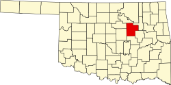
Geography

Slick is on the Deep Fork River, and situated southeast of Bristow on SH-16. [8]

Slick has a public park, located on the west side of SH-16, where Easter Egg Hunts and other events are held. [9]

According to the United States Census Bureau, the town has a total area of 0.4 square miles (1.0 km2), all land.

Demographics

Historical population
CensusPop.Note
1930 422
1940 300−28.9%
1950 151−49.7%
1960 1510.0%
1970 17113.2%
1980 1879.4%
1990 124−33.7%
2000 14819.4%
2010 131−11.5%
2020 15115.3%
U.S. Decennial Census [10]

As of the census [3] of 2000, there were 148 people, 52 households, and 35 families residing in the town. The population density was 335.2 inhabitants per square mile (129.4/km2). There were 63 housing units at an average density of 142.7 per square mile (55.1/km2). The racial makeup of the town was 79.73% White, 10.81% African American, 8.11% Native American, 0.68% from other races, and 0.68% from two or more races. Hispanic or Latino of any race were 0.68% of the population.

There were 52 households, out of which 34.6% had children under the age of 18 living with them, 59.6% were married couples living together, 5.8% had a female householder with no husband present, and 30.8% were non-families. 28.8% of all households were made up of individuals, and 13.5% had someone living alone who was 65 years of age or older. The average household size was 2.85 and the average family size was 3.58.

In the town, the population was spread out, with 29.7% under the age of 18, 10.8% from 18 to 24, 31.8% from 25 to 44, 18.2% from 45 to 64, and 9.5% who were 65 years of age or older. The median age was 34 years. For every 100 females, there were 114.5 males. For every 100 females age 18 and over, there were 96.2 males.

The median income for a household in the town was $35,000, and the median income for a family was $37,500. Males had a median income of $32,083 versus $19,000 for females. The per capita income for the town was $13,554. There were 4.2% of families and 7.3% of the population living below the poverty line, including no under eighteens and 11.8% of those over 64.

See also

Related Research Articles

<span class="mw-page-title-main">Creek County, Oklahoma</span> County in Oklahoma, United States

Creek County is a county located in the U.S. state of Oklahoma. As of the 2020 census, the population was 71,754. Its county seat is Sapulpa.

<span class="mw-page-title-main">Anthony, Kansas</span> City in Harper County, Kansas

Anthony is a city in and the county seat of Harper County, Kansas, United States. As of the 2020 census, the population of the city was 2,108.

<span class="mw-page-title-main">Aline, Oklahoma</span> Town in Oklahoma, United States

Aline is a town in Alfalfa County, Oklahoma, United States. The population was 168 at the time of the 2020 Census.

<span class="mw-page-title-main">Carter, Oklahoma</span> Town in Oklahoma, United States

Carter is a town in Beckham County, Oklahoma, United States. The population was 183 at the time of the 2020 census.

<span class="mw-page-title-main">Bennington, Oklahoma</span> Incorporated Town in Oklahoma, United States

Bennington is an incorporated town in Bryan County, Oklahoma, United States. The population was 334 at the 2010 census.

<span class="mw-page-title-main">Wilson, Oklahoma</span> Town in Oklahoma, United States

Wilson is a town in Carter County, Oklahoma, United States. The population was 1,724 at the 2010 census. It is part of the Ardmore, Oklahoma Micropolitan Statistical Area. It is home to one of the oldest Assemblies of God churches in Oklahoma, the Wilson Assembly of God Church.

<span class="mw-page-title-main">Bristow, Oklahoma</span> City in Oklahoma, United States

Bristow is a city in Creek County, Oklahoma, United States. The population was 4,222 at the 2010 census, down 2.4 percent from the figure of 4,325 recorded in 2000.

<span class="mw-page-title-main">Shamrock, Oklahoma</span> Town in Oklahoma, United States

Shamrock is an unincorporated community in Creek County, Oklahoma, United States, located on Oklahoma State Highway 16 south of Drumright and west-northwest of Bristow. The population was 65 at the time of the 2020 census. It was named for Shamrock, Illinois, the hometown of local store owner, James M. Thomas.

<span class="mw-page-title-main">Breckinridge, Oklahoma</span> Town in Oklahoma, United States

Breckinridge, sometimes spelled Breckenridge, is a town in Garfield County, Oklahoma, United States. The population was 199 as of the 2020 Census.

<span class="mw-page-title-main">Milburn, Oklahoma</span> Town in Oklahoma, United States

Milburn is a town in Johnston County, Oklahoma, United States, along the Blue River. The population was 317 at the 2010 census, an increase of 1.6 percent from the figure of 312 in 2000. The town is notable as the location of the Chickasaw White House, the former home of Chickasaw Governor Douglas H. Johnston. This home is now a museum and is listed on the NRHP.

<span class="mw-page-title-main">Braman, Oklahoma</span> Town in Oklahoma, United States

Braman is a town in Kay County, Oklahoma, United States. The population was 217 at the 2010 census, a decline of 11.1 percent from the figure of 244 in 2000.

<span class="mw-page-title-main">Panama, Oklahoma</span> Town in Oklahoma, United States

Panama is a town in Le Flore County, Oklahoma, United States. It is part of the Fort Smith, Arkansas-Oklahoma Metropolitan Statistical Area. The population was 1,413 at the 2010 census.

<span class="mw-page-title-main">Chandler, Oklahoma</span> City in Oklahoma, United States

Chandler is a city in, and the county seat of, Lincoln County, Oklahoma, United States. and is part of the Oklahoma City Metropolitan Area. The population was 2,858 at the time of the 2020 census. Chandler is located northeast of Oklahoma City on SH-66 and I-44, and north of Shawnee on SH-18.

<span class="mw-page-title-main">Sparks, Oklahoma</span> Town in Oklahoma, United States

Sparks is a town in Lincoln County, Oklahoma, United States. The population was 169 at the 2010 census, a 23.4 percent gain from the figure of 137 in 2000. The center of population of Oklahoma is located in Sparks.

<span class="mw-page-title-main">Earlsboro, Oklahoma</span> Town in Oklahoma, United States

Earlsboro is a town in Pottawatomie County, Oklahoma, United States. The population was 594 by the 2020 United States census. It was once called "...the town that whisky built and oil broke."

<span class="mw-page-title-main">Tecumseh, Oklahoma</span> City in Oklahoma, United States

Tecumseh is a city in Pottawatomie County, Oklahoma. The population was 6,302 by the 2020 United States census. It was named for the noted Shawnee chief, Tecumseh. The locale was designated as the county seat at Oklahoma's statehood, but a county-wide election moved the seat to Shawnee in 1930.

<span class="mw-page-title-main">Davidson, Oklahoma</span> Town in Oklahoma, United States

Davidson is a town in Tillman County, Oklahoma, United States. The population was 241 at the 2020 Census.

<span class="mw-page-title-main">Sentinel, Oklahoma</span> Town in Oklahoma, United States

Sentinel is a town in Washita County, in the U.S. state of Oklahoma. The population was 901 in the 2010 census, an increase of 4.9 percent from the figure of 859 residents in 2000. Towns near Sentinel are Rocky, Cordell, Canute, and Burnsflat.

<span class="mw-page-title-main">Hammon, Oklahoma</span> Town in Oklahoma, United States

Hammon is a town in the U.S. state of Oklahoma, the majority of which is in Roger Mills County, but some of which extends into Custer County. It is located at the junction of Oklahoma State Highways 33 and 34.

<span class="mw-page-title-main">Cashion, Oklahoma</span> Town in Oklahoma, United States

Cashion is a town in Kingfisher and Logan counties in the U.S. state of Oklahoma. The Logan County portion of Cashion is part of the Oklahoma City Metropolitan Statistical Area. The population was 850 as of the 2020 United States census, up 6% from the 802 reported at the 2010 census.

References

  1. "ArcGIS REST Services Directory". United States Census Bureau. Retrieved September 20, 2022.
  2. 1 2 U.S. Geological Survey Geographic Names Information System: Slick, Oklahoma
  3. 1 2 "U.S. Census website". United States Census Bureau . Retrieved January 31, 2008.
  4. "Slick (town), Oklahoma". United States Census Bureau. Retrieved February 22, 2023.
  5. 1 2 3 "Abandonment of Line by Oklahoma-Southwestern Railway Company, decided December 21, 1929". 1930. Retrieved October 21, 2022.
  6. "Oklahoma-Southwestern Railway Company (Abandoned)". Railroads of Oklahoma, June 6, 1870-April 1, 1978, pp. 13, 27 & 60. Retrieved October 21, 2022.
  7. "Slick". Linda D. Wilson, Oklahoma Historical Society. Retrieved July 20, 2020.
  8. "Slick, Oklahoma". Google Maps. Retrieved July 20, 2020.
  9. "Easter Egg Hunt (Slick, Oklahoma)". TravelOK.com. Retrieved July 22, 2020.
  10. "Census of Population and Housing". Census.gov. Retrieved June 4, 2015.