
County Antrim is one of the six counties of Northern Ireland, located within the historic province of Ulster. Adjoined to the north-east shore of Lough Neagh, the county covers an area of 3,086 square kilometres (1,192 sq mi) and has a population of 651,321, as of the 2021 census. County Antrim has a population density of 211 people per square kilometre or 546 people per square mile. It is also one of the thirty-two traditional counties of Ireland.

A glen is a valley, typically one that is long and bounded by gently sloped concave sides, unlike a ravine, which is deep and bounded by steep slopes. The word is Goidelic in origin: gleann in Irish and Scottish Gaelic, glion in Manx. The designation "glen" also occurs often in place names. Glens are appreciated by tourists for their tranquility and scenery.

Rathlin Island is an island and civil parish off the coast of County Antrim in Northern Ireland. It is Northern Ireland's northernmost point. As of the 2021 Census there are 141 people living on the island.

East Antrim is a parliamentary constituency in the United Kingdom House of Commons. The current MP is Sammy Wilson of the DUP.

Ballymoney is a town and civil parish in County Antrim, Northern Ireland. It is within the Causeway Coast and Glens Borough Council area. The civil parish of Ballymoney is situated in the historic baronies of Dunluce Upper and Kilconway in County Antrim, as well as the barony of North East Liberties of Coleraine in County Londonderry. It had a population of 11,048 people at the 2021 census.

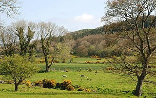
The Glens of Antrim, known locally as simply The Glens, is a region of County Antrim, Northern Ireland. It comprises nine glens (valleys), that radiate from the Antrim Plateau to the coast. The Glens are an area of outstanding natural beauty and are a major tourist attraction in north Antrim.

Slemish, historically called Slieve Mish, is a hill in County Antrim, Northern Ireland. It lies a few miles east of Ballymena, in the townland of Carnstroan. Tradition holds that Saint Patrick, enslaved as a youth, was brought to this area and tended sheep herds on Slemish, and that during this time he found God.

Glenarm is a village in County Antrim, Northern Ireland. It lies on the North Channel coast north of the town of Larne and the village of Ballygalley, and south of the village of Carnlough. It is situated in the civil parish of Tickmacrevan and the historic barony of Glenarm Lower. It is part of Mid and East Antrim Borough Council and had a population of 568 people in the 2011 Census. Glenarm takes its name from the glen in which it lies, the southernmost of the nine Glens of Antrim.

The A2 is a major road in Northern Ireland, a considerable length of which is often referred to the Antrim Coast Road because much of it follows the scenic coastline of County Antrim; other parts of the road follow the coasts in Counties Down and Londonderry.

The Antrim County Board of the Gaelic Athletic Association or Antrim GAA is one of the 32 county boards of the GAA in Ireland, and is responsible for Gaelic games in County Antrim, Northern Ireland. The county board is also responsible for the Antrim county teams.
Andrew Nicholl RHA was an Irish painter. He was a founding member of the Belfast Association of Artists and in 1847 was elected as an associate member to the Royal Hibernian Academy, becoming a full member in 1860.

Scouting in Northern Ireland is represented by three Scouting associations:

Cargan is a hamlet and townland in County Antrim, Northern Ireland. It lies at the foot of Slievenanee in Glenravel – locally known as "The Tenth Glen" along with the more widely known nine Glens of Antrim. It is part of Mid and East Antrim district. It had a population of 588 people in the 2011 Census.

Glendun translates into English as glen of the brown river and is one of the nine Glens of Antrim in County Antrim in Northern Ireland.

The River Dun, also known as the Glendun River is a river in County Antrim, Northern Ireland. It runs through Glendun, one of the nine Glens of Antrim. The river is named after its brown colour, which comes from the peat bogs at its source on the slopes of Slievenanee on the Antrim Plateau. The source of the river is a few hundred metres from that of the River Bush, which flows north-east to meet the sea at Bushmills. Cushendun is a small coastal resort town lying at the mouth of the River Dun and Glendun.

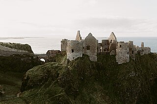
The Antrim Coast and Glens is an area of County Antrim in Northern Ireland, designated as an Area of Outstanding Natural Beauty in 1988.
The Route was a medieval territory in Gaelic Ireland, located on the north-east coast of Ulster. It stretched between Coleraine and Ballycastle and as far south as the Clogh River. Originally part of Twescard, a county of the Earldom of Ulster, it was later ruled by the MacQuillans and then the MacDonnells.

Glenshesk is one of the nine Glens of Antrim in County Antrim, Northern Ireland. It was shaped by glacial erosion. The glen lies on the eastern side of Knocklayde mountain and flows out to the sea at Ballycastle.
Glentaisie is one of the nine Glens of Antrim in County Antrim, Northern Ireland. It was shaped during the Ice Age by glaciers. The glen is most northerly of the nine glens and lies at the foot of Knocklayde mountain. The town of Ballycastle lies on the coast at the foot of the glen.
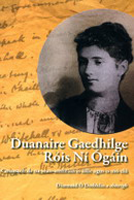
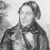
Rose Maud Young was an Irish writer, scholar and collector of Irish songs, best known for her work to preserve the Irish Language.
