
Mason County is a county in the U.S. state of West Virginia. As of the 2020 census, the population was 25,453. Its county seat and largest city is Point Pleasant. The county was founded in 1804 and named for George Mason, delegate to the U.S. Constitutional Convention. Before the Civil War, the county was in the State of Virginia.

Clendenin is a town in Kanawha County, West Virginia, United States, situated along the Elk River. The population was 850 at the 2020 census.

Point Pleasant is a city in and the county seat of Mason County, West Virginia, United States, at the confluence of the Ohio and Kanawha Rivers. The population was 4,101 at the 2020 census. It is the principal city of the Point Pleasant micropolitan area extending into Ohio. The town is best known for the Mothman, a purported humanoid creature reportedly sighted in the area that has become a part of West Virginia folklore.

Ridgeley is a town in Mineral County, West Virginia, United States, and part of the Cumberland Metropolitan Statistical Area. The population was 590 at the 2020 census.

Cornstalk was a Shawnee leader in the Ohio Country in the 1760s and 1770s. His name in the Shawnee language was Hokoleskwa. Little is known about his early life. He may have been born in the Province of Pennsylvania. In 1763, he reportedly led a raid against British-American colonists in Pontiac's War. He first appears in historical documents in 1764, when he was one of the hostages surrendered to the British as part of the peace negotiations ending Pontiac's War.

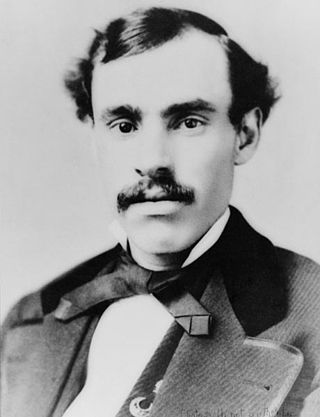
William Nelson Page was an American civil engineer and industrialist. He was active in the Virginias following the U.S. Civil War. Page was widely known as a metallurgical expert by other industry leaders and investors as well as state and federal authorities.

Middle Island Creek is a river, 77 miles (124 km) long, in northwestern West Virginia in the United States. It is a tributary of the Ohio River, draining an area of 565 square miles (1,463 km2) on the unglaciated Allegheny Plateau. It was named by late 18th century pioneering travelers on the Ohio River, who noted the location of the Creek's mouth opposite Middle Island in the larger river.

West Virginia Route 2 is a state highway in the US state of West Virginia. It generally parallels the Ohio River along the western border of the state, from U.S. Route 60 in Huntington northeasterly to U.S. Route 30 in Chester.

West Virginia Route 62 is a north–south state highway in western West Virginia. The southern terminus of the route is at West Virginia Route 25 in Dunbar. The northern terminus is at Interstate 77 and U.S. Route 33 in Ripley.
Gallipolis Ferry is a census-designated place (CDP) in Mason County, West Virginia, United States. It is situated on the Ohio River along West Virginia Route 2. As of the 2010 census, its population was 817. It is the site of the Robert C. Byrd Locks & Dam on the Ohio. The community was named for the fact a ferry once provided service between the town site and nearby Gallipolis, Ohio.

Tu-Endie-Wei State Park is located at the confluence of the Kanawha River and the Ohio River in downtown Point Pleasant, West Virginia. The park commemorates the Battle of Point Pleasant, fought between the settler militia of Virginia and the forces of Shawnee Chief Cornstalk on October 10, 1774. The militia victory by the settlers weakened the alliance between native forces and the British and freed up settlers from western Virginia to cross the Allegheny Mountains and join in the American Revolutionary War.
John M. Phelps was a Methodist minister who became politically active in the Republican Party during the American Civil War, and became the first President of the West Virginia Senate and later served as West Virginia's fifth Secretary of State (1871-1873).
The Point Pleasant Micropolitan Statistical Area, as defined by the United States Census Bureau, is an area consisting of two counties – one in West Virginia and one in Ohio – anchored by the city of Point Pleasant, West Virginia.

In West Virginia folklore, the Mothman is a humanoid creature reportedly seen in the Point Pleasant area from November 15, 1966, to December 15, 1967. The first newspaper report was published in the Point Pleasant Register, dated November 16, 1966, titled "Couples See Man-Sized Bird ... Creature ... Something". The national press soon picked up the reports and helped spread the story across the United States. The source of the legend is believed to have originated from sightings of out-of-migration sandhill cranes or herons.
Letart is an unincorporated community in Mason County, West Virginia, United States. It is located on the Ohio River.

Pleasant Creek Wildlife Management Area is located near Philippi, West Virginia in Barbour and Taylor counties. Located on 3,030 acres (1,230 ha) land that varies from wetlands to steeply forested woodlands, the Pleasant Creek WMA rises to an elevation of 1,600 feet (490 m).
Lakin is an unincorporated community in Mason County, West Virginia, United States. Lakin is located on West Virginia Route 62, 5 miles (8.0 km) southwest of Mason.
Ashton is an unincorporated community in Mason County, West Virginia, United States. Ashton is located on the Ohio River and West Virginia Route 2, 15 miles (24 km) south of Point Pleasant. Ashton has a post office with ZIP code 25503.

Point Pleasant Historic District is a national historic district located at Point Pleasant, Mason County, West Virginia. The district includes 93 contributing buildings and one contributing site in Point Pleasant's central business district and surrounding residential areas. They are in a variety of late 19th- and early 20th-century architectural styles. Notable buildings include the Mansion House (1796), The Church of Christ in Christian Union (1840), Odd Fellows Hall, The Presbyterian Church (1926), Christ Episcopal Church (1869-1873), "Hooff's Opera House" (1905), Pioneer Cemetery, U.S. Post Office Building (1913), and the Poffenbarger House. The Point Pleasant Battleground is located in the district and listed separately on the National Register of Historic Places.


