
East Sussex is a non metropolitan county in South East England on the English Channel coast. It is bordered by the non metropolitan counties of Kent to the north and east, West Sussex to the west, and Surrey for a short distance to the north-west.

Newhaven is a port town in East Sussex in England, lying at the mouth of the River Ouse.

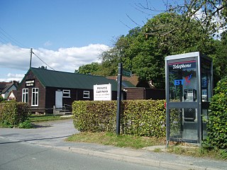
The A272 is a road in southeast England. It follows an approximate east–west route from near Heathfield, East Sussex to the city of Winchester, Hampshire.

Isfield is a small village and civil parish in the Wealden District of East Sussex in England, located north-east of Lewes.

Long Man is a civil parish in the Wealden District of East Sussex, England, which includes the villages of Wilmington, Milton Street and Folkington. The parish is named after the Long Man of Wilmington, a 69.2-metre (227 ft) chalk figure in the parish.
Horam is a village, electoral ward and civil parish in the Wealden District of East Sussex, situated three miles (4.8 km) south of Heathfield. Included in the parish are the settlements of Vines Cross and Burlow.

Maresfield is a village and civil parish in the Wealden District of East Sussex, England. The village itself lies 1.5 miles (2.4 km) north from Uckfield; the nearby villages of Nutley and Fairwarp; and the smaller settlements of Duddleswell and Horney Common; and parts of Ashdown Forest all lie within Maresfield parish.

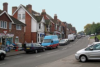
Ticehurst is both a village and a large civil parish in the Rother district of East Sussex, England. The parish lies in the upper reaches of both the Bewl stream before it enters Bewl Water and in the upper reaches of the River Rother flowing to the south-east. The parish includes the parish wards of Ticehurst, Flimwell and Stonegate. The linear settlements of Berner's Hill and Union Street lie between Ticehurst and Flimwell. It lies to the south-east of Tunbridge Wells, and is about ten miles (16 km) distant.

Buxted is a village and civil parish in the Wealden district of East Sussex in England. The parish is situated on the Weald, north of Uckfield; the settlements of Five Ash Down, Heron's Ghyll and High Hurstwood are included within its boundaries. At one time its importance lay in the Wealden iron industry, and later it became commercially important in the poultry and egg industry.

Alfriston is a village and civil parish in the East Sussex district of Wealden, England. The village lies in the valley of the River Cuckmere, about four miles (6 km) north-east of Seaford and south of the main A27 trunk road and part of the large area of Polegate. The parish had a population of 829 at the 2011 census.
Chiddingly is an English village and civil parish in the Wealden District of the administrative county of East Sussex, within historic Sussex, some five miles (8 km) northwest of Hailsham.
Rotherfield is a village and civil parish in the Wealden District of East Sussex, England. It is one of the largest parishes in East Sussex. There are three villages in the parish: Rotherfield, Mark Cross and Eridge. The River Rother, which drains much of the county and discharges at Rye Harbour, has its source on the south side of the hill on which Rotherfield village is built.

Fletching is a village and civil parish in the Wealden District of East Sussex, England. It is located three miles (4.8 km) to the north-west of Uckfield, near one of the entrances to Sheffield Park. The A272 road crosses the parish. The settlement of Piltdown is part of the parish. The Piltdown Man discovery in 1912 was thought to be the 'missing-link' between humans and apes. The significance of the specimen remained controversial until, amidst great publicity, and much embarrassment in scientific circles, it was exposed in 1953 as a forgery thought to have been committed by Charles Dawson.

Westham is a large village and civil parish in the Wealden District of East Sussex, England. The village is adjacent to Pevensey five miles (8 km) north-east of Eastbourne. The parish consists of three settlements: Westham; Stone Cross; and Hankham. The parish is virtually part of the Greater Eastbourne conurbation, and much expansion has been occurring here: hence the large population.

Patching is a small village and civil parish that lies amid the fields and woods of the southern slopes of the South Downs in the National Park in the Arun District of West Sussex, England. It has a visible hill-workings history going back to before the Domesday survey of 1086–7. It is centred four miles (6.4 km) to the east of Arundel and quarter of a mile from Clapham, to the north of the A27 road. The civil parish covers an area of 846.12 hectares.
Gold Cross or Golden Cross may refer to:
Stoughton is a village and civil parish in the District of Chichester in West Sussex, England located nine kilometres north west of Chichester east of the B2146 road, on a lane leading to East Marden. The parish has a land area of 2,987 hectares. In the 2001 census 631 people lived in 255 households, of whom 286 were economically active. At the 2011 Census the population including Walderton had increased to 659. The parish is crossed from west to east by the Monarch's Way long-distance footpath, which passes through the villages of Stoughton and Walderton. There is one pub, The Hare and Hounds.
Funtington is a village and civil parish in the Chichester district of West Sussex, England. It lies on the B2146 Road 4.5 miles (7.2 km) west of Chichester. The parish also contains the villages of East and West Ashling, West Stoke and the Kingley Vale National Nature Reserve lies at its northern tip. There is a farm produce shop and a pub at the centre of the village. Funtington Primary School is in the village of West Ashling.
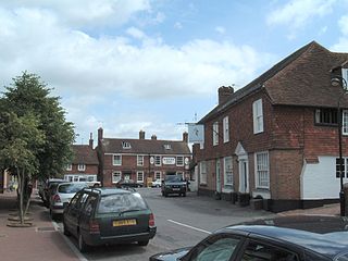
Chelwood Gate is a small village within the civil parish of Danehill in the Wealden district of East Sussex, England. Its nearest town is Uckfield, which lies approximately 6.6 miles (10.6 km) south-east from the village, just off the A22 road. The village is near the West Sussex border.

