
East Sussex is a non metropolitan county in South East England on the English Channel coast. It is bordered by the non metropolitan counties of Kent to the north and east, West Sussex to the west, and Surrey for a short distance to the north-west.

Uckfield is a town in the Wealden District of East Sussex in South East England. The town is on the River Uck, one of the tributaries of the River Ouse, on the southern edge of the Weald.

Ashdown Forest is an ancient area of open heathland occupying the highest sandy ridge-top of the High Weald Area of Outstanding Natural Beauty. It is situated some 30 miles (48 km) south of London in the county of East Sussex, England. Rising to an elevation of 732 feet (223 m) above sea level, its heights provide expansive vistas across the heavily wooded hills of the Weald to the chalk escarpments of the North Downs and South Downs on the horizon.

Crowborough is a town and civil parish in East Sussex, England, in the Weald at the edge of Ashdown Forest in the High Weald Area of Outstanding Natural Beauty, 7 miles (11 km) south-west of Royal Tunbridge Wells and 33 miles (53 km) south of London. It had a population 20,607 at the 2011 Census.

Wealden is a local government district in East Sussex, England. Its council is based in Hailsham. The district's name comes from the Weald, the remnant forest which was once unbroken and occupies much of the centre and north of the area.

Maresfield is a village and civil parish in the Wealden District of East Sussex, England. The village itself lies 1.5 miles (2.4 km) north from Uckfield; the nearby villages of Nutley and Fairwarp; and the smaller settlements of Duddleswell and Horney Common; and parts of Ashdown Forest all lie within Maresfield parish.

The Oxted line is a railway in southern England and part of the Southern franchise. The railway splits into two branches towards the south and has direct trains throughout to London termini.
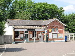
Buxted railway station is on the Uckfield branch of the Oxted Line in England, serving the village of Buxted, East Sussex. It is 43 miles 68 chains (70.6 km) from London Bridge.

Wealden is a constituency represented in the House of Commons of the UK Parliament since 2015 by Nus Ghani, a Conservative. Ghani was the first Muslim woman to be elected as a Conservative member of Parliament.

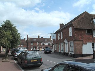
Buxted is a village and civil parish in the Wealden district of East Sussex in England. The parish is situated on the Weald, north of Uckfield; the settlements of Five Ash Down, Heron's Ghyll and High Hurstwood are included within its boundaries. At one time its importance lay in the Wealden iron industry, and later it became commercially important in the poultry and egg industry.
Rotherfield is a village and civil parish in the Wealden District of East Sussex, England. It is one of the largest parishes in East Sussex. There are three villages in the parish: Rotherfield, Mark Cross and Eridge. The River Rother, which drains much of the county and discharges at Rye Harbour, has its source on the south side of the hill on which Rotherfield village is built.

Danehill is a village in East Sussex, England.
The Wealden Line is a partly abandoned double track railway line in East Sussex and Kent that connected Lewes with Tunbridge Wells, a distance of 25.25 miles (40.64 km). The line takes its name from the Weald, the hilly landscape the lies between the North and South Downs.

Ashdown Radio is a community radio station in East Sussex, broadcasting from transmitters in Uckfield and Crowborough. It is owned by Ashdown Radio Limited.
Chelwood Gate is a small village within the civil parish of Danehill in the Wealden district of East Sussex, England. Its nearest town is Uckfield, which lies approximately 6.6 miles (10.6 km) south-east from the village, just off the A22 road. The village is near the West Sussex border.

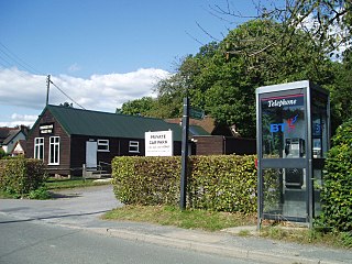
Five Ash Down is a small village within the civil parish of Buxted, in the Wealden district of East Sussex, England. Its nearest town is Uckfield, which lies approximately 1.8 miles (2.9 km) south from the village. The village lies on the A26 road between Uckfield and Crowborough. Five Ash Down is home to the Pig and Butcher public house, a village hall which has a weekly timetable of events and the village shop and Post Office. Five Ash Down Independent Chapel, an Evangelical church, was founded in 1773 and moved to its present site in 1784, although in its present form the chapel is mostly Victorian.
Buxted Parish Council governs the village of Buxted, a civil parish in the Wealden district of East Sussex in England. The council appoints one councillor who is then known as the Chairman or Chairwoman. The current Chairperson is Councillor Vivienne Blandford.

