Goram and Vincent

Last updated

Goram and Vincent (or Ghyston) are legendary giants in the folklore of the Bristol area, UK.

Contents

Summary

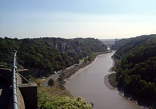
The earliest accounts of the story explain the ascendancy of Bristol over the port of Sea Mills (the earlier Roman settlement Portus Abonae). [1] [2] It also belongs to the genus of myths which explain the origin of local geographical features by supernatural activity, and trade on existing place-names to do so. Such myths are often also the basis for other new names. The most widespread version of the legend relates that two local giants, Goram and Vincent – who, according to one version, were brothers – fancied the same woman, the beautiful Avona (whose name is that of the major local river, the River Avon in Latin). She was open-minded about her suitors, and offered herself to whichever of them could drain the lake which supposedly once occupied the space between Bradford-on-Avon (Wiltshire) and Bristol. They chose different routes through the limestone hills for their drainage channels. Goram opted for a route through Henbury, and Vincent chose one on the south side of Clifton.

Unfortunately for Goram, he overheated while hard at work, drank a giant quantity of ale, and fell asleep in his favourite stone chair, whilst Vincent paced himself better and completed his channel. (One version depicts Goram as lazy and Vincent as keen and industrious.) The story accounts for the narrow gorge of the Hazel Brook (a tributary of the river Trym) in Henbury and the Avon Gorge through which the Avon now flows. [3] [4]

The legend says that the Giant's Footprint formation in the Blaise Estate was caused by Goram stamping his foot after discovering that he had lost Avona's challenge. Giant's Footprint.jpg
The legend says that the Giant's Footprint formation in the Blaise Estate was caused by Goram stamping his foot after discovering that he had lost Avona's challenge.

The legend also provides a basis for explaining the existence of other geographical features. When Goram woke up, he was distraught at losing Avona's affections. He first stamped his foot in a pit, creating The Giant's Footprint in the woods above Henbury gorge, and then drowned himself in the Severn. The two islands in the Severn estuary, Steep Holm and Flat Holm, are his head and shoulder. Goram also has his Soap-Dish, which is a short pillar capped with earth, [5] and a pool also in the Henbury gorge.

Early accounts

The oldest known mention of the giants was by William Worcester, who in 1480 described Ghyston Cliff (now St. Vincent's Rocks, near Clifton Observatory), and said that the hillfort above it (Clifton Down Camp) was founded "by a certain giant called Ghyst", who was "portrayed in/on the ground" (in terra portraiatum), presumably as a hill figure. [6]

An early version of the legend itself was recorded by John Aubrey in his Monumenta Britannica (c.1663–1693):

The Tradition concerning St. Vincent's Rocks is, that there were three Brothers, viz. Vincent, Goram, and the Smyth of Dunderhill: and that there was a Controversy between Gorram and Vincent about this Work: for Goram would have had the Haven to have been at Henbury. (Gorham lived at Henbury, where they still shew Gorham's chaire, and Gorham's Oven.) but at last the two Brothers agreed, and brake the Rock; and when they wore out their Sledges, they threw them to Dunderhill (two miles off) to their Brother to be mended. Perhaps some sparke of Truth might be pick't out in this Mist. [1]

Another version is given in Robert Atkyns' The Ancient and Present State of Glostershire (1712):

Before the Port of Bristol was settled in Frome River, there seems to have been a Dispute whether a Place called Say-Mills was not as convenient a Port as the other; several Men of War and other large Ships having been built in that Place. This occasioned the extravagant fabulous Story, concerning St. Vincent the Spanish Bishop, and Goram a private Hermit. The Story makes these to have been mighty Gyants, and that they contended which way the Rivers Avon and Frome should vent themselves into the Severn: If the Port of Say-Mills had been judged more convenient, then Goram had prevailed; because his Hermitage was in Westbury, on the side of the Brook Trim, which runs down to Say-Mills: But the Port of Frome being thought more advantageous, therefore the Miracle relates that St. Vincent did cleave St. Vincent's Rocks asunder, and so gave Passage to the Rivers, because those Rocks derive their Name from a Chapel dedicated to St. Vincent. [2]

Other variants

In another version of the myth, Goram dug the Avon Gorge himself and there is no sign of Vincent in the story. Having completed the job, he carelessly fell over a barrow called Maes Knoll, on Dundry Hill south of Bristol, and plunged into the Severn estuary, as above. In yet another, Vincent and Goram shared a pickaxe as they went about their labours, and Vincent accidentally killed Goram by throwing it to him inaccurately halfway through their respective jobs. Vincent finished the Avon Gorge out of remorse and did some other major construction work like the Stanton Drew stone circles and even Stonehenge.

The story has also been adapted to other local circumstances. The early 19th-century cleric and folklorist Rev. John Skinner collected a tale from the area that is now called Druid Stoke from a local farmer. Two giants had thrown stones at each other, one standing at Henbury, the other at St Vincent's Rocks by the Avon Gorge. The Henbury giant, called Goram or Gorm, threw a large one at his rival, but it fell short of its target; this accounts for the capstone of a formerly visible megalithic monument at Druid Stoke.[ better source needed ] [7]

One or the other giant is said to have created Maes Knoll hillfort and the pre-Anglo-Saxon period linear earthwork Wansdyke, south-east of Bristol, more or less accidentally with his digging tools. [8]

Names

The name Vincent for one of the giants rests on the fact that at Clifton, at the narrowest point of the Avon Gorge, there was formerly an ancient hermitage and chapel dedicated to St Vincent, at or near the present cave in the cliff-face which bears his name. Another (apparently modern) version of the story calls the Clifton giant Ghyston, which is in fact the name, of obscure origin, for the whole of the cliff-face of the Avon Gorge at least as early as the mid-fifteenth century, in the detailed description of the Bristol area by William Worcestre. [9] The place-name was personified to produce the giant's name. Vincent's Cave is called Ghyston cave or The Giant’s Hole in an article in the July 1837 issue of Felix Farley’s Bristol Journal.

Goram's name may have been borrowed from Iseult's father, the king of Ireland in early versions of the romance of Tristan and Iseult, which might suggest that the legend arose sometime after 1200.[ citation needed ]Gorm is Irish for 'blue' or 'dark-skinned'. The Christian name Vincent is first found in England in the 13th century, [10] suggesting a fashionable cult of the saint (St Vincent the Deacon) around that time.[ citation needed ] These two factors suggest a possible 13th-century origin for the Bristol legend,[ citation needed ] but that is completely uncertain. It is not known, for example, whether the Clifton hermit was himself called Vincent and later became associated with the saint. St Vincent might also have been known in Bristol relatively early through the city's wine trade with Portugal and Spain (he was born in Huesca, lived and worked in Zaragoza, and is patron saint of Lisbon and of vintners).

Modern times

Sculpture of Goram the Giant in the grounds of Ashton Court Goram the Giant.JPG
Sculpture of Goram the Giant in the grounds of Ashton Court

Goram is commemorated in the features Goram's Chair and Footprint (some versions seem to treat these as the same thing, saying that the Chair was formed by the giant stamping his foot) and Soap-Dish in the gorge of the Hazel Brook. A pub of the early 1960s on the Lawrence Weston housing estate in west Bristol is called The Giant Goram, [11] and from about 1954 sporadically to 1996, there was a funfair bearing Goram's name on the Blaise Castle landed estate (by then in the hands of Bristol City Council) in Henbury. [5] [12]

Marc Vyvyan-Jones, with help from Roland Clare and Linda Clare, wrote (on Plough Monday 1993) a mumming-style play based on the legend. This was first performed by Rag Morris at Blaise Castle, Bristol on Saturday 20 March 1993. [13] [14] [15]

Related Research Articles

<span class="mw-page-title-main">River Avon, Bristol</span> River in the south west of England

The River Avon is a river in the southwest of England. To distinguish it from a number of other rivers of the same name, it is often called the Bristol Avon. The name 'Avon' is loaned from an ancestor of the Welsh word afon, meaning 'river'.

<span class="mw-page-title-main">Avon Gorge</span> Gorge on the River Avon in Bristol, England

The Avon Gorge is a 1.5-mile (2.5-kilometre) long gorge on the River Avon in Bristol, England. The gorge runs south to north through a limestone ridge 1.5 miles (2.4 km) west of Bristol city centre, and about 3 miles (5 km) from the mouth of the river at Avonmouth. The gorge forms the boundary between the unitary authorities of North Somerset and Bristol, with the boundary running along the south bank. As Bristol was an important port, the gorge formed a defensive gateway to the city.

<span class="mw-page-title-main">Henbury, Bristol</span> Human settlement in England

Henbury is a suburb of Bristol, England, approximately 5 miles (8.0 km) north west of the city centre. It was formerly a village in Gloucestershire and is now bordered by Westbury-on-Trym to the south; Brentry to the east and the Blaise Castle Estate, Blaise Hamlet and Lawrence Weston to the west. To the north lie the South Gloucestershire village of Hallen and the entertainment/retail park Cribbs Causeway.
<span class="mw-page-title-main">Severn Beach line</span> Railway in Bristol and Gloucestershire, England

The Severn Beach line is a local railway line in Bristol and Gloucestershire, England, which runs from Bristol Temple Meads to Severn Beach, and used to extend to Pilning. The first sections of the line were opened in 1863 as part of the Bristol Port Railway and Pier; the section through Bristol was opened in 1875 as the Clifton Extension Railway.

<span class="mw-page-title-main">Blaise Castle Estate</span> Folly built in 1766 near Henbury in Bristol, England

Blaise Castle is a folly built in 1766 near Henbury in Bristol, England. The castle sits within the Blaise Castle Estate, which also includes Blaise Castle House, a Grade II* listed 18th-century mansion house. The folly castle is also Grade II* listed and ancillary buildings including the orangery and dairy also have listings. Along with Blaise Hamlet, a group of nine small cottages around a green built in 1811 for retired employees, and various subsidiary buildings, the parkland is listed Grade II* on the Register of Historic Parks and Gardens of special historic interest in England.

<span class="mw-page-title-main">Shirehampton</span> Human settlement in England

Shirehampton is a district of Bristol in England, near Avonmouth, at the northwestern edge of the city.

<span class="mw-page-title-main">River Trym</span> Short river in the United Kingdom

The River Trym is a short river, some 4.5 miles (7.2 km) in length, which rises in Filton, South Gloucestershire, England. The upper reaches are culverted, some underground, through mostly urban landscapes, but once it emerges into the open it flows through a nature reserve and city parks before joining the tidal River Avon at Sea Mills. 18th-century water mills near the mouth gave the area its name.

<span class="mw-page-title-main">Lawrence Weston, Bristol</span> Human settlement in England

Lawrence Weston is a post-war housing estate in northwest Bristol, England, between Henbury and Shirehampton.
<span class="mw-page-title-main">Avonmouth Docks</span> Port in United Kingdom

The Avonmouth Docks are part of the Port of Bristol, in England. They are situated on the northern side of the mouth of the River Avon, opposite the Royal Portbury Dock on the southern side, where the river joins the Severn estuary, within Avonmouth.

Sea Mills is a suburb of Bristol, England, 3.5 miles (6 km) north-west of the city centre, towards the seaward end of the Avon Gorge, between the former villages of Shirehampton to the west and Westbury-on-Trym and Stoke Bishop to the east, at the mouth of the River Trym where it joins the River Avon. Sea Mills was part of the city ward of Kingsweston. Following a Local Government Boundary Commission review in 2015, ward boundaries were redrawn and Sea Mills is now split between the Stoke Bishop ward and the Avonmouth and Lawrence Weston ward.

<span class="mw-page-title-main">Parks of Bristol</span>

The English city of Bristol has a number of parks and public open spaces.

The city of Bristol, England, is divided into many areas, which often overlap or have non-fixed borders. These include Parliamentary constituencies, council wards and unofficial neighbourhoods. There are no civil parishes in Bristol.
<span class="mw-page-title-main">Sea Mills railway station</span> Railway station in Bristol, England

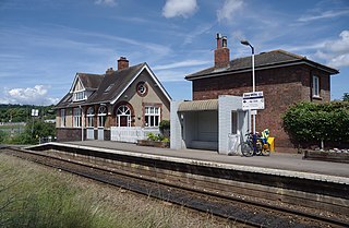
Sea Mills railway station is on the Severn Beach Line and serves the district of Sea Mills and nearby Westbury on Trym in Bristol, England. It is 6 miles (9.7 km) from Bristol Temple Meads, situated at the confluence of the River Avon and River Trym and near the A4 Bristol Portway. Its three letter station code is SML. The station has a single platform which serves trains in both directions. As of 2015 it is managed by Great Western Railway, which is the third franchise to be responsible for the station since privatisation in 1997. They provide all train services at the station, mainly a train every 30 minutes in each direction.

<span class="mw-page-title-main">Avonmouth railway station</span> Railway station in Bristol, England

Avonmouth railway station is located on the Severn Beach Line and serves the district of Avonmouth in Bristol, England. It is 9.0 miles (14.5 km) from Bristol Temple Meads. Its three letter station code is AVN. The station has two platforms, on either side of two running lines. As of 2015 it is managed by Great Western Railway, which is the third franchise to be responsible for the station since privatisation in 1997. They provide all train services at the station, mainly a train every 30 minutes to Bristol Temple Meads and one every hour to Severn Beach.
<span class="mw-page-title-main">Hotwells</span> Human settlement in England

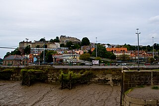
Hotwells is a district of the English port city of Bristol. It is located to the south of and below the high ground of Clifton, and directly to the north of the Floating Harbour. The southern entrance to the Avon Gorge, which connects the docks to the sea, lies at the western end of Hotwells. The eastern end of the area is at the roundabout where Jacobs Well Road meets Hotwell Road. Hotwells is split between the city wards of Clifton, and Hotwells and Harbourside.
<span class="mw-page-title-main">Clifton Observatory</span> Observatory in Bristol, England

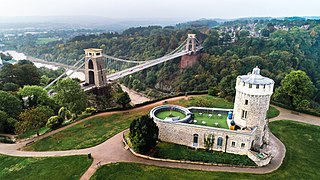
Clifton Observatory is a former mill, now used as an observatory, located on Clifton Down, close to the Clifton Suspension Bridge, Bristol, England.

Kingsweston was a ward of the city of Bristol. The three districts in the ward were Coombe Dingle, Lawrence Weston and Sea Mills. The ward takes its name from the old district of Kings Weston, now generally considered part of Lawrence Weston. Following a Local Government Boundary Commission review in 2015 ward boundaries were redrawn and Kingsweston ward is now split between the Stoke Bishop ward and the Avonmouth and Lawrence Weston ward.

<span class="mw-page-title-main">Portway, Bristol</span> A4 road in Bristol, UK

The Portway is a major road in the City of Bristol. It is part of the A4 and connects Bristol City Centre to the Avonmouth Docks and the M5 motorway via the Avon Gorge.
<span class="mw-page-title-main">Hazel Brook</span> River in England

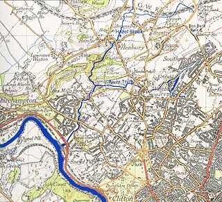
The Hazel Brook, also known as the Hen, is a tributary of the River Trym in Bristol, England. It rises at Cribbs Causeway in South Gloucestershire. From there, its course takes it south, passing the western end of Filton Aerodrome on its left bank, through Brentry and Henbury before dropping through a steep limestone gorge in the Blaise Castle estate. It continues south through two lakes before joining the Trym at Coombe Dingle.

References

  1. 1 2 Aubrey, John. "Of St Vincents Rocks, and Bristow". Monumenta Britannica. Vol. 3. pp. 133r, 134r.
  2. 1 2 Atkyns, Robert (1712). "Clifton". The Ancient and Present State of Glostershire. London: Robert Gosling. p. 361.
  3. Ekwall, Eilert (1928) English river-names. Oxford: Clarendon Press, p21-23
  4. Smith, A.H. (1964) The place-names of Gloucestershire, vol. 1. Cambridge: Cambridge University Press for the English Place-Name Society, p3
  5. 1 2 Hallen and Henbury Women's Institute (1993) A history of Henbury, 3rd edition, p39
  6. Clark, John (2016). "Trojans at Totnes and Giants on the Hoe: Geoffrey of Monmouth, Historical Fiction and Geographical Reality". Report and Transactions of the Devonshire Association. 148. The Devonshire Association: 110. ISSN   0309-7994 . Retrieved 5 November 2022.
  7. Druidical Stones on the 1889 OS 6" map, Gloucestershire at 356176
  8. Tongue, Ruth L., ed. K.M. Briggs (1965) Somerset folklore. London: Folk-Lore Society, p127
  9. Neale, Frances, ed. (2000) William Worcestre: the topography of medieval Bristol. Bristol: Bristol Record Society
  10. Withycombe, E.G. (1977) The Oxford dictionary of English Christian names, 3rd edition. Oxford: Oxford University Press, p289, under Vincent
  11. Helme, Judy (2003) In the footsteps of giants: a history of Lawrence Weston. Bristol: acta Community Theatre Ltd, p124
  12. Helme, Judy (2003) In the footsteps of giants: a history of Lawrence Weston. Bristol: acta Community Theatre Ltd, p121
  13. Bristol Observer (1993) Friday 19 March, p3
  14. Bristol Evening Post (1993) Monday 22 March, p7
  15. Mann, Deborah and Woodward, Kim (2008) Personal communications