Clifton Down

Last updated

Clifton Down
Bristol cd 041004 kites.jpg
Clifton Down
Bristol UK location map.svg
Red pog.svg
Typepublic open space
Location Bristol, England
Coordinates 51°28′10″N2°37′08″W / 51.46945°N 2.619°W / 51.46945; -2.619 Coordinates: 51°28′10″N2°37′08″W / 51.46945°N 2.619°W / 51.46945; -2.619
Area400 acres (160 ha)
OpenAll year
1955 OS map of Clifton Down and Durdham Down 1955 Ordnance Survey map of Durdham Down & Clifton Down.jpg
1955 OS map of Clifton Down and Durdham Down

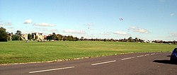
Clifton Down is an area of public open space in Bristol, England, north of the village of Clifton. With its neighbour Durdham Down to the northeast, it constitutes the large area known as The Downs, much used for leisure including walking and team sports. Clifton Down is the part of the Downs south of Stoke Road.

Contents

Close up view of the natural rock slide at Clifton Down Natural Rockslide - Bristol, England at Clifton Downs - Dec 30th, 2004.jpg
Close up view of the natural rock slide at Clifton Down
A kite aerial view of the Via Julia, captured during a visit with the Bath and Bristol Young Archaeologists Club in 2009 Roman Road - The Via Julia, Bristol.jpg
A kite aerial view of the Via Julia, captured during a visit with the Bath and Bristol Young Archaeologists Club in 2009

History

There is an Iron Age hill fort at Clifton Camp on Observatory Hill on the down, and there are remnants of an Iron Age or Roman field system between Ladies Mile and Bristol Zoo. The Roman road from Bath to Sea Mills crossed the Downs near Stoke Road, and a short length is visible as a slightly raised grassy bank. William Worcester described a presumably turf-cut figure of the giant Ghyst on Clifton Down in 1480. [1]

In the Middle Ages Clifton Down was the commons of pasture for the manor of Clifton. It was also valuable farmland used by many farms in the area. In 1676 and 1686 the manor of Clifton was purchased by the Society of Merchant Venturers. During the 18th century Clifton became a fashionable summer spa, and Clifton Down was increasingly used for recreation. There were also lead mines in the 18th century, which account for the bumpy surface in the area by Upper Belgrave Road known as the Dumps. A gibbet was erected opposite the top end of Gallows Acre Lane (now known as Pembroke Road).

By the mid-19th century Clifton Down ceased to be used for grazing. Clifton became a desirable place to live, and large houses were built close to Clifton Down. Bristol Corporation became concerned at the threat to this public amenity, and in 1861 promoted an Act of Parliament, under which the Society of Merchant Venturers undertook to secure Clifton Down for public enjoyment free of charge. [2]

Since 1861 Clifton Down has been managed, with Durdham Down, by the Downs Committee, a joint committee of the Society of Merchant Venturers and Bristol City Council, which owns Durdham Down. [3] The committee appoints a Downs Ranger to oversee the Downs. [4]

Suffragette meeting

On 20 September 1908 there was a meeting across the road near the water tower to support the Suffragette movement: some 10,000 people were there. [5]

World War II

Stone cairns were placed on all open spaces to deter landings of enemy aircraft: the cairns were removed in 1944. In May 1941, 32 acres were requisitioned on the east side of Ladies Mile to store military vehicles in six canvas hangars. There was a tank repair area near the Sea Walls. An area of 42 acres to the west of Ladies Mile was used from February 1944 to store heavy army equipment. [5]

Features

The downs, Clifton and Durdham, are separated by the busy commuter road of Stoke Road, passing the prominent 'concrete elephant' water tower and adjoining tea room. At right angles to Stoke Road runs the dead straight 'Ladies Mile', to the South West corner of the Downs and Bridge Valley Road. In Victorian and Edwardian times this was a promenading and horse-riding spot for the affluent, similar to Rotten Row in London. After the Great War, it remained a promenading spot, but now on a more commercial basis. [6]

From the southwest corner of Clifton Down, in an area known as the Sea Wall, there are panoramic views of the Avon Gorge and the Clifton Suspension Bridge.

Near Clifton village is the site of the Observatory, a small tower with a camera obscura at the top. Located close to the observatory is an open face of rock that has been used as a slide by generations of Bristolians and students. This "rock slide" has become polished and is now an attraction to visitors. [7]

A railway tunnel, Clifton Down Tunnel, passes underneath Clifton on the line from Temple Meads to Severn Beach. One portal is in Clifton near Clifton Down railway station; the other in the Avon Gorge far below Clifton Down. There are three air shafts for the tunnel: two in vertical tower form (near the zoo, and in Walcombe Slade gulley) with the third being a horizontal tunnel on the Portway.

Part of Clifton Down was used by gay men as a cruising ground. In 2008, there were concerns by some gay men at the removal of vegetation as part of the Avon Gorge Management Plan, on the grounds that this was discrimination on the grounds of sexual orientation. [8]

See also

Related Research Articles

<span class="mw-page-title-main">Clifton Suspension Bridge</span> Bridge spanning the Avon Gorge and the River Avon

The Clifton Suspension Bridge is a suspension bridge spanning the Avon Gorge and the River Avon, linking Clifton in Bristol to Leigh Woods in North Somerset. Since opening in 1864, it has been a toll bridge, the income from which provides funds for its maintenance. The bridge is built to a design by William Henry Barlow and John Hawkshaw, based on an earlier design by Isambard Kingdom Brunel. It is a Grade I listed building and forms part of the B3129 road.

<span class="mw-page-title-main">Clifton, Bristol</span> Suburb of Bristol, England

Clifton is both a suburb of Bristol, England, and the name of one of the city's thirty-five council wards. The Clifton ward also includes the areas of Cliftonwood and Hotwells. The eastern part of the suburb lies within the ward of Clifton Down.

<span class="mw-page-title-main">Durdham Down</span> Area of open space in Bristol, England

Durdham Down is an area of public open space in Bristol, England. With its neighbour Clifton Down to the southwest, it constitutes a 400-acre (1.6 km2) area known as The Downs, much used for leisure including walking, jogging and team sports. Its exposed position makes it particularly suitable for kite flying. Durdham Down is the part of the Downs north of Stoke Road.

<span class="mw-page-title-main">The Downs, Bristol</span>

The Downs are an area of public open limestone downland in Bristol, England. They consist of Durdham Down to the north and east and Clifton Down to the south, separated by Stoke Road.

<span class="mw-page-title-main">Society of Merchant Venturers</span> Charitable organisation in Bristol, UK

The Society of Merchant Venturers is a charitable organisation in the English city of Bristol.

<span class="mw-page-title-main">Avon Gorge</span> Gorge on the River Avon in Bristol, England

The Avon Gorge is a 1.5-mile (2.5-kilometre) long gorge on the River Avon in Bristol, England. The gorge runs south to north through a limestone ridge 1.5 miles (2.4 km) west of Bristol city centre, and about 3 miles (5 km) from the mouth of the river at Avonmouth. The gorge forms the boundary between the unitary authorities of North Somerset and Bristol, with the boundary running along the south bank. As Bristol was an important port, the gorge formed a defensive gateway to the city.

<span class="mw-page-title-main">Monarch's Way</span> Long-distance footpath in England

The Monarch's Way is a 625-mile (1,006 km) long-distance footpath in England that approximates the escape route taken by King Charles II in 1651 after being defeated in the Battle of Worcester. It runs from Worcester via Bristol and Yeovil to Shoreham, West Sussex.

<span class="mw-page-title-main">Clifton Rocks Railway</span> Former (1893–1934) funicular railway in Bristol, England

The Clifton Rocks Railway was an underground funicular railway in Bristol, England, linking Clifton at the top to Hotwells and Bristol Harbour at the bottom of the Avon Gorge in a tunnel cut through the limestone cliffs.

<span class="mw-page-title-main">Stoke Bishop</span> Human settlement in England

Stoke Bishop is a medium-sized outer city suburb in the north-west of Bristol, located in between Westbury-on-Trym, Sneyd Park, and Sea Mills. Although relatively low, Stoke Bishop's population has increased due to substantial infilling on the Smelting Works sports ground and The Grove which used to belong to Clifton High school. The population of Stoke Bishop varies throughout the year because of the influx of students to the large campus of Bristol University halls of residence situated on the edge of the suburb and the Downs during term time.

<span class="mw-page-title-main">Bristol Tramways</span> Defunct tram system in Bristol, England (1875–1941)

Bristol Tramways operated in the city of Bristol, England from 1875, when the Bristol Tramways Company was formed by Sir George White, until 1941 when a Luftwaffe bomb destroyed the main power supply cables.

<span class="mw-page-title-main">Sneyd Park</span> Human settlement in England

Sneyd Park is a suburb of Bristol, England, lying on the western fringe of Clifton Down, adjacent to the Avon Gorge and the Sea Walls observation point. It is part of the Stoke Bishop district. Home to many millionaires, Sneyd Park was originally developed in Victorian times. Many Victorian and Edwardian villas line the edge of the Downs. More modern housing has since been built down over the slope, towards Sea Mills, Bristol. Much of this development was carried out by the Stride family builders whose practice was "to purchase an estate freehold and to erect thereon their own houses, with the knowledge that none will be able to come along and dump a lot of cheap houses down in the neighbourhood, thereby spoiling the amenities of the place and detracting from the value of the houses erected by the firm." The 'Stride brothers' specialised in constructing individual style homes with the emphasis on location, finish and design. Buildings were never duplicated and no two were built to the same design. They often have solid oak interior doors, oak-panelled hallways, the hallmark Stride letterboxes and impressive staircases. Brothers Jared and Jethro Stride founded the business in the 1920s, followed by Jared's sons Arthur and Frederick, and then their sons Leslie and Raymond. In 1864 Jared and Jethro's brother Lot was killed in an accident in a sawmill in Cardiff when his hair was caught in the revolving saw. The incident made the newspapers around the world. Prior to developing Sneyd Park Edwin Stride and his sons Jared and Jethro had set up the Crown Brick Works in Shirehampton to supply bricks for the docks then under construction.

<span class="mw-page-title-main">Parks of Bristol</span>

The English city of Bristol has a number of parks and public open spaces.

<span class="mw-page-title-main">Hotwells</span> Human settlement in England

Hotwells is a district of the English port city of Bristol. It is located to the south of and below the high ground of Clifton, and directly to the north of the Floating Harbour. The southern entrance to the Avon Gorge, which connects the docks to the sea, lies at the western end of Hotwells. The eastern end of the area is at the roundabout where Jacobs Well Road meets Hotwell Road. Hotwells is split between the city wards of Clifton, and Hotwells and Harbourside.

<span class="mw-page-title-main">Clifton Observatory</span> Observatory in Bristol, England

Clifton Observatory is a former mill, now used as an observatory, located on Clifton Down, close to the Clifton Suspension Bridge, Bristol, England.

Goram and Vincent are legendary giants in the folklore of the Bristol area, UK.

<span class="mw-page-title-main">Alderman Proctor's Drinking Fountain</span> Building in Bristol, England

The Alderman Proctor's Drinking Fountain is a historic building on Clifton Down, Bristol, England.

Halls of residence at the University of Bristol are generally located within three distinct areas of Bristol, the City Centre, Clifton and Stoke Bishop.

<span class="mw-page-title-main">Portway, Bristol</span> A4 road in Bristol, UK

The Portway is a major road in the City of Bristol. It is part of the A4 and connects Bristol City Centre to the Avonmouth Docks and the M5 motorway via the Avon Gorge.

<span class="mw-page-title-main">Hotwells railway station</span> Railway station in Bristol, England

Hotwells railway station, was a railway station situated in the suburb of Hotwells in Bristol, England. It was the original southern terminus of the Bristol Port Railway and Pier which ran to a station and pier at Avonmouth. The station opened in 1865, originally named Clifton station, and was situated in the Avon Gorge almost underneath the Clifton Suspension Bridge, near the Clifton Rocks Railway, the Hotwells terminus of Bristol Tramways, the Rownham ferry and landing stages used by passenger steamers.

<span class="mw-page-title-main">William West (artist)</span> English painter

William West (1801–61) was an English oil painter and watercolourist who was a member of the Bristol School of artists. He was also the builder of the Clifton Observatory at Clifton Down, Bristol.

References

  1. Clark, John (2016). "Trojans at Totnes and Giants on the Hoe: Geoffrey of Monmouth, Historical Fiction and Geographical Reality". Report and Transactions of the Devonshire Association. The Devonshire Association. 148: 110. ISSN   0309-7994 . Retrieved 5 November 2022.
  2. The Downs Committee, The Downs: Clifton and Durdham Downs, 1861-1961 (Bristol, 1961)
  3. Cameron, Amanda (24 January 2022). "Merchant Venturers asked to give Clifton Down to city of Bristol". Bristol Post. Retrieved 31 January 2023.
  4. "History of The Downs".
  5. 1 2 Friends of the Downs and Avon Gorge "Welcome Issue" pamphlet 2016.
  6. 1 2 Hughes, Victoria (1977). Ladies' Mile. Abson Books. ISBN   0902920316.
  7. Batten, Rhiannon (28 March 2014). "Top 10 outdoor activities in Bristol". The Guardian . Retrieved 7 May 2018.
  8. "Concern over scrub clearance work". BBC News . 8 July 2008. Retrieved 7 May 2018.