Gosforth, Cumbria

Last updated

Gosforth
Parish Church, Gosforth - geograph.org.uk - 48017.jpg
Location map Borough of Copeland.svg
Red pog.svg
Gosforth
Location in the former Copeland Borough
Cumbria UK location map.svg
Red pog.svg
Gosforth
Location within Cumbria
Population1,396 (2011 including Ponsonby and Wasdale) [1]
OS grid reference NY0603
Civil parish
  • Gosforth
District
Shire county
Region
Country England
Sovereign state United Kingdom
Post town SEASCALE
Postcode district CA20
Dialling code 019467
Police Cumbria
Fire Cumbria
Ambulance North West
UK Parliament
List of places
UK
England
Cumbria
54°25′08″N3°26′03″W / 54.41886°N 3.43408°W / 54.41886; -3.43408

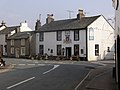
Gosforth is a village, civil parish and electoral ward in the Lake District, in Cumberland in Cumbria, England. Historically in Cumberland, it is situated on the A595 road between Whitehaven and Barrow-in-Furness. It had a population of 1,230 at the 2001 Census. [2] At the 2011 census Gosforth was grouped with Ponsonby and Wasdale giving a total population of 1,396. [1]

Contents

Adjacent settlements include Whitehaven, Egremont, Ravenglass and Wasdale. It is close to Wast Water, the deepest lake in England, and just a 7-minute drive from Seascale village and beach. [3] The Cumbrian Coast railway can be accessed at Seascale.

Viking heritage

Gosforth contains a unique collection of Norse artefacts in and around St. Mary's Church. This includes the Gosforth cross, which is the tallest and oldest Viking cross in England. Another high cross was cut down in 1789 to make a sundial base, though the "fishing stone" panel from this survives in the church. There are also two large "hogback" tombs in the church.

Gosforth Hall

Work began on Gosforth Hall, now a hotel and restaurant near St. Mary's Church, in 1658, by a local gentleman called Robert Copley. The date of completion is not clear, although the date on the coat of arms situated in the bar is 1673. Copley had previously refused to pay the royal herald for his own coat of arms and instead, made one up himself. In his history of The Gosforth District, Dr. C.A. Parker states that Robert Copley in 1658 built "a large handsome house with orchards and gardens suitable", and Parker states that henceforth the house was named Gosforth Hall. With the hall being within the precinct of the church, it was likely that evidence of earlier occupation might be discovered. In 2005, the present owners of Gosforth Hall commissioned a small archaeological excavation within the grounds. This turned up some interesting finds indicating previous occupation on the site. This preliminary work was followed up in 2008 with an archaeological desk-based assessment and field evaluation. [4]

Events

Gosforth is the base for two major athletic events each year, a ten-mile run and associated fun run in June, and a ten-kilometre race on the first Tuesday in September.

There is a thriving art scene in the village, and the Gosforth and District Arts Society (GADAS) holds weekly meetings as well as a very popular art exhibition every year, over the August bank holiday in the village hall.

See also

Related Research Articles

<span class="mw-page-title-main">Cumberland</span> Historic county of England

Cumberland is an area of Northern England which was historically a county. The county was bordered by Northumberland to the north-east, County Durham to the east, Westmorland to the south-east, Lancashire to the south, and the Scottish counties of Dumfriesshire and Roxburghshire to the north. The area includes the city of Carlisle, part of the Lake District and North Pennines, and the Solway Firth coastline.

<span class="mw-page-title-main">Borough of Copeland</span> Former borough and non-metropolitan district in England

The Borough of Copeland was a local government district with borough status in western Cumbria, England. Its council was based in Whitehaven. It was formed on 1 April 1974 by the merger of the Borough of Whitehaven, Ennerdale Rural District and Millom Rural District. The population of the Non-Metropolitan district was 69,318 according to the 2001 census, increasing to 70,603 at the 2011 Census.

Wasdale is a valley and civil parish in the western part of the Lake District National Park in Cumbria, England. The River Irt flows through the valley to its estuary at Ravenglass. A large part of the main valley floor is occupied by Wastwater, the deepest lake in England.

<span class="mw-page-title-main">St Olaf's Church, Wasdale</span>

St Olaf's Church in Wasdale Head, Cumbria, is England's smallest parish church. The earliest record of a church on this site is from 1550, though it is likely that there was an earlier church on this site.

<span class="mw-page-title-main">St Bees</span> Human settlement in England

St Bees is a coastal village, civil parish and electoral ward in the Copeland district of Cumbria, England, on the Irish Sea.

<span class="mw-page-title-main">Egremont, Cumbria</span> Town and parish in England

Egremont is a market town, civil parish and two electoral wards in Cumbria, England, and historically part of Cumberland. It is situated just outside the Lake District National Park, five miles south of Whitehaven and on the River Ehen.

<span class="mw-page-title-main">Urswick</span> Human settlement in England

Urswick is a civil parish that includes the villages of Great Urswick and Little Urswick. It is located in the Furness area of Cumbria, England. The villages are situated to the south-west of the town of Ulverston. In the 2001 census the parish had a population of 351, decreasing at the 2011 census to 1,397.

<span class="mw-page-title-main">Cleator Moor</span> Town and civil parish in Cumbria, England

Cleator Moor is a town and civil parish in Cumbria, England, within the historic county of Cumberland. It had a population of 6,936 at the 2011 census.

<span class="mw-page-title-main">Gosforth Cross</span> Cross in Gosforth, Cumbria, UK

The Gosforth Cross is a large stone monument in St Mary's churchyard at Gosforth in the English county of Cumbria, dating to the first half of the 10th century AD. Formerly part of the kingdom of Northumbria, the area was settled by Scandinavians some time in either the 9th or 10th century. It has gained reputation for its combination of Christian symbols with Nordic symbols, being a tangible piece of evidence of the impact of the Christianization of Scandinavia.

<span class="mw-page-title-main">Seascale</span> Human settlement in England

Seascale is a village and civil parish on the Irish Sea coast of Cumbria, England, historically within Cumberland. The parish had a population of 1,747 in 2001, barely increasing by 0.4% in 2011.

<span class="mw-page-title-main">Waberthwaite</span> Human settlement in England

Waberthwaite is a small, former rural civil parish on the south bank of the estuary of the River Esk, in Copeland, Cumbria, England. Since 1934 it has been part of the combined parish of Waberthwaite and Corney, which covers 10 square miles and has a population of 246. It is located opposite Muncaster Castle and the village of Ravenglass which lie on the north bank of the Esk. It is well known for its Cumberland sausages, and lists among its other assets a granite quarry that is a Site of Special Scientific Interest (SSSI); the Esk estuary, which forms part of the Drigg Coast Special Area of Conservation (SAC) - a designation for areas of European importance; the 800-year-old St. John's Church, and the remains of two Anglian/Norse crosses of an earlier period. Archeological finds within 3 kilometres of Waberthwaite indicate that the area has been continuously inhabited since Mesolithic times.

<span class="mw-page-title-main">Beckermet</span> Village and civil parish in Cumbria, England

Beckermet is a village and civil parish in Cumbria, England, between Egremont and Seascale. The parish had a population of 1,619 in the 2011 census.

<span class="mw-page-title-main">Hensingham</span> Human settlement in England

Hensingham is a suburb of Whitehaven and former civil parish, now in the parish of Whitehaven, in the Cumberland district, in the ceremonial county of Cumbria, England. The ward population taken at the 2011 census was 4,145.

<span class="mw-page-title-main">Crosscanonby</span> Human settlement in England

Crosscanonby is a village and civil parish in Cumbria, England, historically part of Cumberland, near the Lake District National Park in England. It is situated within the Solway Coast, designated an Area of Outstanding Natural Beauty.

<span class="mw-page-title-main">St Bees Priory</span>

St Bees Priory is the parish church of St Bees, Cumbria, in England. There is evidence for a pre-Norman religious site, and on this a Benedictine priory was founded by the first Norman Lord of Egremont William Meschin, and was dedicated by Archbishop Thurstan of York, sometime between 1120 and 1135.

<span class="mw-page-title-main">Nether Wasdale</span> Human settlement in England

Nether Wasdale is a village in Cumbria, England, located in the valley and civil parish of Wasdale, near the River Irt and just over a mile to the west of the Wastwater lake.

<span class="mw-page-title-main">Haile, Cumbria</span> Human settlement in England

Haile is a small village and civil parish in Copeland district, in the county of Cumbria, England. It had a population of 617 at the 2011 Census.

<span class="mw-page-title-main">William Slater Calverley</span> English vicar

The Rev. William Slater Calverley (1847–1898) was an unassuming rural English vicar who through diligent study and painstaking scrutiny became an extraordinary amateur antiquarian. Although born in Leicestershire, Calverley claimed his fame through interpreting the carved sculptured relics that he and others found in Cumberland churchyards. He made intricate drawings, corresponded with academic authorities, and gave his own interpretations, which he then relayed to a wider audience. Calverley later produced in intricate detail a life-sized reproduction of the famous Gosforth Cross, which now stands in Aspatria churchyard.

<span class="mw-page-title-main">St Mary's Church, Gosforth</span> Church in Cumbria, England

St Mary's Church in the village of Gosforth, Cumbria, England, is an active Anglican parish church in the deanery of Calder, the archdeaconry of West Cumberland, and the diocese of Carlisle. Its benefice is united with those of St Olaf, Wasdale Head, and St Michael, Nether Wasdale. The church is recorded in the National Heritage List for England as a designated Grade I listed building. It is associated with "a unique Viking-age assemblage" of carved stones.

References

  1. 1 2 UK Census (2011). "Local Area Report – Gosforth Parish (E04002489)". Nomis. Office for National Statistics . Retrieved 20 April 2021.
  2. Office for National Statistics : Census 2001 : Parish Headcounts : Copeland Archived 3 March 2016 at the Wayback Machine Retrieved 2 June 2010
  3. "Google Earth". Google Earth. Retrieved 8 October 2018.
  4. Wooler, Fiona; Noakes, B, Helen (2008), An archaeological desk-based assessment and field evaluation at Gosforth Hall Hotel, North Pennines Archaeology Ltd., doi:10.5284/1003221