Grace City, North Dakota

Last updated

Grace City, North Dakota
Grace City School.jpg
Grace City School
ND Foster County Grace City.svg
Location of Grace City, North Dakota
Coordinates: 47°33′05″N98°48′14″W / 47.55139°N 98.80389°W / 47.55139; -98.80389
CountryUnited States
State North Dakota
County Foster
Founded1910
Area
[1]
  Total0.24 sq mi (0.63 km2)
  Land0.24 sq mi (0.63 km2)
  Water0.00 sq mi (0.00 km2)
Elevation
[2]
1,513 ft (461 m)
Population
 (2020)
  Total53
  Density216.33/sq mi (83.65/km2)
Time zone UTC-6 (CST)
  Summer (DST) UTC-5 (CDT)
ZIP code
58445
Area code 701
FIPS code 38-31740
GNIS feature ID1036062 [2]

Grace City is a city in Foster County, North Dakota, United States. The population was 53 at the 2020 census. [3] Grace City was founded in 1910.

Contents

Geography

According to the United States Census Bureau, the city has a total area of 0.40 square miles (1.04 km2), all land. [4]

Demographics

Historical population
CensusPop.Note
1990 108
2000 71−34.3%
2010 63−11.3%
2020 53−15.9%
2021 (est.)51 [5] −3.8%
U.S. Decennial Census [6]
2020 Census [3]

2010 census

As of the census of 2010, there were 63 people, 30 households, and 17 families residing in the city. The population density was 157.5 inhabitants per square mile (60.8/km2). There were 36 housing units at an average density of 90.0 per square mile (34.7/km2). The racial makeup of the city was 98.4% White and 1.6% Native American.

There were 30 households, of which 30.0% had children under the age of 18 living with them, 36.7% were married couples living together, 16.7% had a female householder with no husband present, 3.3% had a male householder with no wife present, and 43.3% were non-families. 36.7% of all households were made up of individuals, and 10% had someone living alone who was 65 years of age or older. The average household size was 2.10 and the average family size was 2.82.

The median age in the city was 36.5 years. 27% of residents were under the age of 18; 6.3% were between the ages of 18 and 24; 20.6% were from 25 to 44; 31.7% were from 45 to 64; and 14.3% were 65 years of age or older. The gender makeup of the city was 57.1% male and 42.9% female.

2000 census

As of the census of 2000, there were 71 people, 30 households, and 17 families residing in the city. The population density was 176.4 inhabitants per square mile (68.1/km2). There were 39 housing units at an average density of 96.9 per square mile (37.4/km2). The racial makeup of the city was 100.00% White. Hispanic or Latino of any race were 1.41% of the population.

There were 30 households, out of which 30.0% had children under the age of 18 living with them, 46.7% were married couples living together, 6.7% had a female householder with no husband present, and 43.3% were non-families. 36.7% of all households were made up of individuals, and 20.0% had someone living alone who was 65 years of age or older. The average household size was 2.37 and the average family size was 3.29.

In the city, the population was spread out, with 29.6% under the age of 18, 9.9% from 18 to 24, 26.8% from 25 to 44, 23.9% from 45 to 64, and 9.9% who were 65 years of age or older. The median age was 37 years. For every 100 females, there were 86.8 males. For every 100 females age 18 and over, there were 85.2 males.

The median income for a household in the city was $33,333, and the median income for a family was $43,750. Males had a median income of $32,321 versus $20,000 for females. The per capita income for the city was $14,789. There were 15.8% of families and 18.2% of the population living below the poverty line, including 17.1% of under eighteens and 100.0% of those over 64.

Related Research Articles

<span class="mw-page-title-main">Isanti, Minnesota</span> City in Minnesota, United States

Isanti is a city in Isanti County, Minnesota, United States. The population was 6,804 at the 2020 census. The name Isanti is composed of two Dakota words: isan ("knife") and ati ("camp"), and refers to the Santee Dakota people.

<span class="mw-page-title-main">Esmond, North Dakota</span> City in North Dakota, United States

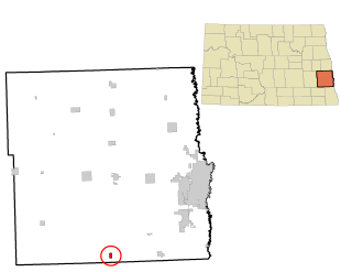
Esmond is a city in Benson County, North Dakota, United States. The population was 91 at the 2020 census. Esmond was founded in 1901.

<span class="mw-page-title-main">Knox, North Dakota</span> City in North Dakota, United States

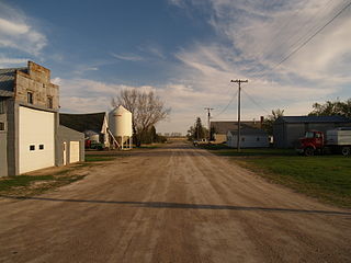
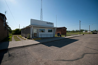
Knox is a city in Benson County, North Dakota, United States. The population was 22 at the 2020 census. Knox was founded in 1887.

<span class="mw-page-title-main">Maxbass, North Dakota</span> City in North Dakota, United States

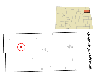
Maxbass is a city in Bottineau County, North Dakota, United States. The population was 89 at the 2020 census. Maxbass was founded in 1905.

<span class="mw-page-title-main">Arthur, North Dakota</span> City in North Dakota, United States

Arthur is a city in Cass County, North Dakota, United States. The population was 328 at the 2020 census.

<span class="mw-page-title-main">Leonard, North Dakota</span> City in North Dakota, United States

Leonard is a city in Cass County, North Dakota, United States. The population was 248 at the 2020 census. Leonard was founded in 1881.

<span class="mw-page-title-main">North River, North Dakota</span> City in North Dakota, United States

North River is a city in Cass County, North Dakota, United States. The population was 55 at the 2020 census. North River was founded in 1973. It is a suburb/bedroom community directly adjacent to the city of Fargo.

<span class="mw-page-title-main">Adams, North Dakota</span> City in North Dakota, United States

Adams is a city in Walsh County, North Dakota, United States. The population was 127 at the 2020 census. Adams was founded in 1905.

<span class="mw-page-title-main">Fairdale, North Dakota</span> City in North Dakota, United States

Fairdale is a city in Walsh County, North Dakota, United States. The population was 30 at the 2020 census. Fairdale was founded in 1905.

<span class="mw-page-title-main">Hoople, North Dakota</span> City in North Dakota, United States

Hoople is a city in Walsh County, North Dakota, United States. The population was 247 at the 2020 census. Hoople, named for early settler Alan Hoople, was founded in 1889. Hoople's nickname is "Tatertown."

<span class="mw-page-title-main">Wagner, South Dakota</span> City in South Dakota, United States

Wagner is a city in Charles Mix County, South Dakota, United States. The population was 1,490 at the 2020 census. The city is served by Wagner Municipal Airport as well as YST Transit buses.

<span class="mw-page-title-main">Corsica, South Dakota</span> City in South Dakota, United States

Corsica is a city in Douglas County, South Dakota, United States. The population was 561 at the 2020 census.

<span class="mw-page-title-main">Milbank, South Dakota</span> City in South Dakota, United States

Milbank is a city in Grant County, South Dakota, United States, located along the South Fork of the Whetstone River. The population was 3,544 at the 2020 census. It is the county seat of Grant County. Milbank is the birthplace of American Legion Baseball. The program was created in Milbank in 1925 and is now enjoyed by high school aged youth on more than five thousand teams in all fifty states.

<span class="mw-page-title-main">Presho, South Dakota</span> City in South Dakota, United States

Presho is a small city in Lyman County, South Dakota, United States. The population was 472 at the 2020 census.

<span class="mw-page-title-main">Lake City, South Dakota</span> Town in South Dakota, United States

Lake City is a town in Marshall County, South Dakota, United States. The population was 45 at the 2020 census. Fort Sisseton Historic State Park, whose fort is listed on the National Register of Historic Places, is located nearby.

<span class="mw-page-title-main">White River, South Dakota</span> City in South Dakota, United States

White River is a city in and the county seat of Mellette County. South Dakota, United States. The population was 533 at the 2020 census.

<span class="mw-page-title-main">Crooks, South Dakota</span> City in South Dakota, United States

Crooks is a city in Minnehaha County, South Dakota, United States and is a suburb of Sioux Falls. The population was 1,362 at the 2020 census. Crooks was named New Hope until 1904. The town's present name honors W. A. Crooks, a local politician.

<span class="mw-page-title-main">Egan, South Dakota</span> City in South Dakota, United States

Egan is a city in Moody County, South Dakota, United States. The population was 241 at the 2020 census.

<span class="mw-page-title-main">Elk Point, South Dakota</span> City in South Dakota, United States

Elk Point is a city in and county seat of Union County, South Dakota, United States. The population was 2,149 as of the 2020 census.

<span class="mw-page-title-main">Iroquois, South Dakota</span> City in South Dakota, United States

Iroquois is a city on the border of Beadle and Kingsbury counties in South Dakota, United States. The population was 292 at the 2020 census. The school building is located in Kingsbury County, while the school parking lot is located in Beadle County. Highway 14 runs directly through Iroquois.

References

  1. "ArcGIS REST Services Directory". United States Census Bureau. Retrieved September 20, 2022.
  2. 1 2 U.S. Geological Survey Geographic Names Information System: Grace City, North Dakota
  3. 1 2 "Explore Census Data". United States Census Bureau . Retrieved July 21, 2022.
  4. "US Gazetteer files 2010". United States Census Bureau. Archived from the original on January 25, 2012. Retrieved June 14, 2012.
  5. "City and Town Population Totals: 2020-2021". United States Census Bureau. July 21, 2022. Retrieved July 21, 2022.
  6. United States Census Bureau. "Census of Population and Housing" . Retrieved February 12, 2014.