Grassy Island Range Lights

Last updated
Grassy Island Range Lights
Grassy Island Range Lights.jpg
The Grassy Island Range Lights as relocated (2014)
Grassy Island Range Lights
LocationGrassy Island north of Green Bay, Wisconsin;
relocated to Green Bay Yacht Club grounds
Coordinates 44°33′37″N87°59′35″W / 44.56028°N 87.99306°W / 44.56028; -87.99306 [1] original;
44°32′10″N88°00′19″W / 44.5362°N 88.0052°W / 44.5362; -88.0052 [2] current
Tower
Constructed1872 [3]
FoundationPier
ConstructionWood with cedar shingles
Automated1934 [3]
ShapePyramidal tower
HeritageNational Register of Historic Places listed place  OOjs UI icon edit-ltr-progressive.svg
Light
Deactivated1966 [3]
Focal height34 ft (10 m) (upper);
27 ft (8.2 m) (lower) [4]
LensSixth Order Fresnel lens
Grassy Island Range Lights
NRHP reference No. 04001484 [5]
Added to NRHPJanuary 12, 2005

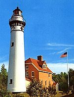
The Grassy Island Range Lights are a pair of lighthouses which were originally established to guide traffic through the channel into Green Bay harbor. They were deactivated and moved to shore as part of a channel-widening project.

History

lower Green Bay in 1867 showing the sinuous channel among the sand bars into the harbor Chart LS33 1867 excerpt.png
lower Green Bay in 1867 showing the sinuous channel among the sand bars into the harbor

Navigation to the mouth of the Fox River was impeded by a series of sand bars jutting out from either side of Green Bay, and thus in 1837 funds were appropriated for the purpose of erecting a light in the area. [6] [7] An initial recommendation to place such a light on Grassy Island (the most southerly of those bars) was countered by the observations of a Lt. Homans, who in visiting the area found the selected site "to be unsuitable for construction of buildings upon it of any durability, and totally uninhabitable by a keeper, being nearly under water, from the great rise of the lake, since the recommendation for a light upon it was made." [2] Instead, the Long Tail Point Light was erected further north.

In 1866 dredging of a new channel into the harbor began. This new channel cut straight across Grassy Island, and an appropriation of $11,000 for construction of lights had been included in the 1864 budget. Due to the delays in the associated harbor improvements, the funds reverted to the treasury and a new appropriation had to be made in 1870, with construction of the two towers and associated keeper's house following in 1872. [6] The two towers were largely identical except for their heights: freestanding wooden pyramidal towers covered in shingles, topped by octagonal lanterns holding sixth-order Fresnel lenses. Initially both displayed a fixed white light. [2] One tower stood at either end of the cut on its eastern side, with the keeper's house standing between them.

The exposed location did lead to maintenance issues, with the roof of the dwelling being replaced in 1880, barely a decade after its construction. [6] A new well was dug in 1884, the first having been filled in by a gale shortly after the station opened. [2] The kitchen and boathouse were rebuilt in 1896; the boathouse was raised further in 1902. In the meantime a breakwater had been built to the east of the station. [6]

The range in operation in 1914 USCGgrassyisland.JPG
The range in operation in 1914

This light was an obvious candidate for automation and was fitted with acetylene lamps in 1934; At the same time the characteristic of both lights was changed to green, with the front light flashing as well, in order to contrast with the lights of the city. [2] [7] All through the life of the station the channel was constantly being dredged and widened, and eventually the decision was made to expand to the east as well as west. Therefore, in 1966 the decision was made to tear down the lights. [2] Members of the Green Bay Yacht Club petitioned the Corps of Engineers to be allowed to remove and preserve the towers. In November of that year the lights were moved to the parking lot of the club. [6] Much of Grassy Island was removed, with a new automated beacon erected on what remains.

In 1998 the two towers were relocated to a breakwater at the edge of the yacht club property, and they were put through a lengthy restoration, being rededicated in 2005. [2] [6] They were listed on the National Register of Historic Places that year. [5]

2017 Grassy Is Lights 2017-GrassyIsRangeLights-view1.jpg
2017 Grassy Is Lights

Then in 2017 a decision was made to move forward with stabilization of the breakwater that had been deteriorating for a number of years and causing fears of the lighthouse foundations failing. For the next year and a half the breakwater was reinforced with steel pile. Additionally the breakwater was widened for two way vehicle traffic, parking area, safety railing, dock access, and other improvements.

2020 Grassy Is. Lights 2020-GrassyIsRangeLights-view2.jpg
2020 Grassy Is. Lights


By the end of 2019 the final improvements had been completed and the "Lighthouse Park" had become a new permanent home for the Grassy Island Range Lights. The result was provided by the generous support of the David L. and Rita E. Nelson Family Fund and the Community Foundation for the Fox Valley Region.


Related Research Articles

<span class="mw-page-title-main">Pottawatomie Light</span> Lighthouse in Wisconsin, United States

Pottawatomie Lighthouse, also known as the Rock Island Light, is a lighthouse in Rock Island State Park, on Rock Island in Door County, Wisconsin. Lit in 1836, it is the oldest light station in Wisconsin and on Lake Michigan. It was served by civilian light keepers from 1836 to 1946, at which point it was automated.

<span class="mw-page-title-main">Ashland Harbor Breakwater Light</span> Lighthouse

The Ashland Harbor Breakwater lighthouse, also known as Ashland Breakwater Lighthouse, is an operational lighthouse located near Ashland in Ashland County, Wisconsin, USA. Located in Chequamegon Bay of Lake Superior, it is owned and managed by the National Park Service, and is a part of the Apostle Islands National Lakeshore. It sits at the end of a long and detached breakwater, which creates an artificial harbor.

<span class="mw-page-title-main">Plum Island Range Lights</span> Lighthouse

The Plum Island Range Lights are a pair of range lights located on Plum Island in Door County, Wisconsin. Plum Island was transferred to the United States Fish and Wildlife Service in 2007 and became part of the Green Bay National Wildlife Refuge. Plum Island is seasonally open to the public for day-time use.

<span class="mw-page-title-main">Lynde Point Light</span> Lighthouse in Connecticut, United States

The Lynde Point Light or Lynde Point Lighthouse, also known as Saybrook Inner Lighthouse, is a lighthouse in Connecticut, United States, on the west side of the mouth of the Connecticut River on the Long Island Sound, Old Saybrook, Connecticut. The first light was a 35 feet (11 m) wooden tower constructed by Abisha Woodward for $2,200 and it was completed in 1803. A new lighthouse was eventually needed and a total of $7,500 was appropriated on July 7, 1838. Jonathan Scranton, Volney Pierce, and John Wilcox were contracted to build the new 65-foot (20 m) octagonal brownstone tower. It was constructed in 1838 and lit in 1839. The lighthouse was renovated in 1867 and had its keeper's house from 1833 replaced in 1858 with a Gothic Revival gambrel-roofed wood-frame house. In 1966, the house was torn down and replaced by a duplex house. The original ten lamps were replaced in 1852 with a fourth-order Fresnel lens, and with a fifth-order Fresnel lens in 1890. Lynde Point Lighthouse used whale oil until 1879 when it switched to kerosene. It was electrified in 1955 and fully automated by the United States Coast Guard in 1978. In 1990, it was added to the National Register of Historic Places and is significant for its "superior stone work in the tapering brownstone walls".

<span class="mw-page-title-main">Reedy Island Range Rear Light</span> Lighthouse

Reedy Island Range Rear Lighthouse is a skeletal tower lighthouse near Taylor's Bridge, Delaware. The tower is an active aid to navigation.

The North Point Range Lights were some of the earliest lights in the Maryland portion of the Chesapeake Bay. Intended to guide ships headed for Baltimore harbor into the Patapsco River, they were superseded by channel construction in the 1870s and 1980s, and were replaced by the Craighill Channel Upper Range front and rear lights.

<span class="mw-page-title-main">Humboldt Harbor Light</span> Lighthouse in California, United States

The Humboldt Harbor Light was an early lighthouse marking the entrance to Humboldt Bay. Plagued by fog, earthquakes, and flooding, it was eventually abandoned and left to deteriorate in favor of a new light at Table Bluff.

<span class="mw-page-title-main">Indiana Harbor East Breakwater Light</span> Lighthouse

The Indiana Harbor East Breakwater Light is an active aid to navigation that marks the end of a breakwater on the east side of the Indiana Harbor and Ship Canal where it enters Lake Michigan.

<span class="mw-page-title-main">Green Island Light (Wisconsin)</span> Lighthouse

The Green Island Light is a lighthouse located on Green Island in Green Bay. Abandoned since its deactivation in 1956, it survives as a hollow shell near the existing skeleton tower.

<span class="mw-page-title-main">Long Tail Point Light</span> Lighthouse

The Long Tail Point Light, also known as the Tail Point Light, was a lighthouse in Green Bay, Wisconsin, USA. Long abandoned but still standing, it was succeeded by two further structures, both since destroyed.

<span class="mw-page-title-main">Port Washington Light</span> Lighthouse

The Port Washington Light is a historical lighthouse in Port Washington, Wisconsin. Replaced by the Port Washington Breakwater Light and converted to a normal dwelling, it was restored with the assistance of the Grand Duchy of Luxembourg and currently serves as a museum.

<span class="mw-page-title-main">Port Washington Breakwater Light</span> Lighthouse on Lake Michigan in Port Washington, Wisconsin, United States

The Port Washington Breakwater Light is a lighthouse built in 1935 at the entrance to the Port Washington, Wisconsin harbor on Lake Michigan. The second tower at this location, it remains an active aid to navigation. It was listed on the National Register of Historic Places in 2018.

<span class="mw-page-title-main">Corregidor Island Lighthouse</span> Historic lighthouse in Cavite, Philippines

The first Corregidor Island Lighthouse was a historic lighthouse located on the island of Corregidor, in the province of Cavite, Philippines. The light station was one of the most important lights in the archipelago. It was established in 1853 to guide ships to the entrance of Manila Bay on their way to the port of Manila, the most important trading center in the country. This light occupies the converging point of two lines of approach for vessels from the China Sea which steer for the entrance of Manila Bay. Vessels from Hong Kong and the ports of China to the northwest first sight the Capones Island light off the southwest coast of Zambales. Vessels from ports of Indo-China first sight the Corregidor lights in the center. Vessels from Singapore, Indonesia, India, and all the ports of the Philippine Islands, to the south, first sight the Cabra Island light. All lines converge on Corregidor light at the bay entrance.

<span class="mw-page-title-main">Green Bay Harbor Entrance Light</span> Lighthouse in Wisconsin, United States

The Green Bay Harbor Entrance Light is an offshore lighthouse near Green Bay, Wisconsin. Located 10 miles (16 km) from the mouth of the Fox River, it was erected to signal the entrance to Green Bay.

<span class="mw-page-title-main">Duluth Harbor North Pier Light</span> Lighthouse

The Duluth Harbor North Pier Light is a lighthouse on the north breakwater of the Duluth Ship Canal in Duluth, Minnesota, United States.

<span class="mw-page-title-main">Duluth South Breakwater Outer Light</span> Lighthouse

The Duluth South Breakwater Outer Light is a lighthouse on the south breakwater of the Duluth Ship Canal in Duluth, Minnesota, United States. It forms a range with the Duluth South Breakwater Inner Light to guide ships into the canal from Lake Superior.

<span class="mw-page-title-main">Grand Marais Harbor of Refuge Inner and Outer Lights</span> Lighthouses in Michigan, United States

The Grand Marais Harbor of Refuge Inner and Outer Lights are a pair of lighthouses located on the west pier at the entry to Grand Marais Harbor of Refuge, in Grand Marais, Michigan. They were listed on the National Register of Historic Places in 2012.

<span class="mw-page-title-main">Racine Harbor Lighthouse and Life Saving Station</span> United States historic place

The Racine Harbor Lighthouse and Life Saving Station is a complex of navigation aids begun by the U.S. government in the 1860s near the harbor of Racine, Wisconsin. It was added to the National Register of Historic Places in 1975.

<span class="mw-page-title-main">Racine Reef Light</span> Lighthouse

The Racine Reef Light was a lighthouse located in Lake Michigan some two miles east of Racine, Wisconsin, marking the edge of its eponymous shallows. It was torn down in 1961 and replaced with a skeleton tower on the same foundation.

References

  1. Light List: Great Lakes: United States and Canada. Washington, DC: Government Printing Office. 1924. p.  230 . Retrieved 2015-02-08.
  2. 1 2 3 4 5 6 7 "Grassy Island Range, WI". LighthouseFriends. Retrieved 2015-02-06.
  3. 1 2 3 "Historic Light Station Information and Photography: Wisconsin". United States Coast Guard Historian's Office. Archived from the original on 2017-05-01.
  4. Pepper, Terry. "Focal Heights" . Retrieved 2015-02-08.
  5. 1 2 "100 Bay Beach Road". Wisconsin Historical Society. January 2012. Retrieved 2015-02-11.
  6. 1 2 3 4 5 6 Pepper, Terry. "Grassy Island Range Lights" . Retrieved 2015-02-10.
  7. 1 2 Wardius, Ken; Wardius, Barb (2013). Wisconsin Lighthouses: A Photographic and Historical Guide. Wisconsin Historical Society Press. pp. 87–90. ISBN   9780870206108 . Retrieved 2015-02-11.