Great Basin montane forests

Last updated
Great Basin montane forests
Prometheus Wheeler.jpg
Great Basin Montane Forests map.svg
Location in North America
Ecology
Realm Nearctic
Biome Temperate coniferous forests
Borders Great Basin shrub steppe and Mojave Desert
Bird species160 [1]
Mammal species91 [1]
Geography
Country United States
States California and Nevada
Conservation
Habitat loss25-50% [2]
Protected97.53% [1]

The Great Basin montane forests is an ecoregion of the Temperate coniferous forests biome, as designated by the World Wildlife Fund (WWF). [2]

Contents

Geography

The Great Basin montane forests ecoregion is located in the Great Basin region of Nevada, eastern California, and western Utah, in the Western United States.

The montane forests are often found on sky islands at elevations above the Great Basin Desert or xeric shrublands. The forests are within the Central or Northern Basin and Range ecoregions defined by the U.S. Environmental Protection Agency.

Species

White fir, Douglas fir, and ponderosa pines are found in the middle elevations of some mountain ranges, while limber pine, subalpine fir, Engelmann spruce, and bristlecone pines occupy the higher elevations, continuing to the upper tree line. Mountain mahogany often dominates drier, warmer south-facing slopes. [3] Pure stands of aspen are also common in this community. [4]

Mountain mahogany, Maverick Canyon 2015-04-27 12 53 45 An older Mountain Mahogany on the north wall of Maverick Canyon, Nevada.jpg
Mountain mahogany, Maverick Canyon

The bristlecone pine is an important species that is indicative of the Great Basin montane forest. Bristlecones live a long time, some for thousands of years. The harsh areas they occupy are often devoid of other plant life, so there is little competition and reduced risk of fire. The trees grow very slowly, producing very dense, disease-resistant wood. These factors contribute to the bristlecone’s long life. [3]

Subregions

In 1987, Omernik defined the area between the Sierra Nevada and the Wasatch Range as a distinct ecoregion, numbered 13. [5] In 1999, the U.S. Environmental Protection Agency adopted Omernik's ecoregion, labeling it as Level III in its ecoregion hierarchy. [6] Ecoregion 13 was further split into Level IV ecoregions according to elevation and location within Nevada and Utah.

The WWF took ecoregion 13 and split it according to elevation, naming the higher sub-ecoregions the "Great Basin montane forests". Below is a list of higher-level Level IV ecoregions. The high-elevation ecoregions are distributed as sky islands, without contact with each other. In general, the further from the Rocky Mountains, the less species-rich the area. [2]

High-Elevation
Central Basin and Range
Level IV ecoregions
code
13dWoodland and Shrub-Covered Low Mountains
13e Carbonate High Elevation Mountains
13lLahontan Uplands
13oHigh Elevation Ruby Mountains
13qCarbonate Woodland
13wTonopah Uplands
13x Sierra Nevada-Influenced Ranges
13y Sierra Nevada-Influenced High Elevation Mountains

Woodland- and Shrub-Covered Low Mountains

The Woodland- and Shrub-Covered Low Mountains ecoregion includes low, rocky mountain ranges, mountain slopes, and foothills with enough available moisture to support open groves of juniper and pinyon pines. The region includes a zone of mountain brush that replaces woodland above the elevational limit of pinyon. In southeastern Nevada, this ecoregion is transitional between the Colorado Plateau, Great Basin Desert, and the Mojave Desert, with some characteristics of each region. Here, Gambel oak, scrub oak, Joshua tree, and blue grama grass may be associated with pinyon–juniper woodland. Summer rainfall is a factor that contributes to woodland diversity and productivity. [7]

High-Elevation Carbonate Mountains

The High-Elevation Carbonate Mountains ecoregion includes a series of mountain ranges composed of limestone, dolomite, quartzite, and conglomerate in east-central Nevada. These mountains are in the zone of summer rain, although much of the precipitation percolates through the porous rock to reemerge at lower elevations as springs. Still, these carbonate-dominated mountains support a wider variety of conifers, such as white fir, Douglas-fir, and Engelmann spruce, and a greater diversity of understory species than other ranges in Nevada at similar elevations. Bristlecone pines have their widest distribution on carbonate substrates above 9,500 feet (2,900 m) elevation. Conditions do not favor alpine tundra, however; alpine plants are more limited than on the nearby granitic High Elevation Ruby Mountains. [7]

Lahontan Uplands

The Lahontan Uplands ecoregion is restricted to the highest elevations of the mountain ranges within the Lahontan Salt Shrub Basin ecoregion. Slopes vary in elevation from 6,400 to 8,800 feet (2,000 to 2,700 m) and are covered by sagebrush, grasses, and scattered Utah juniper. Pinyon pine grows with juniper on the Stillwater Range and on Fairview Peak in the southeast portion of the Lahontan Basin, but it is otherwise absent from this ecoregion. Low sagebrush and black sagebrush grow to the mountaintops above the woodland zone. Cool season grasses, including bluebunch wheatgrass, dominate the understory in the north, but are replaced by warm season grasses, such as Indian ricegrass, in the south. [7]

High-Elevation Ruby Mountains

Aspens in Lamoille Canyon, Ruby Mountains 2013-10-06 15 04 21 Aspens during autumn along the Changing Canyon Nature Trail in Lamoille Canyon, Nevada.jpg
Aspens in Lamoille Canyon, Ruby Mountains

The High Elevation Ruby Mountains ecoregion represents those portions of the Ruby Mountains of Nevada that are dominated by granitic and metamorphic rock types, and that were heavily glaciated during the Pleistocene. Extensive periglacial phenomena, such as solifluction fields, are still active at higher elevations. Since the end of Pleistocene glaciation, closed-canopy conifer forests have not recolonized the Ruby Mountains, even though the Ruby Mountains receive more precipitation than the High Elevation Carbonate Mountains to the east. The High Elevation Ruby Mountains ecoregion is the wettest ecoregion in Nevada outside of the High Elevation Sierra Nevada. Some of the most extensive aspen groves in Nevada occur here. Subalpine meadows and scattered white fir, limber pine, and whitebark pine mingle upwards to the jagged, exposed peaks at elevations over 11,000 feet (3,400 m). Snowmelt moisture trapped by the impervious substrate supports extensive alpine meadows and alpine lakes are common. Wildlife includes mule deer, bighorn sheep, and mountain goats. [7]

Carbonate Woodland

In the Carbonate Woodland Zone, the pinyon-juniper woodland canopy overtops and spans the existing sagebrush and mountain brush communities. The pinyon–juniper woodland has a broader elevational range in the carbonate areas of eastern Nevada than elsewhere in Great Basin montane forests, even extending onto the floors of the higher basins, partially because of greater summer precipitation. Both pinyon pine and juniper decline north of this ecoregion. In the Northern Basin and Range ecoregion, juniper grows alone and without distinct elevational banding. Historically, miners cut pinyon and juniper for mine timbers. Since the beginning of fire suppression early in the last century, juniper–pinyon woodland has increased in density and expanded into lower sagebrush zones. More recently, large areas of pinyon–juniper woodland have been cleared to increase forage for cattle. The woodland understory is diverse due to the influence of carbonate substrates and summer rainfall. There are more springs and live streams in this ecoregion than in western non-carbonate woodlands, because the carbonate substrate is soluble and porous, allowing rapid infiltration. [7]

Tonopah Uplands

Bristlecone pine foliage and pollen cones, Spring Mountains, Nevada 2015-07-13 07 46 24 Great Basin Bristlecone Pine leaves and pollen cones along the North Loop Trail about 5.6 miles west of the trailhead in the Mount Charleston Wilderness, Nevada.jpg
Bristlecone pine foliage and pollen cones, Spring Mountains, Nevada

The Tonopah Uplands ecoregion includes woodland- or shrub-covered hills and mountains ranging from 6,000 to 9,500 feet (1,800 to 2,900 m) in elevation. As elsewhere in the Tonopah region, Great Basin and Mojave Desert elements blend together especially toward the south and east, where some mountain brush and interior chaparral components, including Gambel oak, become more common. Pinyon-juniper woodland is extensive between 6,000 and 8,000 feet (1,800 and 2,400 m) elevation. The highest peaks support a few white fir, limber pine, or bristlecone pine. [7]

Preservation

Approximately 97% of this ecoregion's habitat is preserved, most of which is contained within the Humboldt–Toiyabe and Inyo National Forests. Smaller instances of this ecoregion are preserved within Death Valley and Great Basin National Parks.

See also

Related Research Articles

Great Basin Large depression in western North America

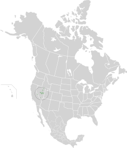
The Great Basin is the largest area of contiguous endorheic watersheds in North America. It spans nearly all of Nevada, much of Oregon and Utah, and portions of California, Idaho, Wyoming, and Baja California, Mexico. It is noted for both its arid climate and the basin and range topography that varies from the North American low point at Badwater Basin in Death Valley to the highest point of the contiguous United States, less than 100 miles (160 km) away at the summit of Mount Whitney. The region spans several physiographic divisions, biomes, ecoregions, and deserts.

Great Basin Desert Desert in the western United States

The Great Basin Desert is part of the Great Basin between the Sierra Nevada and the Wasatch Range. The desert is a geographical region that largely overlaps the Great Basin shrub steppe defined by the World Wildlife Fund, and the Central Basin and Range ecoregion defined by the U.S. Environmental Protection Agency and United States Geological Survey. It is a temperate desert with hot, dry summers and snowy winters. The desert spans a large part of the state of Nevada, and extends into western Utah, eastern California, and Idaho. The desert is one of the four biologically defined deserts in North America, in addition to the Mojave, Sonoran, and Chihuahuan Deserts.

Ecology of California

The ecology of California can be understood by dividing the state into a number of ecoregions, which contain distinct ecological communities of plants and animals in a contiguous region. The ecoregions of California can be grouped into four major groups: desert ecoregions, Mediterranean ecoregions, forested mountains, and coastal forests.

The life zone concept was developed by C. Hart Merriam in 1889 as a means of describing areas with similar plant and animal communities. Merriam observed that the changes in these communities with an increase in latitude at a constant elevation are similar to the changes seen with an increase in elevation at a constant latitude.

Ecology of the Sierra Nevada

The ecology of the Sierra Nevada, located in the U.S. state of California, is diverse and complex: the plants and animals are a significant part of the scenic beauty of the mountain range. The combination of climate, topography, moisture, and soils influences the distribution of ecological communities across an elevation gradient from 500 to 14,500 feet. Biotic zones range from scrub and chaparral communities at lower elevations, to subalpine forests and alpine meadows at the higher elevations. Particular ecoregions that follow elevation contours are often described as a series of belts that follow the length of the Sierra Nevada. There are many hiking trails, paved and unpaved roads, and vast public lands in the Sierra Nevada for exploring the many different biomes and ecosystems.

Intermountain West Geographic region of the Western United States

The Intermountain West, or Intermountain Region, is a geographic and geological region of the Western United States. It is located between the front ranges of the Rocky Mountains on the east and the Cascade Range and Sierra Nevada on the west.

California Floristic Province

The California Floristic Province (CFP) is a floristic province with a Mediterranean-type climate located on the Pacific Coast of North America with a distinctive flora similar to other regions with a winter rainfall and summer drought climate like the Mediterranean Basin. This biodiversity hotspot is known for being the home of the Sierran giant sequoia tree and its close relative the coast redwood. In 1996, the Province was designated as a biodiversity hotspot allowing it to join ranks among 33 other areas in the world with many endemic species. To be named a biodiversity hotspot, an area has to contain species and plant life that cannot be found anywhere else in the world. The California Floristic Province is home to over 3,000 species of vascular plants, 60% of which are endemic to the province.

Pilot Range

The Pilot Range is a mountain range straddling the border of Box Elder County, Utah and Elko County, Nevada, United States. Lying 50 miles west of the Great Salt Lake, the range forms part of the north-west border of the Great Salt Lake Desert. The range reaches a maximum elevation of 10,716 feet at the summit of Pilot Peak. Most of the range is public Bureau of Land Management land and thus has no access restrictions. Its principal uses are mining, livestock grazing, and seasonal elk and deer hunting.

Mount Moriah Wilderness

The Mt. Moriah Wilderness is a 89,790-acre (36,340 ha) wilderness area in the northern part of the Snake Range of White Pine County, in the eastern section of the state of Nevada in the western United States.

White Pine Range Wilderness

The White Pine Range Wilderness is a 40,013-acre (16,193 ha) wilderness area in southwestern White Pine County, in the U.S. state of Nevada.

Eastern Cascades Slopes and Foothills Temperate coniferous forests ecoregion of the United States

The Eastern Cascades Slopes and Foothills ecoregion is a Level III ecoregion designated by the United States Environmental Protection Agency (EPA) in the U.S. states of Oregon, Washington, and California. In the rain shadow of the Cascade Range, the eastern side of the mountains experiences greater temperature extremes and receives less precipitation than the west side. Open forests of ponderosa pine and some lodgepole pine distinguish this region from the Cascades ecoregion, where hemlock and fir forests are more common, and from the lower, drier ecoregions to the east, where shrubs and grasslands are predominant. The vegetation is adapted to the prevailing dry, continental climate and frequent wildfire. Volcanic cones and buttes are common in much of the region.

Blue Mountains (ecoregion) Temperate coniferous forests ecoregion of the United States

The Blue Mountains ecoregion is a Level III ecoregion designated by the United States Environmental Protection Agency (EPA) in the Pacific Northwest, mainly in the state of Oregon, with small areas over the state border in Idaho and southeastern Washington. It is also contiguous with the World Wildlife Fund's Blue Mountain forests ecoregion.

Northern Basin and Range ecoregion

The Northern Basin and Range ecoregion is a Level III ecoregion designated by the United States Environmental Protection Agency (EPA) in the U.S. states of Oregon, Idaho, Nevada, Utah, and California. It contains dissected lava plains, rolling hills, alluvial fans, valleys, and scattered mountain ranges in the northern part of the Great Basin. Although arid, the ecoregion is higher and cooler than the Snake River Plain to the north and has more available moisture and a cooler climate than the Central Basin and Range to the south. Its southern boundary is determined by the highest shoreline of Pleistocene Lake Bonneville, which once inundated the Central Basin and Range. The western part of the region is internally drained; its eastern stream network drains to the Snake River system.

Pinyon–juniper woodland

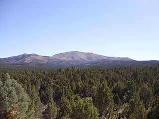
Pinyon–juniper woodland, also spelled piñon–juniper woodland, is a vegetation type (biome) of Western United States higher elevation deserts, characterized by being an open forest dominated by low, bushy, evergreen junipers, pinyon pines, and their associates which vary from region to region. The woodland's crown height may vary from less than 10 meters up to 15 meters, depending on the site. It may consist of pure stands of pinyon pine, or pure stands of juniper.

California montane chaparral and woodlands Mediterranean forests, woodlands, and scrub ecoregion in California, United States

The California montane chaparral and woodlands is an ecoregion defined by the World Wildlife Fund, spanning 7,900 square miles (20,000 km2) of mountains in the Transverse Ranges, Peninsular Ranges, and Coast Ranges of southern and central California. The ecoregion is part of the larger California chaparral and woodlands ecoregion, and belongs to the Mediterranean forests, woodlands, and scrub biome.

Great Basin may refer to:

Cottonwood Creek originates in the Ancient Bristlecone Pine Forests of the White Mountains of eastern California. The creek flows eastward from below the alpine crest of the White Mountains and descends through groves of bristlecone pine, aspen and mountain mahogany, then a woodland of pinyon pine and juniper, and finally into sagebrush as the stream ends in endorheic Fish Lake Valley which is one of the contiguous collection of inward-draining basins that make up the Great Basin.

Sagebrush scrub is a vegetation type (biome) of mid to high elevation Western United States deserts characterized by low growing, drought resistant shrubs including sagebrush and its associates. It is the dominant vegetation type of the Great Basin Desert, occurs along the margins of the Mojave Desert, including in the southern slopes of the Sierra Nevadas and Transverse Ranges of California, and occurs in the Colorado Plateau and Canyonlands region, where it may be referred to as cool desert shrub.

Colorado Plateau shrublands Xeric shrubland ecoregion of the western United States

The Colorado Plateau shrublands is a deserts and xeric shrublands ecoregion in the Western United States.

References

  1. 1 2 3 "Atlas of Global Conservation". The Nature Conservancy. Retrieved 2017-05-08.
  2. 1 2 3 "Great Basin montane forests". Terrestrial Ecoregions. World Wildlife Fund.
  3. 1 2 PD-icon.svg This article incorporates  public domain material from the National Park Service document: "Ecology of the Great Basin" (PDF). Retrieved 2015-07-13.
  4. Brussard, P.F.; Charlet, D.A.; Dobkin, D.S.; Ball, L.C. (1998). "Great Basin-Mojave Desert Region" (PDF). In Mac, M.J.; Opler, P.A.; Puckett Haeker, C.E.; et al. (eds.). Status and trends of the nation's biological resources. 2. Reno, Nevada: U.S. Geological Survey.
  5. Omernik, James M. (1995). "Ecoregions: a framework for managing ecosystems" (PDF). The George Wright Forum. 12 (1): 35–51.
  6. "Ecoregional Boundaries; Omernik Ecoregions Level 3, Metadata". NV Geospatial Data Browser. EPA. 2003. Archived from the original on 2014-01-12.
  7. 1 2 3 4 5 6 PD-icon.svg This article incorporates  public domain material from the United States Geological Survey document: "Level IV Ecoregions of Nevada--poster front side" (PDF). Retrieved 2017-10-01.