
Richmond International Airport is a joint civil-military airport in Sandston, Virginia, United States, an unincorporated community. The airport is about 7 miles (11 km) southeast of downtown Richmond, the capital of the Commonwealth of Virginia. Richmond International Airport is the busiest airport in central Virginia and the third-busiest in the state behind Washington Reagan and Washington Dulles. RIC covers 2,500 acres of land.
Asheville Regional Airport is a Class C airport near Interstate 26 and the town of Fletcher, North Carolina, 9 miles (14 km) south of downtown Asheville. It is owned by the Greater Asheville Regional Airport Authority. The Federal Aviation Administration (FAA) National Plan of Integrated Airport Systems for 2019–2023 categorized it as a small-hub primary commercial service facility. In 2023 it served an all-time record number of passengers for the airport, 2,246,411, an increase of 22.2% over 2022.

Air Atlanta was an airline based in Atlanta, Georgia, United States, during the mid-1980s, serving over a dozen cities from its hub located at the Hartsfield-Jackson Atlanta International Airport (ATL).

Waterloo Regional Airport ( Livingston Betsworth Field) is four miles (6 km) northwest of Waterloo, in Black Hawk County, Iowa. It is used for general aviation and sees one airline.
Newport News/Williamsburg International Airport is in Newport News, Virginia, United States, and serves the Hampton Roads area along with Norfolk International Airport in Norfolk. The airport is owned and operated by the Peninsula Airport Commission, a political subdivision of the Commonwealth of Virginia. PHF covers 1,800 acres.

Pierre Regional Airport is a public airport three miles east of Pierre, in Hughes County, South Dakota.

Lebanon Municipal Airport is a city-owned, public-use airport located three nautical miles (6 km) west of the central business district of Lebanon, a city in Grafton County, New Hampshire, United States. Also known as Lebanon Airport, it is the northernmost commercial airport in New Hampshire, near the Vermont border, off Interstate 89 just south of the junction with Interstate 91. Other nearby towns include Hanover, New Hampshire and White River Junction, Vermont. The area is also the home of Dartmouth College and the Dartmouth–Hitchcock Medical Center.

Barkley Regional Airport is an American domestic airport in West Paducah, Kentucky, 14 miles west of Paducah in McCracken County. It is used for general aviation and sees one airline, subsidized by the Essential Air Service program.
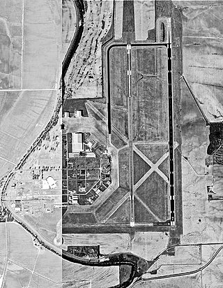
Greenville Mid-Delta Airport, operating as Mid Delta Regional Airport until 2011, is a public use airport in unincorporated Washington County, Mississippi, United States. It is located five nautical miles northeast of the central business district of Greenville, the city that owns the airport. It is served by one commercial airline, Contour Airlines, which is subsidized by the Essential Air Service program. Formerly, the facility was known as Greenville Air Force Base.

Bradford Regional Airport is 11 miles south of Bradford, in Lafayette Township, McKean County, Pennsylvania. It has scheduled airline service subsidized by the Essential Air Service program.
Athens–Ben Epps Airport is a county-owned, public-use airport located three nautical miles (6 km) east of the central business district of Athens, a city in Clarke County, Georgia, United States. The airport is named after Ben T. Epps, the first aviator in the state of Georgia, who opened the airport in 1917. It is mostly used for general aviation, though it was formerly served by one commercial airline with scheduled passenger service subsidized by the Essential Air Service program.

Middle Georgia Regional Airport is a city-owned, public-use airport located nine nautical miles south of the central business district of Macon, a city in Bibb County, Georgia, United States. It is mostly used for general aviation, but is also served by one commercial airline.
Morgantown Municipal Airport is three miles east of Morgantown, in Monongalia County, West Virginia. It is also known as Walter L. Bill Hart Field. It sees one passenger airline, Southern Airways Express, subsidized by the Essential Air Service program.

Mid-Ohio Valley Regional Airport is seven miles northeast of Parkersburg, in Wood County, West Virginia. It is owned by the Wood County Airport Authority and is also known as Wood County Airport or Gill Robb Wilson Field. It serves the Mid-Ohio Valley area which includes the Ohio cities of Marietta and Belpre and the West Virginia cities of Williamstown, Parkersburg and Vienna. It has scheduled passenger service subsidized by the Essential Air Service program.
Venango Regional Airport, also known as Chess Lamberton Field, is a public airport in western Pennsylvania, 2 miles (3 km) southwest of Franklin and about 10 miles (16 km) southwest of Oil City. Both cities are in Venango County, which operates the airport. The airport had limited airline service, which was subsidized by the Essential Air Service program until October 2019.
DuBois Regional Airport, formerly DuBois–Jefferson County Airport, is in Jefferson County, Pennsylvania, eight miles northwest of DuBois, a city in Clearfield County. The airport is in Washington Township. It is owned and operated by the Clearfield-Jefferson Counties Regional Airport Authority, based at the airport. It has scheduled service on one airline, Southern Airways Express, subsidized by the Essential Air Service program.

Tupelo Regional Airport is a public use airport located 3.7 miles; 3.2 nautical miles (6 km) west of the central business district of Tupelo, a city in Lee County, Mississippi, United States. It is owned by the Tupelo Airport Authority. The airport is mostly used for general aviation, but is also served by one commercial airline with scheduled passenger service subsidized by the federal Essential Air Service (EAS) program. Many college football teams visiting the University of Mississippi, 49 miles west in Oxford, fly into Tupelo.

Hattiesburg–Laurel Regional Airport, nicknamed Airport City, is a public airport located in unincorporated Jones County, Mississippi.
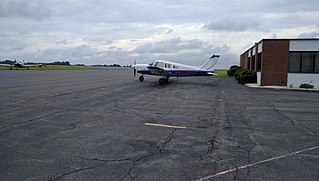
Smith Reynolds Airport is a public airport 3 miles (5 km) northeast of Winston-Salem in Forsyth County, North Carolina. The airport has two runways, and is used for general aviation and flight training as there is now no scheduled passenger airline. Smith Reynolds was once home to the Winston-Salem air show, usually held in September, which drew about 20,000 spectators. There has not been an Airshow since 2015. The Airport has multiple flight schools and maintenance facilities. Smith Reynolds also has an operational control tower that operates from 6:00 AM to 9:30 PM every day of the year. INT covers 702 acres of land.

Piedmont Airlines was an airline in the United States that operated from 1948 to 1989, when it was acquired by and merged into USAir. Its headquarters were at One Piedmont Plaza in Winston-Salem, North Carolina, a building that is now part of Wake Forest University.


