Gschwandt | |
|---|---|
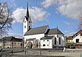
 Gschwandt seen from the southwest | |
 Coat of arms | |
 Gschwandt Location within Austria | |
| Coordinates: 47°56′6″N13°50′44″E / 47.93500°N 13.84556°E | |
| Country | Austria |
| State | Upper Austria |
| District | Gmunden |
| Government | |
| • Mayor | Friedrich Steindl (ÖVP) |
| Area | |
• Total | 16.76 km2 (6.47 sq mi) |
| Elevation | 523 m (1,716 ft) |
| Population (2018-01-01) [2] | |
• Total | 2,750 |
| • Density | 164/km2 (425/sq mi) |
| Time zone | UTC+1 (CET) |
| • Summer (DST) | UTC+2 (CEST) |
| Postal code | 4816 |
| Area code | 07612 |
| Vehicle registration | GM |
| Website | https://www.gschwandt.at/ |
Gschwandt is a municipality in the district of Gmunden in the Austrian state of Upper Austria.