Haileyville, Oklahoma

Last updated

Haileyville, Oklahoma
OKMap-doton-Haileyville.PNG
Location of Haileyville, Oklahoma
Coordinates: 34°51′15″N95°34′42″W / 34.85417°N 95.57833°W / 34.85417; -95.57833
Country United States
State Oklahoma
County Pittsburg
Area
[1]
  Total1.04 sq mi (2.68 km2)
  Land1.03 sq mi (2.68 km2)
  Water0.00 sq mi (0.01 km2)
Elevation
[2]
650 ft (200 m)
Population
 (2020)
  Total716
  Density692.46/sq mi (267.38/km2)
Time zone UTC-6 (Central (CST))
  Summer (DST) UTC-5 (CDT)
ZIP code
74546
Area code(s) 539/918
FIPS code 40-31900 [3]
GNIS feature ID2410682 [2]

Haileyville is a city in Pittsburg County, Oklahoma, United States. The population was 716 at the time of the 2020 United States census. [4]

Contents

History

Located in Pittsburg County, Haileyville lies at the junction of U.S. Route 270#OklahomaU.S. Route 270/State Highway 1 and State Highway 63, fourteen miles east of McAlester and a little more than one mile west of Hartshorne. The French explorer Jean Baptiste Bénard de La Harpe first mapped the site of Haileyville in 1719 during his expedition to the Arkansas River. In 1898 D. M. Hailey, M.D., established the town of Haileyville, when he claimed a tract of land east of McAlester and opened the area's first coal mines. A Confederate veteran, Hailey had first moved into Indian Territory in 1868 to practice medicine and before long had become involved in several business ventures. His mining investments began when he and James Elliot started the Hailey-Ola Mining Company, leasing coal land from the Choctaw, Oklahoma and Gulf Railroad, which laid tracks in the area in 1889–90. The first mine, named Number One Slope, began production on St. Patrick's Day in 1899.

Haileyville, in the Choctaw Nation, was a company town, which was a common feature of coal-mining communities. Italians, American Indians, Russians, and Americans comprised most of Haileyville, and many worked in the mines or on the railroads. Coal from the area was only profitable due to the railroad junction. The town was home to the freight and passenger offices of the Choctaw, Oklahoma, and Gulf Railroad, which later became the Chicago, Rock Island and Pacific Railway Company (Rock Island). By 1902 the railroad had 1,052 miles of track, including a branch from the town that ran to Ardmore. Haileyville remained the division point of the Rock Island Railroad until 1958, when the offices moved to El Reno.

On April 20, 1901, the U.S. Post Office Department established a post office at Haileyville, Indian Territory. [5] The 1907 population stood at 1,452, and it climbed to 2,024 in 1910. In 1911 a bank, the New State newspaper, five hotels, three doctors, and several retail and other businesses served the residents. The community and its close neighbor, Hartshorne, are known as the "twin cities" of Pittsburg County due to their proximity. Governor Lee Cruce proclaimed Haileyville a first class city on February 12, 1912. After a 2,067 population in 1920, the number of residents declined to 1,801 in 1930, 1,183 in 1940, and 922 in 1960. In 1946 one coal company, a bank, and an ice plant were the main businesses, with gas stations, grocery stores, and a hardware store. After the coal mines closed, lumber, farming, and ranching became the primary modes of production.

At the time of its founding, Haileyville was located in Gaines County, a part of the Moshulatubbee District of the Choctaw Nation. [6]

Geography

According to the United States Census Bureau, the city has a total area of 1.0 square mile (2.6 km2), all land.

Demographics

Historical population
CensusPop.Note
1910 2,024
1920 2,0672.1%
1930 1,801−12.9%
1940 1,183−34.3%
1950 1,107−6.4%
1960 922−16.7%
1970 9280.7%
1980 832−10.3%
1990 91810.3%
2000 891−2.9%
2010 813−8.8%
2020 716−11.9%
U.S. Decennial Census [7]

As of the census [3] of 2000, there were 891 people, 375 households, and 253 families residing in the city. The population density was 872.8 inhabitants per square mile (337.0/km2). There were 452 housing units at an average density of 442.8 per square mile (171.0/km2). The racial makeup of the city was 69.81% White, 0.67% African American, 21.89% Native American, 0.34% Asian, 0.56% from other races, and 6.73% from two or more races. Hispanic or Latino of any race were 2.24% of the population.

There were 375 households, out of which 29.3% had children under the age of 18 living with them, 50.4% were married couples living together, 13.9% had a female householder with no husband present, and 32.3% were non-families. 30.1% of all households were made up of individuals, and 12.8% had someone living alone who was 65 years of age or older. The average household size was 2.38 and the average family size was 2.96.

In the city, the population was spread out, with 26.4% under the age of 18, 9.4% from 18 to 24, 24.9% from 25 to 44, 23.9% from 45 to 64, and 15.4% who were 65 years of age or older. The median age was 36 years. For every 100 females, there were 93.7 males. For every 100 females age 18 and over, there were 90.7 males.

The median income for a household in the city was $26,833, and the median income for a family was $29,600. Males had a median income of $29,688 versus $22,500 for females. The per capita income for the city was $13,326. About 14.8% of families and 17.7% of the population were below the poverty line, including 21.4% of those under age 18 and 15.4% of those age 65 or over.

Education

Most of the town is zoned to Haileyville Public Schools while a portion is zoned to Hartshorne Public Schools. [8]

Related Research Articles

<span class="mw-page-title-main">Pittsburg County, Oklahoma</span> County in Oklahoma, United States

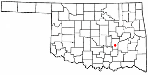
Pittsburg County is a county located in the U.S. state of Oklahoma. As of the 2020 census, the population was 43,773. Its county seat is McAlester. The county was formed from part of the Choctaw Nation in Indian Territory in 1907. County leaders believed that its coal production compared favorably with Pittsburgh, Pennsylvania at the time of statehood.

<span class="mw-page-title-main">LeFlore County, Oklahoma</span> County in Oklahoma, United States

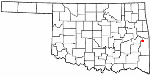
LeFlore County is a county along the eastern border of the U.S state of Oklahoma. As of the 2020 census, the population was 48,129. Its county seat is Poteau. The county is part of the Fort Smith metropolitan area and the name honors a Choctaw family named LeFlore. The United States District Court for the Eastern District of Oklahoma is the federal district court with jurisdiction in LeFlore County.

<span class="mw-page-title-main">Latimer County, Oklahoma</span> County in Oklahoma, United States

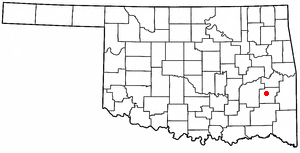
Latimer County is a county located in the southeastern part of the U.S. state of Oklahoma. Its county seat is Wilburton. As of the 2020 census, the population was 9,444. The county was created at statehood in 1907 and named for James L. Latimer, a delegate from Wilburton to the 1906 state Constitutional Convention. Prior to statehood, it had been for several decades part of Gaines County, Sugar Loaf County, and Wade County in the Choctaw Nation.

<span class="mw-page-title-main">Coalgate, Oklahoma</span> City in Oklahoma, United States

Coalgate is a city in and the county seat of Coal County, Oklahoma, United States. The population was 1,967 at the 2010 census, a 1.9 percent decrease from the figure of 2,005 recorded in 2000. The town was founded in 1889 in the Choctaw Nation, Indian Territory as a coal mining camp named Liddle. The name changed to Coalgate on January 23, 1890.

<span class="mw-page-title-main">Lehigh, Oklahoma</span> City in Oklahoma, United States

Lehigh is a city in Coal County, Oklahoma, United States. Its population was 356 at the 2010 census.

Kinta is a town in Haskell County, Oklahoma, United States. The population was 297 at the 2010 census, an increase of 22.2 percent over the figure of 243 recorded in 2000.

McCurtain is a town in Haskell County, Oklahoma, United States. The population was 357 at the 2020 census, a 30.8% decrease over the figure of 516 recorded in 2010. A coal mine disaster in 1912 killed 73 miners and ended McCurtain's prosperity. The mine explosion remains one of the worst disasters in Oklahoma history.

<span class="mw-page-title-main">Calvin, Oklahoma</span> Town in Oklahoma, United States

Calvin is a town in Hughes County, Oklahoma, United States. The population was 294 at the 2010 census.

<span class="mw-page-title-main">Stuart, Oklahoma</span> Town in Oklahoma, United States

Stuart is a town in southeastern Hughes County, Oklahoma, United States. The population was 180 at the 2010 census, down from 220 in 2000.

<span class="mw-page-title-main">Wilburton, Oklahoma</span> City in Oklahoma, United States

Wilburton is a city in Latimer County, Oklahoma, United States. It is the county seat of Latimer County. The city had a population of 2,285 as of the 2020 Census. Robbers Cave State Park is 5 miles (8.0 km) north of Wilburton.

<span class="mw-page-title-main">Bokoshe, Oklahoma</span> Town in Oklahoma, United States

Bokoshe is a town in Le Flore County, Oklahoma, United States. It is part of the Fort Smith, Arkansas-Oklahoma metropolitan statistical area. Bokoshe is a Choctaw word meaning "little creek". The population was 396 at the 2020 census, a 22.3% decrease over the figure of 510 recorded in 2010.

<span class="mw-page-title-main">Panama, Oklahoma</span> Town in Oklahoma, United States

Panama is a town in Le Flore County, Oklahoma, United States. It is part of the Fort Smith, Arkansas-Oklahoma Metropolitan Statistical Area. The population was 1,413 at the 2010 census.

<span class="mw-page-title-main">Shady Point, Oklahoma</span> Town in Oklahoma, United States

Shady Point, sometimes referred to as Shadypoint, is a town in Le Flore County, Oklahoma, United States. It is part of the Fort Smith, Arkansas-Oklahoma Metropolitan Statistical Area. The population was 1,026 at the 2010 census, a 21.0 percent increase over the figure of 848 recorded in 2000.

<span class="mw-page-title-main">Wister, Oklahoma</span> Town in Oklahoma, United States

Wister is a town in Le Flore County, Oklahoma, United States. It is part of the Fort Smith metropolitan area. The population was 1,102 at the 2010 census. Wister is named for Gutman G. Wister, an official with the Choctaw, Oklahoma and Gulf Railroad.

<span class="mw-page-title-main">Hartshorne, Oklahoma</span> City in Oklahoma, United States

Hartshorne is a city in Pittsburg County, Oklahoma, United States. It is the second largest city in the county. The population was 1,947 at the time of the 2020 United States census.

<span class="mw-page-title-main">Krebs, Oklahoma</span> City in Oklahoma, United States

Krebs is a city in Pittsburg County, Oklahoma, United States. The population was 2,083 at the time of the 2020 United States census, up 1.5% from the 2,053 reported at the 2010 census, which in turn was a slight increase from the 2,051 reported in 2000. Its nickname is "Little Italy." Krebs was founded before Oklahoma statehood as a coal-mining town in the Choctaw Nation of Indian Territory.

<span class="mw-page-title-main">McAlester, Oklahoma</span> City in Oklahoma, United States

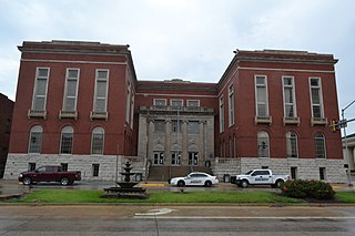
McAlester is the county seat of Pittsburg County, Oklahoma. The population was 18,363 at the time of the 2010 census, a 3.4 percent increase from 17,783 at the 2000 census. The town gets its name from James Jackson McAlester, an early white settler and businessman who later became lieutenant governor of Oklahoma. Known as "J. J.", McAlester married Rebecca Burney, the daughter of a full-blood Chickasaw family, which made him a citizen of the Chickasaw Nation.

Pittsburg is a town in Pittsburg County, Oklahoma, United States. The population was 280 at the 2000 census.

<span class="mw-page-title-main">Savanna, Oklahoma</span> Town in Oklahoma, United States

Savanna is a town in Pittsburg County, Oklahoma, United States. The population was 623 at the time of the 2020 United States census.

Adamson is classified as a Census designated place per the GNIS.

References

  1. "ArcGIS REST Services Directory". United States Census Bureau. Retrieved September 20, 2022.
  2. 1 2 U.S. Geological Survey Geographic Names Information System: Haileyville, Oklahoma
  3. 1 2 "U.S. Census website". United States Census Bureau . Retrieved January 31, 2008.
  4. "Haileyville (city), Oklahoma". United States Census Bureau. Retrieved March 20, 2024.
  5. Shirk, George H. Oklahoma Place Names (Norman: University of Oklahoma Press, 1965), p. 95.
  6. Morris, John W. Historical Atlas of Oklahoma (Norman: University of Oklahoma Press, 1986), plate 38.
  7. "Census of Population and Housing". Census.gov. Retrieved June 4, 2015.
  8. "2020 CENSUS - SCHOOL DISTRICT REFERENCE MAP: Pittsburg County, OK" (PDF). U.S. Census Bureau . Retrieved July 10, 2021.