Harris Township is a civil township of Menominee County in the U.S. state of Michigan. The population was 1,895 at the 2000 census.

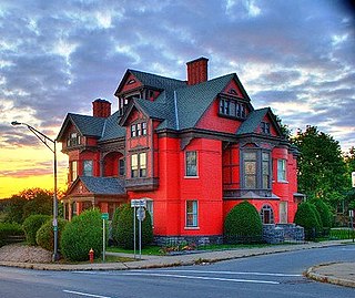
Hallsville is a city in Boone County, Missouri, United States. It is part of the Columbia, Missouri Metropolitan Statistical Area. The population was 1,491 at the 2010 census.

Shady Spring is a census-designated place (CDP) in Raleigh County, West Virginia, United States. The population was 2,998 at the 2010 census. It is a residential community, with a low crime rate.
Platteville is a town in Grant County, Wisconsin, United States. The population was 1,343 at the 2000 census. The city of Platteville is within the town, but is politically independent.
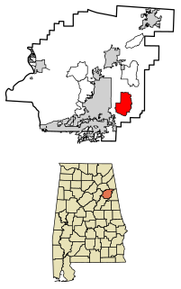
Choccolocco is an unincorporated community and census-designated place in Calhoun County, Alabama, United States. As of the 2010 census, its population was 2,804. It was founded in 1832.
Punkhorn Creek is a small stream in the middle of Byram Township, Sussex County, New Jersey in the United States.
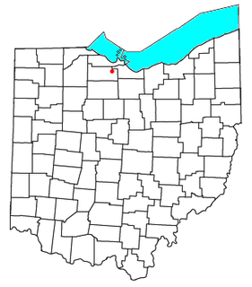
Vickery is an unincorporated community and census-designated places in western Townsend Township, Sandusky County, Ohio, United States. Although it is unincorporated, it has a post office, with the ZIP code of 43464 and a volunteer fire department called Townsend Township FD.

Hallsville is an unincorporated community in northeastern Colerain Township, Ross County, Ohio, United States. Although it is unincorporated, it has a post office, with the ZIP code of 45633. It is located along State Route 180.
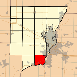
Hollis Township is located in Peoria County, Illinois. As of the 2010 census, its population was 1,881 and it contained 768 housing units. The village of Mapleton is the only incorporated town in the township.
Smithville is a neighborhood in Duluth, Minnesota, United States. Grand Avenue serves as a main route in the community. Stewart Creek flows through the neighborhood, with the Saint Louis River located nearby.

Waterloo is an unincorporated community in Waterloo Township, Fayette County, Indiana.
Little Salisbury is an unincorporated community in Northampton County, Virginia, United States.
Holdcroft is an unincorporated community in Charles City County, Virginia, United States. Capital Airlines Flight 20 crashed in Holdcroft on January 18, 1960.

Karns is an unincorporated community in Harrison Township, Allegheny County, Pennsylvania, USA; it is located in Western Pennsylvania within the Pittsburgh Metropolitan Statistical Area, approximately 24 miles (39 km) northeast of Pittsburgh. Karns is situated along the Allegheny River at Pool 4 across from Jacks Island just above Lock and Dam 4 between Natrona, Natrona Heights, and Sligo. The elevation of Karns is 817 feet above sea level.
The Alder River is a 6.3-mile-long (10.1 km) river in Maine. A tributary of the Androscoggin River, the Alder flows west from Locke Mills to Bethel.
Fairhaven is a populated place in Juneau, Alaska, United States. It is 12 miles (19 km) northwest of the city of Juneau. The name was published in 1962 by the United States Geological Survey, and entered into the Geographic Names Information System on March 31, 1981.
Pinehurst, New York is a hamlet in the town of Hamburg in Erie County, New York, United States.
Snell Creek is a 2.1-mile-long (3.4 km) watercourse in Napa County, California. It is situated approximately five miles north of Aetna Springs and is a tributary of Butts Creek, which ultimately merges into Putah Creek.

Hallsville is an unincorporated community in Barnett Township, DeWitt County, Illinois, United States.