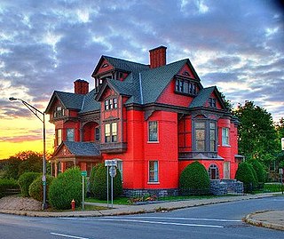
Nelliston, New York

Last updated

Nelliston, New York
USA New York location map.svg
Red pog.svg
Nelliston, New York
Location within the state of New York
Coordinates: 42°56′1″N74°36′49″W / 42.93361°N 74.61361°W / 42.93361; -74.61361
Country United States
State New York
County Montgomery
Area
[1]
  Total1.20 sq mi (3.10 km2)
  Land1.10 sq mi (2.86 km2)
  Water0.09 sq mi (0.23 km2)
Elevation
367 ft (112 m)
Population
 (2020)
  Total555
  Density502.26/sq mi (193.97/km2)
Time zone UTC-5 (Eastern (EST))
  Summer (DST) UTC-4 (EDT)
ZIP code
13410
Area code 518
FIPS code 36-49748
GNIS feature ID0958362

Nelliston is a village in Montgomery County, New York, United States. The population was 596 at the 2010 census. The name is from members of the Nellis family.

Contents

The Village of Nelliston is in the Town of Palatine and is west of Amsterdam.

The Erie Canal passes the village.

History

Perspective map of Fort Plain, New York and Nelliston with list of landmarks published by L.R. Burleigh in 1891 Fort Plain, N.Y. and Nelliston. LOC 75694772.jpg
Perspective map of Fort Plain, New York and Nelliston with list of landmarks published by L.R. Burleigh in 1891

Andrew Nellis, founder of the Nellis family in the area, came to the Town of Palatine in 1722. Fort Fox and Fort Wagner were built at this location during the late colonial period. The village was not well-developed until the time of the Civil War.

The Lasher-Davis House, Ehle House Site, Peter Ehle House, Reformed Dutch Church of Stone Arabia, Jacob Nellis Farmhouse, Nelliston School, Waterman-Gramps House, Walrath-Van Horne House, and Nelliston Historic District are listed on the National Register of Historic Places. [2]

Geography

Nelliston is located at 42°56′1″N74°36′49″W / 42.93361°N 74.61361°W / 42.93361; -74.61361 (42.933644, -74.613531). [3]

According to the United States Census Bureau, the village has a total area of 1.2 square miles (3.1 km2), of which 1.1 square miles (2.8 km2) is land and 0.1 square miles (0.26 km2) (7.56%) is water.

The village is on the northeast side of the Mohawk River across from the Village of Fort Plain and the New York State Thruway.

New York State Route 5 (Main Street) passes through Nelliston. New York State Route 80 has its northern terminus at NY 5 in the village.

Demographics

Historical population
CensusPop.Note
1880 558
1890 72129.2%
1900 634−12.1%
1910 73716.2%
1920 664−9.9%
1930 553−16.7%
1940 63815.4%
1950 6938.6%
1960 7295.2%
1970 716−1.8%
1980 691−3.5%
1990 569−17.7%
2000 6229.3%
2010 596−4.2%
2020 555−6.9%
U.S. Decennial Census [4]

As of the census [5] of 2000, there were 622 people, 257 households, and 172 families residing in the village. The population density was 565.0 inhabitants per square mile (218.1/km2). There were 281 housing units at an average density of 255.3 per square mile (98.6/km2). The racial makeup of the village was 97.75% White, 0.96% Native American, 0.16% Asian, and 1.13% from two or more races. Hispanic or Latino of any race were 0.64% of the population.

There were 257 households, out of which 26.8% had children under the age of 18 living with them, 51.4% were married couples living together, 10.9% had a female householder with no husband present, and 32.7% were non-families. 29.2% of all households were made up of individuals, and 14.8% had someone living alone who was 65 years of age or older. The average household size was 2.42 and the average family size was 2.91.

In the village, the population was spread out, with 24.0% under the age of 18, 7.4% from 18 to 24, 27.7% from 25 to 44, 21.5% from 45 to 64, and 19.5% who were 65 years of age or older. The median age was 41 years. For every 100 females, there were 93.8 males. For every 100 females age 18 and over, there were 91.5 males.

The median income for a household in the village was $31,544, and the median income for a family was $35,875. Males had a median income of $26,500 versus $20,375 for females. The per capita income for the village was $15,002. About 6.4% of families and 9.8% of the population were below the poverty line, including 8.7% of those under age 18 and 8.3% of those age 65 or over.

Notable person

Related Research Articles

<span class="mw-page-title-main">Montgomery County, New York</span> County in New York, United States

Montgomery County is a county in the U.S. state of New York. As of the 2020 census, the population was 49,532. The county seat is Fonda. The county was named in honor of Richard Montgomery, an American Revolutionary War general killed in 1775 at the Battle of Quebec. The county is part of the Mohawk Valley region of the state.
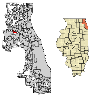
<span class="mw-page-title-main">Deer Park, Illinois</span> Village in Illinois, United States

Deer Park is a village in Lake and Cook Counties, Illinois. Per the 2020 census, the population was 3,681. The village is one of the few left in the Chicago area that enjoy a green belt which is bordered by two large natural areas providing outdoor recreation and open space. The village is home to popular shopping and dining destinations: Deer Park Town Center and the Town Center Promenade. The town is also home to the Vehe Farm, an Illinois Centennial Farm.

Minden Township is a civil township of Sanilac County in the U.S. state of Michigan. The population was 558 at the 2020 census.

Swiftwater Township is a township in Lake of the Woods County, Minnesota, United States. The population was 77 at the 2000 census.

Medusa is a hamlet in the Town of Rensselaerville, in Albany County, New York, United States. The population was 376 at the 2000 census, which listed the community as a census-designated place (CDP), but it was not included as a CDP in the 2010 census.

Harpersfield is a town in Delaware County, New York, United States. The population was 1,442 at the 2020 census. The town is on the northern border of the county.

<span class="mw-page-title-main">Ephratah, New York</span> Town in New York, United States

Ephratah is a town in Fulton County, New York, United States. The population was 1,682 at the 2010 census. It is named after Ephrath, a biblical town in what is now Israel.

Oppenheim is a town in Fulton County, New York, United States. The town is in the southwestern corner of the county and is east of Utica. The population was 1,924 at the 2010 census.

Fort Johnson is a hamlet and former village in Montgomery County, New York, United States located on the north side of the Mohawk River in the town of Amsterdam. The population was 490 at the 2010 census.

Fort Plain is a village in Montgomery County, New York, United States. As of the 2010 census, the village population was 2,322. The village is named after a fort built during the American Revolution at the junction of the Mohawk River and its tributary Otsquago Creek.

Hagaman, formerly Hagamans Mills, is a village in Montgomery County, New York, United States. The population was 1,292 at the 2010 census. It is named after Joseph Hagaman, the founding father.

<span class="mw-page-title-main">Palatine, New York</span> Town in New York, United States

Town of Palatine is a town in Montgomery County, New York, United States. It is located on the north side of the Mohawk River in the northwestern part of the county. The population was 3,240 at the 2010 census, the highest since the 1820s. The name is derived from the Palatinate in the Rhineland, the homeland of the Germans who were the earliest European settlers of this region. Administrative offices of the town are located in Palatine Bridge

Palatine Bridge is a village in Montgomery County, New York, United States. The population was 737 at the 2010 census. The basis of the name is the community's location in a region settled by Palatine Germans. The Village of Palatine Bridge is in the Town of Palatine. The community is in the western part of the county, west of Amsterdam.

<span class="mw-page-title-main">West Hurley, New York</span> CDP in New York, United States

West Hurley is a hamlet in Ulster County, New York, United States. The population was 1,917 at the 2020 census.
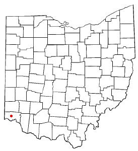
<span class="mw-page-title-main">White Oak West, Ohio</span> Former CDP in Ohio, United States

White Oak West was a census-designated place (CDP) in Hamilton County, Ohio, United States. The population was 2,932 at the 2000 census. As of the 2010 census it had been merged into the larger White Oak CDP.

Delhi is a village and the county seat of Delaware County, New York, United States. The population was 3,087 at the 2010 census.

<span class="mw-page-title-main">Hunter (village), New York</span> Village in New York, United States

Hunter is a village in Greene County, New York, United States. The population was 429 at the 2020 census. The village is in the northwestern part of the town of Hunter on New York State Route 23A.

St. Johnsville is a village in Montgomery County, New York, United States. The population was 1,732 at the 2010 census. Accounts vary as to the etymology of the name, but most of these credit Alexander St. John, an early surveyor and commissioner, while still others credit an early name for the area, St. John's Church.
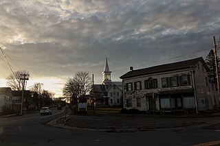
<span class="mw-page-title-main">Esperance (village), New York</span> Village in New York, United States

Esperance is a village in Schoharie County, New York, United States. The population was 345 at the 2010 census. The village was given the French name for "hope."

<span class="mw-page-title-main">Schoharie (village), New York</span> Village in New York, United States

Schoharie is a village in Schoharie County, New York, United States. The population was 922 at the 2010 census. It is the county seat of Schoharie County. The name is a native word for driftwood.

References

  1. "ArcGIS REST Services Directory". United States Census Bureau. Retrieved September 20, 2022.
  2. "National Register Information System". National Register of Historic Places . National Park Service. March 13, 2009.
  3. "US Gazetteer files: 2010, 2000, and 1990". United States Census Bureau. February 12, 2011. Retrieved April 23, 2011.
  4. "Census of Population and Housing". Census.gov. Retrieved June 4, 2015.
  5. "U.S. Census website". United States Census Bureau . Retrieved January 31, 2008.
  6. Reichler, Joseph L., ed. (1979) [1969]. The Baseball Encyclopedia (4th ed.). New York: Macmillan Publishing. ISBN   0-02-578970-8.