Hargelsberg

Last updated

Hargelsberg
Hargelsberg Pfarrkirche hl Andreas.JPG
Church of Saint Andrew
Wappen at hargelsberg.png
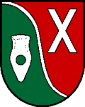
Coat of arms
Austria adm location map.svg
Red pog.svg
Hargelsberg
Location within Austria
Coordinates: 48°9′0″N14°25′32″E / 48.15000°N 14.42556°E / 48.15000; 14.42556 Coordinates: 48°9′0″N14°25′32″E / 48.15000°N 14.42556°E / 48.15000; 14.42556
Country Austria
State Upper Austria
District Linz-Land
Government
   Mayor Manfred Huber (ÖVP)
Area
[1]
  Total17.89 km2 (6.91 sq mi)
Elevation
324 m (1,063 ft)
Population
 (2018-01-01) [2]
  Total1,371
  Density77/km2 (200/sq mi)
Time zone UTC+1 (CET)
  Summer (DST) UTC+2 (CEST)
Postal code
4483
Area code 07255
Vehicle registration LL
Website www.hargelsberg.ooe.gv.at

Hargelsberg is a municipality in the district Linz-Land in the Austrian state of Upper Austria.
Contents

Geography

Hargelsberg lies 324 meters above sea level. The municipality is about 4.5 kilometers from north to south, and about 6.3 km east to west. The total area is 17.8 km². Some 7.9% of the area is wooded, with 84.3% of the area devoted to agriculture.

Localities

Hargelsberg municipality contains the following named villages: Hargelsberg, Penking, Sieding, and Thann. Other localities are Angersberg, Firsching, Franzberg, Hart, Hausmanning, and Pirchhorn.

History

The area surrounding Hargelsberg came under the dominion of the Bavarian Duchy in the seventh century, and the place is heard of in the twelfth century as part of the Austrian Duchy. From 1490 it was incorporated into the Archduchy 'Austria Above the Enns'. During Napoleonic Wars, the location saw French incursions. Since 1918, Hargelsberg has been part of Bundesland Upper Austria. Following the Anschluss with Germany on 13 March 1938, the locality was part of Gau Oberdonau" but in 1945 was restored to Bundesland Upper Austria.

Historical objects from Hargelsberg can be examined in the museum at Enns.

Notgeld

Like many municipalities of Upper Austria, Hargelsberg issued Notgeld for collectors in 1920. Hargelsberg was more prolific than most, with all of its villages and localities issuing special series (Sonderserien) in limited prints. Several hundred varieties exist.

Population

Historical population
YearPop.±%
18691,066    
18801,163+9.1%
18901,111−4.5%
19001,038−6.6%
19101,090+5.0%
19231,056−3.1%
19341,038−1.7%
19391,009−2.8%
YearPop.±%
19511,063+5.4%
1961842−20.8%
1971755−10.3%
1981782+3.6%
1991847+8.3%
20011,082+27.7%
20111,231+13.8%

Related Research Articles

Losenstein Place in Upper Austria, Austria

Losenstein is a small village in the south of Upper Austria, Austria. About 1,700 inhabitants call Losenstein their home. It lies in the southernmost quarter of Upper Austria called "Traunviertel". Its spatial dimension from North to South is 8,1 km, from West to East 4,5 km. 45,9% of its area are covered by forests, another 39,7% are used for agricultural purposes. The closest city of administrative importance is Steyr, which is 20 km to North. It can be accessed via the "B-109 Eisenbundesstrasse" or by train.

Enns (town) Place in Upper Austria, Austria

Enns is a town in the Austrian state of Upper Austria on the river Enns, which forms the border with the state of Lower Austria.

Pilsbach Place in Upper Austria, Austria

Pilsbach is a town in the Austrian state of Upper Austria.

Krimml Place in Salzburg, Austria

Krimml is a municipality in Zell am See District, in the federal state of Salzburg, Austria, in the Pinzgau region.

Freistadt Place in Upper Austria, Austria

Freistadt  is a small Austrian town in the state of Upper Austria in the region Mühlviertel. With a population of approximately 7,500 residents, it is a trade centre for local villages. Freistadt is the economic centre of a district of the same name District Freistadt. The nearest sizeable cities are Linz, the capital of Upper Austria, about 40 km in the south, and České Budějovice, the capital of Southern Bohemia, about 60 km in the north.

Regau Place in Upper Austria, Austria

Regau is a municipality in the Austrian state of Upper Austria near Vöcklabruck, which is the capital of the district.

Ramsau am Dachstein Place in Styria, Austria

Ramsau am Dachstein is a municipality in the district of Liezen, state of Styria, Austria. It is also the name of the elevated plateau between the Dachstein range and the Enns valley on which this municipality is located.

Reichenau, Carinthia Place in Carinthia, Austria

Reichenau is a municipality in the district of Feldkirchen in the Austrian state of Carinthia.

Kötschach-Mauthen Place in Carinthia, Austria

Kötschach-Mauthen is a market town in the district of Hermagor in Carinthia in Austria.

Liebenfels Place in Carinthia, Austria

Liebenfels is a market town in the district of Sankt Veit an der Glan in the Austrian state of Carinthia.

Rennweg am Katschberg Place in Carinthia, Austria

Rennweg am Katschberg is a market town in the district of Spittal an der Drau in Carinthia, Austria.

Obertraun Place in Upper Austria, Austria

Obertraun, Upper Austria is a village in the Salzkammergut, a region in Austria. It is located near the Hallstätter See and Hoher Dachstein. Obertraun is a popular holiday destination offering activities such as skiing, snowboarding in the winter and mountain biking, swimming and kayaking in the summer.

Gallneukirchen Place in Upper Austria, Austria

Gallneukirchen is a small city in the Austrian state of Upper Austria and is part of the district Urfahr-Umgebung.

Franking, Austria Place in Upper Austria, Austria

Franking is a municipality in the district Braunau am Inn in the Austrian state of Upper Austria.

Sandl Place in Upper Austria, Austria

Sandl is a municipality in the district of Freistadt in Upper Austria, Austria.

Gosau Place in Upper Austria, Austria

Gosau is a municipality in the district of Gmunden in Upper Austria, Austria.

Vorchdorf Place in Upper Austria, Austria

Vorchdorf is a market town in the district of Gmunden in Upper Austria, Austria, as well as the name of the municipal area ("Gemeinde") that the town and others occupy. As of the 2005 census, the town of Vorchdorf had a population of 7,287 inhabitants.

Dimbach, Austria Place in Upper Austria, Austria

Dimbach is a municipality in the district Perg in Upper Austria, Austria. It had a population of 1015 according to the 2015 census.

Großraming Place in Upper Austria, Austria

Großraming is a municipality in the district of Steyr-Land in the Austrian state of Upper Austria.

Ottensheim Place in Upper Austria, Austria

Ottensheim is a municipality in the district of Urfahr-Umgebung in the Austrian state of Upper Austria. In July 2008 it hosted the World Rowing Championships, and it did so again in 2019.

References

  1. "Dauersiedlungsraum der Gemeinden Politischen Bezirke und Bundesländer - Gebietsstand 1.1.2018". Statistics Austria. Retrieved 10 March 2019.
  2. "Einwohnerzahl 1.1.2018 nach Gemeinden mit Status, Gebietsstand 1.1.2018". Statistics Austria. Retrieved 9 March 2019.