Kirchberg-Thening

Last updated

Kirchberg-Thening
Thening1.jpg
Wappen Kirchberg-Thening.svg
Coat of arms
Austria adm location map.svg
Red pog.svg
Kirchberg-Thening
Location within Austria
Coordinates: 48°15′53″N14°9′34″E / 48.26472°N 14.15944°E / 48.26472; 14.15944 Coordinates: 48°15′53″N14°9′34″E / 48.26472°N 14.15944°E / 48.26472; 14.15944
Country Austria
State Upper Austria
District Linz-Land
Government
   Mayor Josef Berger (SPÖ)
Area
[1]
  Total15.9 km2 (6.1 sq mi)
Elevation
322 m (1,056 ft)
Population
 (2018-01-01) [2]
  Total2,364
  Density150/km2 (390/sq mi)
Time zone UTC+1 (CET)
  Summer (DST) UTC+2 (CEST)
Postal code
4062
Area code 07221
Vehicle registration LL
Website www.kirchberg-thening.ooe.gv.at

Kirchberg-Thening is a municipality in the district Linz-Land in the Austrian state of Upper Austria.

Population

Historical population
YearPop.±%
18691,301    
18801,286−1.2%
18901,277−0.7%
19001,355+6.1%
19101,376+1.5%
19231,541+12.0%
19341,443−6.4%
19391,503+4.2%
19511,763+17.3%
19611,617−8.3%
19711,803+11.5%
19811,872+3.8%
19911,955+4.4%
20012,130+9.0%
20112,298+7.9%

Related Research Articles

Horn, Austria Place in Lower Austria, Austria

Horn is a small town in the Waldviertel in Lower Austria, Austria and the capital of the district of the same name.

Schwarzach, Vorarlberg Place in Vorarlberg, Austria

Schwarzach is a municipality in the Austrian state of Vorarlberg.

Nenzing Place in Vorarlberg, Austria

Nenzing is a market town in the district of Bludenz in the Austrian state of Vorarlberg.

Bildstein Place in Vorarlberg, Austria

Bildstein is a municipality in the district of Bregenz in the Austrian state of Vorarlberg.

Blons Place in Vorarlberg, Austria

Blons is a municipality in the district of Bludenz in Austrian state of Vorarlberg.

Bludesch Place in Vorarlberg, Austria

Bludesch is a municipality in the district of Bludenz in the Austrian state of Vorarlberg.

Dalaas Place in Vorarlberg, Austria

Dalaas is a municipality in the district of Bludenz in the Austrian state of Vorarlberg.

Lorüns Place in Vorarlberg, Austria

Lorüns is a municipality in the district of Bludenz in the Austrian state of Vorarlberg.

Silbertal Place in Vorarlberg, Austria

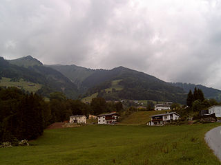
Silbertal is a municipality in the district of Bludenz in the Austrian state of Vorarlberg.

Stallehr Place in Vorarlberg, Austria

Stallehr is a municipality in the district of Bludenz in the Austrian state of Vorarlberg.

Thüringerberg Place in Vorarlberg, Austria

Thüringerberg is a municipality in the district of Bludenz in the Austrian state of Vorarlberg.

Fußach Place in Vorarlberg, Austria

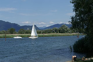
Fußach is a municipality in the district of Bregenz in the Austrian state of Vorarlberg.

Höchst, Austria Place in Vorarlberg, Austria

Höchst is a municipality in the district of Bregenz in the Austrian state of Vorarlberg.

Schnepfau Place in Vorarlberg, Austria

Schnepfau is a municipality in the district of Bregenz in the Austrian state of Vorarlberg.

Mäder Place in Vorarlberg, Austria

Mäder is a municipality in the district of Feldkirch in the Austrian state of Vorarlberg.

Röns Place in Vorarlberg, Austria

Röns is a municipality in the district of Feldkirch in the Austrian state of Vorarlberg.

Schlins Place in Vorarlberg, Austria

Schlins is a municipality in the district of Feldkirch in the Austrian state of Vorarlberg.

Sulz, Vorarlberg Place in Vorarlberg, Austria

Sulz is a municipality in the district of Feldkirch in the Austrian state of Vorarlberg.

Altschwendt Place in Upper Austria, Austria

Altschwendt is a municipality in the district of Schärding in the Austrian state of Upper Austria.

Bad Waltersdorf Place in Styria, Austria

Bad Waltersdorf is a municipality in the district of Hartberg-Fürstenfeld in Styria, Austria.

References

  1. "Dauersiedlungsraum der Gemeinden Politischen Bezirke und Bundesländer - Gebietsstand 1.1.2018". Statistics Austria. Retrieved 10 March 2019.
  2. "Einwohnerzahl 1.1.2018 nach Gemeinden mit Status, Gebietsstand 1.1.2018". Statistics Austria. Retrieved 9 March 2019.