
Marys River is a 40-mile (64 km) tributary of the Willamette River in the U.S. state of Oregon. From its source at the confluence of its east and west forks near Summit, it flows generally southeast from the Central Oregon Coast Range to Corvallis.

The Alsea River flows 48.5 miles (78.1 km) from Alsea, an unincorporated community in the coastal mountains of the U.S. state of Oregon, to the Pacific Ocean near the city of Waldport. It begins at the confluence of the North Fork Alsea River and the South Fork Alsea River and ends in Alsea Bay, a wide estuary at Waldport. The river flows generally west-northwest in a winding course through the mountains of southern Benton and Lincoln counties, passing near the unincorporated community of Tidewater and through the Siuslaw National Forest. Its drainage basin extends into Lane County, along the headwaters of the South Fork Alsea River.

Kings Valley is an unincorporated community and census-designated place in Benton County, Oregon, United States. It is located on the Luckiamute River and Oregon Route 223, the Kings Valley Highway. As of the 2010 census it had a population of 65.

Wren is an unincorporated community in Benton County, Oregon, United States. It is located at the junction of U.S. Route 20 and Oregon Route 223 on the Marys River.

Ash Grove Cement Company is a cement manufacturer based in Overland Park, Kansas. It was the largest US-owned cement company until it was acquired in 2018 by CRH plc, a global building materials business headquartered in Ireland.
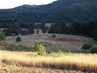
High Pass is a mountain pass in the foothills of the Coast Range mountains in Lane County, Oregon, United States. High Pass Road connects the unincorporated community of Horton, on the west side of the pass, with Cheshire, Monroe, Junction City, and the other low-lying farm towns to the east. Oregon Route 36 provides an alternate route through the foothills over the nearby Low Pass.

Pedee is an unincorporated community in Polk County, Oregon, United States. Pedee is at the intersection of Oregon Route 223 and Maple Grove Road. It is part of the Salem Metropolitan Statistical Area.

Flynn is an unincorporated community in Benton County, Oregon, United States. Flynn is located on U.S. Route 20 at its interchange with Oregon Route 34, just west of Philomath, near the Marys River.

Greenberry is an unincorporated community in Benton County, Oregon, United States. It is located on Oregon Route 99W about 8 miles south of Corvallis.
Hoskins is an unincorporated community in Benton County, Oregon, United States. Hoskins lies west of Oregon Route 223's intersection with Hoskins Road. Hoskins is northwest of Wren and southwest of Kings Valley. The Luckiamute River flows through Hoskins. The community was named after Fort Hoskins, which was itself named after a soldier who died in the Mexican–American War, Lt. Charles Hoskins.

Lewisburg is an unincorporated community in Benton County, Oregon, United States. Lewisburg lies at the intersection of Oregon Route 99W and Lewisburg Avenue at the northeastern corner of Corvallis. It is located south of Adair Village and west of Albany.
Noon is an unincorporated community in Benton County, Oregon, United States. Noon lies at the intersection of U.S. Route 20 and Noon Road and is located at 44°32′43″N123°23′53″W. Noon is located approximately 0.7 miles (1.1 km) west of Flynn and 1.5 miles (2.4 km) west of Philomath. Noon is also about 6.9 miles (11.1 km) west-southwest of Corvallis.

Ash Creek is a short stream in Polk County, in the U.S. state of Oregon. Formed by the merger of its north and middle forks near Monmouth, it flows generally east to meet the Willamette River at Independence. The creek passes under Oregon Route 51 just before entering the river. The creek's mouth is about 95 miles (153 km) upstream of the Willamette's confluence with the Columbia River.

Bridgeport is an unincorporated community in Polk County, Oregon, United States. Bridgeport is 5 miles (8.0 km) southwest of Dallas and just west of Oregon Route 223.
Salt Creek is an unincorporated historic community in Polk County, Oregon, United States on Oregon Route 22 about six miles northwest of Dallas. As an early European American settlement of the Oregon Country, the cemetery at Salt Creek has graves dating back to 1847. Salt Creek, a tributary of the South Yamhill River, was named by early settlers for the salt licks found on its banks. The Salt Creek post office, named after the creek, was established in 1852 and closed in 1903. James B. Riggs, who arrived in Oregon via the Oregon Trail and the Meek Cutoff in 1845, was the first postmaster. Riggs previously been the first postmaster of Yoncalla, followed by Jesse Applegate.

Brunks Corner is an unincorporated community in Polk County, Oregon, United States, at the junction of Oregon Route 22 and Oak Grove Road, near the terminus of Oregon Route 51.
Tiernan is an unincorporated community in Lane County, Oregon, United States. It is about five miles west of Mapleton on Oregon Route 126 near the Siuslaw River and within the Siuslaw National Forest.
Burnt Woods is an unincorporated community in Lincoln County, Oregon, United States. It is located about 16 miles (26 km) west of Philomath on U.S. Route 20 in the Central Oregon Coast Range near the Tumtum River.
Bethel-Danebo, most commonly referred to as Bethel, is a neighborhood of west Eugene, Oregon, United States. The neighborhood boundaries are Oregon Route 99 on the east, the former Southern Pacific Coos Bay Line on the south, Green Hill Road on the west and Clear Lake Road on the north.
Suver is an unincorporated community in Polk County, Oregon, United States. It is located about 10 miles north of Corvallis and about 8 miles south of Monmouth, 1 mile east of Oregon Route 99W.

