Harwood, Greater Manchester

Last updated

Harwood
Greater Manchester UK location map 2.svg
Red pog.svg
Harwood
Location within Greater Manchester
OS grid reference SD751113
Metropolitan borough
Metropolitan county
Region
Country England
Sovereign state United Kingdom
Post town BOLTON
Postcode district BL2
Dialling code 01204
Police Greater Manchester
Fire Greater Manchester
Ambulance North West
UK Parliament
List of places
UK
England
Greater Manchester
53°35′49″N2°22′37″W / 53.597°N 2.377°W / 53.597; -2.377

Harwood is a suburb to the north-northeast of Bolton, Greater Manchester, bordering Bury in North West England. Harwood is also part of the historic county of Lancashire.

Contents

History

The township was recorded as Harewode in 1212 and 1302. The manor which included Bradshaw, was part of the Manchester fee held by the Grelleys in the Middle Ages. In 1212 it was divided, the parts held by Roger de Samlesbury and Alexander de Harwood. The Samlesbury portion descended in the same way as Breightmet and the Harwood portion to the Traffords of Trafford who sold it in 1589 and afterwards much divided. The Radcliffes and Bartons of Smithills Hall held land in Harwood for many generations and Adam Mort of Astley held a messuage and a fulling mill in 1630. [1] In 1612, Sir Nicholas Mosley and his son, Edward, conveyed the manor of Harwood to a partnership of five yeomen; Matthew Harrison, Henry Haworth, Raufe Higson, Lawrence Horrocks and Edward Greenhalgh. [2] In the Hearth tax returns of 1666, forty-two hearths were liable to tax but only one house had three hearths. The common lands were enclosed in 1801. Christ Church was built in 1840 and Wesleyan and Primitive Methodist chapels were also built. [1]

Governance

Lying within the boundaries of the historic county of Lancashire since the early 12th century, Harwood was a township in the ecclesiastical parish of Bolton le Moors in the Hundred of Salford. [3] In 1837 it became part of the Bolton Poor Law Union which took responsibility for funding the Poor Law in that area [4] and in 1898 it became part of Turton Urban District. [5]

Geography

Harwood is 2+12 miles north east of Bolton in the West Pennine Moors to the north of the road to Bury. Bradshaw Brook separates it from Tonge. The township covered about 1,240 acres (5.0 km2) of hilly land, the highest point is 825 feet (251 m) at Bowstone Hill and the lowest 300 feet (91 m). Stone was quarried and the brooks used by bleachworks. The underlying rocks are coal measures, sandstones and shales. [1] [3]

Originally a small village within the former Turton Urban District, but now a small part of the Metropolitan Borough of Bolton. Harwood is mostly residential, with most businesses and shops concentrated around a Morrisons supermarket at its centre. Neighbouring districts include Affetside, Bradshaw and Breightmet.

There are several public houses; (House Without a Name, Seven Stars,Grey Mare, Bill'n'Coos, Crofters and the White Horse) many serving food, a medical practice,library, large park (Longsight Park also containing Bolton arboretum) and a small playground off Recreation Street. Numerous footpaths leading out to the West Pennine Hills.

Transport

Harwood is served by the 507 bus from Bolton. On Monday to Saturday weekdays, the 480 runs hourly running between Bolton and Bury, via Bradshaw, Harwood, Affetside and Tottington. The nearest railway stations are located at Hall i' th' Wood within walking distance on the main road and Bromley Cross within the public footpaths in Bradshaw.

Education

Primary schools in the area are St Brendan's, St Maxentius, Harwood Meadows, Hardy Mill. The popular secondary school for residents of Harwood is Turton High School in Bromley Cross, though both Canon Slade and Bolton St Catherine's Academy are nearby.

See also

Related Research Articles

<span class="mw-page-title-main">Egerton, Greater Manchester</span> Human settlement in England

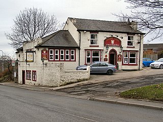
Egerton,, is a village in the unparished area of South Turton, in the northern part of the Metropolitan Borough of Bolton, Greater Manchester, England. Historically a part of Lancashire, it is situated three miles north of Bolton and 12 miles north west of Manchester city centre within the West Pennine Moors.

<span class="mw-page-title-main">Tottington, Greater Manchester</span> Human settlement in England

Tottington is a town in the Metropolitan Borough of Bury in Greater Manchester, England, on the edge of the West Pennine Moors.

<span class="mw-page-title-main">Affetside</span> Village in the Metropolitan Borough of Bury, in Greater Manchester, England

Affetside is a village in Greater Manchester, England. Historically in Lancashire, it is in the Tottington ward of Bury Metropolitan Borough Council and the Bury North parliamentary constituency, in the West Pennine Moors.

<span class="mw-page-title-main">Blackrod</span> Human settlement in England

Blackrod is a town and civil parish in the Metropolitan Borough of Bolton, Greater Manchester,and also the Historic County of Lancashire, England, 3.9 miles (6.3 km) northeast of Wigan and 6.6 miles (10.6 km) west of Bolton. At the United Kingdom Census 2011, it had a population of 5,001.

<span class="mw-page-title-main">Darcy Lever</span> Human settlement in England

Darcy Lever is an area of the Metropolitan Borough of Bolton in Greater Manchester, England. Historically part of Lancashire, the area lies on the B6209, between Bolton and Little Lever. Its history dates to the time of William the Conqueror when it was part of the Salford Hundred given to Roger of Poitou for his participation in the Norman conquest of England.

<span class="mw-page-title-main">Turton Urban District</span> Historical government district in Lancashire, England

Turton Urban District was, from 1873 to 1974, a local government district centred on the historical area of Turton in the administrative county of Lancashire, England.

<span class="mw-page-title-main">Breightmet</span> Human settlement in England

Breightmet is a neighbourhood of Bolton, in Greater Manchester, England. The population of the ward taken at the 2011 census was 13,584. Historically a township of the civil and ecclesiastical parish of Bolton le Moors in the Salford hundred of Lancashire, it lies 2 miles (3.2 km) north-east of Bolton and 4 miles (6.4 km) north-west of Bury.

Bolton le Moors was a large civil parish and ecclesiastical parish in hundred of Salford in the historic county of Lancashire, England. It was administered from St Peter's Church, Bolton in the township of Great Bolton.

Bradshaw is a village of the unparished area of South Turton in the Metropolitan Borough of Bolton in Greater Manchester, England. It gives its name to the larger Bradshaw electoral ward, which includes Harwood. within the Historic County of Lancashire, Bradshaw lies on the southern edge of the West Pennine Moors.

South Turton is an unparished area of the Metropolitan Borough of Bolton, in Greater Manchester, England. Historically the southern part of Turton, and within the Historic County of Lancashire, it lies on the southern slopes of the West Pennine Moors, and has a population of 25,067.

Turton is a historical area in the North West of England. It is divided between the ceremonial counties of Lancashire and Greater Manchester. The Turton area is located north of Bolton and south of Blackburn. The area historically formed a township in the ancient parish of Bolton le Moors. The principal village in the township is now known as Chapeltown.

<span class="mw-page-title-main">Bromley Cross</span> Human settlement in England

Bromley Cross is a residential area of South Turton in the Metropolitan Borough of Bolton, Greater Manchester, England. It gives its name to a larger electoral ward, which includes Eagley, Egerton, and Cox Green. Historically part of Lancashire, Bromley Cross lies on the southern edge of the West Pennine Moors.

<span class="mw-page-title-main">Entwistle, Lancashire</span> Human settlement in England

Entwistle is a village in the Blackburn with Darwen unitary authority in Lancashire in the north west of England.

<span class="mw-page-title-main">Ainsworth Mill, Breightmet</span> Cotton mill in Greater Manchester, England

Ainsworth Mill, Breightmet is a mercerising mill near the Breightmet neighborhood of Bolton, Greater Manchester. It was bought by the Lancashire Cotton Corporation in the 1940s as an attempt to develop a cotton finishing presence.

Tonge with Haulgh was a township of the civil and ecclesiastical parish of Bolton le Moors in the Salford hundred of Lancashire, England.

<span class="mw-page-title-main">Quarlton</span>

Quarlton was a township of the civil and ecclesiastical parish of Bolton le Moors in the Hundred of Salford, Lancashire, England. It lay 4+12 miles (7.2 km) north east of Bolton.

Longworth was a township of the civil and ecclesiastical parish of Bolton le Moors in the Salford hundred of Lancashire, England.

Sharples, a suburb of Bolton, was a township of the civil and ecclesiastical parish of Bolton le Moors in the Salford hundred of Lancashire, England. It lay 2+12 miles north of Bolton. It contained the smaller settlements of Banktop, Sweet-Loves, High-Houses, Gale, Folds, Belmont, Piccadilly, Water-Meetings, Old Houses and part of Astley Bridge.

<span class="mw-page-title-main">Turton Local History Society</span>

Turton Local History Society (TLHS) is an English local history society covering the area of Turton in the North West of England. The district includes the ancient townships of Bradshaw, Edgworth, Entwistle, Harwood, Longworth, Quarlton and Turton, and includes the areas now known as Egerton, Bromley Cross and Chapeltown.

References

  1. 1 2 3 Farrer, William; Brownbill, J., eds. (1911), "Harwood", A History of the County of Lancaster: Volume 5, British History Online, pp. 268–270, retrieved 27 November 2010
  2. Horrdige, J. F. (2006). Harwood: The Early Years. Turton Local History Society. pp. 27–28.
  3. 1 2 Lewis, Samuel (1848), "Harwood", A Topographical Dictionary of England, British History Online, pp. 431–435, retrieved 27 November 2010
  4. Workhouse, workhouses.org.uk, archived from the original on 5 June 2011, retrieved 28 November 2010
  5. Greater Manchester Gazetteer, Greater Manchester County Record Office, Places names – G-H, archived from the original on 18 July 2011, retrieved 27 November 2010