Whittington is a village and civil parish which lies approximately 3 miles south east of Lichfield, in the Lichfield district of Staffordshire, England. According to the 2001 census it had a population of 2,591, increasing to 2,603 at the 2011 Census. The parish council is a joint one with Fisherwick. The Coventry Canal borders the village to the north and east.

Staverton is a village and civil parish in the south-west of Northamptonshire, England. It is 2.3 miles west of Daventry, 7.9 miles east of Southam and 15.3 miles east of Leamington Spa. It straddles the A425 road from Daventry to Leamington. The Jurassic Way long-distance footpath between Banbury and Stamford passes through the village.
Wootton Wawen is a village and civil parish in the Stratford-on-Avon district of Warwickshire, England. The village is on the A3400 in mid-western Warwickshire, about 20 miles (32 km) from Birmingham, about 2 miles (3 km) south of Henley-in-Arden and about 6.5 miles (10 km) north of Stratford-upon-Avon. The soil is a strong clay and some arable crops are grown, but the land is mainly in pasture. The common fields were inclosed in 1776, but some inclosures had already been made about 1623.
Upton is a village in south-west Warwickshire, England. It is just off the A46, between Alcester and Stratford-upon-Avon, about a mile east of Alcester.

Great Alne is a small village in Warwickshire, England, 7 miles (11 km) north-west of Stratford-upon-Avon, 3 miles (4.8 km) north-east of Alcester and 15 miles (24 km) from Warwick, on the road to Wootton Wawen. It takes its name from the River Alne and was first chronicled in the charter of King Ethelbald (723–737). In 1969 Warwickshire County Council designated part of Great Alne as a Conservation Area, including most of the village east of the Memorial Hall and twelve listed buildings of local architectural and historical value. At the 2001 Census the population was 587.

Withington is a village and parish in Shropshire, England.

Hockley Heath is a large village and civil parish in the Arden area mostly within the Metropolitan Borough of Solihull, West Midlands, England. It incorporates the hamlet of Nuthurst, and has a history dating back to the year 705 AD as a wood owned by Worcester Cathedral. The parish, known as Nuthurst cum Hockley Heath, is to the south of the West Midlands conurbation, 12 miles (19 km) southeast of Birmingham 5.5 miles (8.9 km) from Solihull town centre and 13 miles (21 km) north of Stratford-upon-Avon. The village forms part of the border with Warwickshire and the District of Stratford-on-Avon to the south, with some parts of the village on either side of the border. According to the 2001 census, the parish had a population of 6,771, being measured at the 2011 Census as 2,038.

Grindon is a small village in the Staffordshire Peak District of England.

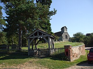
Kinwarton is a village in the valley of the River Alne, Warwickshire, to the north-east of the market town of Alcester. The population of the civil parish at the 2011 Census was 1,082. The ground is mostly low-lying, with a maximum altitude of 206 ft. and some of the fields near the river are liable to floods. The road from Alcester to Henley-in-Arden runs through the middle of the parish. A branch road leads off to the church and rectory about a quarter of a mile to the south and thence continues as a field-path down to a ford across the River Alne below Hoo Mill. From the north side of the main road a by-road branches off to Coughton.
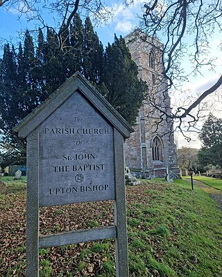
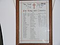
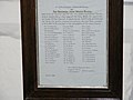
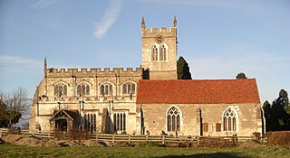
Upton Bishop is a small village in Herefordshire, England. The population of the village at the 2011 census was 602.
Upton is a small village in Nottinghamshire, England, 2 miles (3.2 km) east of Southwell, 5 miles (8.0 km) west of Newark and 3 miles (4.8 km) south of Hockerton; it lies on the A612 Nottingham-Newark road. In 1889, the village was described as sitting on a bend in the main road, "on the summit of a hill which commands a fine view of the Trent Valley.... The church, which is a prominent feature in the landscape, has a substantial Perpendicular tower crowned by eight pinnacles, and having in the centre a lofty master pinnacle which rises above its neighbours, and so adds materially to the effect."

Upton Scudamore is a village and civil parish in Wiltshire, England. The village lies about 1.8 miles (3 km) north of the town of Warminster and about the same distance south of Westbury. The parish includes the hamlet of Halfway.

Little Leigh is a civil parish and village within the unitary authority of Cheshire West and Chester and the ceremonial county of Cheshire, England. It is situated on high ground on the north bank of the River Weaver; it is approximately 2 miles north of Weaverham on the A533 road and about three miles north-west of Northwich. The population of the civil parish taken at the 2011 census was 567.

Coughton is a small village located between Studley 2.4 miles (4 km) to the North and Alcester, 2 miles (3 km) to the South, in the county of Warwickshire, England. The village lies 19.3 miles (31 km) from Birmingham on the Birmingham–Alcester A435 road, which here follows the line of the Roman road Icknield Street. The village mainly consists of a number of houses on Sambourne Lane, Coughton Lane and farms and is primarily noted as being the location of the National Trust property, Coughton Court, which lies 400 yards to the east of the A435. The population according to the 2001 Census was 139, increasing to 157 in the 2011 Census.

St Andrew's Church is an Anglican church in Church Road, Hove, in the English city of Brighton and Hove. It is usually referred to as St Andrew (Old Church) to distinguish it from another St Andrew's Church in Waterloo Street, elsewhere in Hove. It served as Hove's parish church for several centuries until 1892, although the building was in a state of near-ruin until Hove began to grow from an isolated village to a popular residential area in the early 19th century.

Henley is a village and civil parish in the Mid Suffolk district of Suffolk in eastern England located just north of the town Ipswich in Suffolk, England.

Great Wolford is a village and civil parish in the Stratford-on-Avon district of Warwickshire, England. With the neighbouring parish of Little Wolford it is part of 'The Wolfords'.
Morton Bagot is a small village in the Stratford-on-Avon District of Warwickshire, England. It lies about 1.5 miles (2 km) east of the Birmingham-Alcester road, the modern A435 and Roman road Ryknild Street, 6.5 miles (10 km) north of Alcester, 9.5 miles (15 km) from Stratford-upon-Avon and 12 miles from Warwick, across the valley of a small brook, flowing south-east to join the River Arrow.

St Paul's Church, Stockingford, is a Church of England parish church in Stockingford, Nuneaton, Warwickshire, England. It is part of the Diocese of Coventry.