Hatherton Flush SSSI is located at SJ672483, on the east bank of the River Weaver.[2][4] It is on private land, immediately southeast of a public footpath from the A529 at Chapel Farm that crosses the Weaver via a footbridge.[5] Mineral-bearing groundwater from local aquifers gradually drips down the steep riverbank, forming a flush, a type of wetland which is similar to a spring-fed fen, but with a slower water flow. The type of vegetation depends on the underlying geology, here glacial deposits.[2][6]
The SSSI covers an area of 1.935 hectares (4.78 acres).[1] The flush is designated for the variety of wetland plants it supports, described by Natural England as an "excellent assemblage,"[2] and much of the site supports a wide range of plants. These include several species of orchid, which grow in abundance at the site, particularly common spotted orchid (Dactylorhiza fuchsii) and southern marsh orchid (Dactylorhiza praetermissa), and also the locally rare species, marsh helleborine (Epipactis palustris).[2][3] Seven species of sedge (Carex) are found in this area of the SSSI, as well as the locally rare species marsh lousewort (Pedicularis palustris) and tubular water dropwort (Oenanthe fistulosa), and the locally scarce species bog pimpernel (Lysimachia tenella, syn. Anagallis tenella) and marsh valerian (Valeriana dioica). Other plants include marsh pennywort (Hydrocotyle vulgaris), marsh arrowgrass (Triglochin palustris) and great horsetail (Equisetum telmateia).[2][3]
The southern part of the flush is less diverse, supporting predominantly a mix of rushes (Juncus) and fleabane (Pulicaria dysenterica).[2]
Some of the species found at the SSSI (not photographed there); flush species:
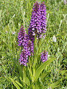
Common spotted orchid
Southern marsh orchid
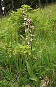
Marsh helleborine
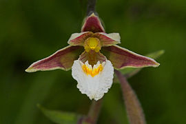
Marsh helleborine flower
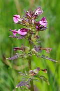
Marsh lousewort
Bog pimpernel
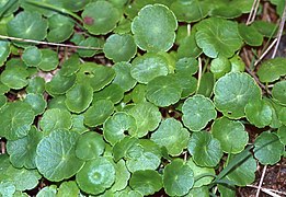
Marsh pennywort
Marsh arrowgrass
Great horsetail
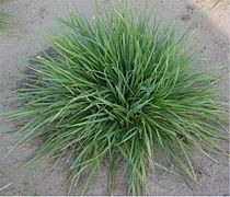
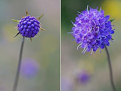
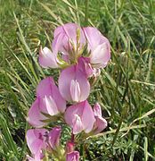
Grassland species:
Crested dog's-tail
Bird's-foot trefoil
Devil's-bit scabious
Sheep's sorrel
Spiny restharrow
Condition and management
The site was assessed by Natural England as being in "unfavourable" but "recovering" condition in July 2008, after removal of scrub and changes to the way in which the area is grazed.[7] According to Natural England, management requires avoidance of drainage or water extraction, as well as protection of the groundwater aquifer from excessive animal faeces and animal feed, fertilisers, lime, pesticides, herbicides and other agricultural chemicals. Some grazing is considered beneficial.[6]
This page is based on this Wikipedia article Text is available under the CC BY-SA 4.0 license; additional terms may apply. Images, videos and audio are available under their respective licenses.