Hatherton, Cheshire

Last updated

Hatherton
Hatherton - Birchenhill Wood.jpg
Birchenhill Wood, Hatherton
Cheshire UK location map.svg
Red pog.svg
Hatherton
Location within Cheshire
Population360 (2011)
OS grid reference SJ687474
Civil parish
  • Hatherton
Unitary authority
Ceremonial county
Region
Country England
Sovereign state United Kingdom
Post town NANTWICH
Postcode district CW5
Dialling code 01270
Police Cheshire
Fire Cheshire
Ambulance North West
UK Parliament
List of places
UK
England
Cheshire
53°01′19″N2°28′05″W / 53.022°N 2.468°W / 53.022; -2.468

Hatherton is a hamlet and civil parish in the unitary authority of Cheshire East and the ceremonial county of Cheshire, England. The hamlet is on the B5071 at SJ687474 , 2+34 miles (4.4 km) to the north east of Audlem and 3+34 miles (6.0 km) to the south east of Nantwich. The civil parish has an area of 673 hectares (1,660 acres) and also includes the small settlements of Birchall Moss, Broomlands and part of Artlebrook, [1] with a total population of 360 in 2011. Nearby villages include Hankelow, Stapeley, Walgherton, Wybunbury, Blakenhall and Buerton. [2] [3] The A529 runs through the parish and the River Weaver forms the western boundary.

Contents

Hatherton was first recorded in the Domesday survey as Haretone. The 18th-century Hatherton Manor farmhouse is listed at grade II*, and there are also grade-II-listed timber-framed and brick farmhouses and former country houses. The hamlet has a Methodist chapel. The Hatherton Flush Site of Special Scientific Interest is a wetland by the Weaver that supports marsh helleborine, marsh lousewort and tubular water-dropwort, which are rare in Cheshire.

History

Haretone was a small manor at the time of the Domesday survey of 1086, and was held by William Malbank, Baron of Wich Malbank (Nantwich), with an annual value of 10  shillings. Before the Norman Conquest, it had been held by Ulfkil, when it had been valued at £2. Five households were recorded, interpreted as a manor house, lodge and two farms, as well as five ploughlands and a small wood. [4] [5] [6] The old Hatherton Hall was replaced by a farmhouse. [5] During the Civil War, Sir Thomas Smythe of Hatherton was a Parliamentarian who was among the Cheshire gentry who signed the "Cheshire Remonstrance" of 1642. [7]

The parish had two Methodist chapels. The earliest dates from 1864, and is a Primitive Methodist chapel on Crewe Road (now the B5071). A Wesleyan Methodist chapel was constructed on Audlem Road (now the A529) in 1900; it closed in 1968. [1] [5] During the First World War, eighty German prisoners-of-war were interned in Hatherton and employed as agricultural labourers, [7] and the stables of The Broomlands near Birchall Moss served as an equine hospital. [5] The stables were later converted into dwellings and a village store and post office, [5] which has since closed. [2]

In 1881, more than two-thirds of the men in the parish were engaged in agriculture. [8] Hatherton was within the Delves-Broughton estate until it was broken up in around 1920. [5] [7] In the 1960s, the Co-operative Wholesale Society bought many local farms and ran them as Co-op farms. The 1967–68 outbreak of foot-and-mouth disease caused major problems for dairy farms in the Wybunbury area, including Joseph Heler's in Hatherton. [7] The parish remained largely rural in 1990, with only minimal development noted since the 1960s. [5]

Governance

Pasture on the South Cheshire Way in the south east of the parish South Cheshire Way, nr Bearcat Fields.jpg
Pasture on the South Cheshire Way in the south east of the parish

Hatherton is administered jointly with the adjacent parish of Walgherton by Hatherton and Walgherton Parish Council. [9] From 1974 the civil parish was served by Crewe and Nantwich Borough Council, which was succeeded on 1 April 2009 by the unitary authority of Cheshire East. [10] Hatherton falls in the parliamentary constituency of Crewe and Nantwich, [3] which has been represented by Kieran Mullan since 2019, after being represented by Laura Smith (2017–19), Edward Timpson (2008–17) and Gwyneth Dunwoody (1983–2008). [11] [12]

Geography, ecology and transport

The civil parish has an area of 673 hectares (1,660 acres). [3] The A529 runs north–south through the parish and the B5071 (Crewe Road) runs to the north-east from the A529 junction at Oakes Corner towards Walgherton. Park Lane connects the A529 and the B5071, and Hunsterson Road runs eastwards from this junction on the B5071 to the hamlet of Hunsterson in the adjacent parish. Lodge Lane runs south-east from the B5071 to Hunsterson Road. Bridgemere Lane runs eastwards from the A529 to Hunsterson, and Birchall Moss Lane cuts from the A529 to Bridgemere Lane. The hamlet of Hatherton is centred at the crossroads of Park Lane/Hunsterson Road with the B5071, extending along both unclassified roads. The South Cheshire Way long-distance footpath runs through the south of the parish, partly following Bridgemere Lane and the A529. [2] [3]

Marsh helleborine, an orchid found at Hatherton Flush that is rare in Cheshire Epipactis palustris-01-Kaernten-2008-Thomas Huntke.jpg
Marsh helleborine, an orchid found at Hatherton Flush that is rare in Cheshire

The River Weaver runs north–south forming the western boundary of the parish, Artle Brook runs on or near the northern boundary, and Birchall Brook forms part of the south-western boundary. The terrain is undulating, sloping more steeply down to the Weaver in the west, with a lowest elevation of around 38 metres (125 ft) along the Weaver. The highest area is in the south of the parish, around Birchall Moss and south of Bridgemere Lane, at around 72 metres (236 ft). The entire civil parish is classified by Cheshire Wildlife Trust as "Lower Farms and Woods", and the area in the south of the parish around Birchall Moss has been identified as a key area for wildlife. [13] There are numerous small meres or ponds, as well as small areas of deciduous and mixed woodland, including Birchall Moss, Birchenhill Wood, Acton's Rough, Lane Wood, Gorse Wood, Chestnut Wood and Blackthorn Wood. [2] [3] Chestnut and Blackthorn Woods, which line Birchall Brook on the boundary with Hankelow, are marked on tithe maps and might represent small patches of ancient woodland. [14]

Hatherton Flush is a Site of Special Scientific Interest on the bank of the Weaver south of Acton's Rough (at SJ672483 ), designated for its variety of wetland plants. It is the largest example of its kind of flush in the county. [15] [16] The flush is set in partly unimproved acidic grassland. The site supports abundant orchids, including the locally rare species marsh helleborine, as well as seven species of sedge; other locally rare species include marsh lousewort and tubular water-dropwort, and the locally scarce species bog pimpernel, marsh valerian and spiny restharrow are also found at the site. [15] [16]

Demography

Horse paddocks by the B5071 Paddocks by the B5071 - geograph.org.uk - 244281.jpg
Horse paddocks by the B5071

According to the 2001 census, Hatherton civil parish had a population of 344, [1] increasing to 360 in 143 households at the 2011 census. [17] This represents a small decline from the mid-19th-century peak, but an increase compared with the mid-20th-century population; historical population figures are 191 (1801), 394 (1851), 367 (1871), 290 (1901) and 321 (1951). [1] [18]

Landmarks

There is a small mid-19th-century Methodist chapel on Crewe Road; as of 2020, it forms part of the Methodist ministry of nearby Hankelow. [19]

There are several listed buildings within the parish, one of which is designated as grade II*, the middle of the three grades, denoting "particularly important buildings of more than special interest": [20] Hatherton Manor, off Audlem Road (A529), is a farmhouse of five bays in orange-red brick with stone dressings, dating from 1703. There are two storeys, plus a basement and attics, under a tiled roof, and the main entrance is approached by a flight of stone steps. [21] Of the buildings listed at grade II, the oldest is Yew Tree Farmhouse on Audlem Road, a 16th-century, timber-framed house with a tiled roof, featuring small framing infilled with brick. [22] Birchall Moss Hall, also on Audlem Road, is a timber-framed, rendered former farmhouse with small framing and a tiled roof, dating originally from the late 16th or 17th century. [23]

Bank House, Audlem Road (A529) Bank House, Hatherton.jpg
Bank House, Audlem Road (A529)

Several brick houses built between the 17th and mid-19th centuries are also listed at grade II. Part of Park House on Park Lane dates from the 17th century and is in brick described by Historic England as "plum coloured". The three-bay main façade dates from the early 19th century and uses orange-red brick with stone dressings; it features a Tuscan porch. [24] Bank House, on Audlem Road by Oakes Corner, dates originally from the late 17th or early 18th century, and is in plum-coloured brick with stone dressings under a tiled roof. [25] Hatherton House on Broad Lane dates originally from the late 18th or early 19th century. Its three-storey, three-bay main façade is in red brick with stone dressings, with decorative yellow-brick quoins. The arched ashlar doorway features pilasters and carved wreaths; above it is a first-floor window whose stone surround is topped with a pediment. [26] The early 19th-century Hatherton Lodge stands on Lodge Lane, on the site of an earlier lodge, and is described by Historic England as an example of the Picturesque Movement. The L-shaped villa has a stucco-rendered front façade of three bays with stucco quoins. The central limestone portico with Tuscan columns has a bow window above it. [27] The Broomlands on Birchall Moss Lane is a large mid-19th-century former country house, now divided into three, which has a rendered finish and a slate roof. The entrance front has a colonnade porch with stone Doric columns, and the five-bay garden façade features two small bows. [5] [28] A disused 19th-century road bridge over Birchall Brook, on the boundary with Hankelow, is also listed; it is in red brick with stone dressings. [29]

Education

There are no educational facilities in Hatherton. The civil parish falls within the catchment areas of Brine Leas School in Nantwich, and Stapeley Broad Lane Church of England Primary School. [3]

See also

Related Research Articles

<span class="mw-page-title-main">Austerson</span> Human settlement in England

Austerson is a civil parish in the unitary authority of Cheshire East and the ceremonial county of Cheshire, England, lying immediately south of the town of Nantwich and north of the village of Audlem. Predominantly rural with scattered farms, the civil parish includes the small settlement of Old Hall Austerson at SJ656493, about two miles south of Nantwich centre. In 2001, the total population was a little under 150, increasing to 194 at the 2011 Census. Nearby villages include Broomhall Green, Hack Green, Hankelow, Sound Heath and Stapeley.

<span class="mw-page-title-main">Batherton</span> Rural civil parish in England

Batherton is a former civil parish, now in the parish of Stapeley and District, in the unitary authority area of Cheshire East and the ceremonial county of Cheshire, England. It lies immediately south of Nantwich and is jointly administered with the nearby settlement of Stapeley. In 2011 the parish had a population of 124. The River Weaver runs along the western boundary, and its floodplain provides a habitat for wetland species, including the great crested newt and the nationally rare black poplar.

<span class="mw-page-title-main">Blakenhall, Cheshire</span> Human settlement in England

Blakenhall is a small village and former civil parish, now in the parish of Doddington and District, in the unitary authority area of Cheshire East and the ceremonial county of Cheshire, England, about 7 miles (11 km) south-east of Nantwich. It lies on the county boundary with Staffordshire. The parish has an area of 654 hectares and also includes the small settlements of The Den and Gonsley Green, with a total population of 125 in 2001. Nearby villages include Wybunbury in Cheshire and Betley and Wrinehill in Staffordshire. Blakenhall was first recorded in the Domesday survey as Blachenhale, and the parish had one of Cheshire's early ironworks in the 17th and 18th centuries. The area is rural and predominantly agricultural, with small areas of ancient woodland and the nature reserve of Blakenhall Moss, a rejuvenating lowland raised bog. The Crewe-to-Stafford railway line runs through the parish and it is on the proposed route of HS2.

<span class="mw-page-title-main">Buerton, Cheshire East</span> Human settlement in England

Buerton is a village at SJ685435 and civil parish in the unitary authority of Cheshire East and the ceremonial county of Cheshire, England, about 7 miles south of the town of Nantwich and 1½ miles east of the village of Audlem, on the border with Shropshire. The parish also includes the small settlements of Hankins Heys, Moblake, Pinder's End and Three Wells, as well as parts of Chapel End, College Fields, Kinsey Heath, Longhill, Raven's Bank, Sandyford and Woolfall. In 2001, the total population was a little under 500, which had increased marginally to 503 at the 2011 Census. Nearby villages include Adderley, Audlem, Bridgemere, Hankelow, Hatherton, Hunsterson and Woore.

<span class="mw-page-title-main">Norbury, Cheshire</span> Human settlement in England

Norbury is a hamlet and former civil parish, now in the parish of Marbury and District, in the Cheshire East district, in the ceremonial county of Cheshire, England. It included the small settlements of Gauntons Bank, Hurst Green, Swanwick Green, Norbury Common and Holtridge, with a total population of nearly 200 people in 2011. The hamlet of Norbury lies around 5 miles (8 km) north of Whitchurch, Shropshire. Nearby villages include No Man's Heath, Marbury and Wrenbury.

<span class="mw-page-title-main">Bridgemere</span> Human settlement in England

Bridgemere is a village and former civil parish, now in the parish of Doddington and District, in the unitary authority area of Cheshire East and the ceremonial county of Cheshire, England. It is around 7 miles (11 km) south east of Nantwich and 12 miles (19 km) west of Stoke-on-Trent. The southern boundary of the parish is on the border with Shropshire. The civil parish also included the small settlements of Admiral's Gorse, Parrah Green, Prince Hill, Seven Stars and Wheel Green. In 2011 the parish had a population of 148. Nearby towns include Crewe in Cheshire, Market Drayton and Whitchurch in Shropshire, and villages include Blakenhall, Buerton and Hankelow in Cheshire, Madeley, Staffordshire and Woore, Shropshire.

<span class="mw-page-title-main">Chorlton, Cheshire East</span> Human settlement in England

Chorlton is a village and former civil parish, now in the parish of Hough and Chorlton, in the unitary authority area of Cheshire East and the ceremonial county of Cheshire, England. The village lies 4 miles (6.4 km) to the south east of Crewe. Nearby villages include Hough, Shavington, Weston and Wybunbury in Cheshire and Betley in Staffordshire. In 2011 the parish had a population of 897.

<span class="mw-page-title-main">Hough, Cheshire</span> Human settlement in England

Hough is a village and former civil parish, now in the parish of Hough and Chorlton, in the unitary authority area of Cheshire East and the ceremonial county of Cheshire, England. The village is 3 miles (4.8 km) south of Crewe and 4 miles (6.4 km) east of Nantwich. The parish also included part of the settlement of Goodalls Corner. The total population is a little over 800, measured at 808 in the 2011 Census. Nearby villages include Basford, Chorlton, Shavington, Weston and Wybunbury.

<span class="mw-page-title-main">Hunsterson</span> Human settlement in England

Hunsterson is a hamlet and former civil parish, now in the parish of Doddington and District, in the unitary authority area of Cheshire East and the ceremonial county of Cheshire, England. The hamlet is located 2¾ miles to the north east of Audlem and 6 miles to the south of Crewe. The parish also included the settlements of Brown Moss, Four Lane End, Foxes Bank and Whittaker's Green. In 2011 the parish had a population of 163. Nearby villages include Audlem, Buerton, Hatherton and Hankelow.

<span class="mw-page-title-main">Shavington cum Gresty</span> Human settlement in England

Shavington cum Gresty is a civil parish in the unitary authority of Cheshire East and the ceremonial county of Cheshire, England. It lies to the south of Crewe. It includes the large village of Shavington, which lies 2+12 miles south of Crewe, as well as the smaller settlements of Dodds Bank, Park Estate, Puseydale, Sugar Loaf and part of Goodall's Corner. Nearby villages include Basford, Hough, Willaston, Wistaston and Wybunbury. The total population of the civil parish is a little under 5,000.

<span class="mw-page-title-main">Stapeley</span> Human settlement in England

Stapeley is a hamlet and former civil parish, now in the parish of Stapeley and District, in the unitary authority area of Cheshire East and the ceremonial county of Cheshire, England. The hamlet lies 2¼ miles to the south east of Nantwich. The parish also included the small settlements of Broad Lane and Butt Green, and parts of Artle Brook, Haymoor Green and Howbeck Bank, as well as a recent residential development north of the A5301 adjacent to Nantwich. In 2008, the total population was estimated to be a little under 3000, increasing to 3,336 at the 2011 Census. Nearby villages include Shavington, Willaston and Wybunbury.

<span class="mw-page-title-main">Walgherton</span> Human settlement in England

Walgherton is a village and civil parish in the unitary authority of Cheshire East and the ceremonial county of Cheshire, England. The village lies at SJ697489 by the junction of the A51 and B5071 roads, 3½ miles to the south east of Nantwich and 4½ miles to the south of Crewe. The civil parish also includes the small settlement of Hussey's Nook. The total population is just under 130 people. Sand has been extracted at Hough Mill Quarry. The remainder of the parish is predominantly agricultural. Nearby villages include Hatherton, Stapeley and Wybunbury.

<span class="mw-page-title-main">Wybunbury</span> Human settlement in England

Wybunbury is a village and civil parish in the unitary authority of Cheshire East and the ceremonial county of Cheshire, England. The village lies 3¼ miles to the south east of Nantwich and 3¾ miles to the south of Crewe. The parish also includes the settlements of Clannor Heath, Daisy Hill, The Flag, Pinfold and parts of Blakelow, Haymoor Green and Howbeck Bank. Nearby villages include Hough, Shavington, Stapeley and Walgherton. The A51 runs east–west through the south-western corner of the parish.

<span class="mw-page-title-main">Coole Pilate</span> Human settlement in England

Coole Pilate is a civil parish in the unitary authority of Cheshire East and the ceremonial county of Cheshire, England, which lies to the north of Audlem and to the south of Nantwich. The area is predominantly rural with scattered farms, and a total population of 60 people. At the 2011 Census the population remained less than 100. Details are included in the civil parish of Austerson. Nearby villages include Broomhall Green, Hankelow, Hatherton and Newhall.

<span class="mw-page-title-main">Doddington, Cheshire</span> Human settlement in England

Doddington is a former civil parish, now in the parish of Doddington and District, in the unitary authority area of Cheshire East and the ceremonial county of Cheshire, England, which lies to the north east of Audlem and to the south of Crewe. Nearby villages include Blakenhall, Bridgemere, Checkley, Hatherton, Walgherton and Wybunbury. The A51 runs north–south through the parish.

<span class="mw-page-title-main">Lea, Cheshire</span> Human settlement in England

Lea is a former civil parish, now in the parish of Doddington and District, in the unitary authority area of Cheshire East and the ceremonial county of Cheshire, England, which lies to the north east of Audlem and to the south of Crewe. The parish was predominantly rural, but it includes the hamlet of Lea Forge. Nearby villages include Betley, Blakenhall, Hough, Walgherton and Wybunbury.

<span class="mw-page-title-main">Hankelow</span> Human settlement in England

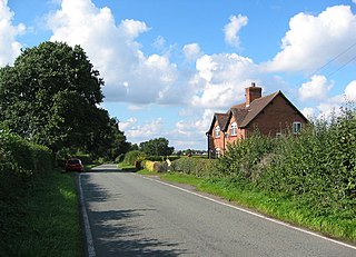
Hankelow is a village and civil parish in the unitary authority of Cheshire East and the ceremonial county of Cheshire, England. The village lies on the A529, around 1.25 miles (2.0 km) north east of Audlem and 4.5 miles (7.2 km) south of Nantwich. The civil parish has an area 369 hectares and also includes the small settlement of The Dell and part of Corbrook, with a total population of just over 260 in 2011. Nearby villages include Aston, Broomhall Green, Sound, Hatherton and Buerton in Cheshire and Woore in Shropshire.

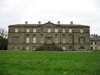
Hankelow is a civil parish in Cheshire East, England. It contains six buildings that are recorded in the National Heritage List for England as designated listed buildings. Of these, two are listed at Grade II*, the middle grade, and the others are at Grade II. Apart from the village of Hankelow, the parish is entirely rural. The listed buildings consist of a former country house, now in ruins, three farmhouses, a disused bridge, and a former mill now converted into residential use.

Hatherton is a civil parish in Cheshire East, England. It contains nine buildings that are recorded in the National Heritage List for England as designated listed buildings. Of these, one is listed at Grade II*, the middle grade, and the others are at Grade II. The parish is almost entirely rural. Apart from a disused bridge, the listed buildings are all domestic properties.

<span class="mw-page-title-main">Ball Farm</span>

Ball Farm is the oldest surviving building in the village of Hankelow, near Audlem in Cheshire, England, and is thought to date from 1510. Most of its original timber frame was replaced by brick in the 19th century, but some close studding and small framing survives, as well as part of a mullioned-and-transomed window. Ball Farm was occupied by the Hassalls, a prominent local family, and might have once been used as a district court of justice. It is listed at grade II* by the Historic Buildings and Monuments Commission for England, the middle of the three grades, denoting "particularly important buildings of more than special interest".

References

  1. 1 2 3 4 "Hatherton", UK & Ireland Genealogy, retrieved 8 March 2020
  2. 1 2 3 4 Crewe & Nantwich: Whitchurch & Tattenhall (OS Explorer series 257), Ordnance Survey, 2000, ISBN   0-319-21893-7
  3. 1 2 3 4 5 6 Search at Cheshire East Council Public Map Viewer (accessed 8, 14 March 2020)
  4. Husain, frontispiece
  5. 1 2 3 4 5 6 7 8 Cheshire Federation of Women's Institutes, pp. 116–17
  6. Powell-Smith, Anna; Palmer, J. J. N., and team, "Land of William Malbank", Open Domesday, retrieved 8 March 2020
  7. 1 2 3 4 Wybunbury Neighbourhood Plan, pp. 7–9, 11–12
  8. "Hatherton Tn/CP: Industry Statistics: Occupation data: Table view", A Vision of Britain through Time, University of Portsmouth , retrieved 10 March 2020
  9. Hatherton & Walgherton Parish Council, Cheshire East Council, retrieved 8 March 2020
  10. The Cheshire (Structural Changes) Order 2008, The National Archives, 4 March 2008, retrieved 3 March 2020
  11. Crewe & Nantwich Parliamentary constituency, BBC, retrieved 8 March 2020
  12. Watt, Nicholas; Morris, Steven; Sparrow, Andrew (23 May 2008), "Brown facing meltdown as Labour crash in Crewe", The Guardian , retrieved 1 March 2020
  13. Cheshire Wildlife Trust, pp. 6, 10
  14. Cheshire Wildlife Trust, p. 22
  15. 1 2 Hatherton Flush (PDF), Natural England , retrieved 8 March 2020
  16. 1 2 Cheshire Wildlife Trust, pp. 7, 22
  17. UK Census (2011), "Local Area Report – Hatherton Parish (E04010948)", Nomis, Office for National Statistics , retrieved 8 March 2020
  18. "Hatherton Tn/CP: Population Statistics: Total Population: Table view", A Vision of Britain through Time, University of Portsmouth , retrieved 10 March 2020
  19. Hankelow with Hatherton, Cheshire South Methodist Church, 2020, retrieved 10 March 2020
  20. Listed Buildings, Historic England, retrieved 7 March 2020
  21. Historic England, "Hatherton Manor (1312575)", National Heritage List for England , retrieved 9 March 2020
  22. Historic England, "Yew Tree Farmhouse (1136970)", National Heritage List for England, retrieved 9 March 2020
  23. Historic England, "Birchall Moss Hall (1138507)", National Heritage List for England, retrieved 9 March 2020
  24. Historic England, "Park House (1330168)", National Heritage List for England, retrieved 9 March 2020
  25. Historic England, "Bank House (1138506)", National Heritage List for England, retrieved 9 March 2020
  26. Historic England, "Hatherton House (1138508)", National Heritage List for England, retrieved 9 March 2020
  27. Historic England, "Hatherton Lodge (1137010)", National Heritage List for England, retrieved 9 March 2020
  28. Historic England, "The Broomlands (1137003)", National Heritage List for England, retrieved 10 March 2020
  29. Historic England, "Birchall Old Bridge (1136980)", National Heritage List for England, retrieved 10 March 2020
Sources

Commons-logo.svg Media related to Hatherton, Cheshire at Wikimedia Commons