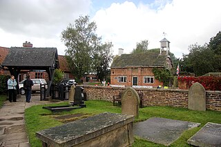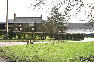
Gawsworth is a civil parish and village in the unitary authority of Cheshire East and the ceremonial county of Cheshire, England. The population of the civil parish at the 2011 census was 1,705. It is one of the eight ancient parishes of Macclesfield Hundred. Twenty acres of the civil parish were transferred to Macclesfield civil parish in 1936.

Macclesfield was, from 1974 to 2009, a local government district with borough status in Cheshire, England. It included the towns of Bollington, Knutsford, Macclesfield and Wilmslow and within its wider area the villages and hamlets of Adlington, Disley, Gawsworth, Kerridge, Pott Shrigley, Poynton, Prestbury, Rainow, Styal, Sutton and Tytherington.

A civil parish is a country subdivision, forming the lowest unit of local government in England. There are 333 civil parishes in the ceremonial county of Cheshire, most of the county being parished. Cheshire East unitary authority is entirely parished. At the 2001 census, there were 565,259 people living in 332 parishes, accounting for 57.5 per cent of the county's population.

Agden is a former civil parish, now in the parish of Little Bollington with Agden, in the borough of Cheshire East and the ceremonial county of Cheshire, England. It is near High Legh, and about 15 miles (24 km) south-west from Manchester City Centre. It is the site of Agden Hall. According to the 2001 census, the population of the civil parish was 146. Because the population is so small, it did not have a parish council, instead, relying on a parish meeting.

Alpraham is a village and former civil parish, now in the parish of Alpraham and Calveley, in the Cheshire East district, in the ceremonial county of Cheshire, England. It is on the A51 road between Nantwich and Chester, seven miles north-west of Nantwich. The population is around 400.

Kettleshulme is a village and former civil parish, now in the parish of Kettleshulme and Lyme Handley, in the Cheshire East district, in the ceremonial county of Cheshire, England. The village is close to the border with Derbyshire, on the B5470 road from Whaley Bridge to Macclesfield in the valley of the Todd Brook, a tributary of the River Goyt. In 2001 the parish had a population of 353.

Norbury is a hamlet and former civil parish, now in the parish of Marbury and District, in the Cheshire East district, in the ceremonial county of Cheshire, England. It included the small settlements of Gauntons Bank, Hurst Green, Swanwick Green, Norbury Common and Holtridge, with a total population of 194 people in 2011. The hamlet of Norbury lies around 5 miles (8 km) north of Whitchurch, Shropshire. Nearby villages include No Man's Heath, Marbury and Wrenbury.

Lyme Handley, sometimes known as Lyme, is a former civil parish, now in the parish of Kettleshulme and Lyme Handley, in between Disley and Stockport, in the unitary authority area of Cheshire East and the ceremonial county of Cheshire, England. According to the 2001 census, it had a population of 151.

Little Bollington is a village and former civil parish, now in the parish of Little Bollington with Agden, in the Cheshire East district, in the ceremonial county of Cheshire, England. The Bridgewater Canal runs through the western side and Dunham Park lies to the north east. The village is 2.5 miles (4.0 km) west of Altrincham, near the boundary with Greater Manchester, which here follows the River Bollin.

Lea is a former civil parish, now in the parish of Doddington and District, in the unitary authority area of Cheshire East and the ceremonial county of Cheshire, England, which lies to the north east of Audlem and to the south of Crewe. The parish was predominantly rural, but it includes the hamlet of Lea Forge. Nearby villages include Betley, Blakenhall, Hough, Walgherton and Wybunbury.

Peover Inferior is a civil parish in the Borough of Cheshire East and the ceremonial county of Cheshire, England. The village is known for its picturesque surrounding countryside and surprisingly convenient location. The name Peover is pronounced 'Peever' and derives from the Anglo-Saxon 'Peeffer' meaning 'a bright river', this 'bright river' being the River Peover which runs through the parish. The village and its neighbour Peover Superior lie on the river Peover, 'Inferior' here meaning downstream. The parish is situated on the B5081 roughly 25 km south south west of Manchester between Knutsford and Holmes Chapel and within five miles of junction 19 on the M6. Together with Nether Peover, it forms part of the village of Lower Peover, Lower Peover being the parish council. Peover Inferior is in Cheshire East, however Nether Peover is in Cheshire West, this often causes complications for the Lower Peover parish council. According to the 2011 census, it had a population of 220.

Peover Superior is a former civil parish, now in the parish of Peover Superior and Snelson, in the unitary authority area of Cheshire East and the ceremonial county of Cheshire, England. It is described by the Office for National Statistics as a village surrounded by inhabited countryside. The civil parish included the village of Over Peover and the hamlet of Peover Heath. In 2011 the parish had a population of 666.

Lower Kinnerton is a village and former civil parish, now in the parish of Dodleston, in the unitary authority of Cheshire West and Chester and the ceremonial county of Cheshire, England, close to the England–Wales border. The neighbouring village of Higher Kinnerton is across the border in Flintshire. Lower Kinnerton is south of Broughton and to the north west of the village of Dodleston. It is a small agricultural community, which is also home to a local kennel and cattery business.

Hapsford is a village and former civil parish, now in the parish of Dunham-on-the-Hill and Hapsford, in the unitary authority area of Cheshire West and Chester and the ceremonial county of Cheshire, England. It is located on the A5117 road, with Helsby to the east and the village of Elton, near Ellesmere Port, to the north west. Junction 14 of the M56 motorway and Chester services motorway service station are sited nearby.

Millington is a former civil parish, now in the parishes of Millington and Rostherne and Little Bollington with Agden, in the Cheshire East district, in the ceremonial county of Cheshire, England. The parish was 8 miles (13 km) from Warrington and 3 miles (5 km) from Altrincham. Its name is a "relic of Saxon clanship – the ton or town of the Millings". The parish is primarily agricultural, with a number of farms including Moss House Farm, Newhall Farm, Mereside Farm, Boothbank Farm and Stonedelph Farm. Millington has been recently described on Britain Streets as a "hamlet or isolated settlement in the inhabited countryside". Millington is situated within the market town Macclesfield. The M56 motorway was close to the parish, which allows travel into areas of Warrington and Manchester, 13 miles (21 km) and 14 miles (23 km) away respectively. In 2011 the parish had a population of 234.

Tabley Superior is a civil parish in the Borough of Cheshire East and ceremonial county of Cheshire in England. In 2001, it had a population of 316. The parish contains the village of Over Tabley.

Tatton is a former civil parish, now in the parish of Millington and Rostherne, in the Cheshire East district and ceremonial county of Cheshire in England. It lay to the north of Knutsford and mostly covered Tatton Park. At the 2001 census, it had a population of 35. The parish did not have a parish council.

Churton by Farndon is a former civil parish, now in the parish of Churton, in the borough of Cheshire West and Chester and ceremonial county of Cheshire in England. In 2001 it had a population of 146, increasing to 153 at the 2011 Census. The parish included the southern part of the village of Churton.

Huxley is a small rural village and former civil parish, now in the parish of Hargrave and Huxley, in the Cheshire West and Chester district, and ceremonial county of Cheshire in England. In 2001 the parish had a population of 220, increasing to 251 at the 2011 Census. The civil parish was abolished in 2015


