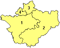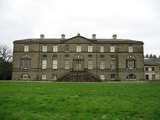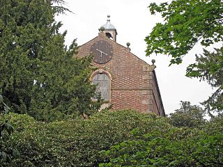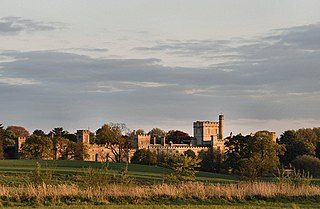
Great Sankey is a civil parish and suburb of Warrington, Cheshire, England. It is 2 miles (3.2 km) west of Warrington town centre and has a population of 24,211.

Congleton was, from 1974 to 2009, a local government district with borough status in Cheshire, England. It included the towns of Congleton, Alsager, Holmes Chapel, Middlewich and Sandbach. The headquarters of the borough council were located in Sandbach.

A civil parish is a country subdivision, forming the lowest unit of local government in England. There are 333 civil parishes in the ceremonial county of Cheshire, most of the county being parished. At the 2001 census, there were 565,259 people living in 332 parishes, accounting for 57.5 per cent of the county's population.

Betchton is a civil parish in the unitary authority of Cheshire East and the ceremonial county of Cheshire, England. According to the 2001 census it had a population of 620, increasing to 677 at the 2011 Census. The parish is immediately to the east of Sandbach, and includes Betchton Heath, Malkin's Bank and Hassall Green.
Astbury was one of the eight ancient parishes of the Macclesfield Hundred of Cheshire, England. It included two chapelries and ten townships. The chapelry of Congleton was an ancient borough and became a municipal borough in 1835. Under the Poor Law Amendment Act 1886 the townships and chapelries became civil parishes in their own right. Nine of the townships became part of Congleton Rural District in 1894. whereas Eaton became part of Macclesfield Rural District. At the same time, the Chapelry of Buglawton was made an Urban Sanitary District before being abolished in 1936. On its abolition 2,865 acres (11.59 km2) were transferred to Congleton, 32 acres (130,000 m2) to Eaton and 14 acres (57,000 m2) to North Rode.

Henbury is a village and civil parish in the unitary authority of Cheshire East and the ceremonial county of Cheshire, England. According to the 2001 census, the entire civil parish had a population of 594. The village is 3.8 miles (6.1 km) west of Macclesfield on the A537.

Church Lawton is a small village and located in the unitary authority of Cheshire East and the ceremonial county of Cheshire in England. Its location is such that its eastern boundary forms part of the county boundary between Cheshire and Staffordshire and, because of its close proximity to Stoke-on-Trent, the parish has a Stoke postcode. In addition to ribbon development connecting Kidsgrove with Scholar Green, the parish also contains the hamlets of Lawton Gate, Lawton Heath and Lawton Heath End, and the Lawton Hall estate. According to the 2001 census, the population of the entire parish was 2,201.

Brereton is a civil parish in the unitary authority of Cheshire East and the ceremonial county of Cheshire, England. According to the 2001 census, the population of the entire civil parish was 1,012, increasing to 1,190 at the 2011 Census. Brereton is mentioned in the Domesday book as the Manor of Bretune. The civil parish includes the hamlets of Brereton Green, Brereton Heath, Smethwick Green, Medhurst Green, Sandlow Green and Davenport.

Hulme Walfield is a small village and civil parish, just north of Congleton, in the unitary authority of Cheshire East and the ceremonial county of Cheshire. It is home to most of Westlow Mere. According to the 2001 census, the population of the civil parish was 140, increasing slightly to 148 at the 2011 Census

Shavington cum Gresty [ʃævɪŋtən] is a civil parish in the unitary authority of Cheshire East and the ceremonial county of Cheshire, England. It lies to the south of Crewe. It includes the large village of Shavington, which lies 2½ miles south of Crewe, as well as the smaller settlements of Dodds Bank, Park Estate, Puseydale, Sugar Loaf and part of Goodall's Corner. Nearby villages include Basford, Hough, Willaston, Wistaston and Wybunbury. The total population of the civil parish is a little under 5,000.

Little Bollington is a village and civil parish in Cheshire, England. The Bridgewater Canal runs through the western side and Dunham Park lies to the north east.

Checkley cum Wrinehill is a civil parish in the unitary authority of Cheshire East and the ceremonial county of Cheshire, England, which lies adjacent to the boundaries with Shropshire and Staffordshire. The hamlet of Checkley lies to the south east of Crewe and to the west of Newcastle-under-Lyme. The parish is largely rural but also includes the small settlements of Bunkers Hill and Randilow. Wrinehill was formerly included in the parish, becoming part of Staffordshire in 1965. Nearby villages include Blakenhall, Bridgemere, Madeley and Woore.

Doddington is a civil parish in the unitary authority of Cheshire East and the ceremonial county of Cheshire, England, which lies to the north east of Audlem and to the south of Crewe. Nearby villages include Blakenhall, Bridgemere, Checkley, Hatherton, Walgherton and Wybunbury. The A51 runs north–south through the parish.

Somerford Booths is a small civil parish in the unitary authority of Cheshire East and the ceremonial county of Cheshire, England. In the census of 2001 it was recorded as having a population of 175. increasing to 181 at the 2011 Census. The civil parish holds a parish council meeting under a grouping scheme with the civil parish of Hulme Walfield, and so it is consequently called Hulme Walfield & Somerford Booths Parish Council. The parish is small and now consists of scattered farms and small groupings of houses, including the hamlet of Newsbank. It contains Somerford Booths Hall as well as Grove House Farm and Broomfield Farm which are shown as ancient buildings on the Ordnance Survey map of the area.

Somerford is a civil parish in the unitary authority of Cheshire East and the ceremonial county of Cheshire, England. It is adjacent to the north west of Congleton, from which town it has some housing overflow. According to the 2001 census, the population of the civil parish was 343, increasing to 430 at the 2011 Census.

Great Moreton Hall is a former country house in Moreton cum Alcumlow near Congleton, in Cheshire, England, less than a mile (1.6 km) from its better-known near namesake Little Moreton Hall. Designed by Edward Blore, it was built in 1841 by Manchester businessman George Holland Ackers, to replace a large timber-framed building that had been the home of the Bellot family since 1602. The house is designed in the style of a Palladian villa, except that the Great Hall is one of a number of rooms off a large central space, rather than being at the centre of the building. Great Moreton Hall is built in two storeys, interspersed with three and four-storey towers. The service wing to the left of and adjoining the main part of the building is slightly lower than the rest of the structure.
Moreton cum Alcumlow is a civil parish in Cheshire East, England, United Kingdom. It contains 13 buildings that are recorded in the National Heritage List for England as designated listed buildings. Of these, one is listed at Grade II*, the middle grade, and the others are at Grade II. The major building in the parish is Great Moreton Hall; this and a number of structures associated with it are listed. The Macclesfield Canal runs through the parish, and four bridges crossing it are listed. Apart from the estate of Great Moreton Hall, the parish is rural, and two farmhouses are also listed.


