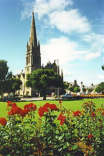
Ballater is a village in Aberdeenshire, Scotland, on the River Dee, immediately east of the Cairngorm Mountains. Situated at an elevation of 213 metres, Ballater is a centre for hikers and known for its spring water, once said to cure scrofula. It is home to more than 1500 inhabitants.

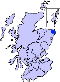
Buchan is an area of north-east Scotland, historically one of the original provinces of the Kingdom of Alba. It is now one of the six committee areas and administrative areas of Aberdeenshire Council, Scotland. These areas were created by the council in 1996, when the Aberdeenshire council area was created under the Local Government etc (Scotland) Act 1994. The council area was formed by merging three districts of the Grampian Region: Banff and Buchan, Gordon and Kincardine and Deeside. The committee area of Buchan was formed from part of the former district of Banff and Buchan.

Aboyne is a village on the edge of the Highlands in Aberdeenshire, Scotland, on the River Dee, approximately 26 miles (42 km) west of Aberdeen. It has a swimming pool at Aboyne Academy, all-weather tennis courts, a bowling green and is home to the oldest 18 hole golf course on Royal Deeside. Aboyne Castle and the Loch of Aboyne are nearby.

Cruden Bay is a small village in Scotland, on the north coast of the Bay of Cruden in Aberdeenshire, 26 miles (42 km) north of Aberdeen.

Insch is a village in the Garioch, Aberdeenshire, Scotland. It is located approximately 28 miles (45 km) from the city of Aberdeen.

Crimond is a village in Aberdeenshire, in the northeast of Scotland, located 9 miles (14 km) northwest of the port of Peterhead and just over 2 miles (3.2 km) from the coast.

Torphins is a village in Royal Deeside, Aberdeenshire, Scotland which lies about 22 miles (35 km) west of Aberdeen. It is situated on the A980, about 7 miles (11 km) north-west of Banchory, and was once served by the Great North of Scotland Railway.

Maud is a village in the Buchan area of the Scottish county of Aberdeenshire, with a population of 780. Located 13 miles (21 km) west of Peterhead on the South Ugie Water, Maud rose to prosperity after 1863 as a railway junction of the Formartine and Buchan Railway that ran through Maud to Fraserburgh and Peterhead, but has always been the meeting place of six roads. It has had a variety of names:

The name Bullers of Buchan refers both to a collapsed sea cave and to the adjacent village, situated about 6 miles (9.7 km) south of Peterhead in Buchan, Aberdeenshire, Scotland.

Newmachar is a village in Aberdeenshire, Scotland about 10 miles (16 km) to the north-west of Aberdeen.

Mintlaw(literally meaning a smooth, flat place) is a large village in Aberdeenshire, Scotland lying along the A952 road and is geographically a route centre. The 2001 UK census records a population of 2,647 people.

Longside is a village located in Aberdeenshire, Scotland, consisting of a single main street. It lies seven miles inland from Peterhead and two miles from Mintlaw on the A950. Its population in 2001 was 721. The River Ugie flows through it.

Strichen is a village in Aberdeenshire, Scotland. It sits on the A981, connecting it to New Deer 7.2 miles (12 km) to the southwest and Fraserburgh 8 miles (13 km) to the north-northeast, and the B9093, connecting it to New Pitsligo about 4 miles (6.4 km) due west. The village got its name from Lord Strachen. It is situated on the River Ugie at the foothills of Mormond Hill. The Strichen White Horse is constructed of quartz on Mormond Hill, some 1,500 m (1,600 yd) northeast of Strichen.

Fetterangus is a small village in Aberdeenshire, Scotland, located just to the north of Mintlaw. Fetterangus is often called "Fishie", though the origin of this nickname is unknown.

Lumphanan is a village in Aberdeenshire, Scotland located 25 miles (40 km) from Aberdeen and 10 miles (16 km) from Banchory.

New Pitsligo, also known as Cavoch, is a village in Aberdeenshire, Scotland, quite near Fraserburgh.

Boddam is a coastal village in Aberdeenshire, Scotland. It is 29 miles (47 km) north of Aberdeen and 3 miles (4.8 km) south of Peterhead. The settlement of Stirling Village lies immediately to the west. Sea cliffs rise to 200 feet (61 m), south of the village: a coastal path leads along these to the Bullers of Buchan.

St Combs is a small fishing village in Aberdeenshire, Scotland, immediately southwest of Inverallochy. It has existed since at least the 17th century, and takes its name from a church to St Colm that used to exist in the area and was abandoned in 1607. Only a fragment of it remains. The remains of Lonmay Castle are also in the area. The village sits across Loch Strathbeg from Rattray.

Hatton of Fintray, commonly referred to as Fintray, is a village on the River Don in Aberdeenshire, Scotland, in the parish of Fintray. It was a textile village and its church dates from 1821, and there used to be a nearby ferry crossing the river.
Edzell Woods is a village in the Kincardine and Mearns area of Aberdeenshire, Scotland. It is 4 miles (6.4 km) from Edzell by road, but only one mile (1.6 km) directly east, over the River North Esk, which forms the boundary between Aberdeenshire and Angus. In 2010 the population of Edzell Woods was 346. Local council services are provided by Aberdeenshire Council and the Westminster parliamentary constituency is West Aberdeenshire and Kincardine.


