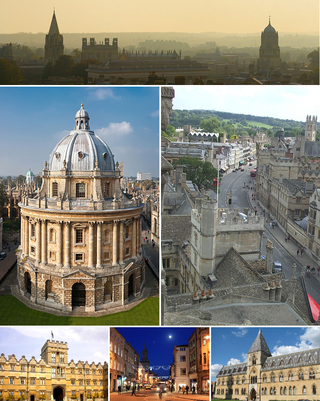
Oxford is a city in England. It is the county town and only city of Oxfordshire. It had a population of 162,100 at the 2021 census. It is 56 miles (90 km) north-west of London, 64 miles (103 km) south-east of Birmingham and 61 miles (98 km) north-east of Bristol. The city is home to the University of Oxford, the oldest university in the English-speaking world; it has buildings in every style of English architecture since late Anglo-Saxon. Oxford's industries include motor manufacturing, education, publishing, information technology and science.

Oxfordshire is a ceremonial and non-metropolitan county in South East England. It is locally governed by Oxfordshire County Council and the lower-tier authorities of its five non-metropolitan districts: City of Oxford, Cherwell, South Oxfordshire, Vale of White Horse, and West Oxfordshire. The county is landlocked and bordered by Northamptonshire to the north-east, Warwickshire to the north-west, Buckinghamshire to the east, Berkshire to the south, Wiltshire to the south-west, and Gloucestershire to the west. The areas of Oxfordshire south of the River Thames were part of the historic county of Berkshire, including the county's highest point, the 261-metre (856 ft) White Horse Hill. The largest settlement in the county is Oxford, its only city, with an estimated population of 151,584.

Oxford Brookes University is a public university in Oxford, England. It is a new university, having received university status through the Further and Higher Education Act 1992. The university was named after its first principal, John Henry Brookes, who played a major role in the development of the institution.

Headington is an eastern suburb of Oxford, England. It is at the top of Headington Hill overlooking the city in the Thames valley below, and bordering Marston to the north-west, Cowley to the south, and Barton and Risinghurst to the east. The life of the large residential area is centred upon London Road, the main road between London and Oxford.

Headington School is an independent girls' school in Headington, Oxford, England, founded by a group of evangelical Christians in 1915. The Good Schools Guide called Headington "A delightful school, [which] nurtures and entertains its pupils while at the same time achieving excellent academic results... fun and stimulating to be at."

St Clement's is a district in Oxford, England, on the east bank of the River Cherwell. "St Clement's" is usually taken to describe a small triangular area from The Plain bounded by the Cherwell in the West, Cowley Road in the East. to the foot of Headington Hill in the South. It also refers to the ecclesiastical parish of St Clement's which includes some neighbouring areas and is used in the names of local City and County electoral districts.

Marston Road is a road in the east of Oxford, England. It links London Place, the junction of St Clements, the foot of Headington Hill, and Morrell Avenue by South Park to the south with the suburb of New Marston to the north. A mini-roundabout has been replaced by traffic lights and connects with Cherwell Drive and Headley Way at the northern end. To the north is the suburb of Northway. The road is designated the B4150 but this is not shown on signs.

Headington Hill Hall stands on Headington Hill in the east of Oxford, England. It was built in 1824 for the Morrell family, who remained in residence for 114 years. It became the home to Pergamon Press and to media tycoon Robert Maxwell. It currently houses Oxford Brookes School of Law.

Headington Hill is a hill in the east of Oxford, England, in the suburb of Headington. The Headington Road goes up the hill leading out of the city. There are good views of the spires of Oxford from the hill, especially from the top of South Park.
Headington Road is an arterial road in the east of Oxford, England. The road connects the junction of St Clements and Marston Road with the suburb of Headington, up Headington Hill. When it reaches the Headley Way junction, it becomes London Road, as the Boundary Brook runs under the road at this point.

Cotuit Hall is part of the EF International Academy's campus in Oxford, England. Until 2011 it was one of the halls of residence at Oxford Brookes University.
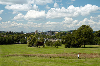
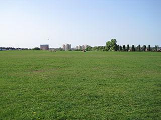
South Park is a park on Headington Hill in east Oxford, England. It is the largest park within Oxford city limits. A good view of the city centre with its historic spires and towers of Oxford University can be obtained at the park's highest point, a favourite location for photographers.
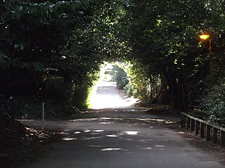
Pullens Lane is in Headington, east Oxford, England. It is located at the top of Headington Hill, leading north off Headington Road to Jack Straw's Lane and Harberton Mead. The cul-de-sac Pullens Field leads off west from Pullens Lane.

The Vines is on Pullens Lane, Headington, a suburb in east Oxford, England. It was the first house to be built on the west side of the lane, on land that was originally owned by the Morrell family, local brewers. The house is built of red brick with stone dressings.
St Clement's Church is an evangelical Church of England parish church situated just to the east of central Oxford, England.
Morrell's Brewing Company, also known as the Lion Brewery, was the only major brewery in Oxford, England. It operated between 1782 and 1998.
Clitterhouse Recreation Ground or Clitterhouse Playing Fields is a park and Site of Local Importance for Nature Conservation in Brent Cross in the London Borough of Barnet. It is a large area of mown grass with a children's playground, bordered by thick hedges. Clitterhouse Stream, a tributary of the River Brent, runs along its eastern border.

Morrell Avenue is a residential tree-lined road in Headington, east Oxford, England.
Dorset House was a large house in Headington, Oxford, England.

Emily Morrell was a British land and brewery owner of the Oxford-based Morrell family.
