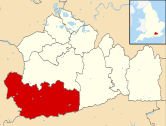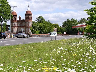
East Horsley is a village and civil parish in Surrey, England, 21 miles southwest of London, on the A246 between Leatherhead and Guildford. Horsley and Effingham Junction railway stations are on the New Guildford line to London Waterloo. The two-halves of ancient Horsley are similar in having substantial woodland and some chalky lower slopes, in the south, of the North Downs.

Frimley Green is a large village and ward of 580 acres (2.3 km2) in the Borough of Surrey Heath in Surrey, England, approximately 30 mi (48 km) southwest of central London. It is 1 mi (1.6 km) south of the town of Frimley.

Banstead is a town in the borough of Reigate and Banstead in Surrey, England. It is 3 miles (5 km) south of Sutton, 5 miles (8 km) south-west of Croydon, 8 miles (13 km) south-east of Kingston-upon-Thames, and 13 miles (21 km) south of Central London.

Artington is a village and civil parish in the borough of Guildford, Surrey, England. It covers the area from the southern edge of the built-up centre of Guildford and steep Guildown, the start of the Hog's Back and part of the North Downs AONB, to New Pond Farm by Godalming and the edge of Peasmarsh. It contains Loseley Park, a country estate with dairy, and the hamlet of Littleton.

Ash is a village and civil parish in the far west of the borough of Guildford, Surrey. Ash is on the eastern side of the River Blackwater, with a station on the Reading-Guildford-Gatwick line, and direct roads to Aldershot, Farnham and Guildford. The 2011 census counted the residents of the main ward of Ash, which excludes Ash Vale, as 6,120. It is within the Aldershot Urban Area and adjoins the riverside in the east of that large town; Ash has a small museum in the local cemetery chapel, a large secondary school and a library.

Peaslake, Hoe, and Colman's Hill are in the centre of the Surrey Hills AONB and mid-west of the Greensand Ridge about 5 miles (8.0 km) ESE of Guildford. Surrounded by denser pine and other coniferous forest-clad hills, the three conjoined settlements have a small core in Peaslake itself with the amenities of a village, but are otherwise lightly scattered settlements at a higher elevation than the centre of Shere, the civil parish.

West Byfleet is a village in Surrey which grew up around its relatively minor stop on the London & South Western Railway: the station, originally Byfleet and Woodham, opened in 1887. More than 1 mile (1.6 km) from the medieval village of Byfleet, the initial concentration of a new development soon established its own economy apart from that of a dependent London commuter village and spread in most directions to its borders including to the border of the old settlement, divided by the shielded M25 motorway today. The first place of worship was dedicated in 1912, the parish of West Byfleet associated with it was established in 1917. The village is bounded to the north by the Basingstoke Canal and to the east by the M25 and the Wey Navigation Canal. Forming part of the contiguous development centred on London and its stockbroker belt just outside the M25 motorway, it is 18 miles from London Heathrow and equidistant between the business parks of Woking and Brooklands. In local government it forms a ward on the same basis as its parish in the Borough of Woking.

West End is a village and civil parish in Surrey Heath, Surrey, England, approximately 25 miles (40 km) southwest of central London. It is midway between the towns of Camberley and Woking, 4 mi (6.4 km) to the west and east respectively. The River Bourne rises from its sources to the immediate west to run through the village. Until the mid 20th century, the West End consisted of a collection of smallholdings surrounded by a substantial area of common land
Hale is a village in Surrey, England or part of Farnham, towards Aldershot excluding the area between the two to the east which is Badshot Lea, and without formal definition in part overlaps Weybourne and Heath End, Surrey. The history of Farnham being a vast town parish in the late medieval age means all three small places overlapping, which are difficult to class as villages, for example Farnham Youth football club is in two possible alternates, or within greater Farnham as its name suggests, and some maps give Lower Hale and Upper Hale but the area between is indistinct and all of the village is quite elevated so this extremely fine distinction unless referring to an extreme end is deprecated. On the side of the Farnham clay and sandstone range. Some housing and roads have views southward towards the Greensand Ridge from Hindhead to Ewhurst. The electoral ward Farnham Upper Hale has a population of 4,241. Often the eastern built-up (low-rise) area, Weybourne is considered separately but both localities share all amenities and form a neatly buffered settlement.
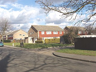
Stanwell Moor is a village and moor in the Borough of Spelthorne, approximately 17 miles (27 km) west of central London. Historically part of the county of Middlesex, it was transferred to Surrey in 1965. West of its generally narrow moor is the M25 London Orbital Motorway and the village is 1 mile (1.6 km) southwest of Heathrow Airport Terminal 5.

Tongham is a village northeast of the town of Farnham in Surrey, England. The village's buildings occupy most of the west of the civil parish, adjoining the A31 and the A331. The boundaries take in Poyle Park in the east and the replacement to Runfold's manor house in the west.
Weybourne is a small village in Surrey, England. It lies on the outskirts of Farnham, Surrey and borders onto Aldershot, Hampshire.
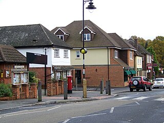
Churt is a village and civil parish in the borough of Waverley in Surrey, England, about 5.5 miles (8.9 km) south of the town of Farnham on the A287 road towards Hindhead. A clustered settlement is set in areas acting as its green buffers, which include the Devil's Jumps. The west of the village slopes down to the steep edge of Whitmore Vale, which is mostly in Headley, Hampshire; at the foot of this bank is a steeply cut brook which defines the Hampshire border. There are forests and heathland by and atop the Greensand Ridge, and the hamlet of Crosswater is in the north of the parish.
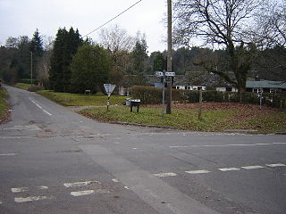
Seale and Sands is a civil parish in the Guildford District Council area of Surrey, England with a population of 887. The principal settlement is Seale; other places include Sandy Cross and The Sands.
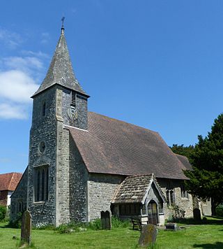
Horne is a rural village and civil parish in the District of Tandridge in Surrey, England. The parish includes the hamlet of Newchapel, where the British Wildlife Centre is situated. Eastern fields forming a narrow part of the parish are split by the A22 road, a main road to East Grinstead.

Dockenfield is a linear settlement and rural civil parish in the borough of Waverley in Surrey, England. The parish is undulating, has a number of sources of the River Wey and borders the Alice Holt Forest.

St Johns and Hook Heath is a suburban ward in Surrey consisting of two settlements founded in the 19th century in the medieval parish of Woking. The two 'villages' have residents' associations and are centred 2.5 km WSW and SW of Woking's town centre in the northwest of the English county – by including such suburbs, Woking is the largest town in the county. The ward in 2011 contained 1,888 homes across its 3.46 square kilometres (1.34 sq mi).

Sheerwater is a residential neighbourhood or small suburb of Woking, in the Woking district in Surrey, England, occasionally described as a village, between West Byfleet and Horsell. Its border is defined to the north by a gently winding part of the Basingstoke Canal and to the south by the South West Main Line which passes from cutting level to that of an embankment. The neighbourhood has a business park and light industry at its south-western end. The whole area is linear, includes diverse green spaces to north and south, and covers 92 hectares.

Pixham is a chapelry within the parish of Dorking, Surrey on the near side of the confluence of the River Mole and the Pipp Brook to its town, Dorking, which is centred 1 km (0.6 mi) southwest. The town as a whole, uniquely in Surrey, has three railway stations; Pixham adjoins or is the location of two of the three; and is near the junction of the A24 and A25 main roads.

Nether Haddon is a sparsely populated village and civil parish in Derbyshire, England. It is immediately downstream along the River Wye from the small town of Bakewell and much of its land is owned by Haddon Hall, a medieval and Tudor building largely rendered in stone. The population of the village is included in the civil parish of Over Haddon.


