North East Derbyshire is a local government district in Derbyshire, England. The council is based in the large village of Wingerworth. The district also includes the towns of Dronfield and Clay Cross as well as numerous villages and surrounding rural areas.

Swadlincote is a former mining town in the district of South Derbyshire, England, lying within The National Forest area. It borders the counties of Leicestershire and Staffordshire, 5 miles (8 km) south-east of Burton upon Trent and north-west of Ashby-de-la-Zouch, 24 miles (39 km) north-east of Birmingham and 12 miles (19 km) south-west of Derby. It also covers Newhall, Oversetts, Midway and the suburban villages of Church Gresley and Woodville, with the sub-district of Goseley. It has a population of some 36,000. Castle Gresley is 2 miles (3 km) to the south-west and Albert Village 1.5 miles (2 km) to the south.

Bolsover is a constituency in Derbyshire, represented in the House of Commons of the UK Parliament by Mark Fletcher, a member of the Conservative Party. The constituency was created in 1950, and is centred on the town of Bolsover.

North East Derbyshire is a constituency created in 1885 represented in the House of Commons of the UK Parliament since 2017 by Lee Rowley of the Conservative Party. This was the first time a Conservative candidate had been elected since 1935.

Temple Normanton is a village and a civil parish in the North East Derbyshire district in Derbyshire, England. The population of the civil parish at the 2011 census was 490.

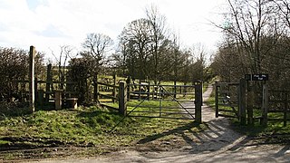
Heath is a village in the North East Derbyshire district of the English county of Derbyshire.

North Wingfield is a large village and civil parish in the North East Derbyshire district in the county of Derbyshire, England. Located approximately 4½ miles south-east of Chesterfield, and 1 mile north-east of Clay Cross. The population of the civil parish as of the 2011 census was 6,505. The A6175 road from the M1 motorway to the A61 road runs through the village.
North East Derbyshire District Council elections are held every four years. North East Derbyshire District Council is the local authority for the non-metropolitan district of North East Derbyshire in Derbyshire, England. Since the last boundary changes in 2019, 53 councillors have been elected from 24 wards.
Pilsley is a village and civil parish in the district of North East Derbyshire in the county of Derbyshire, England. It is located near to the town of Chesterfield. At the 2011 Census the population was 3,487.

Sudbury is a village and civil parish in Derbyshire, England, located about 9 miles (14 km) south of Ashbourne. It is part of the Derbyshire Dales district. The population as recorded at the 2001 Census was 976, increasing to 1,010 at the 2011 Census. The £0.5m A50 bypass opened in 1972. The parish includes the hamlets of Aston, Aston Heath, Dalebrook and Oaks Green.

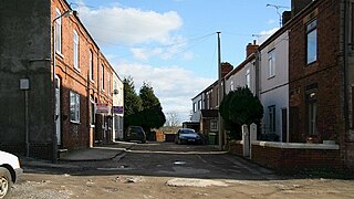
Holmewood is a village in the North East Derbyshire district of Derbyshire, England. Historically a coal mining village, it has close links to the villages of Heath, North Wingfield and Temple Normanton. It is in the civil parish of Heath and Holmewood.
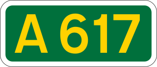
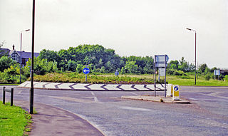
The A617 road runs through the northern East Midlands, England, between Newark-on-Trent and Chesterfield.
Allen Turner was an English cricketer who played first-class cricket for Derbyshire in 1920.
Heath railway station was a railway station in the village of Holmewood, Derbyshire. The station name of Heath was named after the neighbouring village of Heath although the station was in Holmewood instead.
Heath and Holmewood is a civil parish in the North East Derbyshire district of Derbyshire, England. The parish contains seven listed buildings that are recorded in the National Heritage List for England. All the listed buildings are designated at Grade II, the lowest of the three grades, which is applied to "buildings of national importance and special interest". The parish contains the villages of Heath and Holmewood, and the surrounding area. The listed buildings consist of farmhouses, a thatched cottage, parts of a former house, a church, and the ruins of a former church.