The East Midlands is one of nine official regions of England at the first level of ITL for statistical purposes. It comprises the eastern half of the area traditionally known as the Midlands. It consists of Derbyshire, Leicestershire, Lincolnshire, Northamptonshire, Nottinghamshire and Rutland. The region has an area of 15,627 km2 (6,034 sq mi), with a population over 4.5 million in 2011. The most populous settlements in the region are Derby, Leicester, Lincoln, Mansfield, Northampton and Nottingham. Other notable settlements include Boston, Buxton, Chesterfield, Corby, Gainsborough, Glossop, Grantham, Hinckley, Kettering, Loughborough, Louth, Mansfield, Market Harborough, Matlock, Newark-on-Trent, Oakham, Skegness, Wellingborough and Worksop.

Nottinghamshire is a landlocked county in the East Midlands region of England, bordering South Yorkshire to the north-west, Lincolnshire to the east, Leicestershire to the south, and Derbyshire to the west. The traditional county town is Nottingham, though the county council is based at County Hall in West Bridgford in the borough of Rushcliffe, at a site facing Nottingham over the River Trent.
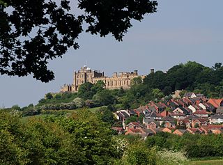
Bolsover is a market town and the administrative centre of the Bolsover District, Derbyshire, England. It is 145 miles (233 km) from London, 18 miles (29 km) from Sheffield, 26 miles (42 km) from Nottingham and 27 miles (43 km) from Derby. It is the main town in the Bolsover district.
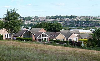
North East Derbyshire is a local government district in Derbyshire, England. It borders the districts of Chesterfield, Bolsover, Amber Valley and Derbyshire Dales in Derbyshire, and Sheffield and Rotherham in South Yorkshire. The population of the district as taken at the 2011 Census was 99,023. The district council is a non-constituent partner member of the Sheffield City Region Combined Authority. The district is a non-constituent member of the Sheffield City Region and shares a membership along with neighbouring Derbyshire Dales, Borough of Chesterfield, Bolsover District and Bassetlaw District in Nottinghamshire. The district is also part of The Derby, Derbyshire, Nottingham and Nottinghamshire Local Enterprise Partnership.

Grimethorpe is a large village in the metropolitan borough of Barnsley in South Yorkshire, England. Historically within the West Riding of Yorkshire, it had a population of 4,672 at the 2011 census. Grimethorpe is located to the east of Barnsley and south of Hemsworth; until the local government reorganisation of 1974, it was part of the Hemsworth district and constituency. At the 2011 Census the village was part of the North East ward of Barnsley MBC.

Swadlincote is a former mining town in the district of South Derbyshire, England, lying within The National Forest area. It borders the counties of Leicestershire and Staffordshire, 5 miles (8 km) south-east of Burton upon Trent and north-west of Ashby-de-la-Zouch, and 11.5 miles (19 km) south-west of Derby. It also covers Newhall, Oversetts, Midway and the villages of Church Gresley and Woodville, with the sub-district of Goseley. It has a population of some 36,000. Castle Gresley is 2 miles (3 km) to the south-west and Albert Village 1.5 miles (2 km) to the south.

Ashmore Park is a large housing estate in Wednesfield, England. It has been part of the city of Wolverhampton, West Midlands since 1966, when the majority of Wednesfield was incorporated into Wolverhampton. It constitutes mostly of the Wednesfield North ward of the Wolverhampton council.

Haydock is a village within the Metropolitan Borough of St Helens, in Merseyside, England. At the 2011 Census, it had a population of 11,416 Haydock's historic area covers the Haydock electoral ward and a section of the Blackbrook ward.
Horden is a village and electoral ward in County Durham, England. It is situated on the North Sea coast, to the east of Peterlee, approximately 12 miles south of Sunderland. Horden was a mining village until the closure of the Horden Colliery in 1987. Main features include the Welfare and Memorial Parks and St Mary's church. It is connected to the villages of Blackhall Colliery and Blackhall Rocks to its south by a spectacular rail viaduct which spans Castle Eden Dene near Denemouth. Horden Dene provides Horden's northern boundary with Easington Colliery.

Gleadless is a suburb and parish within the City of Sheffield, it lies five km south east of the city centre. It is bordered by the adjoining suburbs of Gleadless Valley to the west, Frecheville to the east and Intake to the north. The land to the south is the rural area of North East Derbyshire district which is outside the city boundary. Gleadless was formerly a country hamlet, then village before becoming part of the expanding city of Sheffield in 1921. The word Gleadless comes from the Old English language and means either “forest clearings haunted by a kite” or “bright clearing”.

Killamarsh is a town and civil parish in North East Derbyshire, England, bordering Sheffield and South Yorkshire to the north-west. Killamarsh is surrounded by, in a clockwise direction from the north, Rother Valley Country Park, the village of Wales, South Yorkshire, Kiveton, Woodall, Harthill, Barlborough, Spinkhill, Renishaw, Eckington, and the Sheffield suburbs of Oxclose, Halfway and Holbrook.
Fitzwilliam is a small village on the edge of West Yorkshire, England, in the City of Wakefield district. The village falls within the Hemsworth ward of Wakefield City Council.

Temple Normanton is a village and a civil parish in the North East Derbyshire district in Derbyshire, England. The population of the civil parish at the 2011 census was 490.

Heath is a village in the North East Derbyshire district of the English county of Derbyshire.

Ton Pentre is a village in the Rhondda Valley in the county borough of Rhondda Cynon Taf, Wales. Historically part of Glamorgan, Ton Pentre, a former industrial coal mining village, is a district of the community of Pentre. The old district of Ystradyfodwg was named after the church at Ton Pentre. Ton Pentre is, perhaps, best known for an event in 1924, when the Duke of York played a round of golf with Trade Unionist Frank Hodges.

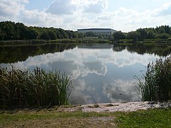
Pinxton is a village and civil parish in Derbyshire on the eastern boundary of Nottinghamshire, England, just south of the Pinxton Interchange at Junction 28 of the M1 motorway where the A38 road meets the M1. Pinxton is part of the Bolsover District and at the 2011 Census had a population of 5,699. "Pinxton CCTV level crossing", located on the up and down Kirkby lines, is a major tourist attraction for train enthusiasts who come from all over the country to take photographs of some of the unique locomotives that pass over the crossing.

Micklefield is a village and civil parish east of Leeds, West Yorkshire, England. It neighbours Garforth, Aberford and Brotherton and is close to the A1 Motorway. It is in the City of Leeds metropolitan borough. The population as of the 2011 Census was 1,893, increased from 1,852 in 2001.

Snibston is an area east of Ravenstone, north west Leicestershire, in the English Midlands. Originally rural, part of Snibston was transformed into a coal mining village by the opening of coal mines by the Snibston Colliery Company in the early 1830s. This industrial part of Snibston was subsequently subsumed into the developing town of Coalville, though small rural areas of Snibston survive within the civil parishes of Ravenstone with Snibston and Hugglescote and Donington le Heath. In the part of Snibston within the latter civil parish stands the 13th-century church of St Mary, noted as the smallest church still in use for regular worship in England. The main Snibston Colliery was sunk in 1831, and after its closure the Snibston Country Park with the Snibston Discovery Museum was built on part of the colliery site. Part of the park is Snibston Grange Local Nature Reserve. The population is included in the civil parish of Ravenstone with Snibston.

Ashington is a town and civil parish in Northumberland, England, with a population of 27,864 at the 2011 Census. It was once a centre of the coal mining industry. The town is 15 miles (24 km) north of Newcastle upon Tyne, west of the A189 and bordered to the south by the River Wansbeck. The North Sea coast at Newbiggin-by-the-Sea is 3 miles (5 km) away.
Brunswick Village is a village split between North Tyneside and Newcastle upon Tyne, Tyne and Wear, England. It is situated approximately 6 miles north of Newcastle upon Tyne, and borders Hazlerigg, Dinnington and Wideopen. It was formerly known as Dinnington Colliery.