Hemlock, Michigan

Last updated
Hemlock, Michigan
Hemlock, MI (September 2022).jpg
Looking west along M-46 at N. Hemlock Road
Hemlock, MI location.png
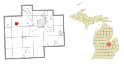
Location within Saginaw County
USA Michigan location map.svg
Red pog.svg
Hemlock
Location within the state of Michigan
Usa edcp location map.svg
Red pog.svg
Hemlock
Location within the United States
Coordinates: 43°25′07″N84°13′52″W / 43.41861°N 84.23111°W / 43.41861; -84.23111 [1]
Country United States
State Michigan
County Saginaw
Township Richland
Area
[2]
  Total2.78 sq mi (7.19 km2)
  Land2.75 sq mi (7.13 km2)
  Water0.02 sq mi (0.06 km2)
Elevation
[1]
650 ft (200 m)
Population
 (2020)
  Total1,408
  Density511.63/sq mi (197.55/km2)
Time zone UTC-5 (Eastern (EST))
  Summer (DST) UTC-4 (EDT)
ZIP code(s)
48626
Area code 989
FIPS code 26-37600 [3]
GNIS feature ID2393046 [1]

Hemlock is an unincorporated community in Richland Township, Saginaw County in the U.S. state of Michigan. It is also a census-designated place (CDP) for statistical purposes, but without any legal status as an incorporated municipality. The population of the CDP was 1,585 at the 2000 census. The area included in the CDP is in the south central portion of Richland Township. [4] The Hemlock post office, with ZIP code 48626, serves nearly all of Richland Township, as well as portions of Fremont Township to the south, small areas of Thomas and Swan Creek townships to the southeast, and part of Ingersoll Township to the north in Midland County. [5]

Contents

History

The community was first settled in 1865. A Post Office was established in 1869 with the name "Hemlock City". This was shortened to Hemlock in 1895. [6] [7] [8] Its annual festival, known as Sawdust Days, is held in September. [9] The festival started in the late 1970s after the local hardware store held a chainsaw promotion and demonstration on the third Saturday of September. [10]

Geography

According to the United States Census Bureau, the CDP has a total area of 2.5 square miles (6.5 km2), all land.

Demographics

Historical population
CensusPop.Note
2020 1,408
U.S. Decennial Census [11]

As of the census [3] of 2000, there were 1,585 people, 618 households, and 443 families residing in the CDP. The population density was 624.1 inhabitants per square mile (241.0/km2). There were 650 housing units at an average density of 255.9 per square mile (98.8/km2). The racial makeup of the CDP was 97.98% White, 0.13% African American, 0.32% Native American, 0.06% Asian, 1.32% from other races, and 0.19% from two or more races. Hispanic or Latino of any race were 2.78% of the population.

Out of the 618 households, 38.0% had children under the age of 18 living with them, 52.1% were married couples living together, 15.2% had a female householder with no husband present, and 28.3% were non-families. 24.8% of all households were made up of individuals, and 9.9% had someone living alone who was 65 years of age or older. The average household size was 2.55 and the average family size was 3.03.

In the CDP, the population was spread out, with 29.5% under the age of 18, 6.9% from 18 to 24, 30.6% from 25 to 44, 20.3% from 45 to 64, and 12.7% who were 65 years of age or older. The median age was 34 years. For every 100 females, there were 90.0 males. For every 100 females age 18 and over, there were 82.7 males.

The median income for a household in the CDP was $40,846, and the median income for a family was $45,074. Males had a median income of $42,448 versus $23,512 for females. The per capita income for the CDP was $18,085. About 9.5% of families and 9.9% of the population were below the poverty line, including 8.1% of those under age 18 and 7.0% of those age 65 or over.

Related Research Articles

<span class="mw-page-title-main">Waverly, Michigan</span> Census-designated place & unincorporated community in Michigan, United States

Waverly is an unincorporated community in Eaton County in the U.S. state of Michigan. It is a census-designated place (CDP) for statistical purposes and has no legal status as a municipality. The population was 23,925 at the 2010 census, up from 16,194 at the 2000 census. Waverly is home to the Lansing Mall and Waverly Community Schools.

Campbell Township is a civil township of Ionia County in the U.S. state of Michigan. The population was 2,243 at the 2000 census.

Sherman Township is a civil township of Iosco County in the U.S. state of Michigan. The population was 493 at the 2000 census and slightly decreased to 448 at the 2010 census.

<span class="mw-page-title-main">Michigamme, Michigan</span> Place in Michigan, United States

Michigamme is an unincorporated community in Marquette County in the U.S. state of Michigan. It is located within Michigamme Township on the north shores of Lake Michigamme. For statistical purposes, the United States Census Bureau has defined Michigamme as a census-designated place (CDP). The CDP had a population of 255 at the 2020 census.

<span class="mw-page-title-main">Canadian Lakes, Michigan</span> Census-designated place & unincorporated community in Michigan, United States

Canadian Lakes is an unincorporated community in Mecosta County in the U.S. state of Michigan. The area is mostly within the southwest portion of Morton Township, southwest of Mecosta and east of Stanwood.

Morton Township is a civil township of Mecosta County in the U.S. state of Michigan. The population was 3,597 at the 2000 census.

<span class="mw-page-title-main">Temperance, Michigan</span> Census-designated place & unincorporated community in Michigan, United States

Temperance is an unincorporated community and census-designated place (CDP) in Monroe County in the U.S. state of Michigan. The population was 9,188 at the 2020 census. The CDP is located within Bedford Township.

<span class="mw-page-title-main">Brant Township, Michigan</span> Civil township in Michigan, United States

Brant Township is a civil township of Saginaw County in the U.S. state of Michigan. As of the 2010 Census, the township population was 2,012.

<span class="mw-page-title-main">Bridgeport, Michigan</span> Census-designated place & unincorporated community in Michigan, United States

Bridgeport is an unincorporated community in Bridgeport Charter Township, Saginaw County in the U.S. state of Michigan. It is also a census-designated place (CDP) for statistical purposes. The population was 6,571 at the 2020 census. Bridgeport is also the name of a post office with ZIP code 48722. The area served by the ZIP code includes the southeast portion of the CDP and includes southeastern portions of Bridgeport Charter Township outside of the CDP as well as portions of southwest Frankenmuth Township and a small area of northeastern Birch Run Township. The remainder of the CDP area is served by the Saginaw ZIP code 48601.

<span class="mw-page-title-main">Burt, Michigan</span> Census-designated place & unincorporated community in Michigan, United States

Burt is a census-designated place (CDP) and Unincorporated community for statistical purposes in Taymouth Township, Saginaw County in the U.S. state of Michigan. The CDP's population was 1,122 at the 2000 census. Burt is also the name of a post office with ZIP code 48417, which includes the area of the CDP as well as portions of Taymouth Township to the north of the CDP and the eastern part of Albee Township and a small area of southeastern Spaulding Township. The town is named for Wellington R. Burt.

<span class="mw-page-title-main">Carrollton Township, Michigan</span> Civil township in Michigan, United States

Carrollton Township is a civil township of Saginaw County in the U.S. state of Michigan. The population was 6,103 at the 2010 census. Established in 1866, Carrollton contains a full-time police department, fire department, parks and recreation services, as well as its own public school system, Carrollton Public Schools. Along with being located on the Saginaw River, Carrollton offers close access to shopping malls, medical facilities, Saginaw Valley State University, and I-75.

<span class="mw-page-title-main">Freeland, Michigan</span> Census-designated place & unincorporated community in Michigan, United States

Freeland is a census-designated place in Tittabawassee Township, Saginaw County in the U.S. state of Michigan. It is part of the Saginaw-Midland-Bay Metropolitan Area. As of the 2000 census, the CDP population was 5,147. The CDP covers an area in the central portion of Tittabawassee Township. The Freeland post office, ZIP code 48623, serves nearly the entire township, as well as portions of Midland and Williams townships to the north, Frankenlust and Kochville townships to the east, Thomas and Richland townships to the south, and Ingersoll Township to the west.

<span class="mw-page-title-main">Richland Township, Saginaw County, Michigan</span> Civil township in Michigan, United States

Richland Township is a civil township of Saginaw County in the U.S. state of Michigan. The 2010 Census placed the population at 4,144, which is a decrease from the 4,281 residents recorded at the 2000 Census.

Elk Township is a civil township of Sanilac County in the U.S. state of Michigan. The population was 1,522 at the 2020 census.

Minden Township is a civil township of Sanilac County in the U.S. state of Michigan. The population was 633 at the 2000 census.

<span class="mw-page-title-main">Akron Township, Michigan</span> Township in Michigan, United States

Akron Township is a civil township of Tuscola County in the U.S. state of Michigan. The population was 1,379 at the 2020 Census.

Tuscola Township is a civil township of Tuscola County in the U.S. state of Michigan. The population was 2,082 at the 2010 Census.

<span class="mw-page-title-main">Franklin Township, Lenawee County, Michigan</span> Civil township in Michigan, United States

Franklin Township is a civil township of Lenawee County in the U.S. state of Michigan. The population was 2,939 at the 2000 census.

<span class="mw-page-title-main">Richland Township, Missaukee County, Michigan</span> Civil township in Michigan, United States

Richland Township is a civil township of Missaukee County in the U.S. state of Michigan. The population was 1,491 at the 2010 census.

Richland Township is a civil township of Montcalm County in the U.S. state of Michigan. The population was 2,868 at the 2000 census.

References

  1. 1 2 3 U.S. Geological Survey Geographic Names Information System: Hemlock, Michigan
  2. "2020 U.S. Gazetteer Files". United States Census Bureau. Retrieved May 21, 2022.
  3. 1 2 "U.S. Census website". United States Census Bureau . Retrieved 2008-01-31.
  4. There are two elementary schools, one middle school, and one high school. There are also smaller religious schools that may lead up to the high school level. Hemlock CDP, Michigan - Reference Map - American FactFinder [ permanent dead link ], U.S. Census Bureau, 2000 census
  5. 48626 5-Digit ZCTA, 486 3-Digit ZCTA - Reference Map - American FactFinder [ permanent dead link ], U.S. Census Bureau, 2000 census
  6. History of Saginaw County, Michigan. Mills, James Cooke. Saginaw: Seeman & Peters, 1918 pp. 414-417
  7. Romig, Walter (1986) [1973]. Michigan Place Names. Detroit, Michigan: Wayne State University Press. ISBN   0-8143-1838-X.
  8. Hemlock In The Headlines. Bohn, Matt. Bloomington: 1st Books, 2003 ISBN   1-4107-4406-X
  9. "Hemlock Sawdust Days – September 16-18, 2016". www.hemlocksawdustdays.com. Retrieved 2017-08-24.
  10. "Hemlock Sawdust Days". www.facebook.com. Retrieved 2017-08-24.
  11. "Census of Population and Housing". Census.gov. Retrieved June 4, 2016.