Shields, Michigan

Last updated

Shields, Michigan
Sheilds, MI (September 2022).jpg
Road signage looking east along M-46
Shields, MI location.png
Location within Saginaw County
USA Michigan location map.svg
Red pog.svg
Shields
Location within the state of Michigan
Usa edcp location map.svg
Red pog.svg
Shields
Location within the United States
Coordinates: 43°25′16″N84°04′29″W / 43.42111°N 84.07472°W / 43.42111; -84.07472 [1]
Country United States
State Michigan
County Saginaw
Townships James and Thomas
Area
[2]
  Total8.04 sq mi (20.81 km2)
  Land7.88 sq mi (20.40 km2)
  Water0.16 sq mi (0.41 km2)
Elevation
[1]
604 ft (184 m)
Population
 (2020)
  Total7,035
  Density892.99/sq mi (344.78/km2)
Time zone UTC-5 (Eastern (EST))
  Summer (DST) UTC-4 (EDT)
ZIP code(s)
48609 (Saginaw)
Area code 989
FIPS code 26-73560 [3]
GNIS feature ID2393234 [1]

Shields is an unincorporated community in Thomas Township, Saginaw County in the U.S. state of Michigan. It is also a census-designated place (CDP) for statistical purposes, but with no legal status as an incorporated municipality. The population of the CDP was 7,035 at the 2020 census.

Contents

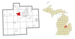
The community of Shields is located on M-46/Gratiot Road just west of the Tittabawassee River. [1] In the 2000 census, the CDP included an area bounded on the east by the Tittabawassee River, north to State Street, west to N. Miller Road, south to Geddes Road, west to N. Thomas Road, south to M-46/Gratiot Road, east to Swan Creek, south to the railroad crossing on Schomaker Road, east along the rail tracks to Stroebel Road, northwest to Ronald Drive and east to the Tittabawassee River. Most of the CDP is within Thomas Township with a small portion extending into northwest James Township. [4]

History

A post office operated in Shields from August 15, 1894 until Dec 15, 1902. [5]

The Shields brothers William and Arthur were born in 1826 and 1830 respectively in County Armagh [lower-alpha 1] , Ireland. Along with their family, they immigrated to Michigan settling in Thomas Township in 1842. The bachelor brothers settled on 160 acres (0.65 km2) in section three. Eventually the southeastern part of the Township came to be known as the Shields area. [6]

Paines is a place within James Township and the CDP located on Dutch Road between River Roads and Stroebel Roads. [7] [8] Paines was first settled in 1871 and named for A. B. Paine, a local brick manufacturer. It was a station at the junction of the Michigan Central and the Pere Marquette rail lines. A post office named "Painesville" was established on October 10, 1873, closed on May 29, 1876, and reopened on July 14, 1876. The office was renamed "Paines" on October 19, 1880 and continued until June 30, 1904. [9] [10]

Geography

According to the United States Census Bureau, the CDP has a total area of 6.6 square miles (17 km2), of which 6.5 square miles (17 km2) is land and 0.1 square miles (0.26 km2) (1.06%) is water.

Demographics

Historical population
CensusPop.Note
2020 7,035
U.S. Decennial Census [11]

As of the census [3] of 2000, there were 6,590 people, 2,508 households, and 1,875 families residing in the CDP. The population density was 1,007.9 inhabitants per square mile (389.2/km2). There were 2,587 housing units at an average density of 395.7 per square mile (152.8/km2). The racial makeup of the CDP was 96.74% White, 0.80% African American, 0.27% Native American, 0.52% Asian, 0.74% from other races, and 0.93% from two or more races. Hispanic or Latino of any race were 3.32% of the population.

There were 2,508 households, out of which 31.8% had children under the age of 18 living with them, 63.4% were married couples living together, 8.5% had a female householder with no husband present, and 25.2% were non-families. 21.7% of all households were made up of individuals, and 8.7% had someone living alone who was 65 years of age or older. The average household size was 2.56 and the average family size was 2.98.

In the CDP, the population was spread out, with 24.4% under the age of 18, 7.6% from 18 to 24, 25.3% from 25 to 44, 28.5% from 45 to 64, and 14.2% who were 65 years of age or older. The median age was 41 years. For every 100 females, there were 90.3 males. For every 100 females age 18 and over, there were 88.5 males.

As of the census of 2010, the median income for a household in the CDP was $52,457, and the median income for a family was $62,566. Males working full-time and year-round had a median income of $44,018 versus $39,471 for full-time, year-round working females. The per capita income for the CDP was $24,397. About 4.4% of families and 4.7% of the population were below the poverty line, including 5.1% of those under age 18 and 7.6% of those age 65 or over. [12]

Related Research Articles

<span class="mw-page-title-main">Gratiot County, Michigan</span> County in Michigan, United States

Gratiot County is a county in the U.S. state of Michigan. As of the 2020 Census, the population was 41,761. The county seat is Ithaca, although its most populous city is Alma.

<span class="mw-page-title-main">Frankenlust Township, Michigan</span> Civil township in Michigan, United States

Frankenlust Township is a civil township of Bay County in the U.S. state of Michigan. The 2020 Census placed the population at 3,672. This is a 3.1% increase from the 3,562 recorded at the 2010 Census, the second largest increase in Bay County during that time period. The 2000 Census recorded 2,530. It is included in the Bay City Metropolitan Statistical Area. It is home to Delta College.

<span class="mw-page-title-main">Greendale Township, Michigan</span> Civil township in Michigan, United States

Greendale Township is a civil township of Midland County in the U.S. state of Michigan. As of the 2020 census, the township population was 1,731.

<span class="mw-page-title-main">Larkin Charter Township, Michigan</span> Charter township in Michigan, United States

Larkin Charter Township is a charter township of Midland County in the U.S. state of Michigan. The population was 5,331 at the 2020 census.

<span class="mw-page-title-main">Brant Township, Michigan</span> Civil township in Michigan, United States

Brant Township is a civil township of Saginaw County in the U.S. state of Michigan. As of the 2010 Census, the township population was 2,012.

<span class="mw-page-title-main">Bridgeport, Michigan</span> Census-designated place & unincorporated community in Michigan, United States

Bridgeport is an unincorporated community in Bridgeport Charter Township, Saginaw County in the U.S. state of Michigan. It is also a census-designated place (CDP) for statistical purposes. The population was 6,571 at the 2020 census. Bridgeport is also the name of a post office with ZIP code 48722. The area served by the ZIP code includes the southeast portion of the CDP and includes southeastern portions of Bridgeport Charter Township outside of the CDP as well as portions of southwest Frankenmuth Township and a small area of northeastern Birch Run Township. The remainder of the CDP area is served by the Saginaw ZIP code 48601.

<span class="mw-page-title-main">Bridgeport Charter Township, Michigan</span> Charter township in Michigan, United States

Bridgeport Charter Township is a charter township of Saginaw County in the U.S. state of Michigan. The 2020 Census placed the population at 10,104.

<span class="mw-page-title-main">Buena Vista Charter Township, Michigan</span> Charter township in Michigan, United States

Buena Vista Charter Township is a charter township of Saginaw County in the U.S. state of Michigan. Per the 2020 census, the population was 7,664.

<span class="mw-page-title-main">Carrollton Township, Michigan</span> Civil township in Michigan, United States

Carrollton Township is a civil township of Saginaw County in the U.S. state of Michigan. The population was 6,103 at the 2010 census. Established in 1866, Carrollton contains a full-time police department, fire department, parks and recreation services, as well as its own public school system, Carrollton Public Schools. Along with being located on the Saginaw River, Carrollton offers close access to shopping malls, medical facilities, Saginaw Valley State University, and I-75.

<span class="mw-page-title-main">Freeland, Michigan</span> Census-designated place & unincorporated community in Michigan, United States

Freeland is a census-designated place in Tittabawassee Township, Saginaw County in the U.S. state of Michigan. It is part of the Saginaw-Midland-Bay Metropolitan Area. As of the 2000 census, the CDP population was 5,147. The CDP covers an area in the central portion of Tittabawassee Township. The Freeland post office, ZIP code 48623, serves nearly the entire township, as well as portions of Midland and Williams townships to the north, Frankenlust and Kochville townships to the east, Thomas and Richland townships to the south, and Ingersoll Township to the west.

<span class="mw-page-title-main">James Township, Michigan</span> Civil township in Michigan, United States

James Township is a civil township of Saginaw County in the U.S. state of Michigan. The population was 2,023 at the 2010 Census.

<span class="mw-page-title-main">Lakefield Township, Saginaw County, Michigan</span> Civil township in Michigan, United States

Lakefield Township is a civil township of Saginaw County in the U.S. state of Michigan. The population was 1,029 at the 2010 Census.

<span class="mw-page-title-main">Marion Township, Saginaw County, Michigan</span> Civil township in Michigan, United States

Marion Township is a civil township of Saginaw County in the U.S. state of Michigan. The population was 923 at the 2010 Census.

<span class="mw-page-title-main">Saginaw Charter Township, Michigan</span> Charter township in Michigan, United States

Saginaw Charter Township is a charter township of Saginaw County in the U.S. state of Michigan. The population was 41,679 at the 2020 census. The city of Saginaw is adjacent to the township to the southeast, but is administratively autonomous.

<span class="mw-page-title-main">Saginaw Township North, Michigan</span> Place in Michigan, United States

Saginaw Township North is an unincorporated community and former census-designated place (CDP) in Saginaw County in the U.S. state of Michigan. The community is located within Saginaw Charter Township, and the CDP boundaries consisted of most of the northern portion of the township. Saginaw Township South is in the southern portion of the township.

<span class="mw-page-title-main">Saginaw Township South, Michigan</span> Place in Michigan, United States

Saginaw Township South is an unincorporated community and former census-designated place (CDP) in Saginaw County in the U.S. state of Michigan. The community is located within Saginaw Charter Township, and the CDP boundaries consisted of the southern portion of the township. Saginaw Township North is in the northern portion of the township.

<span class="mw-page-title-main">Taymouth Township, Michigan</span> Civil township in Michigan, United States

Taymouth Township is a civil township of Saginaw County in the U.S. state of Michigan. The population was 4,520 at the 2010 Census.

<span class="mw-page-title-main">Thomas Township, Michigan</span> Civil township in Michigan, United States

Thomas Township is a civil township of Saginaw County in the U.S. state of Michigan. The 2020 Census places the population at 11,931.

<span class="mw-page-title-main">Tittabawassee Township, Michigan</span> Civil township in Michigan, United States

Tittabawassee Township is a civil township of Saginaw County in the U.S. state of Michigan. The 2020 Census placed the population at 10,691. The township is named for the Tittabawassee River.

<span class="mw-page-title-main">Mills Township, Midland County, Michigan</span> Civil township in Michigan, United States

Mills Township is a civil township of Midland County in the U.S. state of Michigan, United States. The population was 1,775 at the 2020 census, down from 1,939 in 2010.

References

  1. 1 2 3 4 U.S. Geological Survey Geographic Names Information System: Shields, Michigan
  2. "2020 U.S. Gazetteer Files". United States Census Bureau. Retrieved May 21, 2022.
  3. 1 2 "U.S. Census website". United States Census Bureau . Retrieved January 31, 2008.
  4. Shields CDP, Michigan Reference Map Archived 2020-02-12 at archive.today , U.S. Census Bureau, 2000 census
  5. U.S. Geological Survey Geographic Names Information System: Shields Post Office (historical)
  6. Leeson, Michael (1881). History of Saginaw County, Michigan. Chicago, United States: C.C. Chapman & co. pp. 942–943. ISBN   9781371007560.
  7. Saginaw County Map. J. Shively. State of Michigan Department of Information Technology Technology Center for Geographic Information. September 2007.
  8. U.S. Geological Survey Geographic Names Information System: Paines, Michigan
  9. Romig, Walter (1986) [1973]. Michigan Place Names. Detroit, Michigan: Wayne State University Press. ISBN   0-8143-1838-X.
  10. U.S. Geological Survey Geographic Names Information System: Paines Post Office (historical)
  11. "Census of Population and Housing". Census.gov. Retrieved June 4, 2016.
  12. United States Census
  1. Incorrectly spelled as 'County Armot' in 'History of Saginaw County, Michigan'.