
Bath is the largest city in the county of Somerset, England, known for and named after its Roman-built baths. In 2011, the population was 88,859. Bath is in the valley of the River Avon, 97 miles (156 km) west of London and 11 miles (18 km) southeast of Bristol. The city became a World Heritage site in 1987, and was later added to the transnational World Heritage site known as the "Great Spa Towns of Europe" in 2021.

Pulteney Bridge crosses the River Avon in Bath, England. It was completed by 1774, and connected the city with the land of the Pulteney family which they wished to develop. Designed by Robert Adam in a Palladian style, it is exceptional in having shops built across its full span on both sides. It has been designated as a Grade I listed building.

Bathwick is an electoral ward in the City of Bath, England, on the opposite bank of the River Avon to the historic city centre.

Sir William Pulteney, 5th Baronet, known as William Johnstone until 1767, was a Scottish advocate, landowner and politician who sat in the House of Commons between 1768 and 1805. He was reputedly the wealthiest man in Great Britain. He profited from slave plantations in North America, and invested in building developments in Great Britain, including the Pulteney Bridge and other buildings in Bath, buildings on the sea-front at Weymouth in Dorset, and roads in his native Scotland.

East Harptree is a village and civil parish in Somerset, England. It is situated 5 miles (8.0 km) north of Wells and 15 miles (24.1 km) south of Bristol, on the northern slope of the Mendip Hills overlooking the Chew Valley. The parish has a population of 644. The parish includes the hamlet of Coley.

Chewton Keynsham is a hamlet on the River Chew in the Chew Valley, Somerset. It is 7 miles from Bristol, 7 miles from Bath, and 2 miles (3.2 km) south of the centre of the town of Keynsham.
Thomas Baldwin was an English architect in the city of Bath, who was responsible for designing some of Bath's principal Georgian buildings.
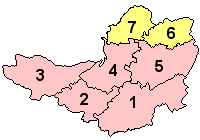
The Grade I listed buildings in Somerset, England, demonstrate the history and diversity of its architecture. The ceremonial county of Somerset consists of a non-metropolitan county, administered by Somerset County Council, which is divided into five districts, and two unitary authorities. The districts of Somerset are West Somerset, South Somerset, Taunton Deane, Mendip and Sedgemoor. The two administratively independent unitary authorities, which were established on 1 April 1996 following the breakup of the county of Avon, are North Somerset and Bath and North East Somerset. These unitary authorities include areas that were once part of Somerset before the creation of Avon in 1974.
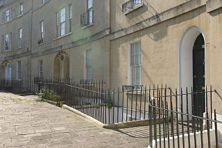
Widcombe is a district of Bath, England, immediately south-east of the city centre, across the River Avon.

Bath and North East Somerset is a unitary authority created on 1 April 1996, following the abolition of the County of Avon, which had existed since 1974. Part of the ceremonial county of Somerset, Bath and North East Somerset occupies an area of 220 square miles (570 km2), two-thirds of which is green belt. It stretches from the outskirts of Bristol, south into the Mendip Hills and east to the southern Cotswold Hills and Wiltshire border. The city of Bath is the principal settlement in the district, but BANES also covers Keynsham, Midsomer Norton, Radstock and the Chew Valley. The area has a population of 170,000, about half of whom live in Bath, making it 12 times more densely populated than the rest of the area.
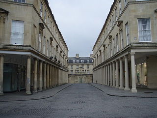
Bath Street in Bath, Somerset, England was built by Thomas Baldwin in 1791. Several of the buildings have been designated as Grade I listed buildings.

Duke Street in Bath, Somerset, England was built in 1748 by John Wood, the Elder. Several of the buildings have been designated as Grade I listed buildings. The street, which overlooks the River Avon, is pedestrianised with no vehicles permitted to enter.

Milsom Street in Bath, Somerset, England was built in 1762 by Thomas Lightholder. The buildings were originally grand town houses, but most are now used as shops, offices and banks. Most have three storeys with mansard roofs and Corinthian columns.

Laura Place Bathwick, Bath, Somerset, England, consists of four blocks of houses around an irregular quadrangle at the end of Pulteney Bridge. It was built by Thomas Baldwin and John Eveleigh between 1788 and 1794.

Johnstone Street in the Bathwick area of Bath, Somerset, England was designed in 1788 by Thomas Baldwin, with some of the buildings being completed around 1805-1810 by John Pinch the elder.
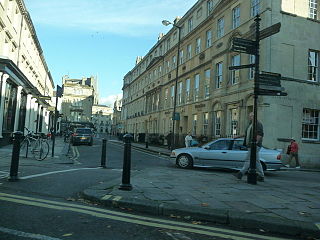
Wood Street in Bath, Somerset, England was built in 1778 an has been designated as a Grade I listed building.
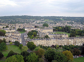
The buildings and architecture of Bath, a city in Somerset in the south west of England, reveal significant examples of the architecture of England, from the Roman Baths, to the present day. The city became a World Heritage Site in 1987, largely because of its architectural history and the way in which the city landscape draws together public and private buildings and spaces. The many examples of Palladian architecture are purposefully integrated with the urban spaces to provide "picturesque aestheticism". In 2021, the city was added to a second World Heritage Site, a group of historic spa towns across Europe known as the "Great Spas of Europe". Bath is the only entire city in Britain to achieve World Heritage status, and is a popular tourist destination.

The following is a timeline of the history of the city of Bath, Somerset, England.
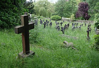
Smallcombe Cemetery is on the edge of Bath, Somerset, England, in a valley between Widcombe Hill and Bathwick Hill. It has two distinct parts, the Anglican section known as St Mary's Churchyard and the nonconformist section known as Smallcombe Vale cemetery; they are sometimes known together as Smallcombe Garden cemetery. The two cemeteries have been closed to new burials since 1988 and are maintained by Bath and North East Somerset Council. The Bath Corporation had assumed responsibility for both cemeteries in 1947.
Henrietta Street may refer to:


