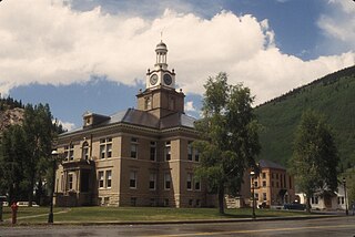
San Juan County is one of the 64 counties of the U.S. state of Colorado. As of the 2010 census, the population was 699, making it the least populous county in Colorado. The county seat and the only incorporated municipality in the county is Silverton. The county name is the Spanish language name for "Saint John", the name Spanish explorers gave to a river and the mountain range in the area. With a mean elevation of 11,240 feet (3426 meters), San Juan County is the highest county in the United States.
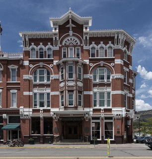
La Plata County is one of the 64 counties in the U.S. state of Colorado. As of the 2010 census, the population was 51,334. The county seat is Durango. The county was named for the La Plata River and the La Plata Mountains. "La plata" means "the silver" in Spanish.
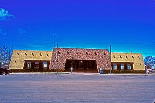
Conejos County is a county located in the U.S. state of Colorado. As of the 2010 census, the population was 8,256. The county seat is the unincorporated community of Conejos.

Farmington is a city in San Juan County in the U.S. state of New Mexico. As of the 2010 census the city had a total population of 45,877 people. Farmington makes up one of the four Metropolitan Statistical Areas (MSAs) in New Mexico. The U.S. Census Bureau's population estimate in 2019 for Farmington was 44,372.

The San Juan River is a major tributary of the Colorado River in the Southwestern United States, providing the chief drainage for the Four Corners region of Colorado, New Mexico, Utah and Arizona. Originating as snowmelt in the San Juan Mountains of Colorado, it flows 383 miles (616 km) through the deserts of northern New Mexico and southeastern Utah to join the Colorado River at Glen Canyon. The river drains a high, arid region of the Colorado Plateau and along its length it is often the only significant source of fresh water for many miles. The San Juan is also one of the muddiest rivers in North America, carrying an average of 25 million US tons of silt and sediment each year.

Animas River (On-e-mas) is a 126-mile-long (203 km) river in the western United States, a tributary of the San Juan River, part of the Colorado River System.

The Collegiate Peaks Wilderness is a 168,000-acre (680 km2) area located in central Colorado between Leadville and Buena Vista to the east and Aspen to the west and Crested Butte to the southwest. Most of the area is in the San Isabel and Gunnison National Forests, with a smaller area in the White River National Forest southeast of Aspen. Most of the area is in northwest Chaffee County with smaller portions in Gunnison, Pitkin, and Lake counties.

Uncompahgre National Forest is a U.S. National Forest covering 955,229 acres in parts of Montrose, Mesa, San Miguel, Ouray, Gunnison, Hinsdale, San Juan, and Delta Counties in western Colorado. Only its headquarters is in Delta County, in the city of Delta. It borders the San Juan National Forest to the south.

Red Mountain Pass elevation 11,018 ft (3,358 m) is a mountain pass in the San Juan Mountains of western Colorado in the United States.
The Pike National Forest is located in the Front Range of Colorado, United States, west of Colorado Springs including Pikes Peak. The forest encompasses 1,106,604 acres (4,478 km2) within Clear Creek, Teller, Park, Jefferson, Douglas and El Paso counties. The major rivers draining the forest are the South Platte and Fountain Creek. Rampart Reservoir is a large artificial body of water located within the forest.

There are more than 1,500 properties and historic districts in Colorado listed on the National Register of Historic Places. They are distributed over 63 of Colorado's 64 counties; only Broomfield County has none.

The San Juan National Forest is a U.S. National Forest covering over 1,878,846 acres in western Colorado. The forest occupies land in Archuleta, Conejos, Dolores, Hinsdale, La Plata, Mineral, Montezuma, Rio Grande, San Miguel and San Juan Counties. It borders the Uncompahgre National Forest to the north and the Rio Grande National Forest to the east. The forest covers most of the southern portion of the San Juan Mountains west of the Continental Divide. The forest contains two alpine wilderness areas; the Weminuche and South San Juan, as well as the Piedra Area. The Durango and Silverton Narrow Gauge Railroad passes through the National Forest.

The Big Sur River is a 15.7-mile-long (25.3 km) river on the Central Coast of California. The river drains a portion of the Big Sur area, a thinly settled region of the Central California coast where the Santa Lucia Mountains rise abruptly from the Pacific Ocean. The upper river and watershed lies within the Ventana Wilderness and encompasses the headwaters downstream to the area known as the Gorge. The lower river flows roughly northwest through Pfeiffer Big Sur State Park, the Big Sur village, several private camp grounds and Andrew Molera State Park where it flows through a lagoon and sandbar into the Pacific Ocean at the Monterey Bay National Marine Sanctuary. Major Tributaries of the river include, in order: Redwood Creek, Lion Creek, Logwood Creek, Terrace Creek, Ventana Creek, Post Creek, Pfeiffer-Redwood Creek, Juan Higuera Creek, and Pheneger Creek.

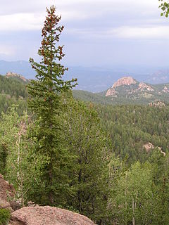
The Weminuche Wilderness is a wilderness area in southwest Colorado managed by the United States Forest Service as part of the San Juan National Forest on the west side of the Continental Divide and the Rio Grande National Forest on the east side of the divide. It is about 5 miles (8.0 km) south east of the town of Silverton and about 15 miles (24 km) northeast of Durango. At 499,771 acres (2,022.50 km2), it is the largest wilderness area in the state of Colorado. The wilderness was named after the Weminuche Indians.

Windom Peak is the highest summit of the Needle Mountains range of the Rocky Mountains of North America. The prominent 14,093-foot (4,296 m) fourteener is located in the Weminuche Wilderness of San Juan National Forest, 28.2 miles (45.4 km) northeast by north of the City of Durango in La Plata County, Colorado, United States. The summit of Windom Peak is the highest point in La Plata County and the entire San Juan River drainage basin. The mountain was named in honor of Minnesota senator William Windom.

Rio Grande National Forest is a 1.86 million-acre (7,530 km²) U.S. National Forest located in southwestern Colorado. The forest encompasses the San Luis Valley, which is the world's largest agricultural alpine valley, as well as one of the world's largest high deserts located around mountains. The Rio Grande river rises in the forest, and the Continental Divide runs along most of its western border. The forest lies in parts of nine counties. In descending order of land area within the forest they are Saguache, Mineral, Conejos, Rio Grande, Hinsdale, San Juan, Alamosa, Archuleta, and Custer counties. Forest headquarters are currently located in Monte Vista, Colorado, but plan to move to Del Norte. There are local ranger district offices in Del Norte, La Jara, and Saguache.
Chicago Basin comprises the upper portion of the Needle Creek watershed in the Needle Mountains (Colorado), a subrange of the San Juan Mountains in the US State of Colorado. It lies within the Weminuche Wilderness, part of the San Juan National Forest. Needle Creek is an east-side tributary of the Animas River. The basin is a popular destination in summer for climbers and backpackers. The upper portion of the basin is surrounded by three fourteeners: Mount Eolus, Windom Peak, and Sunlight Peak. Columbine Pass lies to the east of the lower basin.

Hermosa is an unincorporated community in La Plata County, Colorado. It is located north of Durango along U.S. Highway 550.

