Hewins, Kansas | |
|---|---|
 | |
 Hewins  Hewins | |
| Coordinates: 37°2′27″N96°24′30″W / 37.04083°N 96.40833°W [1] | |
| Country | United States |
| State | Kansas |
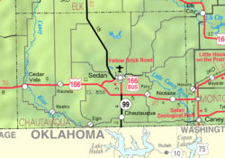
| County | Chautauqua |
| Named after | Edwin Hewins |
| Elevation | 886 ft (270 m) |
| Time zone | UTC-6 (CST) |
| • Summer (DST) | UTC-5 (CDT) |
| Area code | 620 |
| FIPS code | 20-31625 |
| GNIS ID | 484429 [1] |
Hewins is an unincorporated community in Chautauqua County, Kansas, United States. [1]
