Greenland is located between the Arctic Ocean and the North Atlantic Ocean, northeast of Canada and northwest of Iceland. The territory comprises the island of Greenland—the largest island in the world—and more than a hundred other smaller islands. Greenland has a 1.2-kilometer-long (0.75 mi) border with Canada on Hans Island. A sparse population is confined to small settlements along certain sectors of the coast. Greenland possesses the world's second-largest ice sheet.

A glacier is a persistent body of dense ice that is constantly moving under its own weight. A glacier forms where the accumulation of snow exceeds its ablation over many years, often centuries. It acquires distinguishing features, such as crevasses and seracs, as it slowly flows and deforms under stresses induced by its weight. As it moves, it abrades rock and debris from its substrate to create landforms such as cirques, moraines, or fjords. Although a glacier may flow into a body of water, it forms only on land and is distinct from the much thinner sea ice and lake ice that form on the surface of bodies of water.

An impact event is a collision between astronomical objects causing measurable effects. Impact events have been found to regularly occur in planetary systems, though the most frequent involve asteroids, comets or meteoroids and have minimal effect. When large objects impact terrestrial planets such as the Earth, there can be significant physical and biospheric consequences, as the impacting body is usually traveling at several kilometres a second, though atmospheres mitigate many surface impacts through atmospheric entry. Impact craters and structures are dominant landforms on many of the Solar System's solid objects and present the strongest empirical evidence for their frequency and scale.

The Chicxulub crater is an impact crater buried underneath the Yucatán Peninsula in Mexico. Its center is offshore, but the crater is named after the onshore community of Chicxulub Pueblo. It was formed slightly over 66 million years ago when a large meteorite, about ten kilometers in diameter, struck Earth. The crater is estimated to be 200 kilometers in diameter and 20 kilometers in depth. It is the second largest confirmed impact structure on Earth, and the only one whose peak ring is intact and directly accessible for scientific research.
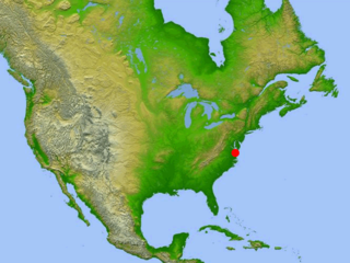
The Chesapeake Bay impact crater is a buried impact crater, located beneath the mouth of Chesapeake Bay, United States. It was formed by a bolide that struck the eastern shore of North America about 35.5 ± 0.3 million years ago, in the late Eocene epoch. It is one of the best-preserved "wet-target" impact craters in the world.

In glaciology, an ice sheet, also known as a continental glacier, is a mass of glacial ice that covers surrounding terrain and is greater than 50,000 km2 (19,000 sq mi). The only current ice sheets are the Antarctic ice sheet and the Greenland ice sheet. Ice sheets are bigger than ice shelves or alpine glaciers. Masses of ice covering less than 50,000 km2 are termed an ice cap. An ice cap will typically feed a series of glaciers around its periphery.
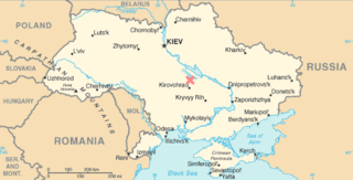
The Boltysh crater or Bovtyshka crater is a buried impact crater in the Kirovohrad Oblast of Ukraine, near the village of Bovtyshka. The crater is 24 kilometres (15 mi) in diameter and its age of 65.39 ± 0.14/0.16 million years, based on argon-argon dating techniques, less than 1 million years younger than Chicxulub crater in Mexico and the Cretaceous–Paleogene boundary. The Chicxulub impact is believed to have caused the mass extinction at the end of the Cretaceous period, which included the extinction of the non-avian dinosaurs. The Boltysh crater is currently thought to be unrelated to the Chicxulub impact, and to have not generated major global environmental effects.

Lappajärvi is a lake in Finland, in the municipalities of Lappajärvi, Alajärvi and Vimpeli. It is formed in a 23 km (14 mi) wide, partly eroded meteorite impact crater. The lake is part of Ähtävänjoki basin together with Lake Evijärvi that is located downstream (north) of it.

The Vredefort impact structure is the largest verified impact structure on Earth. The crater, which has since been eroded away, has been estimated at 170–300 kilometres (110–190 mi) across when it was formed. The remaining structure, comprising the deformed underlying bedrock, is located in present-day Free State province of South Africa. It is named after the town of Vredefort, which is near its centre. The structure's central uplift is known as the Vredefort Dome. The impact structure was formed during the Paleoproterozoic Era, 2.023 billion years ago. It is the second-oldest known impact structure on Earth, after Yarrabubba.

The Byrd Polar and Climate Research Center (BPCRC) is a polar, alpine, and climate research center at Ohio State University founded in 1960.

The Greenland ice sheet is an ice sheet which forms the second largest body of ice in the world. It is an average of 1.67 km (1.0 mi) thick, and over 3 km (1.9 mi) thick at its maximum. It is almost 2,900 kilometres (1,800 mi) long in a north–south direction, with a maximum width of 1,100 kilometres (680 mi) at a latitude of 77°N, near its northern edge. The ice sheet covers 1,710,000 square kilometres (660,000 sq mi), around 80% of the surface of Greenland, or about 12% of the area of the Antarctic ice sheet. The term 'Greenland ice sheet' is often shortened to GIS or GrIS in scientific literature.
A subglacial lake is a lake that is found under a glacier, typically beneath an ice cap or ice sheet. Subglacial lakes form at the boundary between ice and the underlying bedrock, where pressure decreases the pressure melting point of ice. Over time, the overlying ice gradually melts at a rate of a few millimeters per year. Meltwater flows from regions of high to low hydraulic pressure under the ice and pools, creating a body of liquid water that can be isolated from the external environment for millions of years.
The Alvarez hypothesis posits that the mass extinction of the non-avian dinosaurs and many other living things during the Cretaceous–Paleogene extinction event was caused by the impact of a large asteroid on the Earth. Prior to 2013, it was commonly cited as having happened about 65 million years ago, but Renne and colleagues (2013) gave an updated value of 66 million years. Evidence indicates that the asteroid fell in the Yucatán Peninsula, at Chicxulub, Mexico. The hypothesis is named after the father-and-son team of scientists Luis and Walter Alvarez, who first suggested it in 1980. Shortly afterwards, and independently, the same was suggested by Dutch paleontologist Jan Smit.
The Younger Dryas impact hypothesis (YDIH) proposes that the onset of the Younger Dryas (YD) cool period (stadial) at the end of the Last Glacial Period, around 12,900 years ago was the result of some kind of extraterrestrial event with specific details varying between publications. The hypothesis is controversial and not widely accepted by relevant experts.
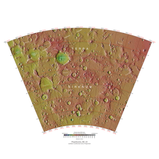
The Phaethontis quadrangle is one of a series of 30 quadrangle maps of Mars used by the United States Geological Survey (USGS) Astrogeology Research Program. The Phaethontis quadrangle is also referred to as MC-24.

Almost all water on Mars today exists as ice, though it also exists in small quantities as vapor in the atmosphere. What was thought to be low-volume liquid brines in shallow Martian soil, also called recurrent slope lineae, may be grains of flowing sand and dust slipping downhill to make dark streaks. While most water ice is buried, it is exposed at the surface across several locations on Mars. In the mid-latitudes, it is exposed by impact craters, steep scarps and gullies. Additionally, water ice is also visible at the surface at the north polar ice cap. Abundant water ice is also present beneath the permanent carbon dioxide ice cap at the Martian south pole. More than 5 million km3 of ice have been detected at or near the surface of Mars, enough to cover the whole planet to a depth of 35 meters (115 ft). Even more ice might be locked away in the deep subsurface. Some liquid water may occur transiently on the Martian surface today, but limited to traces of dissolved moisture from the atmosphere and thin films, which are challenging environments for known life. No evidence of present-day liquid water has been discovered on the planet's surface because under typical Martian conditions, warming water ice on the Martian surface would sublime at rates of up to 4 meters per year. Before about 3.8 billion years ago, Mars may have had a denser atmosphere and higher surface temperatures, potentially allowing greater amounts of liquid water on the surface, possibly including a large ocean that may have covered one-third of the planet. Water has also apparently flowed across the surface for short periods at various intervals more recently in Mars' history. Aeolis Palus in Gale Crater, explored by the Curiosity rover, is the geological remains of an ancient freshwater lake that could have been a hospitable environment for microbial life. The present-day inventory of water on Mars can be estimated from spacecraft images, remote sensing techniques, and surface investigations from landers and rovers. Geologic evidence of past water includes enormous outflow channels carved by floods, ancient river valley networks, deltas, and lakebeds; and the detection of rocks and minerals on the surface that could only have formed in liquid water. Numerous geomorphic features suggest the presence of ground ice (permafrost) and the movement of ice in glaciers, both in the recent past and present. Gullies and slope lineae along cliffs and crater walls suggest that flowing water continues to shape the surface of Mars, although to a far lesser degree than in the ancient past.

The Eltanin impact is thought to be an asteroid impact in the eastern part of the South Pacific Ocean that occurred around the Pliocene-Pleistocene boundary approximately 2.51 ± 0.07 million years ago. The impact occurred at the north edge of the Bellingshausen Sea 1,500 km (950 mi) southwest of Chile, where the sea floor is approximately 4–5 kilometres (2.5–3.1 mi) deep. The asteroid was estimated to be about 1 to 4 km in diameter. No crater associated with the impact has been discovered. The impact likely evaporated 150 km3 (36 cu mi) of water, generating large tsunami waves hundreds of metres high.

Occator is an impact crater located on Ceres, the largest object in the main asteroid belt that lies between the orbits of Mars and Jupiter, that contains "Spot 5", the brightest of the bright spots observed by the Dawn spacecraft. It was known as "Region A" in ground-based images taken by the W. M. Keck Observatory on Mauna Kea.

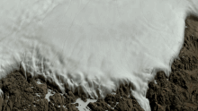
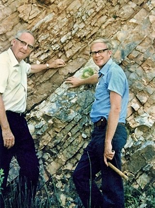
The Hiawatha impact structure is a probable impact structure discovered beneath the Hiawatha Glacier in northwest Greenland, from which it gets its name. It was identified using airborne radar surveys that showed the presence of a crater-like depression in the bedrock beneath the ice. Shocked quartz grains and melt rock clasts have been found in fluvio-glacial sediments deposited by a river that drains the area of the structure. The timing of the impact has been dated using argon-argon dating and uranium-lead dating of zircon crystals within the melt rock to 57.99 ± 0.54 million years ago, during the late Paleocene.