High Street, Bristol

Last updated

High Street, Bristol
High Street, Bristol 2018.jpg
High Street, Bristol, looking from the central crossroads towards Bristol Bridge.
Location map United Kingdom Bristol Central1.png
Red pog.svg
Location within Central Bristol
Maintained by Bristol City Council
Location Bristol, England
Postal codeBS1
Coordinates 51°27′16″N2°35′33″W / 51.4545°N 2.5925°W / 51.4545; -2.5925
North Broad Street
East Wine Street
South Bristol Bridge
West Corn Street

High Street, together with Wine Street, Broad Street and Corn Street, is one of the four cross streets which met at the carfax, later the site of the Bristol High Cross, the heart of Bristol, England when it was a walled medieval town. From this crossroads High Street runs downhill south-east to Bristol Bridge, a distance of approximately 155m. [1]

Contents

Once an important shopping street, wartime destruction and post-war planning have left High Street shabby and a constraint on pedestrian movement between the Old City and Castle Park. Bristol City Council are now seeking to redevelop the area to repair this. [2]

History

Robert Ricart's map of Bristol in 1479. High Street is shown running south-east from the High Cross (Alta Crux) Robert Ricart's map of Bristol.png
Robert Ricart's map of Bristol in 1479. High Street is shown running south-east from the High Cross (Alta Crux)

High Street, together with Corn Street, Broad Street and Wine Street, formed the earliest nucleus of Bristol. [1] It is shown clearly on Ricart's Plan, one of the first English town plans, with the High Cross at its top and St Nicholas Church (which then incorporated the town's southern gate) at its foot. [3]

The street appears to have changed little by the time Millerd's Citty of Bristoll map was published in 1673. [4] In 1747 the cleric John Wesley collided with a cart while passing through St Nicholas Gate on his way to a preaching engagement, and was shot over his horse's head 'as an arrow from a bow'. Neither man nor horse were hurt. [5] It was clear however that improvement was needed, and in 1760 a bill was passed through parliament primarily to replace Bristol Bridge, but also allowing for the removal of St Nicholas Gate and the rebuilding of the church. During these works the gradient of High Street was reduced. [5] [6]

Puritan diarist Nehemiah Wallington describes Bristol Bridge and High Street in the 17th century as containing the chief shops of mercers, silkmen and linen drapers. Those who could not get premises on the bridge, which at that time was lined with shops, considered High Street the next best location. [5]

By the mid-19th century shop fronts lined the slope of High Street, [7] and development continued into the 20th century. Thomas Jones, the Pembrokeshire draper whose department store eventually became part of the Debenhams group, acquired three shops on High Street, ten on Wine Street and three on Mary le Port Street. In the 1920s the firm even tried to buy the landmark Dutch House which stood on the corner of High Street and Wine Street; when that bid failed the firm embarked on a modernisation programme which was almost complete by 1940. [8]

The majority of buildings on the east side of High Street were destroyed by aerial bombing on 24 November 1940. [9] St Nicholas Church, also damaged by bombing, was subsequently repaired and brought back into use. [10]

After the war, Bristol's shopping centre was moved to Broadmead. [11] In 1963 the few remaining buildings on the east side of High Street were demolished, the street was widened, [12] and its junction with Wine Street was turned into a short dual carriageway which diverted traffic away from the original crossroads with Corn Street and Broad Street. [13] [14]

Post-war plans to build a riverside hotel and exhibition centre on High Street were quietly dropped on cost grounds, and new premises for the Bank of England and the Norwich Union Insurance Company were built in their place. [11]

High Street today

High Street forms part of the main north–south route through the Old City. Following its postwar widening, High Street and its junction with Wine Street constrain pedestrian movement between these streets and Castle Park. [12] [2]

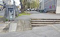
The east side of High Street 'has a lax, dissipated air, its former tension bled away on expanses of shabby paving'. [15] Bristol City Council is seeking redevelopment of this area, to help connect the markets area with the shopping quarter at Broadmead. This would include reducing High Street to more closely resemble its historic proportions. [16] The redevelopment of this area 'offer[s] perhaps the greatest potential of any site in the city to demonstrate the ambition of Bristol and to realise a connected and coherent historic core'. [2]

High Street is within the Old City and Queen Square Conservation Area. [17]

Sites of interest

Listed buildings

High Street has several listed buildings:

NumberGradeYear listedDescription
Scheduled Monumentn/aVault in High Street [18]
II*1959City Museum, former church of St Nicholas [10]
31–34Unlisted building of meritn/aSt Nicholas House [22]
II*1959The Market, High Street [20]
41II197741, High Street [23]
42–43II197742 and 43, High Street [24]
44II197744, High Street [25]
45II197745, High Street [26]
46aII1977No 46a and attached rear area railings [27]
47–48II197747 and 48, High Street [28]
49II197749, High Street [29]

High Street uses a clockwise-consecutive house numbering system, so No.1 was opposite No.49. [30]

Related Research Articles

<span class="mw-page-title-main">Bristol</span> City and county in England

Bristol is a city, unitary authority area and ceremonial county in South West England, the most populous city in the region. Built around the River Avon, it is bordered by the ceremonial counties of Gloucestershire to the north and Somerset to the south. The county is the West of England combined authority area, this includes the Greater Bristol area and nearby places such as Bath.

<span class="mw-page-title-main">Bristol Harbour</span> Harbour in Bristol, England

Bristol Harbour is the harbour in the city of Bristol, England. The harbour covers an area of 70 acres. It is the former natural tidal river Avon through the city but was made into its current form in 1809 when the tide was prevented from going out permanently. A tidal by-pass was dug for 2 miles through the fields of Bedminster for the river, known as the "River Avon New Cut", "New Cut", or simply "The Cut". It is often called the Floating Harbour as the water level remains constant and it is not affected by the state of the tide on the river in the Avon Gorge, The New Cut or the natural river southeast of Temple Meads to its source.

<span class="mw-page-title-main">Bristol City Centre</span> Central Business District in England

Bristol City Centre is the commercial, cultural and business centre of Bristol, England. It is the area north of the New Cut of the River Avon, bounded by Clifton Wood and Clifton to the north-west, Kingsdown and Cotham to the north, and St Pauls, Lawrence Hill and St Phillip's Marsh to the east. The Bristol Royal Infirmary, Bristol Royal Hospital for Children, the BBC, the main campus of the University of Bristol, the Crown and Magistrate's Courts, Temple Meads railway station, Bristol bus station, the Park Street, Broadmead and Cabot Circus shopping areas together with numerous music venues, theatres and restaurants are located in this area. The area consists of the council wards of Central, Hotwells & Harbourside, and part of Lawrence Hill.

<span class="mw-page-title-main">Broadmead</span> Area of Bristol, England

Broadmead is a street in the central area of Bristol, England, which has given its name to the principal shopping district of the city. It is part of Bristol Shopping Quarter.

<span class="mw-page-title-main">Buildings and architecture of Bristol</span>

Bristol, the largest city in South West England, has an eclectic combination of architectural styles, ranging from the medieval to 20th century brutalism and beyond. During the mid-19th century, Bristol Byzantine, an architectural style unique to the city, was developed, and several examples have survived.

<span class="mw-page-title-main">Castle Park, Bristol</span>

Castle Park is a public open space in Bristol, England, managed by Bristol City Council. It is bounded by the Floating Harbour and Castle Street to the south, Lower Castle Street to the east, and Broad Weir, Newgate and Wine Street to the north. Its western boundary is less obviously defined and has been the subject of controversy, perhaps because the area around High Street and St Mary le Port Church, though not part of the park and always intended for development, is often considered at the same time as the park.

<span class="mw-page-title-main">Bristol Bridge</span> Historic bridge in United Kingdom

Bristol Bridge is a bridge over the floating harbour in Bristol, England. The floating harbour was constructed on the original course of the River Avon, and there has been a bridge on the site since long before the harbour was created by impounding the river in 1809. The current bridge was completed in 1768 and is a Grade II listed building.

<span class="mw-page-title-main">College Green, Bristol</span> Public open space in Bristol, England

College Green is a public open space in Bristol, England. The Green takes the form of a segment of a circle with its apex pointing east, and covers 1.1 hectares. The road named College Green forms the north-eastern boundary of the Green, Bristol Cathedral marks the south side, and City Hall closes the Green in an arc to the north-west.

<span class="mw-page-title-main">Queen Square, Bristol</span> Public square in Bristol, England

Queen Square is a 2.4 hectares Georgian square in the centre of Bristol, England. Following the 1831 riot, Queen Square declined through the latter part of the 19th century, was threatened with a main line railway station, but then bisected by a dual carriageway in the 1930s. By 1991 20,000 vehicles including scheduled buses were crossing the square every day, and over 30% of the buildings around it were vacant.

Reece Winstone FRPS (1909–1991) was an English photographer from Bristol. He edited and self-published the 'Bristol As It Was' books of photographs of Bristol, covering in detail the period from the dawn of photography to 1962.

<span class="mw-page-title-main">Park Street, Bristol</span>

Park Street is a major shopping street in Bristol, England, linking the city centre to Clifton. It forms part of the A4018.

<span class="mw-page-title-main">St Nicholas Church, Bristol</span> Church in Bristol, England

St Nicholas is a church in St Nicholas Street, Bristol, England. The church was bombed in the Second World War and rebuilt in 1974–1975 as a church museum. This museum closed in 2007 and the building was used by the city council as offices; in 2018 the church came back into use as an Anglican place of worship in the Diocese of Bristol.

<span class="mw-page-title-main">Cumberland Basin (Bristol)</span> Place in Bristol, England

The Cumberland Basin is the main entrance to the docks of the city of Bristol, England. It separates the areas of Hotwells from the tip of Spike Island.

<span class="mw-page-title-main">Corn Street, Bristol</span> Street in the centre of Bristol, England

Corn Street, together with Broad Street, Wine Street and High Street, is one of the four cross streets which met at the Bristol High Cross, the heart of Bristol, England when it was a walled medieval town. From this crossroads Corn Street and its later extension Clare Street runs downhill approximately 325m south-westwards to The Centre.

<span class="mw-page-title-main">The Dutch House, Bristol</span> Building in Bristol, England

The Dutch House was a large timber-framed building situated at Nos 1 and 2, High Street Bristol, England. It was a well-known local landmark until its destruction in 1940.

<span class="mw-page-title-main">The Centre, Bristol</span> Open space in Bristol, England, UK

The Centre is a public open space in the central area of Bristol, England, created by covering over the River Frome. The northern end of The Centre, known as Magpie Park, is skirted on its western edge by Colston Avenue; the southern end is a larger paved area bounded by St Augustine's Parade to the west, Broad Quay the east, and St Augustine's Reach to the south, and bisected by the 2016 extension of Baldwin Street. The Centre is managed by Bristol City Council.

<span class="mw-page-title-main">20th century road schemes in Bristol</span>

Road building was central to planning policy for much of the 20th century in Bristol, England. The planned road network evolved over time but at its core was a network of concentric ring roads and high-capacity radial roads.

<span class="mw-page-title-main">Mary le Port Street, Bristol</span>

Mary le Port Street was an important thoroughfare from an early stage in the development of the settlement of Bristol, England, linking the area around St Peters Church and, later, Bristol Castle with the Saxon core of the town to the west at High Street, Wine Street, Corn Street and Broad Street. It was heavily damaged by aerial bombing in 1940, and was relegated to an unnamed service road and footway in post-war reconstruction of the area.

<span class="mw-page-title-main">Wine Street, Bristol</span> Major street in Bristol, UK

Wine Street, together with High Street, Broad Street and Corn Street, is one of the four cross streets which met at the Bristol High Cross, the heart of Bristol, England when it was a walled mediaeval town. From this crossroads Wine Street runs along a level ridge approximately 175m north-eastwards to the top of Union Street.

References

  1. 1 2 Watts, Lorna; Rahtz, Philip (1985). Mary-le-Port Bristol Excavations 1962/3. City of Bristol Museums and Art Gallery. pp. 16–17. ISBN   0-900199-26-1.
  2. 1 2 3 "The City Centre Framework - Old City - character statement and place plan" (PDF). Bristol City Council City Design Group. 2018. pp. 4–6. Archived (PDF) from the original on 28 May 2018. Retrieved 10 May 2018.
  3. "Plan of Bristol, from Ricart's calendar". Bristol Archives. Bristol City Council. Retrieved 10 May 2018.
  4. "Millerd's 'The Citty of Bristoll'". Bristol Museums Galleries Archives. Archived from the original on 30 April 2018. Retrieved 29 April 2018.
  5. 1 2 3 Wells, Charles (1969). "3 High Street and Vicinity". Bristol's History. Reece Winstone. ISBN   0 900814 29 2.
  6. Bantock, Anton (2004). Ashton Court. p. 29. ISBN   0-7524-3213-3.
  7. Winstone, Reece (1978). "Plate 13". Bristol in the 1850s. ISBN   0 900814 53 5.
  8. Reid, Helen (1987). "4 Oh Lord, send them in, send them in!". Bristol & Co. Redcliffe Press. ISBN   0 948265 61 2.
  9. Besley, James; Reid, Helen (1990). "2 Living Through the Blitz". West at War. Redcliffe Press Limited. ISBN   0 948 265 64 7.
  10. 1 2 3 Historic England. "City Museum, former church of St Nicholas (1202553)". National Heritage List for England . Retrieved 30 April 2018.
  11. 1 2 Priest, Gordon; Cobb, Pamela (1980). "Open Spaces". The Fight for Bristol. Bristol Civic Society and The Redcliffe Press.
  12. 1 2 Winstone, Reece (1978). "plate 107". Bristol as it Was 1960-1962. Reece Winstone. ISBN   0-900814-62-4.
  13. "Castle Park - west end". Bristol Civic Society. Archived from the original on 11 May 2018. Retrieved 10 May 2018.
  14. Winstone, John (1990). Bristol as it Was 1963-1975. p. 16. ISBN   0 900814 70 5.
  15. Foyle, Andrew (2004). Pevsner Architectural Guides: Bristol. Yale University Press. p.  139. ISBN   0 300 10442 1.
  16. "Bristol Central Area Plan" (PDF). Bristol City Council. 2015. pp. 60–61. Archived (PDF) from the original on 10 May 2018.
  17. "Conservation Area No.4 - City and Queen Square - Character Appraisal" (PDF). Bristol City Council. Archived (PDF) from the original on 4 May 2018. Retrieved 3 May 2018.
  18. 1 2 Historic England. "Vault in High Street (1004540)". National Heritage List for England . Retrieved 30 April 2018.
  19. "The medieval vaults you had no idea were behind this Bristol city centre door". Bristol Post. Archived from the original on 10 May 2018. Retrieved 10 May 2018.
  20. 1 2 Historic England. "The Market, High Street (1202292)". National Heritage List for England . Retrieved 30 April 2018.
  21. Winstone, Reece (1972). "Plate 9". Bristol as it Was 1914-1900. Reece Winstone. ISBN   0 900814 41 1.
  22. "Conservation Area No.4 – City and Queen Square – Character Appraisal". Bristol City Council. p. 33. Archived from the original on 2 May 2018. Retrieved 1 May 2018.
  23. Historic England. "41, High Street (1202290)". National Heritage List for England. Retrieved 30 April 2018.
  24. Historic England. "42 and 43, High Street (1293240)". National Heritage List for England. Retrieved 30 April 2018.
  25. Historic England. "44, High Street (1282262)". National Heritage List for England. Retrieved 30 April 2018.
  26. Historic England. "45, High Street (1208284)". National Heritage List for England. Retrieved 30 April 2018.
  27. Historic England. "No 46a and attached rear area railings (1208298)". National Heritage List for England. Retrieved 30 April 2018.
  28. Historic England. "47 and 48, High Street (1202291)". National Heritage List for England. Retrieved 30 April 2018.
  29. Historic England. "49, High Street (1208318)". National Heritage List for England. Retrieved 30 April 2018.
  30. "Search the List - Map Search". Historic England. Archived from the original on 21 March 2018. Retrieved 10 May 2018.