History
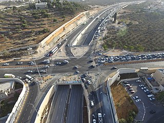
Highway 9 was approved by the Supreme Court of Israel on October 24, 2010. The purpose of Highway 9 is to connect the Trans-Israel Highway, Highway 4, and Highway 2 in the center of the country. A small part of the route of Highway 9 already existed near the Baqa-Jatt Interchange and was called Highway 61.
On May 2, 2011, the National Roads Company of Israel released a tender for the construction of a four-lane road between Highway 4 and the Trans-Israel Highway at the cost of 700 million NIS with construction being completed in 2014 and Highway 9 being opened to the public on July 24, 2014.
Highway 9 was first built with two lanes in each direction, but preparation includes a future third lane in the center, to avoid damaging the side of the road during construction. Highway 9 includes a diamond interchange south of the city of Hadera, connecting the city to the national road system. In addition, five new bridges were built, two overpasses and three underpasses along Highway 9.

Highway 6, also known as the Trans-Israel Highway or Cross-Israel Highway, is a major electronic toll highway in Israel. Highway 6 is the first Israeli Build-Operate-Transfer road constructed, carried out mainly by the private sector in return for a concession to collect tolls on the highway for a given number of years. It is also one of the largest infrastructure projects undertaken in Israel.

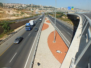
Highway 20, more commonly known as the Ayalon Highway, or simply Ayalon, is a major inter city freeway in Gush Dan, Israel. The road runs along the eastern border of central Tel Aviv from north to south and connects all of the major highways leading to the city—such as Highway 4 from Ashdod and the Southern regions, Highway 2 from Haifa and the Northern regions, Highway 5 from the East, and Highway 1 from Jerusalem and the Southeast. The Ayalon Highway is heavily used; on an average day, almost 600,000 vehicles enter the freeway. It consists of a multi-lane highway with a multi-track railway located between the opposite travel lanes. Some of the highway's route is along the Ayalon River, hence its name.

Highway 5 or the Trans-Samaria Highway, is one of Israel's main highways, connecting the Mediterranean coast immediately north of Tel Aviv with the central Sharon plain and eastwards to Ariel and other Israeli settlements in the northern West Bank.

Highway 1 is the main highway in Israel, connecting Tel Aviv and Jerusalem, and continuing eastwards to the Jordan Valley in the West Bank.
Highway 50, officially called Begin Boulevard and also referred to as Menachem Begin Expressway or Begin Highway, is a north-south urban freeway, through western Jerusalem, named after Israel's sixth Prime Minister, Menachem Begin. Local Jerusalemites simply refer to it as 'Begin'. It enters Area C of the West Bank on the north end and East Jerusalem on both ends.

Highway 2 is an Israeli highway located on the coastal plain of the Mediterranean Sea. It begins as a major arterial road within Tel Aviv, becoming a freeway as it exits the city northward, continuing to Haifa. North of Tel Aviv, the highway is also called The Coastal Highway.
Highway 4 is an Israeli highway that runs along Israel's entire coastal plain of the Mediterranean Sea, from the Rosh HaNikra border crossing with Lebanon in the North to the Erez Border Crossing with the Gaza Strip in the South. The highway follows in part the route of the ancient Via Maris.
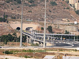
Highway 23, more-commonly known as the "Carmel Tunnels", are a set of toll tunnels in Haifa, Israel. The tunnels' purpose is to reduce road congestion in the Haifa area and to provide an alternate route for reaching the eastern and central parts of the city, Haifa Bay and the Krayot area to and from Israel's central coastal plain without having to travel through traffic-congested downtown Haifa, having to drive up and across Mount Carmel, or bypassing Haifa from the east – along the edge of the Jezreel Valley. The tunnels cut the travel time from the Haifa South interchange in the west to the Checkpost interchange in the east from 30–50 minutes down to 6 minutes.
Highway 22, also known as the Bay Highway, is a suburban freeway in the Haifa metropolitan area connecting downtown Haifa with the city's northern exit to the Krayot. From there it continues northwards as a bypass of the Krayot, providing an alternative route to Highway 4.

Highway 3 is a highway in Israel. It begins at Highway 4 on the outskirts of Ashkelon, running east-northeast, passing through Kiryat Malakhi and Latrun, and ending just short of Modi'in.
Highway 7 is a highway in the South District of Israel from Ashdod to Yad Binyamin. It connects the Port of Ashdod with the Trans-Israel Highway.

Highway 13 is an expressway in southern Israel. It is 12 km long. It begins in the north at Tzihor junction with Highway 40 and ends in the south at Menuha junction with Highway 90. Thus, it connects between Highway 40, which runs north to Mizpe Ramon and Beersheba via the central Negev, and Highway 90, which traverses the Arava region on Israel's eastern border.

Highway 25 is a rural highway in southern Israel. It begins northwest of Nahal Oz at the border with the Gaza Strip, and it passes through Netivot, Beersheba and Dimona. It continues southeast toward Arava Junction, where it meets Highway 90. Its length is estimated by the Israeli Department of Transportation as 172 km and 780 meters.
Highway 41 is an arterial road in south-central Israel. It connects Highway 4 and Highway 7 to the Port of Ashdod. The designation "41" also applied to the continuation of the road eastward to Gedera until that section of the road was upgraded and renamed "7".
Highway 42 is a north-south highway in central Israel. It leads from just south of Ashdod Interchange in the south to Gan Rave interchange in the north. The road is 19 km (12 mi) long.

Highway 71 is an east-west highway that passes through the eastern Jezreel Valley and the Beit She'an Valley, below the north slopes of the Gilboa mountains, in northern Israel. The road follows a path parallel to the Harod Creek in the Harod Valley and to the Jezreel Valley railway. It is 35 kilometres (22 mi) long and leads from Afula in the west, via Beit She'an, to the Jordan River Border Crossing in the east. The Navot interchange located approximately 10 km southeast of Afula provides a shortcut via Route 675 through the Ta'anakh region from Highway 71 and Beit She'an to Highway 65 and central Israel.
Route 866 is a north-south regional highway in northern Israel. It begins at Hananya junction with Highway 85 in the south and ends at Meron junction with Highway 89 in the north.

Route 531, is a suburban freeway in the southern Sharon region of Israel, just north of the Tel Aviv Metropolitan Area. The highway begins at Highway 6 and terminates at the Ayalon Highway with an extension to the Coastal Highway.

Highway 45 is the official designation of a 3.3 km stretch of road forming a continuous connection between Route 443 from the Tel Aviv Metropolitan Area and Highway 50 to central Jerusalem and a 1.4 km spur serving the Atarot Industrial Park.

Route 505 is a regional Israeli highway in the Israeli-occupied West Bank.

